The best cycling routes around San Godenzo
4.2
(76)
1,279
riders
79
rides
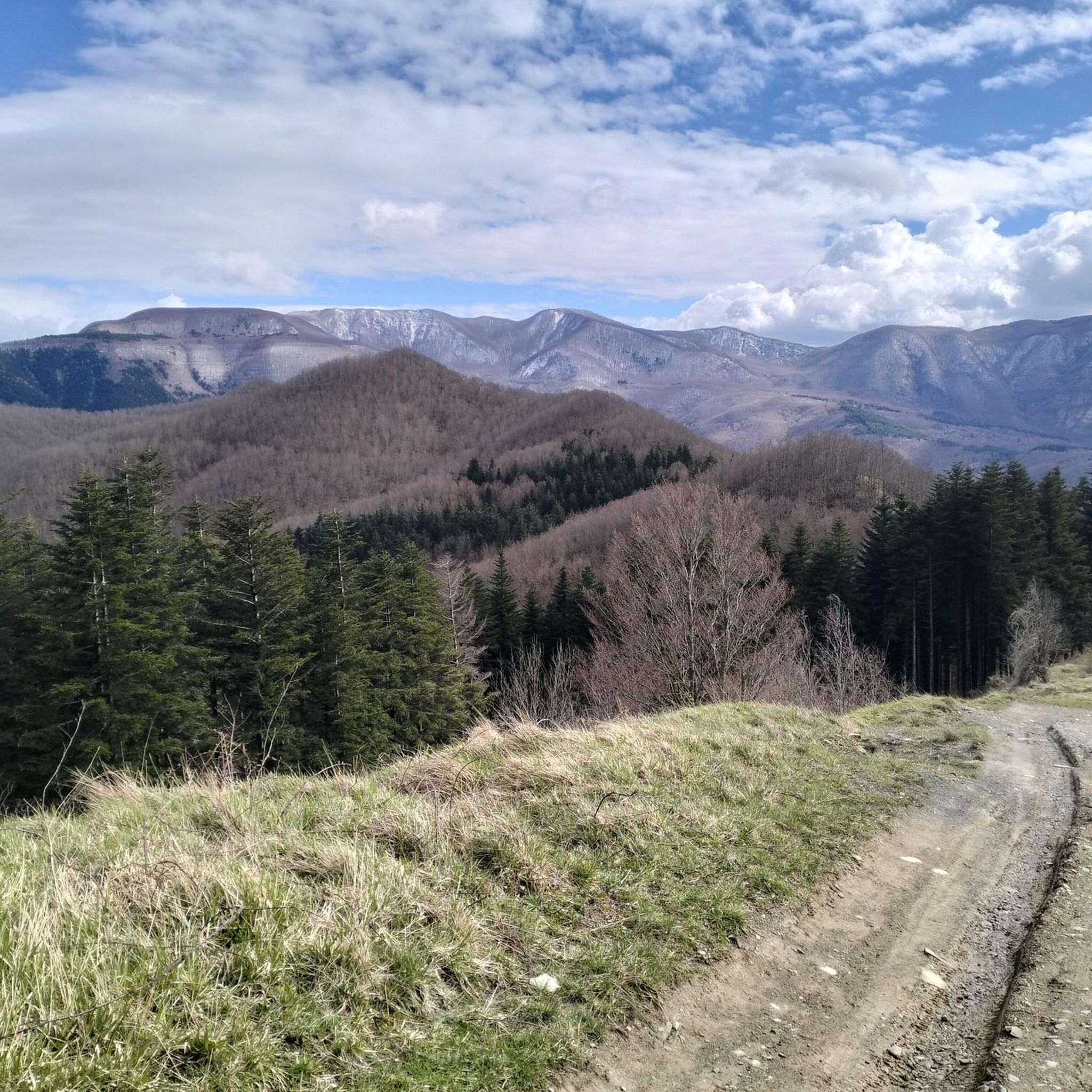
Touring cycling around San Godenzo offers routes through the Tuscan Apennines, situated between the Mugello and Casentino valleys. The region features a mountainous terrain with elevations often exceeding 900 meters, characterized by dense forests and scenic river valleys. These landscapes form part of the Foreste Casentinesi, Monte Falterona, and Campigna National Park, providing a diverse environment for cycling. Cyclists can expect significant elevation gains across varied terrain, from river paths to challenging mountain passes.
Best touring cycling routes around San…
Last updated: August 23, 2026
5.0
(3)
31
riders
32.8km
03:00
910m
910m
Hard bike ride. Very good fitness required. Mostly paved surfaces. Suitable for all skill levels.
8
riders
68.0km
06:00
1,880m
1,880m
Hard bike ride. Very good fitness required. Mostly paved surfaces. Suitable for all skill levels.

Sign up for free
4.0
(2)
22
riders
132km
09:01
1,990m
1,990m
Hard bike ride. Very good fitness required. Mostly paved surfaces. Suitable for all skill levels.
5.0
(1)
9
riders
52.7km
04:39
1,600m
1,610m
Hard bike ride. Very good fitness required. Mostly paved surfaces. Suitable for all skill levels.
5.0
(1)
13
riders
38.8km
03:46
1,130m
1,120m
Hard bike ride. Very good fitness required. Mostly paved surfaces. Suitable for all skill levels.
Get access to more routes and recommendations from other explorers.
Sign up for free
Already have an account?
Our route recommendations are based on thousands of hikes, rides, and runs completed by other people on komoot.
Start today with a free account
Your next adventure awaits.
Login or Signup

Other adventures around San Godenzo

Tips from the Community

Streams, gorges, waterfalls, caves and cool pools to dive into and large, flat, smooth rocks where you can sunbathe while being lulled by the sound of the flowing water, amplified by the natural acoustics, making it sound like a scream.
0
0

immediately after the Valico dei 3 Faggi sign you will find the sign for the entrance to the Casentinesi forests, a road all downhill immersed in the wonderful panorama and scent of the woods
0
0

The bridge allows you to avoid the state road
1
0

Wonderful dirt track that winds along the CAI 401 trail at altitude. It connects the Pista del Cucco (a challenging dirt climb starting from San Benedetto in Alpe) to Valico Manzo (or Passo Valbura). The difficulty is negligible, as the route is mostly flat with occasional short ups and downs. It can be easily traveled even with a gravel bike. Be careful of the many fallen trees and branches that are often found along the route. They are basically an inconvenience that can be overcome with short portage sections. ========= A wonderful dirt track that winds along the CAI 401 trail at altitude. It connects the Pista del Cucco (a challenging dirt climb starting from San Benedetto in Alpe) to Valico Manzo (or Passo Valbura). The difficulty is negligible, as the route is mostly flat with occasional short ups and downs. It can be easily traveled even with a gravel bike. Caution is advised due to numerous fallen trees and branches often found along the path. These mainly represent a manageable inconvenience, requiring short sections of portage.
2
0
Forest dirt road that continues from Via Monte Gemelli to San Benedetto in Alpe and provides access to the CAI 401 trail, on the ridge. It is a climb on fairly compact dirt terrain but challenging. The average gradient is 10% and from San Benedetto in Alpe to the CAI 401 trail there is approximately 550 meters of positive elevation gain. ========= A forest dirt road that continues from Via Monte Gemelli to San Benedetto in Alpe and provides access to the CAI 401 trail along the ridge. It is a climb on fairly compact dirt terrain but challenging. The average gradient is 10%, and from San Benedetto in Alpe to the CAI 401 trail, there is approximately 550 meters of positive elevation gain.
2
0
Magnificent pass on the ridge that divides the Montone and Rabbi valleys. Crossed by CAI path 401, corresponding at this point to the Cammino di Sant'Antonio.
0
0

Above all, don't miss the fantastic graffiti on each pylon! Unfortunately, they are starting to fade a bit.
1
0

Route from Osteria Nuova (path 405) passing through: - Acquacheta waterfall (8.1 km) - Spring or fountain (9.9 km) - San Benedetto in Alpe note: leaving San Benedetto you follow an unmarked off-trail track, after a first short but intense climb, you cross an uncultivated field, after which we lost the track and had to improvise in the middle of the woods until we reached a stream that we forded barefoot. At this point we reached the road a few hundred meters from our car.
0
0
Frequently Asked Questions
How many touring cycling routes are available around San Godenzo?
There are over 70 touring cycling routes around San Godenzo, offering a wide range of options for exploring the Tuscan Apennines. Most of these routes are considered difficult, with 54 challenging options, 13 moderate, and 5 easier trails.
What kind of terrain can I expect on touring cycling routes in San Godenzo?
The terrain around San Godenzo is diverse, featuring significant elevation gains as it's nestled in the Tuscan Apennines. You'll encounter mountainous areas with peaks exceeding 900 meters, dense woods, and scenic river valleys. Some routes may include unpaved sections, so a suitable bike and good fitness are recommended.
Are there any circular touring cycling routes in San Godenzo?
Yes, many touring cycling routes in San Godenzo are designed as loops. For example, you can try the challenging Ponte di Annibale (Vicchio) – Sieve Cycle Path loop from Dicomano, which covers 54.5 km, or the San Benedetto in Alpe – Manzo Pass loop from San Benedetto in Alpe, a 32.8 km difficult route climbing towards Manzo Pass.
What natural attractions can I see along the touring cycling routes?
San Godenzo is rich in natural beauty. You can find stunning waterfalls like the View of Acquacheta Waterfall, praised by Dante Alighieri, and the Sega Waterfalls. The region is also part of the Foreste Casentinesi National Park, offering majestic trees and diverse wildlife. Mountain peaks such as Mount Falco and Monte Falterona provide scenic backdrops.
Are there any challenging touring cycling routes for experienced cyclists?
Absolutely. San Godenzo is known for its challenging routes with significant elevation gains. A particularly demanding option is the Manzo Pass – Tre Faggi Pass loop from Dicomano, which spans 84.3 km and features nearly 2000 meters of ascent. Another difficult route is the Dicomano – Rincine MTB Trail Area loop from Dicomano, covering 41.6 km with substantial climbing.
What do other touring cyclists enjoy most about cycling in San Godenzo?
The area is highly rated by the komoot community, with an average score of 4.5 stars from over 50 reviews. Cyclists often praise the diverse landscapes, the challenge of the mountainous terrain, and the opportunity to explore dense forests and scenic river valleys away from heavy traffic. The region's natural beauty and varied routes are frequently highlighted.
Are there any mountain passes accessible by touring bike in the San Godenzo area?
Yes, the San Godenzo area is home to several notable mountain passes that can be incorporated into touring cycling routes. You can cycle towards passes like Calla Pass, Muraglione Pass, and Manzo Pass. These passes often offer spectacular views and serve as gateways to further exploration.
What historical or cultural points of interest can I find near the cycling routes?
Beyond its natural beauty, San Godenzo offers historical sites. The Benedictine Abbey of San Gaudenzio is a significant example of Romanesque architecture. The region also has trails like the Civiltà del Castagno, which provides insights into local rural traditions and chestnut cultivation. Many routes connect villages and monuments, offering a blend of nature and history.
Is San Godenzo suitable for bikepacking?
Yes, the Apennine mountains around San Godenzo are considered an excellent and often underrated region for bikepacking. The area features good road quality with minimal traffic and stunning views. Many old roads and passes have been abandoned, creating routes almost entirely free from vehicle traffic, ideal for extended cycling adventures.
What types of bikes are suitable for the routes around San Godenzo?
Given the diverse terrain, including unpaved sections and significant elevation changes, a variety of bikes are suitable. While touring bikes are ideal for many routes, mountain bikes, e-bikes, gravel bikes, and trekking bikes are also well-suited, especially for routes that combine gentle dirt roads and secondary lanes.
Are there any routes that lead to mountain huts or shelters?
Yes, some routes will take you towards mountain huts. For instance, the Calla Pass – La Capanna Mountain Hut loop from Valagnesi is an 18.7 km trail that leads through mountain passes and directly to La Capanna Mountain Hut, offering a potential stop or destination.
Most popular attractions around San Godenzo

Get inspired with the komoot mobile app


Explore more
Browse the best Cycling routes in other regions.
