The best walks and hikes around Pietraroja
4.3
(119)
490
hikers
59
hikes
Hiking around Pietraroja offers diverse landscapes within the Matese Regional Park, characterized by the Apennine mountains. The region features varied terrain, including prominent peaks like Mount Mutria and areas of geological significance. This natural setting provides a range of outdoor activities for different fitness levels.
Best hiking trails around Pietraroja
- The most popular hiking route is Monte Mutria – loop tour – Matese Regional Park, a 3.0 miles (4.8 km) trail that takes 1 hour 41 minutes to complete. This easy route offers panoramic views within the Matese Regional Park.
- Another top favourite among local hikers is Grotta delle fate – ring tour – Parco Regionale del Matese, an easy 2.9 miles (4.6 km) path. This trail explores the natural features of the Parco Regionale del Matese.
- Local hikers also love the Civitella Vicino, Grotta delle Fate e Grotta dei Briganti – loop in the Parco Regionale del Matese, a 5.5 miles (8.9 km) trail leading through the Parco Regionale del Matese, often completed in about 3 hours 2 minutes.
- Hiking around Pietraroja is defined by the Apennine mountains, the Matese Regional Park, and diverse natural features. The network of routes offers options for easy, moderate, and difficult ability levels.
- The routes in Pietraroja are highly rated by the komoot community with an average score of 4.4 stars from over 120 reviews. More than 470 hikers have used komoot to explore Pietraroja's varied terrain.
Last updated: July 8, 2026
4.0
(8)
44
hikers
4.80km
01:41
260m
260m
Imagine hiking through varied terrain, from shaded paths in ancient beech forests to open sections offering expansive views. This easy 3.0-mile (4.8 km) loop takes about 1 hour and 40 minutes to complete, with an elevation gain of 859 feet (262 metres). As you ascend, the landscape opens up, leading you to the summit of Monte Mutria and past the Chapel of Saint Anthony.
Parking is generally available at Bocca della Selva, which serves as a common starting point for this hike. The route is well-marked with CAI signs, making it easy to follow your way. While there are no specific warnings, be aware that mountain blooms appear in spring, and conditions can change with the seasons. Always check local conditions before you go.
This loop offers a rewarding experience within Matese National Park, providing a unique perspective on the region. From the summit of Monte Mutria, you can enjoy magnificent panoramic views. On clear days, you might even spot the Tyrrhenian and Adriatic Seas, along with Lake Matese, adding a special touch to your hike.
5.0
(1)
1
hikers
4.64km
01:36
230m
230m
Easy hike. Great for any fitness level. Easily-accessible paths. Suitable for all skill levels.

Sign up for free
4.4
(9)
20
hikers
8.90km
03:02
450m
450m
Hike the moderate 5.5-mile Forre di Lavello Loop Trail in Parco Regionale del Matese, exploring river-carved gorges and ancient paths.
4.0
(1)
3
hikers
12.4km
04:02
550m
550m
Embark on a moderate hike through the Bocca della Selva loop tour in Matese Regional Park, covering 7.7 miles (12.4 km) with an elevation gain of 1818 feet (554 metres). This route typically takes around 4 hours and 1 minute to complete. You will traverse extensive beech forests that offer cool shade, alternating with steep rock faces and limestone peaks. From higher vantage points, you can enjoy picturesque landscapes and, on clear days, panoramic views stretching all the way to both the Tyrrhenian and Adriatic Seas.
Bocca della Selva, situated at 1,395 to 1,450 meters above sea level, serves as an accessible starting point for exploring the wider Matese area. While the trail is excellent for hiking in warmer months, the region transforms into a destination for snowshoeing during winter. In spring, the meadows and woods burst with life, showcasing the park's rich flora. Be prepared for varied terrain, including non-asphalted sections and dedicated hiking paths.
This loop tour is notable for its diverse landscapes, combining dense beech forests, open meadows, and dramatic limestone formations. The Matese Regional Park is a haven for biodiversity, featuring beech, fir, and maple forests, along with numerous springs and waterways. Keep an eye out for diverse wildlife, as the park is home to species like wolves and eagles. The area's strategic location and multi-seasonal appeal make it a compelling choice for nature lovers.
4.0
(2)
6
hikers
5.11km
01:32
150m
150m
Easy hike. Great for any fitness level. Easily-accessible paths. Suitable for all skill levels.
Get access to more routes and recommendations from other explorers.
Sign up for free
Already have an account?
Our route recommendations are based on thousands of hikes, rides, and runs completed by other people on komoot.
Start today with a free account
Your next adventure awaits.
Login or Signup

Tips from the Community

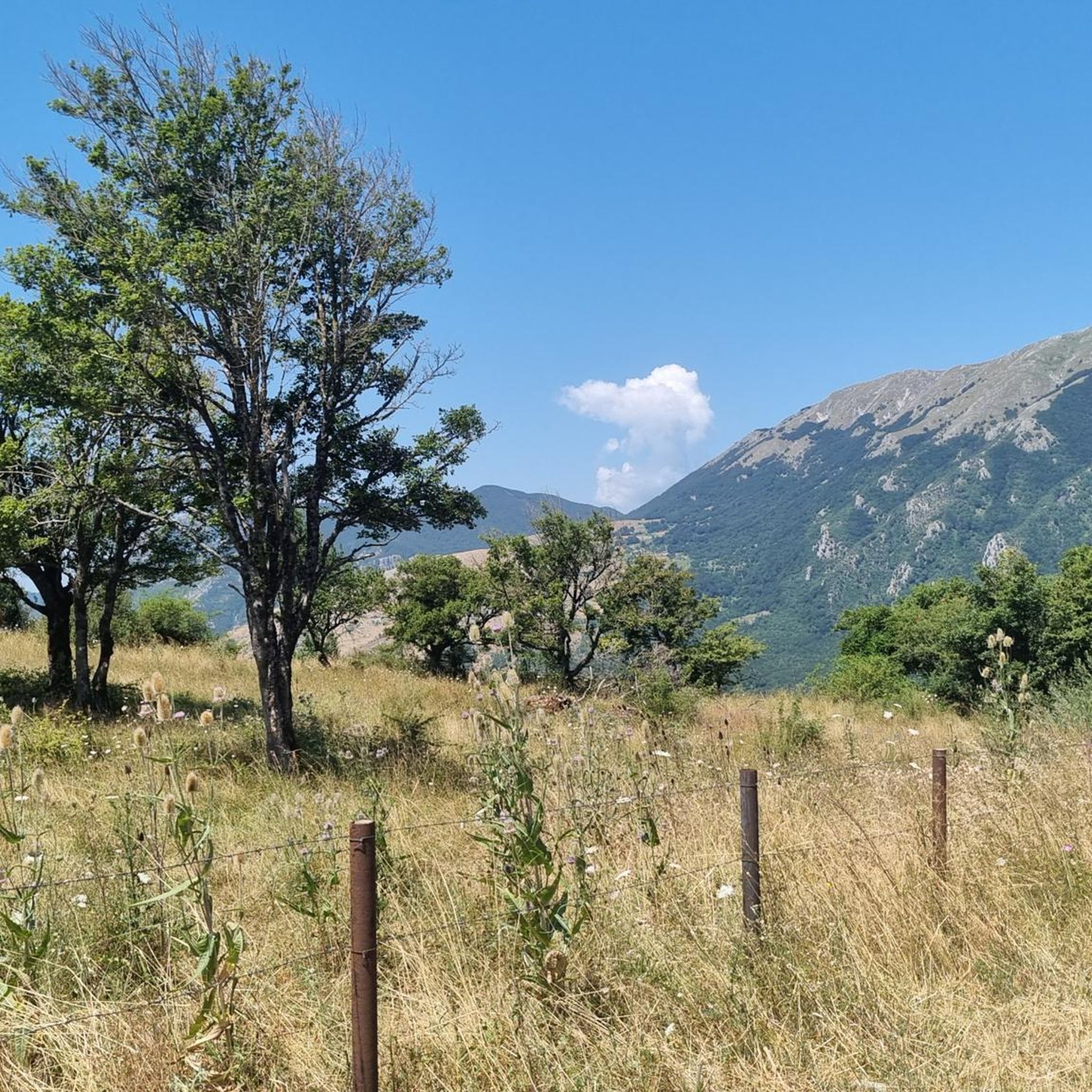
Monte Mutria is the highest peak of the Guardiaregia-Campochiaro Regional Reserve, with its 1823 meters of altitude. Near the top is the chapel of Sant'Antonio, built in the 1990s and a destination for summer pilgrimages. The panorama extends over the great mountains of the Apennines, and on the clearest days you can even see the sea.
2
0

Here we are in an area with forest near the "5 of Coins" (they are along the path continuing south). This is five beech hedge.
1
0
From here it is possible to enjoy a beautiful panoramic view of the Pesco Lombardo and Pastonico mountains, among the closest ones, and the whole valley below.
1
0
From here there is a beautiful view of Monte Erbano from a distance, while to the east is Montalto with its 851 meters.
1
0
The waterfall can be admired from a medieval bridge, and the water here falls about 30 meters (in the warmer months the waterfall could be dry).
1
0
Here it is possible to see the Arcichiaro dam, designed in 1975 but never put into operation.
1
0
The Rifugio Bocca della Selva is a mountain refuge, and also a restaurant, bar, hotel, tobacco shop and a location for events. The day of the weekly closure is currently Monday.
1
0

Bridge over titern9, now only cycle and pedestrian path
0
0
Frequently Asked Questions
What types of hiking trails can I find around Pietraroja?
Pietraroja, situated within the Matese Regional Park, offers a diverse range of hiking trails. You'll find routes suitable for various fitness levels, including easy paths, moderate trails, and more challenging treks. In total, there are over 50 hiking routes available, with 16 easy, 24 moderate, and 12 difficult options.
Are there any family-friendly hiking trails in Pietraroja?
Yes, Pietraroja has several easy trails perfect for families. One excellent option is the Monte Mutria – loop tour – Matese Regional Park, an easy 4.8 km (3.0 miles) route that offers panoramic views and takes about 1 hour 41 minutes to complete. Another easy choice is the Vallantica Waterfall - Matese Regional Park, a 5.1 km (3.2 miles) trail that leads to a beautiful waterfall.
Are there any circular walks or loop trails in the Pietraroja area?
Yes, many trails around Pietraroja are designed as circular routes. Besides the popular Monte Mutria loop, you can explore the Grotta delle fate – ring tour – Parco Regionale del Matese, an easy 4.6 km (2.9 miles) path exploring natural features. For a moderate option, consider the Bocca della Selva – loop tour – Matese Regional Park, which is 12.4 km (7.7 miles) long.
What natural features or landmarks can I see while hiking near Pietraroja?
Pietraroja is rich in natural beauty and unique geological sites. You can hike to the summit of Mount Mutria for expansive views, or explore trails leading to the Grotta delle Fate (Fairy Cave). The region is also home to the Pietraroja Geo-Paleontological Park, famous for the dinosaur fossil 'Ciro'. You can also find highlights like Lake Campolattaro - WWF Oasis and viewpoints such as Belvedere del Pianellone: View over Lake Matese.
Are there any hikes that include waterfalls in Pietraroja?
Yes, you can find trails that lead to waterfalls. The Vallantica Waterfall - Matese Regional Park is an easy 5.1 km (3.2 miles) hike specifically designed to take you to the Vallantica Waterfall, offering a refreshing natural experience.
What is the best time of year to go hiking in Pietraroja?
The Matese Regional Park, where Pietraroja is located, offers beautiful scenery throughout much of the year. Spring and autumn generally provide the most pleasant hiking conditions with mild temperatures and vibrant landscapes. Summer can also be suitable, especially for higher elevation trails, but be prepared for warmer weather. Winter hikes are possible but may require specific gear and caution due to snow and ice, particularly on higher peaks like Mount Mutria.
What do other hikers say about the trails in Pietraroja?
The hiking routes in Pietraroja are highly regarded by the komoot community, with an average rating of 4.4 stars from over 120 reviews. Hikers often praise the diverse terrain, the stunning views from peaks like Mount Mutria, and the immersive experience within the Matese Regional Park. Many appreciate the variety of trails catering to different skill levels.
Can I combine hiking with cultural or scientific exploration in Pietraroja?
Absolutely. Pietraroja is unique for its Geo-Paleontological Park, home to the remarkably preserved dinosaur fossil 'Ciro'. This site offers a fascinating educational experience, providing insights into prehistoric life and the geological history of the area. You can easily combine a hike in the Matese Regional Park with a visit to the park for a blend of outdoor adventure and scientific discovery. More information can be found at isprambiente.gov.it.
Are there any historical sites or castles near the hiking trails?
Yes, the region around Pietraroja features several historical sites and castles. You can explore nearby settlements like Faicchio, Morcone, and Guardia Sanframondi, which often have historical centers. Additionally, the Gioia Sannitica Castle is another notable landmark in the vicinity.
What is the typical duration for hikes around Pietraroja?
Hike durations vary significantly depending on the trail's length and difficulty. Easy routes like the Monte Mutria loop can take around 1 hour 41 minutes for 4.8 km (3.0 miles). Moderate trails, such as the Civitella Vicino, Grotta delle Fate e Grotta dei Briganti – loop in the Parco Regionale del Matese, which is 8.9 km (5.5 miles), typically take about 3 hours 2 minutes. Longer or more challenging routes will naturally require more time.
Is Pietraroja a good destination for wildlife spotting?
Pietraroja is located within the Matese Regional Park, an area known for its rich natural diversity. While specific wildlife sightings are never guaranteed, the park's varied ecosystems, including forests and mountain landscapes, provide habitats for a range of animals. Keep an eye out for local bird species, small mammals, and other wildlife typical of the Apennine mountains during your hikes.
Most popular attractions around Pietraroja

Get inspired with the komoot mobile app


Explore more
Browse the best Hikes in other regions.
