The best walks and hikes around San Lorenzo Maggiore
4.4
(91)
298
hikers
33
hikes
Hiking around San Lorenzo Maggiore offers diverse terrain for outdoor exploration. The region is characterized by its varied landscape, including hills like Monte Pendime and Pizzo dei Favi, and natural features such as the Vallantica Waterfall within the Matese Regional Park. These areas provide a mix of forested paths and open ascents, contributing to a range of hiking experiences.
Best hiking trails around San Lorenzo Maggiore
- The most popular hiking route is From Vitulano to Monte Pendime – ring tour…
Last updated: July 8, 2026
3.2
(5)
28
hikers
10.5km
03:47
630m
620m
Moderate hike. Good fitness required. Easily-accessible paths. Suitable for all skill levels.
4.0
(2)
6
hikers
5.11km
01:32
150m
150m
Easy hike. Great for any fitness level. Easily-accessible paths. Suitable for all skill levels.

Sign up for free
12.1km
03:43
410m
410m
Moderate hike. Good fitness required. Easily-accessible paths. Suitable for all skill levels.
4.5
(6)
23
hikers
12.5km
03:36
310m
310m
Moderate hike. Good fitness required. Easily-accessible paths. Suitable for all skill levels.
3.8
(6)
13
hikers
6.89km
02:07
240m
240m
Moderate hike. Good fitness required. Easily-accessible paths. Suitable for all skill levels.
Get access to more routes and recommendations from other explorers.
Sign up for free
Already have an account?
Our route recommendations are based on thousands of hikes, rides, and runs completed by other people on komoot.
Start today with a free account
Your next adventure awaits.
Login or Signup

Tips from the Community

a small clearing, located before the path that leads to the hermitage of San Michele, with some picnic tables
0
0
a large clearing in the middle of the woods, with a few picnic tables
0
0

Hermitage set in the rock which is just over a thousand meters above sea level. An ancient place probably dating back to the Lombard era.
2
0
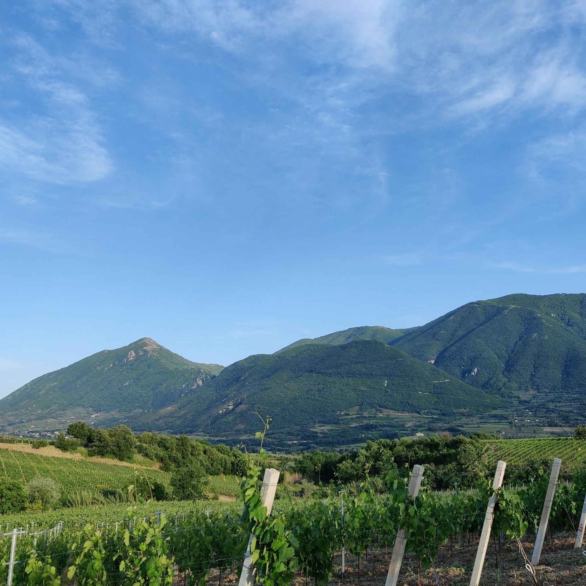
A regional park located on the Taburno Camposauro massif in the province of Benevento. A destination much appreciated by hikers and cyclists for the beauty of its beech woods and the views of the plain below.
1
0

This is the heart of the Taburno Camposauro Regional Park, just below the summit of Monte Camposauro which can be reached by a gravel road turning off at the Chapel of Santa Barbara. There is a fountain and some picnic tables.
1
0

This regional park was established in 2002 and is located in the province of Benevento. It takes its name from the two highest peaks: the Taburno mountains (1,394 m) and Camposauro (1,388 m). Inside the protected area, vast open spaces alternate with thick woods, especially beech woods.
1
0
The hermitage is located within the Taburno-Camposauro Regional Park. To reach it, it is necessary to take path 720, immersed in a thick and wonderful forest. The structure is leaned against the majestic limestone rock walls. A beautiful discovery!
2
0

Pizzo dei Favi is located within the Taburno Regional Park, at a height of 1187 metres. The closest refuge is the Vitulano refuge. From here it is possible to enjoy a 360 degree panoramic view, and you can see Monte Miletto, Monte Rosa, Monte Altorotondi and many other peaks around.
1
0
Frequently Asked Questions
How many hiking trails are available around San Lorenzo Maggiore?
There are over 25 hiking routes in the San Lorenzo Maggiore area, offering a variety of experiences from easy strolls to more challenging moderate ascents. The komoot community has explored these trails over 200 times.
Are there any easy hiking trails suitable for beginners or families?
Yes, San Lorenzo Maggiore offers 14 easy hiking trails perfect for beginners or families. A great option is the Vallantica Waterfall - Matese Regional Park route, which is an easy 3.2-mile (5.1 km) path leading to a scenic waterfall.
What do other hikers enjoy most about hiking in San Lorenzo Maggiore?
The area is highly rated by the komoot community, with an average score of 4.3 stars from over 80 reviews. Hikers often praise the diverse terrain, including hills like Monte Pendime and Pizzo dei Favi, and natural features such as the Vallantica Waterfall, which provide a mix of forested paths and open ascents.
Are there any circular hiking routes in San Lorenzo Maggiore?
Yes, several circular routes allow you to start and end in the same location. For example, the From Vitulano to Monte Pendime – ring tour is a popular moderate 6.5-mile (10.5 km) option. Another is the Fountain of the Trinity – Pizzo dei Favi loop from Rifugio Vitulano, a moderate 7.7-mile (12.5 km) trail.
Are there any trails that feature waterfalls?
Absolutely. The Vallantica Waterfall - Matese Regional Park trail is specifically designed to lead you to the beautiful Vallantica Waterfall within the Matese Regional Park, offering a rewarding natural spectacle.
What kind of landmarks or attractions can I see along the hiking trails?
Hiking around San Lorenzo Maggiore offers views of various landmarks. You can encounter mountain peaks like Pizzo dei Favi and the Monte Pentime Summit Cross. Other notable attractions include the Lavello Gorges and the historic Hermitage of San Menna.
How long do hikes in San Lorenzo Maggiore typically take?
Hike durations vary depending on the trail's length and difficulty. Easy trails like the Vallantica Waterfall - Matese Regional Park can be completed in about 1 hour 30 minutes. More moderate routes, such as the Leonessa from San Lupo Trail (7.5 miles / 12.1 km), typically take around 3 hours 40 minutes.
Are there any trails with good viewpoints?
Many trails in the region offer excellent viewpoints, especially those ascending hills and peaks. Routes that traverse Monte Pendime or Pizzo dei Favi, such as the From Vitulano to Monte Pendime – ring tour, provide panoramic vistas of the surrounding landscape.
What is the best time of year to go hiking in San Lorenzo Maggiore?
The spring and autumn months generally offer the most pleasant hiking conditions in San Lorenzo Maggiore, with milder temperatures and vibrant natural scenery. Summer can be warm, so early morning or late afternoon hikes are often preferred, while winter may bring cooler temperatures and potentially some snow at higher elevations.
Are there any less crowded hiking options for a more peaceful experience?
While popular routes can see more visitors, exploring some of the lesser-known trails or hiking during off-peak hours (early mornings, weekdays) can offer a more tranquil experience. The region has 27 trails in total, so there are many options to discover beyond the most frequented paths.
Can I find trails that are suitable for dog walking?
Many trails in the San Lorenzo Maggiore area are suitable for dogs, provided they are kept on a leash and you follow local regulations regarding pet waste. It's always a good idea to check specific trail information or local park rules before heading out with your dog.
Most popular routes around San Lorenzo Maggiore
Most popular attractions around San Lorenzo Maggiore

Get inspired with the komoot mobile app


Explore more
Browse the best Hikes in other regions.
