The best cycling routes around Schlegel
4.5
(2449)
10,944
riders
423
rides
Touring cycling around Schlegel, located in eastern Germany, offers routes through a landscape characterized by rolling hills and scenic valleys. The region features natural beauty with areas like the Rothental Valley and the Selbitz river, providing varied terrain for cyclists. While the village itself is suitable for shorter excursions, its surroundings can be integrated into broader regional touring cycling routes. The area provides a blend of natural features and cultural heritage, making it appealing for outdoor activities.
Best touring cycling routes around Schlegel
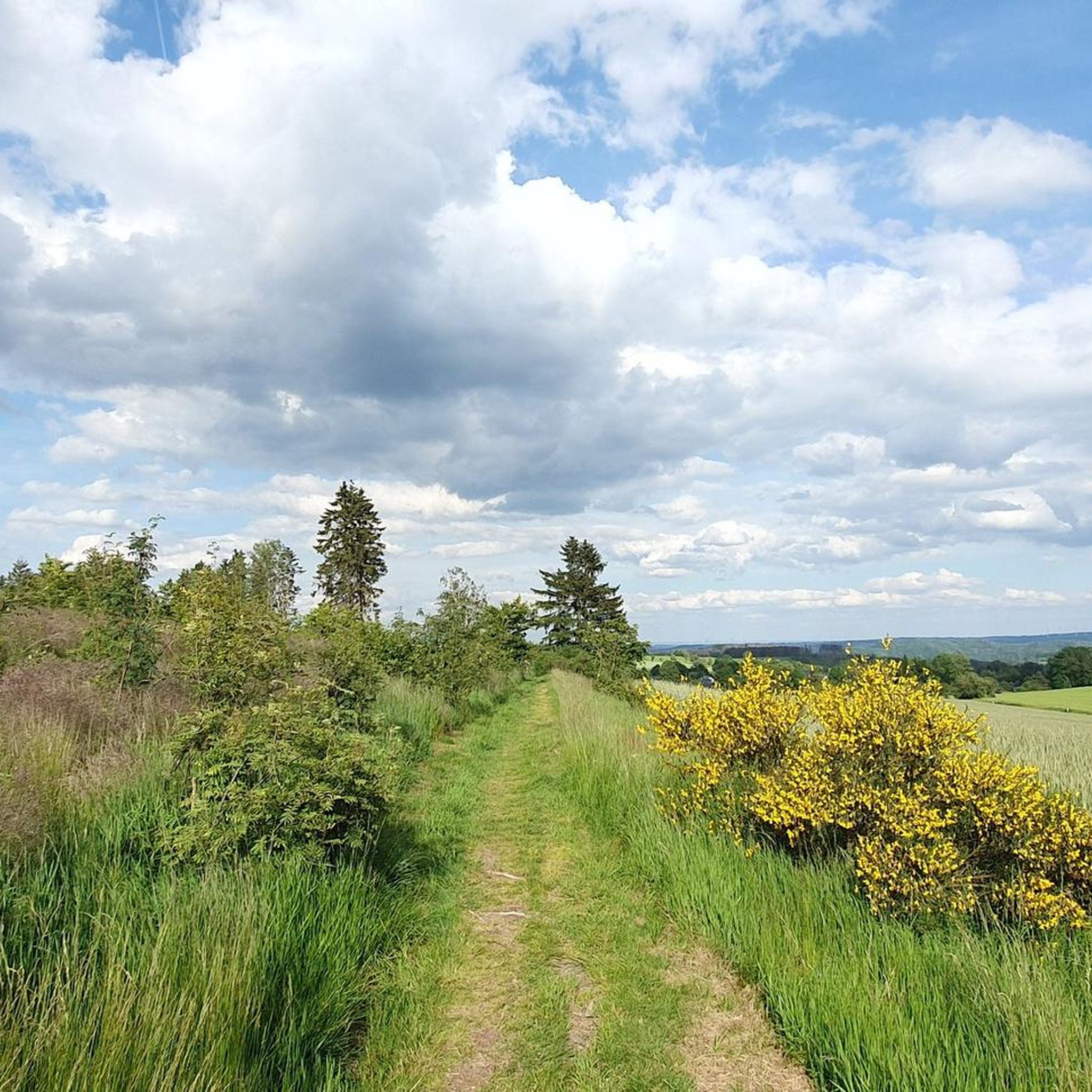
- The most popular touring cycling route is Tour zur Kur, a 21.2 miles (34.1 km) trail that takes 2 hours 17 minutes to complete. This route offers a moderate challenge through the local landscape.
- Another top favourite among local touring cyclists is Höllental along the Selbitz – Höllental Gorge (Franconian Forest) loop from Lichtenberg, a moderate 11.7 miles (18.9 km) path. This route explores the scenic Höllental Gorge alongside the Selbitz river.
- Local touring cyclists also love the Jungfernsteg Bridge – Höllental along the Selbitz loop from Bad Steben, a 19.7 miles (31.7 km) trail leading through the Höllental along the Selbitz, often completed in about 2 hours 16 minutes.
- Touring cycling around Schlegel is defined by rolling hills, river valleys, and forested areas. The network offers options for different ability levels, from moderate rides to more challenging routes.
- The routes in Schlegel are highly rated by the komoot community with an average score of 4.5 stars from over 2400 reviews. More than 11000 touring cyclists have used komoot to explore Schlegel's varied terrain.
Last updated: May 14, 2026
4.6
(92)
328
riders
34.1km
02:17
400m
400m
Moderate bike ride. Good fitness required. Mostly paved surfaces. Suitable for all skill levels.
4.6
(98)
339
riders
Moderate bike ride. Good fitness required. Mostly paved surfaces. Suitable for all skill levels.

Sign up for free
4.7
(75)
323
riders
Moderate bike ride. Good fitness required. Mostly paved surfaces. Suitable for all skill levels.
4.6
(57)
249
riders
Moderate bike ride. Good fitness required. Mostly paved surfaces. Suitable for all skill levels.
4.5
(42)
190
riders
Hard bike ride. Very good fitness required. You may need to push your bike for some segments of this route.
Get access to more routes and recommendations from other explorers.
Sign up for free
Already have an account?
Our route recommendations are based on thousands of hikes, rides, and runs completed by other people on komoot.
Start today with a free account
Your next adventure awaits.
Login or Signup
Tips from the Community

There is a very large enclosure with fallow deer here.
3
0

The route climbs gently almost continuously, gaining a total elevation of 150 meters. Unfortunately, more and more forest disappears along the route.
1
0

In 1933, a wood mill was converted into the current hydroelectric power plant. Along the right bank of the Selbitz River, the 1.60-meter-high pipes run 1,855 meters in length, with a drop of 37.4 meters, carrying water from the weir to the water tower and from there into the power plant. During the summer months, on Sundays and public holidays, and when the water level is sufficient, a 28-meter-high water fountain can be seen at the power plant, delighting hikers.
13
0
The Rennsteig Trail ends at this bridge—the border between Thuringia and Bavaria. Here, the pebbles collected from the Werra in Hörschel are transferred to the Selbitz River.
8
0
The spa gardens in Bad Steben were created to offer both guests and locals a chance to escape from everyday life and enjoy the magnificent floral displays and the splashing fountains. Few people know that many years ago, there was a mine right next to the spa square. If you look closely, you can still see traces of the past in the ground. Back then, iron and copper were extracted from the depths using the simplest of means.
16
0
In 1887, the local railway line from Hof via Naila to Marxgrün was opened and extended to Bad Steben in 1898. As early as 1897, Blankenstein received a railway connection via Lobenstein to Triptis. Due to the industrialization of the Franconian Forest, particularly the Rosenthal paper mill, an extension of the line through the Höllental Valley to Marxgrün was planned. From 1900 to 1901, 250 workers built the 6.3-kilometer-long Höllental Railway from Marxgrün via Hölle, through the valley, and via Blechschmidtenhammer to Blankenstein. On August 14, 1901, the first train ran through the Höllental Valley. In April 1945, the last train ran on the Höllental Railway. The inner-German border marked the end of the connection between Bavaria and Thuringia. In 1971, freight traffic to Blechschmidtenhammer ended on the Bavarian side. Around ten years later, the German Federal Railway had the tracks in the Höllental Valley torn out. The old train station building in Blechschmidtenhammer has been preserved and is now the information center of the Franconian Forest Nature Park.
10
0

It goes 10 km uphill, but never steep
0
0
Frequently Asked Questions
How many touring cycling routes are available around Schlegel?
There are over 400 touring cycling routes in the Schlegel area, offering a wide range of options for different skill levels and preferences. These routes are highly rated by the komoot community, with an average score of 4.5 stars.
Are there any easy touring cycling routes suitable for beginners or families?
Yes, Schlegel offers several easy touring cycling routes. For instance, the Selbitz Cycle Path – Höllensprudel Spring House loop from Bad Steben is an easy 20.5 km path that takes approximately 1 hour 15 minutes to complete, making it a good option for a relaxed ride.
What kind of terrain can I expect on touring cycling routes in Schlegel?
The touring cycling routes around Schlegel are characterized by rolling hills, scenic river valleys, and forested areas. You'll find varied terrain that includes both gentle inclines and more challenging ascents, often following natural features like the Rothental Valley and the Selbitz river.
Are there any circular touring cycling routes in the Schlegel area?
Yes, many routes around Schlegel are designed as loops. An example is the Höllental along the Selbitz – Höllental Gorge (Franconian Forest) loop from Lichtenberg, a moderate 18.9 km route that allows you to start and end in the same location.
What are some scenic highlights or natural attractions I can see while cycling?
While cycling, you can explore natural monuments such as the dramatic Höllental (Hell Valley) and the Höllental Gorge (Franconian Forest). The region also features the picturesque Rothental Valley and the Stegenbach Waterfall, offering beautiful spots for a break. Don't miss the König David Viewpoint for expansive views.
Are there any challenging touring cycling routes for experienced riders?
Absolutely. For experienced touring cyclists seeking a challenge, routes like the Jungfernsteg Bridge – Höllental along the Selbitz loop from Bad Steben offer a difficult 31.7 km ride with significant elevation changes. Another demanding option is the Bad Steben spa park and cafés – South End of Ködeltalsperre loop from Bad Steben, which covers 41.5 km.
What do other touring cyclists enjoy most about the routes in Schlegel?
The area is highly rated by the komoot community, with an average score of 4.5 stars from over 2,400 reviews. Reviewers often praise the diverse landscapes, the blend of natural beauty and cultural heritage, and the well-maintained paths that make for an enjoyable cycling experience.
Are there places to stop for refreshments or rest along the routes?
Yes, you'll find various spots for refreshments and rest. There are several huts and shelters, such as the Meiler Hohe Tanne Shelter and the Shelter on the Horse Trail. For a more substantial stop, consider the Reile am Rennsteig Tavern & Snack Bar.
What is the best season for touring cycling in Schlegel?
The best season for touring cycling in Schlegel is generally from spring to autumn. During these months, the weather is most favorable for outdoor activities, allowing you to fully enjoy the region's natural beauty and scenic routes. Summer offers lush landscapes, while autumn provides vibrant foliage.
Can I find routes that pass by historical sites or cultural landmarks?
While the focus is on natural landscapes, the region around Schlegel does offer cultural heritage. Schlegel Castle, a 13th-century fortress, and its beautifully maintained Hofgarten provide a glimpse into the region's past and can be integrated into your cycling excursions.
Is there parking available at the trailheads for touring cyclists?
While specific parking details for every trailhead are not listed, many popular cycling regions in Germany, including areas like Schlegel, typically offer designated parking facilities near trail access points, especially in or near villages and towns that serve as starting points for routes. It's advisable to check local signage upon arrival.
Most popular attractions around Schlegel

Get inspired with the komoot mobile app


Explore more
Browse the best Cycling routes in other regions.
