The best running trails around Filettino
4.5
(2)
261
runners
24
runs
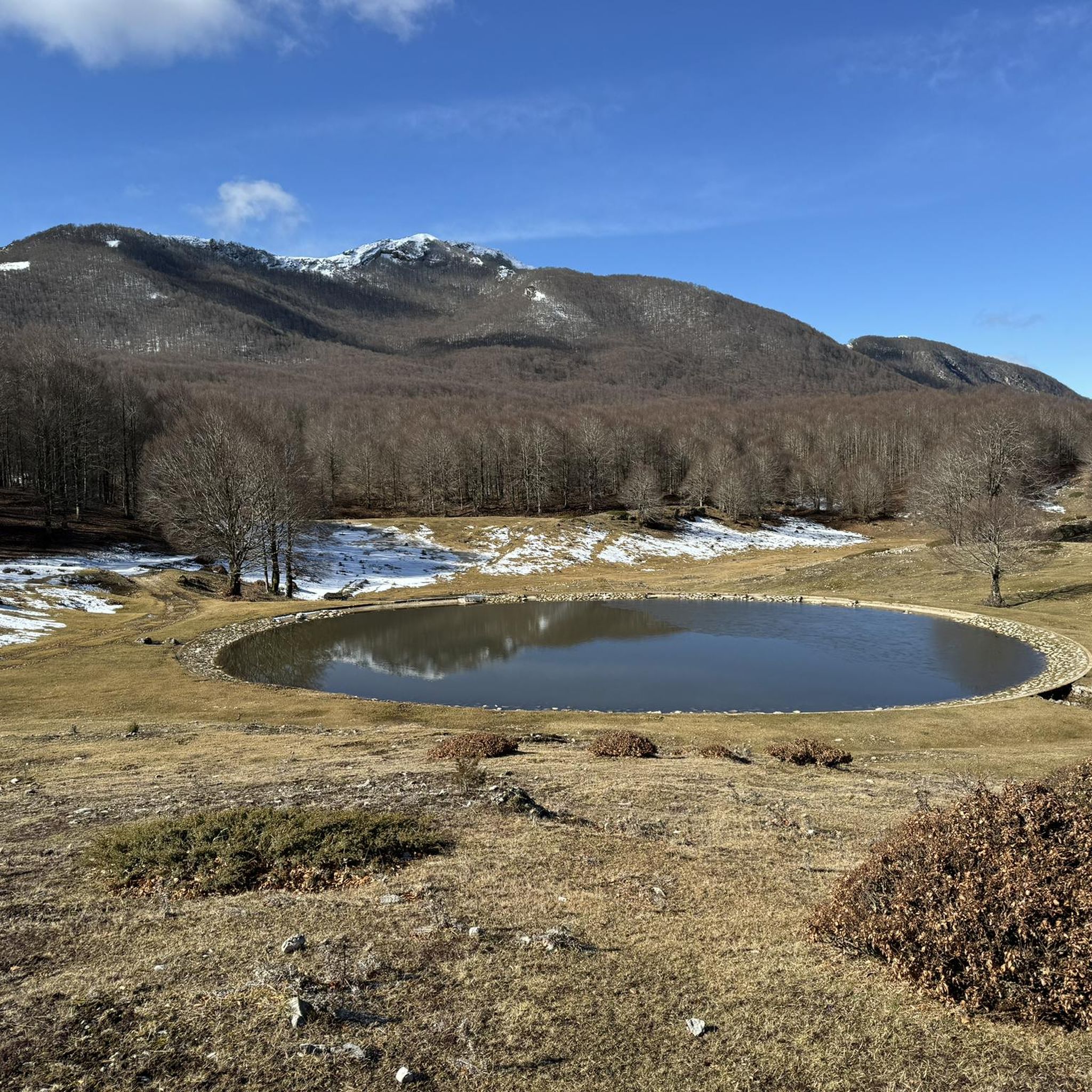
Jogging routes around Filettino are set within a mountainous landscape, nestled over 1,000 meters above sea level. The region is characterized by significant peaks such as Monte Viglio and Monte Autore, offering varied elevation for runners. Diverse forests of fir, birch, beech, and oak trees provide shaded paths, while the source of the Aniene River and Pertuso Lake add natural features to the terrain. This environment supports a range of running experiences, from forest trails to more challenging mountain ascents.
…Last updated: October 22, 2026
9.37km
01:15
250m
250m
Jog this 5.8-mile (9.4 km) moderate route from Trevi in Lazio to the ancient Arco di Trevi, gaining 831 feet (253 metres) through scenic bee
24
runners
10.3km
01:23
390m
390m
Hard run. Very good fitness required. Mostly paved surfaces.

4.0
(1)
14
runners
10.1km
01:53
650m
660m
Hard run. Very good fitness required. Sure-footedness, sturdy shoes and alpine experience required.
18
runners
19.8km
02:54
990m
990m
Hard run. Very good fitness required. Sure-footedness, sturdy shoes and alpine experience required.
10
runners
22.3km
03:37
1,340m
1,340m
Hard run. Very good fitness required. Sure-footedness, sturdy shoes and alpine experience required.
Get access to more routes and recommendations from other explorers.
Already have an account?
Our route recommendations are based on thousands of hikes, rides, and runs completed by other people on komoot.
Start today with a free account
Your next adventure awaits.

Tips from the Community


Simple walk but with a wonderful view!!
0
0

Panoramic point at about 1750 meters above sea level, important crossroads for singletrack
0
0

Very beautiful, but be careful with the loose gravel base.
0
0

Vallepietra is a small village nestled in the Simbrivio River valley. The view from the village is exceptional: the wooded peak of Mount Autore, the rocky walls of the Santissima Trinità sanctuary, and the narrow valley carved out by the river.
0
0
Hello everyone, I can only tell you that it was a lucky excursion for a great running event on all the paths of Campo dell'Osso up to Monte Autoro, a beautiful trial marathon with many participants. Just the day, cool and sunny, perfect day
0
0

At the end of the dirt road that starts from Campo Minnio you arrive at the panoramic point Le Vedute with a view of Monte Tarino, Monte Viglio and the Santissima Trinità
0
0

Monna dell'Orso is a mountain located in the Monte Livata district, in the Simbruini Mountains. With a height of 1,745 meters above sea level, it is one of the most emblematic peaks in the area. The mountain is famous for its ski resort, which includes a four-seater chairlift that allows you to easily reach the top and enjoy spectacular views of the surrounding valley. In addition to winter, Monna dell'Orso is also a popular destination during the summer season, thanks to its trails that lead to panoramic excursions in the heart of the Simbruini Mountains Regional Natural Park.
2
0
Frequently Asked Questions
What kind of terrain can I expect on running routes around Filettino?
Running routes around Filettino are primarily set within a mountainous landscape, nestled over 1,000 meters above sea level. You'll find varied elevation, with significant peaks like Monte Viglio and Monte Autore. The terrain includes diverse forests of fir, birch, beech, and oak trees, offering shaded paths, as well as natural features like the source of the Aniene River and Pertuso Lake.
Are there any running routes suitable for beginners in Filettino?
The running routes in Filettino are generally categorized as moderate to difficult. While there are no routes specifically listed as 'easy' in our data, moderate options like the Sentiero Italia CAI Cycle Route (9.4 km) offer a steady challenge without extreme ascents. It's advisable for beginners to choose shorter, less steep sections or consider walking parts of the moderate trails.
Can I find routes with waterfalls or other natural water features?
Yes, the region is rich in natural water features. The source of the Aniene River is located near Filettino, and Pertuso Lake is a popular spot. For a specific route featuring a waterfall, consider the challenging Zompo Lo Schioppo Waterfall loop from Zompo lo Schioppo, which takes you through the Zompo lo Schioppo Regional Reserve.
Are there any circular running routes in the Filettino area?
Yes, there are several circular running routes available. A popular moderate option is the Pozzo della Neve – Pozzo della Creta Rossa loop from Volubro Vecchio, which explores varied terrain over about 10.4 km. For a longer, more challenging loop, the Certosa di Trisulti – Pozzo D'Antullo loop from Collepardo covers 18.6 km through mountainous terrain.
What are some notable landmarks or scenic viewpoints I can encounter while running?
Filettino is surrounded by impressive peaks offering panoramic views. You might encounter highlights such as the Monte Autore Summit or the Monte Viglio summit (2,156 m), which is the highest point of the Cantari Mountains. The Monna della Forcina Meadow also offers scenic natural beauty.
How long are the running trails in Filettino typically?
The running trails in Filettino vary in length. Many popular routes range from approximately 9 km to 18 km. For example, the Sentiero Italia CAI Cycle Route is about 9.4 km, while the Certosa di Trisulti – Pozzo D'Antullo loop from Collepardo is 18.6 km. There are 19 routes in total, offering a good range of distances.
What do other runners say about the trails in Filettino?
The running routes in Filettino are highly rated by the komoot community, with an average score of 3.5 stars. Over 200 runners have used komoot to explore the varied terrain, often praising the mountainous landscapes and diverse forests that provide a unique and challenging experience.
Are there any challenging running routes for experienced runners?
Absolutely. Filettino offers several difficult routes for experienced runners seeking a challenge. For instance, the Running loop from Canistro is a demanding 10.3 km trail with significant elevation changes. The region's mountainous terrain, including peaks like Monte Viglio, provides ample opportunities for advanced trail running.
What is the best time of year to go running in Filettino?
Filettino, nestled over 1,000 meters above sea level, offers varied conditions throughout the year. While specific 'best times' depend on personal preference, the warmer months are ideal for exploring the higher mountain trails. Even in winter, areas like Campo Staffi, known for its ski slopes, can offer different forms of outdoor exercise, though specific running conditions would depend on snow cover.
Is Filettino a good destination for outdoor enthusiasts beyond just running?
Yes, Filettino is an exceptional destination for a wide range of outdoor activities. Its location between the Monti Simbruini Regional Natural Park and the Zompo lo Schioppo Regional Reserve makes it perfect for hiking and cycling. The area also hosts events like the annual 'Filettino in Corsa' road race, highlighting its active outdoor community. Pertuso Lake is popular for trout fishing, and in winter, Campo Staffi offers skiing.
Are there any specific trails that offer views of the wider Apennines?
Yes, Monte Autore (1,854 meters) provides expansive panoramic views of the Apennines. From its summit, you can often see distant sights of Gran Sasso and Mount Velino. While not a specific running route itself, incorporating a climb towards such peaks or trails that traverse their slopes would offer these breathtaking vistas.
Most popular attractions around Filettino

Get inspired with the komoot mobile app


Explore more
Browse the best Running Trails & Routes in other regions.
