The best walks and hikes around Montelanico
4.5
(536)
2,330
hikers
101
hikes
Hiking around Montelanico offers access to the diverse landscapes of the Lepini Mountains, characterized by green valleys and ancient paths. The region features centuries-old chestnut and beech woods, providing shaded routes and varied terrain. Montelanico also overlooks the Sacco River valley, contributing to scenic views. Hikers can encounter historical elements such as remnants of city walls and fortified towers integrated into the natural environment.
Best hiking trails around Montelanico
- The most popular hiking route is From Campo di Segni to…
Last updated: May 24, 2026
4.3
(51)
140
hikers
9.66km
03:20
520m
520m
Moderate hike. Good fitness required. Mostly accessible paths. Sure-footedness required.
4.6
(9)
41
hikers
18.2km
05:57
750m
750m
Hard hike. Very good fitness required. Mostly accessible paths. Sure-footedness required.

Sign up for free
4.3
(19)
103
hikers
8.34km
03:04
520m
520m
Moderate hike. Good fitness required. Mostly accessible paths. Sure-footedness required.
5
hikers
5.22km
01:59
340m
340m
Moderate hike. Good fitness required. Mostly accessible paths. Sure-footedness required.
5.0
(2)
15
hikers
6.41km
01:55
200m
200m
Easy hike. Great for any fitness level. Easily-accessible paths. Suitable for all skill levels.
Get access to more routes and recommendations from other explorers.
Sign up for free
Already have an account?
Our route recommendations are based on thousands of hikes, rides, and runs completed by other people on komoot.
Start today with a free account
Your next adventure awaits.
Login or Signup
Tips from the Community

Once you reach the top, a wonderful view
0
0

An excellent panoramic point (on the route towards Monte Lupone) from which to admire Piana di Segni.
0
0
Funnily enough, nature takes on the most imaginative forms, like this beech tree that appears to have a rhinoceros' head sticking out of its trunk.
0
0

It is worth lengthening the route from the top of Mount Lupone to cover this downhill section of the ridge. The panorama that can be enjoyed walking on the sea and on the interior of the Lepini mountains is incredible.
2
0
Monte Lupone is the northernmost peak of the Lepini massif. The altitude, 1,378 meters, is modest but you can still enjoy a 360-degree panorama that ranges from the Apennine peaks above Frosinone to the coast of the Tyrrhenian Sea.
4
0
The summit of Monte Locino can be reached by leaving the main path that leads to Monte Lupone. The ascent path is not marked but after the short stretch of wood the summit is clearly visible. From here you have a panoramic view of Campo di Segni and the top of Mount Lupone.
4
0
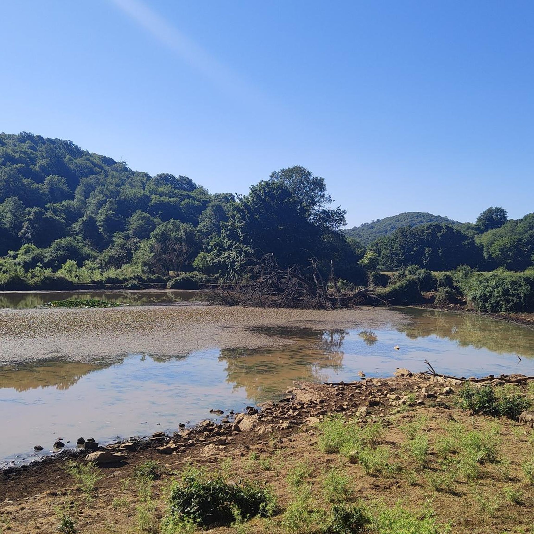
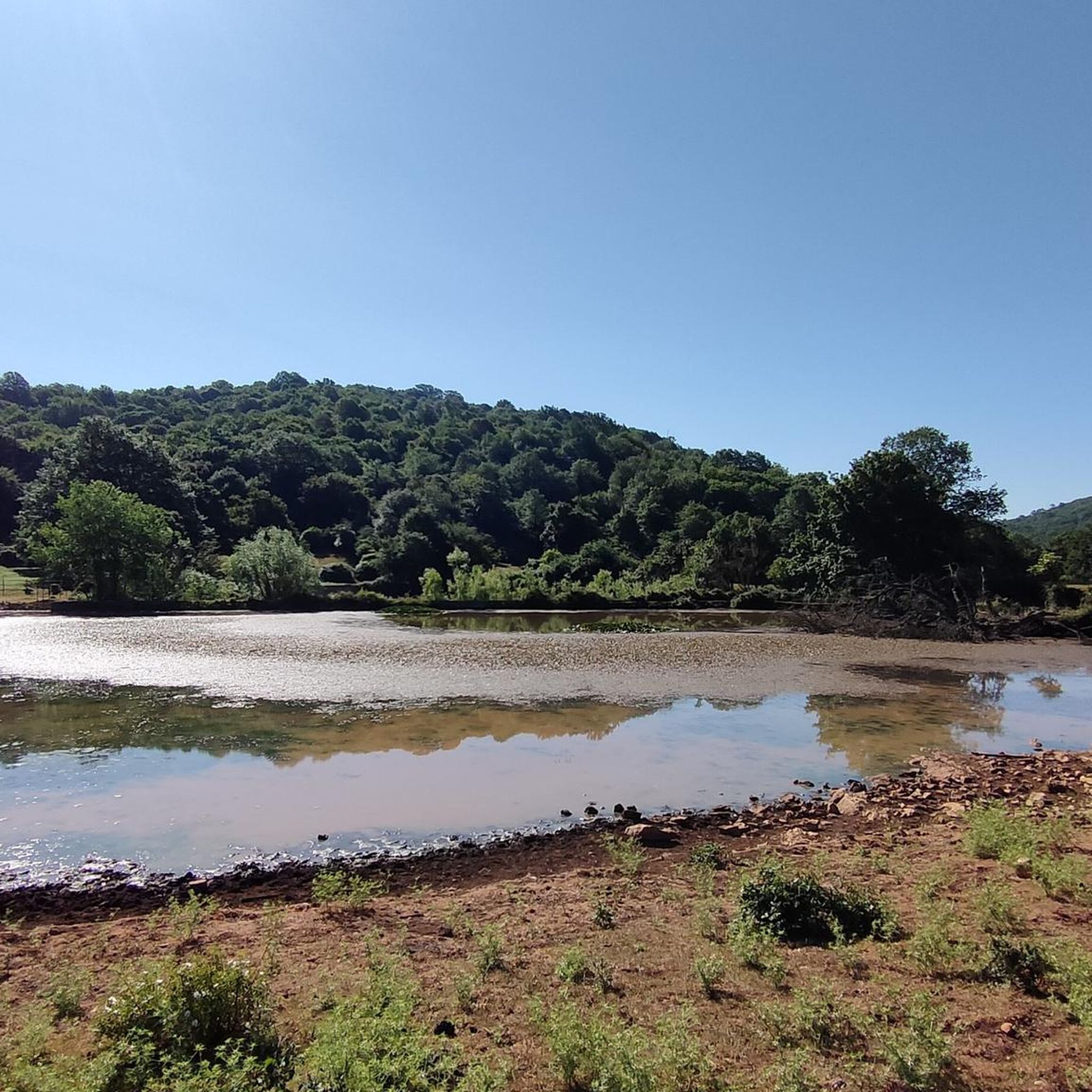
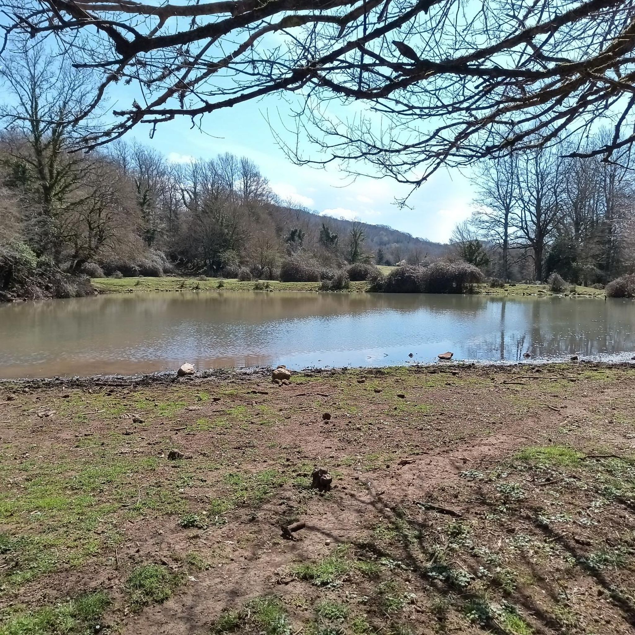
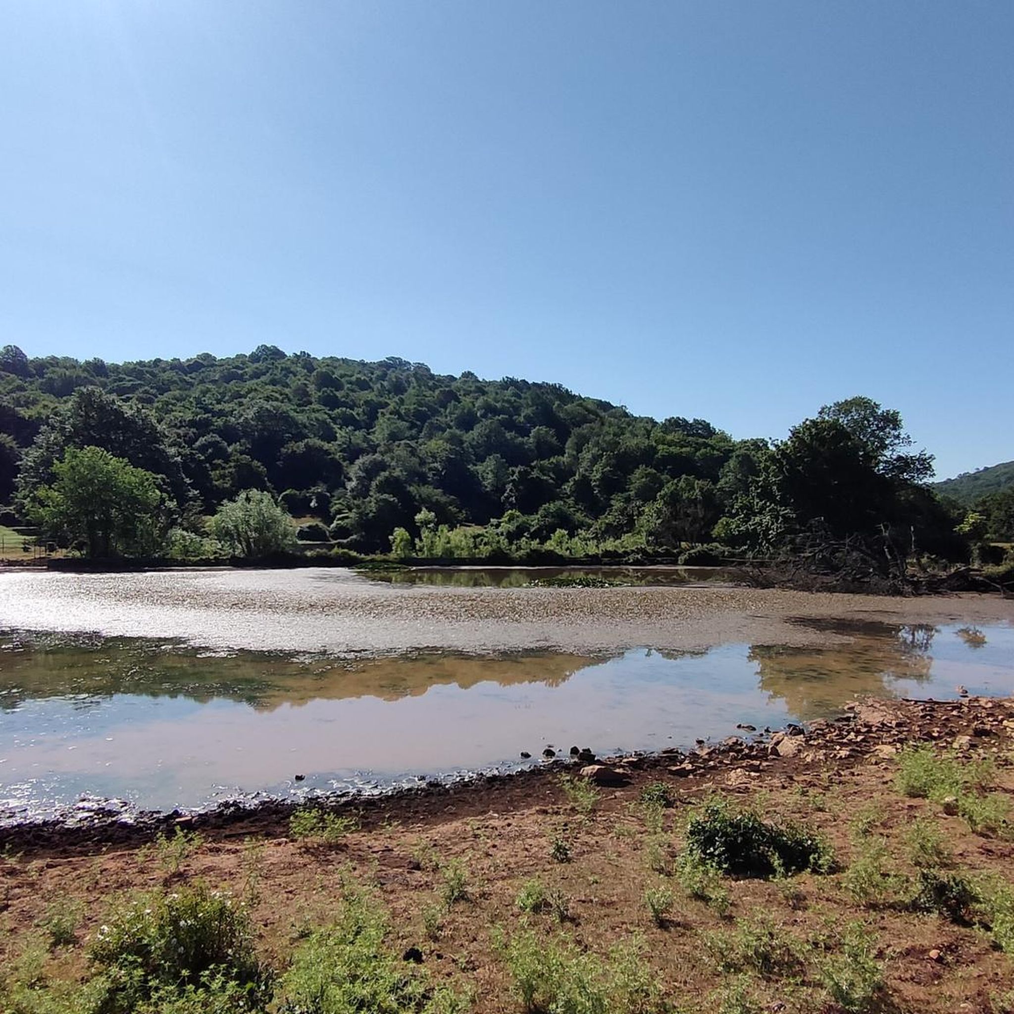
The field of Segni is the most evident evidence of the karst phenomenon on the Lepini mountains. On the large grassy plateau there are three volumes, small lakes used to water the livestock that graze freely here. This place is great for a family picnic surrounded by nature.
4
0

Alternative trekking to the usual tour on Monte Lupone, these two peaks are not far from each other, the path that runs along them at the bottom, therefore it is necessary to leave the path, which however is not very visible in some points.
0
0
Frequently Asked Questions
How many hiking trails are available around Montelanico?
There are nearly 100 hiking trails available around Montelanico, offering a wide range of options for different skill levels. You'll find everything from easy walks to more challenging ascents through the Lepini Mountains.
What are the different difficulty levels for hiking trails in Montelanico?
The trails around Montelanico cater to various fitness levels. There are 9 easy routes, 56 moderate routes, and 29 difficult routes, ensuring there's a suitable path for every hiker.
Are there many circular hiking routes in Montelanico?
Yes, Montelanico offers several excellent circular hiking routes. For example, you can explore the From Campo di Segni to Monte Lupone - ring tour, a moderate 9.7 km path, or the more challenging Loop of Mount Lupone from Segni – Lepini Mountains, which is 18.2 km long.
What kind of landscapes can I expect to see while hiking in Montelanico?
Hiking in Montelanico will take you through the diverse landscapes of the Lepini Mountains. You'll encounter green valleys, centuries-old chestnut and beech woods, and scenic views overlooking the Sacco River valley. The trails often feature a mix of mountainous terrain and dense woodlands.
Are there any easy trails suitable for beginners or families?
Yes, there are several easy trails perfect for beginners or families. One such option is the Campo di Segni – Campo di Segni loop from Punta dei Briganti, a 6.3 km route with minimal elevation gain, offering a pleasant walk through the natural surroundings.
What historical or cultural points of interest can be found along the trails?
Beyond the natural beauty, Montelanico's ancient origins mean you can discover historical elements integrated into the landscape. Remnants of city walls, fortified towers, and city gates are visible. Additionally, the Chapel of the Madonna di Collemezzo is nestled amidst the ancient beech and chestnut trees of the Lepini Mountains, offering a cultural stop on your hike.
What do other hikers enjoy the most about hiking in Montelanico?
The area is highly rated by the komoot community, with an average score of 4.6 stars from over 490 reviews. Reviewers often praise the varied terrain, the stunning views across the Lepini Mountains, and the peaceful atmosphere of the ancient woodlands.
Are there any prominent peaks or summits to aim for on a hike?
Yes, the Lepini Mountains offer several notable peaks. You can hike to the Summit of Monte Lupone, which is a popular destination. Other significant summits in the area include Monte Semprevisa (Daniele Nardi Peak) and Monte Malaina Summit.
Can I find trails that lead through dense forests?
Absolutely. Montelanico is surrounded by centuries-old chestnut and beech woods, providing picturesque and shaded routes. Many trails, such as the Summit of Monte Lupone – Campo di Segni loop from Campo di Segni, lead through these dense forested slopes, offering a refreshing experience.
Are there any natural monuments or unique geological features to explore?
Yes, the region around Montelanico features interesting natural monuments. You can explore the Giardini di Ninfa, known for its unique botanical gardens, or discover the Ouso di Passo Pratiglio Cave. These offer diverse natural experiences beyond typical hiking trails.
What is the best time of year to go hiking in Montelanico?
Montelanico offers pleasant hiking conditions for much of the year. Spring and autumn are particularly ideal, with mild temperatures and vibrant natural colors. The centuries-old chestnut and beech woods also provide shaded routes, making summer hiking enjoyable, especially in the mornings or late afternoons.
Is Montelanico easily accessible from Rome for a day trip?
Montelanico is located approximately 70 km from Rome, making it a feasible destination for a day trip. The village's proximity to the capital allows for relatively easy access to its extensive network of hiking trails in the Lepini Mountains.
Most popular attractions around Montelanico

Get inspired with the komoot mobile app


Explore more
Browse the best Hikes in other regions.
