The best MTB trails around Scheiblingkirchen-Thernberg
4.5
(281)
1,280
riders
16
rides
Mountain biking around Scheiblingkirchen-Thernberg offers diverse terrain within the district of Neunkirchen, Austria. The region is characterized by a varied topography, including rolling hills, dense forests, and scenic valleys, providing a suitable backdrop for outdoor activities. This landscape features natural monuments and offers a mix of challenging ascents and flowing descents for mountain bikers. The area's geographical setting supports a range of routes for different skill levels.
Best mountain bike trails around Scheiblingkirchen-Thernberg
- The most popular mountain bike trail is…
Last updated: October 5, 2026
4.5
(15)
84
riders
72.7km
06:02
1,480m
1,480m
Hard mountain bike ride. Very good fitness required. Advanced riding skills necessary.
4.6
(5)
31
riders
52.3km
03:48
920m
920m
Hard mountain bike ride. Very good fitness required. Advanced riding skills necessary.

5.0
(1)
18
riders
51.9km
03:28
500m
500m
Hard mountain bike ride. Good fitness required. Advanced riding skills necessary. Some portions of the route may require you to push your bike.
3.7
(3)
21
riders
47.3km
03:10
660m
660m
Moderate mountain bike ride. Good fitness required. Suitable for all skill levels.
5.0
(1)
12
riders
Moderate mountain bike ride. Good fitness required. Advanced riding skills necessary.
Get access to more routes and recommendations from other explorers.
Already have an account?
Our route recommendations are based on thousands of hikes, rides, and runs completed by other people on komoot.
Start today with a free account
Your next adventure awaits.
Popular around Scheiblingkirchen-Thernberg

Viennese Alpenbogen – Lower Austria's most beautiful peaks
Hiking around Scheiblingkirchen-Thernberg
Road Cycling Routes around Scheiblingkirchen-Thernberg
Cycling around Scheiblingkirchen-Thernberg
Running Trails around Scheiblingkirchen-Thernberg
Mountain Hikes around Scheiblingkirchen-Thernberg
Gravel biking around Scheiblingkirchen-Thernberg
Other adventures around Scheiblingkirchen-Thernberg

Tips from the Community

Small old train station in Scheiblingkirchen
3
0
Beautiful old building, unfortunately I don't know if you can visit it
3
0

The so-called Sauerbründl in Katzelsdorf is a picturesque spring capture, which visually resembles a small wooden hut for resting. A few steps lead down to the water source surrounded by striking, iron-red deposits. Today, the object serves as a popular resting place on hiking and walking trails, with the water explicitly not classified as drinking water.
2
0

Schloss Eichbüchl (Aichbüchl) was probably built in the 14th century by the Lords of Vierdung. According to other sources in Wiener Neustadt, it was supposedly only built between 1558 and 1566. It is possible that a first castle was destroyed during the First Turkish Siege in 1529 and that the current castle was rebuilt slightly off to the side.
1
0
Even when it's busy, in St. Wolfgang people take the time for a "little chat". The cooking and baking are absolutely wonderful, and the prompt and friendly service also leaves nothing to be desired. We are already looking forward to our next visit.
1
0
A church below the castle ("sub castello") is first mentioned from 1000 AD onwards and is likely to be one of the oldest Christian places of worship in the region. The rock cave behind the mountain church is dedicated to Saints Peter and Paul.
1
0
The former Hochwolkersdorf Castle, built in 1543 by Hans Freiherr von Weisspriach and redesigned in 1805, is located in the village center (Dorfstraße 8). The single-story building served as a state youth home from 1904 and today houses a social therapeutic residential community. Viewing the building, which was remodeled in the 19th century, is only possible from the outside.
1
0
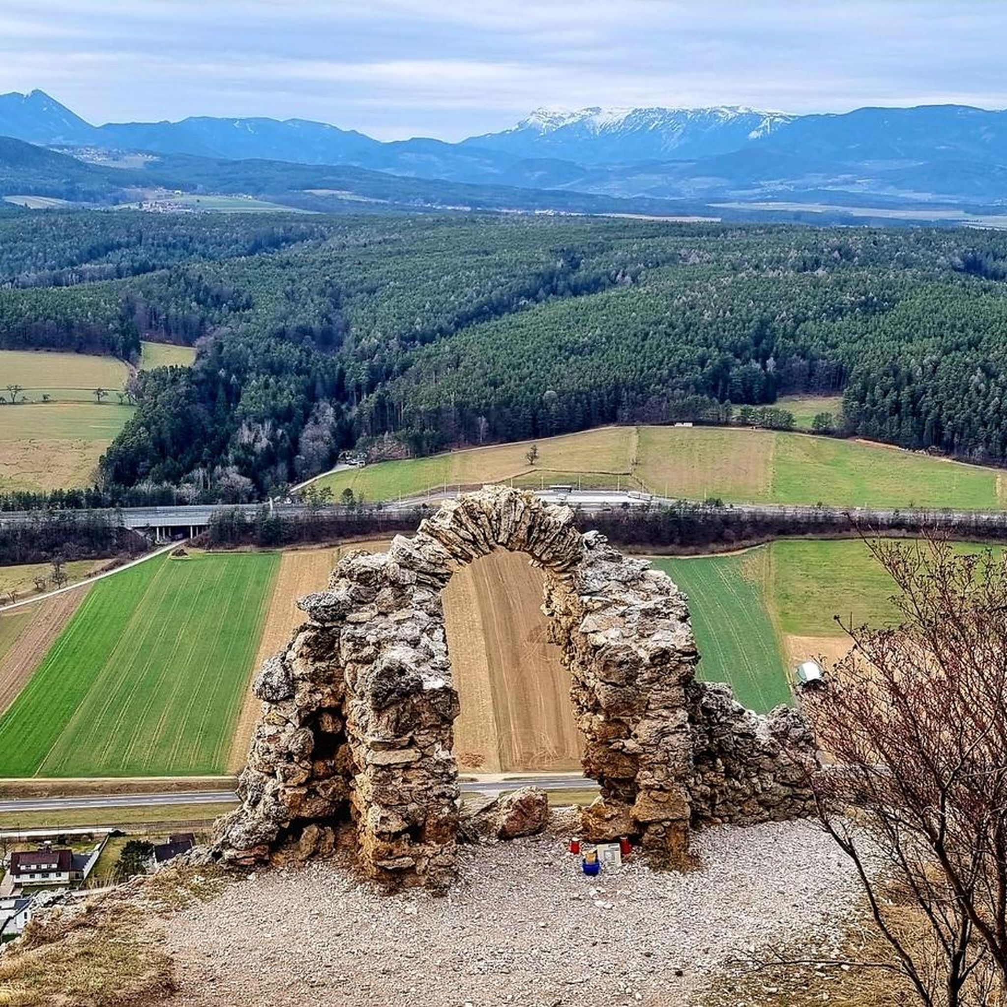
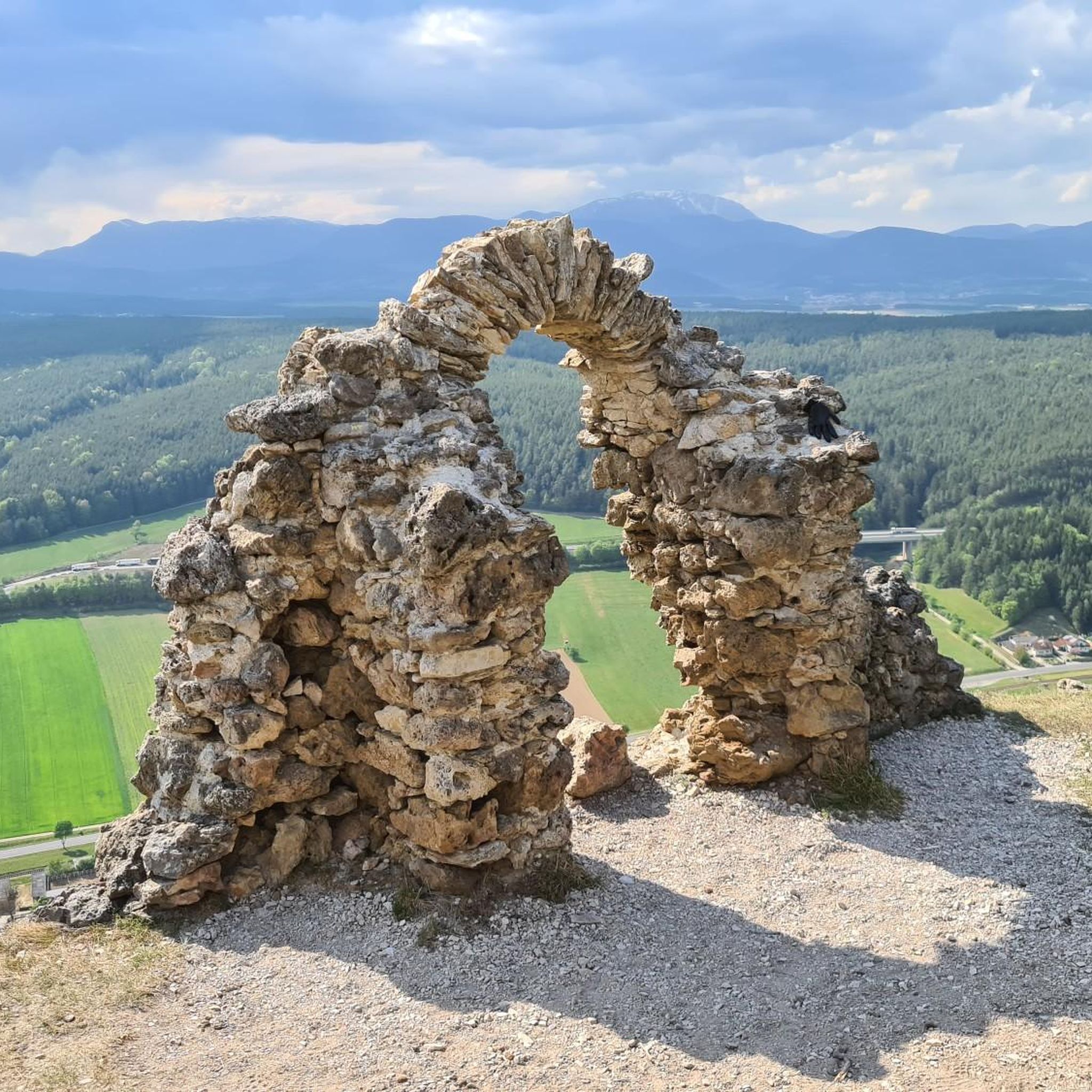
The view from Türkensturz is breathtakingly beautiful, and the vista of the snow-capped mountains in the distance is magical! It's no wonder this spot is a very popular destination for hikers and cyclists. Enjoy the sunshine and the magnificent view.
0
0
Frequently Asked Questions
How many mountain bike trails are available in Scheiblingkirchen-Thernberg?
There are 16 mountain bike trails around Scheiblingkirchen-Thernberg documented on komoot. These routes offer a diverse range of experiences, from easy rides to challenging ascents.
What is the overall difficulty level of mountain biking in Scheiblingkirchen-Thernberg?
The trails around Scheiblingkirchen-Thernberg cater to various skill levels. You'll find 1 easy route, 8 moderate routes, and 7 difficult routes, ensuring options for both beginners and experienced riders.
Are there any family-friendly mountain bike routes in the area?
Yes, while many routes are moderate to difficult, there is 1 easy mountain bike route available, which is generally more suitable for families or those looking for a relaxed ride. The region's varied topography also includes accessible paths for general cycling, which might be suitable for families.
What do other mountain bikers say about the trails in Scheiblingkirchen-Thernberg?
The mountain bike trails in Scheiblingkirchen-Thernberg are highly regarded by the komoot community, with an average rating of 4.5 out of 5 stars from over 240 reviews. Riders often praise the diverse terrain, rolling hills, and scenic viewpoints.
Are there any circular mountain bike routes available?
Yes, many of the mountain bike routes in Scheiblingkirchen-Thernberg are circular. For example, the difficult route Marienseer Schwaig – Uphill Flowtrail Wexl Trails loop from Scheiblingkirchen-Warth and the moderate route Aspang-Markt town center – Amazing view loop from Scheiblingkirchen-Warth are both loops.
What natural features or landmarks can I see along the mountain bike trails?
The region is rich in natural beauty and historical sites. You can encounter impressive mountain peaks and intriguing caves. Notable landmarks include the Gfiederwarte Observation Tower, offering expansive views, and the Summit cross and viewpoint near Türkensturz. The Rosalia Chapel on Heuberg is also a significant point of interest.
Are there any caves accessible near the mountain bike routes?
Yes, the area features several interesting caves. You can explore highlights such as the Mountain Church and Cave Church Pitten, the Kulmriegel Cave (Marian Grotto), and the Templar Cave. These offer a unique diversion from the trails.
Which mountain bike trails offer the best views?
Many trails provide scenic viewpoints. The route View of Türkensturz – St. Urban Chapel loop from Gleißenfeld specifically highlights views of the Türkensturz ruins. Additionally, the Steinkogel Lookout Tower – Rosalia Chapel on Heuberg loop from Scheiblingkirchen-Warth passes by significant viewpoints.
What is the longest mountain bike trail in Scheiblingkirchen-Thernberg?
The longest mountain bike trail is the difficult Marienseer Schwaig – Uphill Flowtrail Wexl Trails loop from Scheiblingkirchen-Warth, which spans approximately 72.7 kilometers (45.2 miles) and includes significant elevation gain.
What kind of terrain can I expect on the mountain bike trails?
You can expect a varied topography, including rolling hills, dense forests, and scenic valleys. The trails offer a mix of challenging ascents and flowing descents, providing a dynamic riding experience across different surfaces.
Is Scheiblingkirchen-Thernberg suitable for advanced mountain bikers?
Yes, Scheiblingkirchen-Thernberg offers challenging options for advanced riders. There are 7 difficult routes, such as the Leitha Covered Bridge – Mitterriegel loop from Scheiblingkirchen-Warth, which features varied terrain and significant elevation changes, providing a demanding experience.
Most popular routes around Scheiblingkirchen-Thernberg
Most popular attractions around Scheiblingkirchen-Thernberg

Get inspired with the komoot mobile app


Explore more
Browse the best MTB trails in other regions.
