The best walks and hikes around Santa Caterina Villarmosa
4.2
(12)
36
hikers
2
hikes
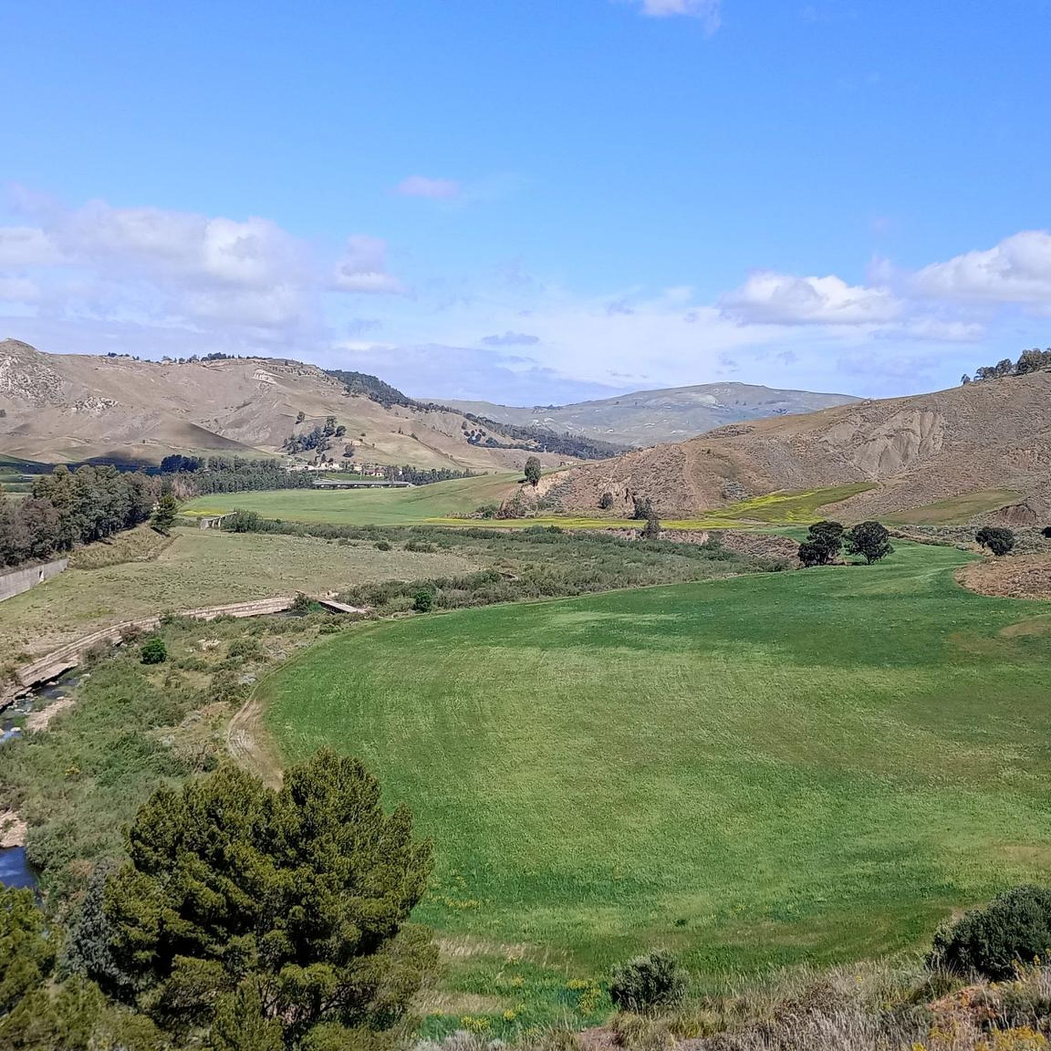
Hiking around Santa Caterina Villarmosa offers exploration of a hilly landscape in central Sicily. The region is characterized by rugged terrain, including dramatic gorges carved by the Imera River and notable elevations like Monte Capodarso and Monte Quartarone. Diverse forests and agricultural lands, such as olive groves, contribute to the varied scenery. Geological features, including gypseous rocks shaped by erosion, are also present in areas like Contrada Scaleri.
Best hiking trails around Santa Caterina Villarmosa
- The most popular hiking route…
Last updated: October 8, 2026
4.6
(9)
24
hikers
12.3km
03:43
420m
420m
Moderate hike. Good fitness required. Easily-accessible paths. Suitable for all skill levels.
5.0
(1)
1
hikers
19.3km
05:40
540m
540m
Hard hike. Very good fitness required. Easily-accessible paths. Suitable for all skill levels.

16.9km
05:11
610m
610m
Hard hike. Very good fitness required. Mostly accessible paths. Sure-footedness required.
3.0
(2)
9
hikers
10.8km
03:03
230m
230m
Moderate hike. Good fitness required. Mostly accessible paths. Sure-footedness required.
2
hikers
5.63km
01:34
110m
110m
Easy hike. Great for any fitness level. Easily-accessible paths. Suitable for all skill levels.
Our route recommendations are based on thousands of hikes, rides, and runs completed by other people on komoot.
Start today with a free account
Your next adventure awaits.
Tips from the Community

"Il Cammino dei Frati" is part of the hiking trail from Caltanissetta to Cefalù. In total, it is 166km long.
2
0


Currently closed, April 2024
0
0

The bridge absolutely deserves to be reached, due to its position and therefore setting, with the river passing underneath it makes the landscape suggestive
1
0

Survey of over 500 meters above sea level located inside the Mustigarufi State Park.
2
0
At the farm there are tables, benches and barbecues. The best months to visit the area are between April and June to enjoy the flowering of numerous floral species.
1
0
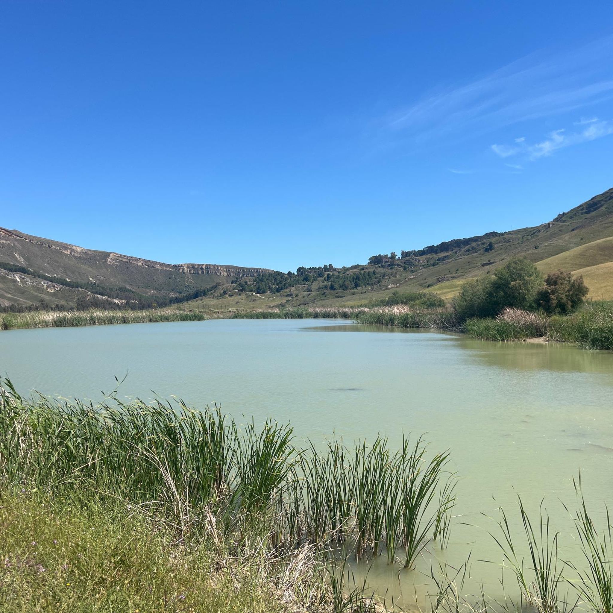
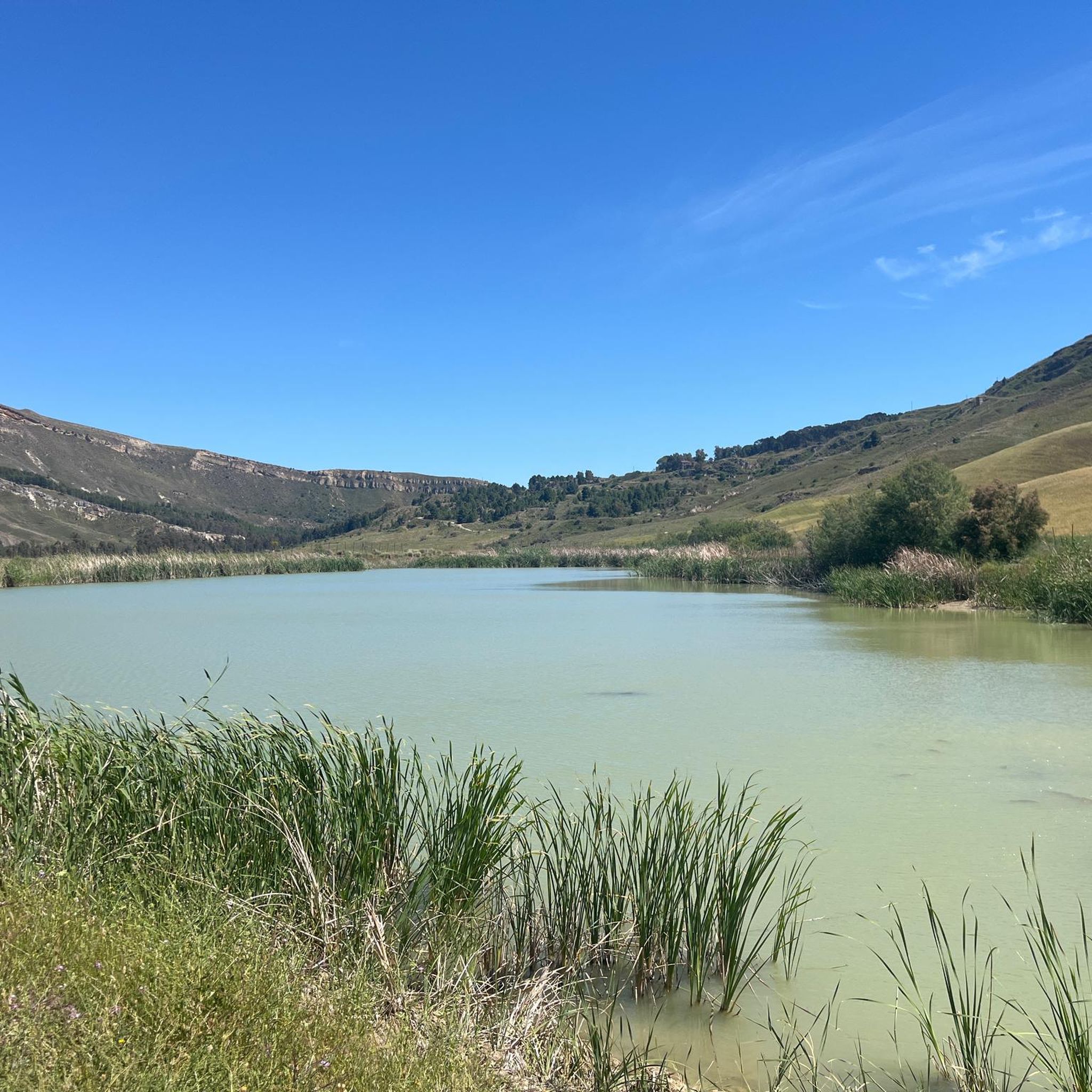
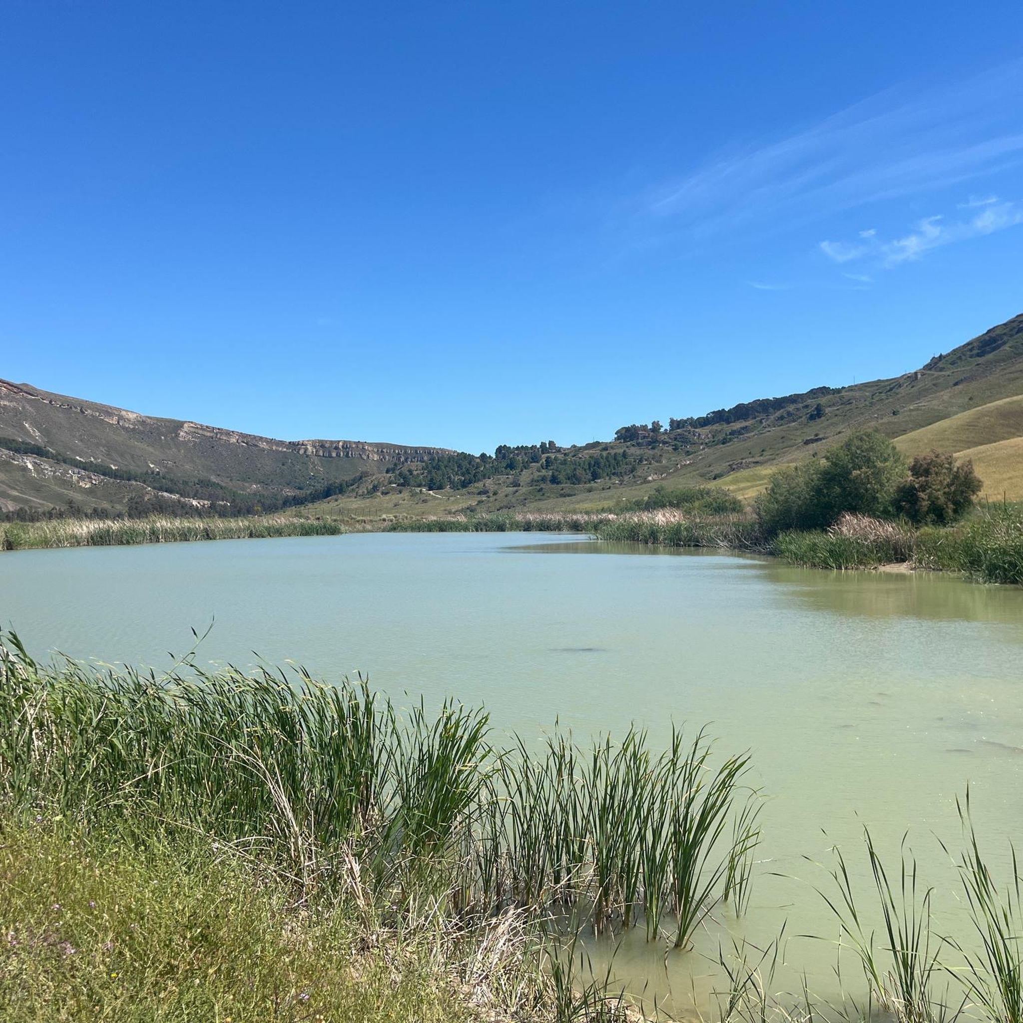
The lake is located in the homonymous nature reserve, it was formed following the subsidence of the most superficial rock layer and the water level is almost constant, which suggests underground sources.
3
0
Point from which it is possible to change the side of Mount Capodarso without having to pass through the point of maximum height. Separate the north wall from the south.
3
0
Frequently Asked Questions
What types of landscapes can I expect to see while hiking around Santa Caterina Villarmosa?
The region offers a diverse and rugged Sicilian landscape. You'll encounter dramatic gorges carved by the Imera River, notable elevations like Monte Capodarso and Monte Quartarone, and varied scenery including diverse forests and agricultural lands such as olive and almond groves. Geological features, like the gypseous rocks shaped by erosion in the Contrada Scaleri Geological Reserve, also add to the unique natural beauty.
Are there hiking trails suitable for different fitness levels in Santa Caterina Villarmosa?
Yes, the area provides a range of itineraries for various fitness levels. While the guide highlights moderate and difficult routes, the broader region offers options from leisurely walks to challenging treks. For example, the Monte Capodarso Loop is a moderate option, while the Monte Quartarone Loop Trail is considered difficult.
What are some notable landmarks or points of interest I can discover on hikes?
Hikers can explore several interesting landmarks. Along the Imera River, you'll find the historic Ponte Capodarso, a significant bridge. The region also features ancient farm ruins, particularly along the Monte Quartarone Loop Trail. Additionally, the archaeological site of Cozzo Scavo, an Iron Age settlement, offers a glimpse into the area's history. You can also visit the Capodarso Bridge over the Imera River.
Are there any circular hiking routes available in Santa Caterina Villarmosa?
Yes, several routes are designed as loops, allowing you to start and end in the same location. Popular circular options include the Monte Capodarso Loop, the Monte Quartarone Loop Trail, and the Friars' Way and Lago Sfondato Loop.
What is the best time of year to go hiking in Santa Caterina Villarmosa?
The region's Mediterranean climate generally makes spring and autumn ideal for hiking, offering pleasant temperatures and lush scenery. Summer can be quite hot, especially in July and August, so early morning or late afternoon hikes are recommended during these months. Winter hiking is also possible, with milder temperatures compared to northern Europe, though some trails might be affected by rain.
What do other hikers say about the trails in Santa Caterina Villarmosa?
The hiking routes in Santa Caterina Villarmosa are highly rated by the komoot community, with an average score of 4.2 stars from more than 10 reviews. Hikers often praise the varied terrain, the natural beauty of the Imera River gorges, and the opportunity to explore historical sites and diverse forests.
Are there any family-friendly hiking options in the area?
While many trails offer substantial distances, some shorter and less strenuous options can be suitable for families. For instance, the The Friars' Path loop from Carabinieri is a relatively short 5.61 km path, which might be a good starting point for families looking for a quicker outing.
Can I bring my dog on the hiking trails in Santa Caterina Villarmosa?
Generally, dogs are welcome on many outdoor trails in Sicily, especially in natural, undeveloped areas. However, it's always advisable to keep your dog on a leash, especially in areas with wildlife or near agricultural lands, and to check for any specific local regulations or signage on individual trails or protected areas.
Are there any archaeological sites or historical places to visit near the hiking routes?
Yes, the region is rich in history. Besides the historic Ponte Capodarso, you can explore the archaeological site of Cozzo Scavo, an Iron Age settlement. The historic center of Santa Caterina Villarmosa itself offers narrow streets and ancient architecture, providing a cultural complement to your outdoor activities.
How many hiking trails are there in Santa Caterina Villarmosa?
There are several established hiking routes around Santa Caterina Villarmosa, with at least five notable trails highlighted in this guide. These range from moderate loops to more challenging treks, offering a variety of experiences for hikers.
What is the longest hiking trail in Santa Caterina Villarmosa?
Among the highlighted routes, the Monte Quartarone Loop Trail is the longest, spanning 19.3 km (12.0 miles). This difficult route takes you through diverse forests and past ancient farm ruins within the Parco Demaniale Mustigarufi.
Are there any trails that follow the Imera River?
Yes, the Imera River is a prominent natural feature in the region. The Monte Capodarso Loop explores the Imera River and its gorges. Another option is the Trail on the Imera River loop from Ponte Capodarso, which offers a 10.8 km path along the river.
Most popular attractions around Santa Caterina Villarmosa

Get inspired with the komoot mobile app


Explore more
Browse the best Hikes in other regions.
