Attractions and Places To See around Piazza Al Serchio - Top 20
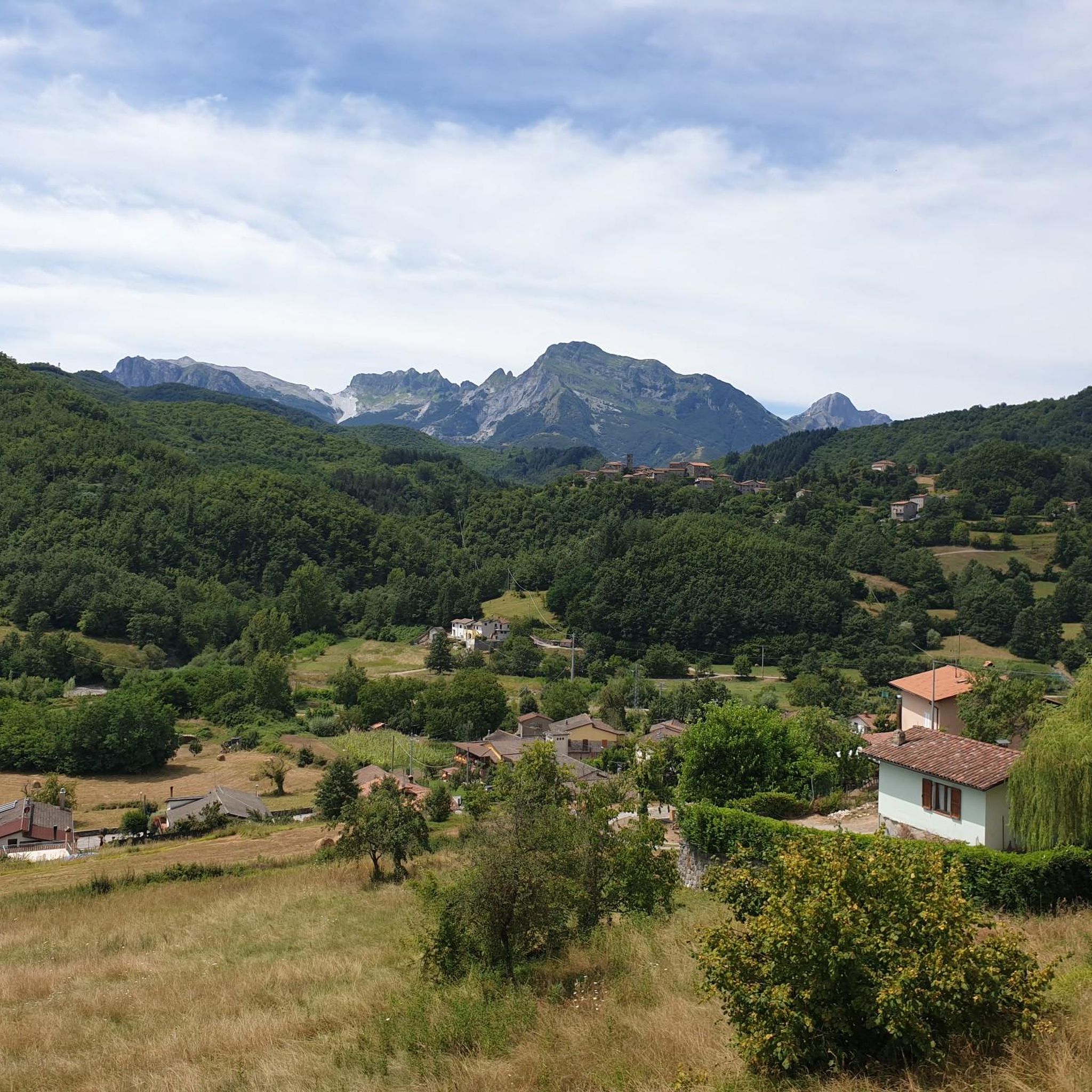
Attractions and places to see around Piazza Al Serchio are situated where the Serchio River's two arms converge, nestled between the Garfagnana, Lunigiana, and Emilia Romagna regions. The area features a landscape of rolling hills, mountains, and forests, with the Apuan Alps providing a backdrop. Historically, Piazza Al Serchio served as a medieval crossroads, contributing to its rich collection of historical landmarks and cultural sites.
Best attractions and places to see around Piazza Al Serchio
- The most popular attractions is Cesare Battisti Hut, a hut located at 1,780 meters above sea level. It offers accommodation and refreshment options, with 60 beds and a winter bivouac.
- Another must-see spot is Tambura Pass, a mountain pass. Located at 1630 meters above sea level at the foot of Mount Focoletta, it offers 360-degree views and is known for its historical road.
- Visitors also love Nello Conti Hut, a hut in the Apuan Alps. This structure has about 20 places to sleep and serves coffee and lunch.
- Piazza Al Serchio is known for historical landmarks, natural features, and cultural sites. The area offers a variety of sites, from ancient bridges and medieval forts to nature reserves and museums.
- The attractions around Piazza Al Serchio are appreciated by the komoot community, with over 190 upvotes and 60 photos shared.
Last updated: June 22, 2026
Lama Lite Pass
Highlight • Mountain Pass
From the pass in a short time you can reach three refuges for refreshment and rest. The closest is the Battisti Refuge, descending towards Ligonghio you will find the Bargetana Refuge and towards Civago you will find the Segheria Refuge.
Translated by Google •
Tip by

Lake Vagli
Highlight • Lake
Translated by Google •
Tip by

Sign up now to discover places like this
Get recommendations on the best single tracks, peaks, & plenty of other exciting outdoor places.
Sign up for free
Cesare Battisti Hut
Highlight • Mountain Hut
Translated by Google •
Tip by

Tambura Pass
Highlight • Mountain Pass
Nearby Mount Tambura is one of the largest mountains in the Apuan Alps, easily visible from afar.
Translated by Google •
Tip by

Nello Conti Hut
Highlight • Mountain Hut
Translated by Google •
Tip by

Sign up for free to discover even more attractions around Piazza Al Serchio.
Sign up for free
Already have an account?
Start today with a free account
Your next adventure awaits.
Login or Signup
Tips from the Community

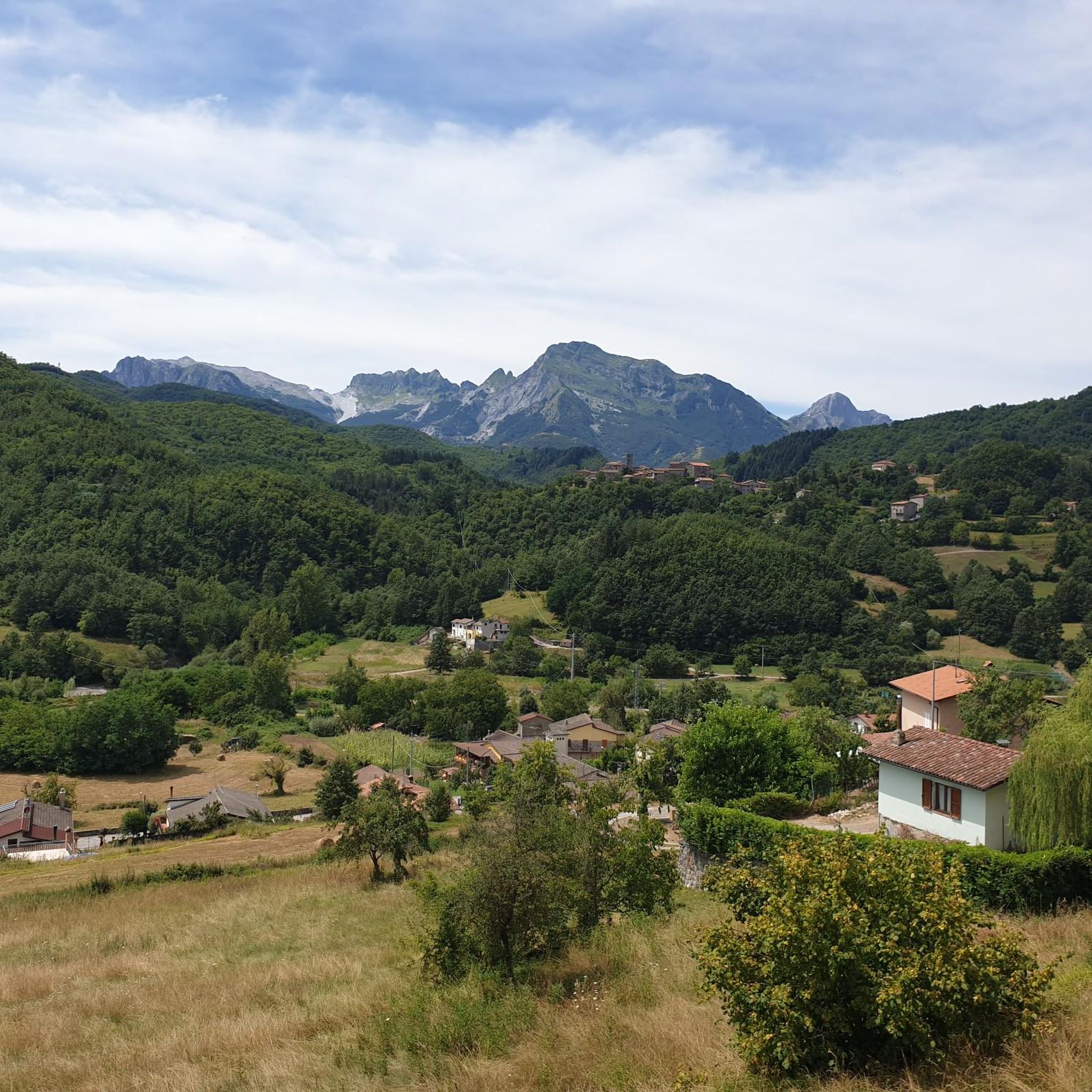
The Passo di Lama Lite is a very important mountain pass located at an altitude of 1,749 meters in the Alto Appennino Reggiano, on the border between Emilia-Romagna and Tuscany. It is located in the heart of the Tuscan-Emilian Apennine National Park. This pass serves as a fundamental watershed between the valley of the Dolo stream and the valley of the Ozola stream, positioned at the foot of the Monte Prado massif and offering a splendid view of Monte Cusna.
0
0

The construction of the hydroelectric dam, designed by Count Eng. Ignazio Prinetti Castelletti, began in 1941, slowed down during wartime, and was completed in 1947 under the supervision of SELT Valdarno (now Enel). In the period 1951-53, the dam was raised by about 30 m, bringing the overall height to about 88-92 m. The ordinary arch and gravity dam, built in concrete, has a crest 150 m long and 5 m wide, while the width at foundation level is about 70 m. The crest is accessible to the public all year round. The lake, artificially formed in 1947 by damming the Edron stream, constitutes the dam's reservoir. Upon filling, the rising lake waters submerged some villages, the main one being Fabbriche di Careggine, a small village of blacksmiths from Brescia, founded in the 13th century, which re-emerges with every emptying of the basin. Since the Vajont disaster, the basin has not been filled beyond 80% of its maximum capacity. The basin holds about 35 million cubic meters of water and is exceptionally emptied in case maintenance intervention is necessary. This has happened four times: in 1958, 1974, 1983, and 1994. In the latter year, almost 1 million tourists from all over the world arrived in Vagli.
0
0

A beautiful refuge nestled in the mountains. I recommend booking in advance to secure a spot, even just for lunch. The trail is steep; I recommend appropriate equipment, especially footwear.
0
0

Lama Lite is a well-known mountain pass. Just looking at it on the map is enough to understand its importance. I have passed through it dozens of times but I can never avoid stopping to take a picture.
2
0

crossroads of paths coming from the royal fir forest on the right you go to the refuge. Battisti and Monte Cusna, continuing you arrive at the Bargetana lake and climb to Monte Prado on the left you return to the Rif. Segheria
2
0

Perhaps the most beautiful refuge in the Apuan Alps
1
0

Perhaps the most beautiful bivouac in the Apuan Alps!
1
0
Frequently Asked Questions
What historical landmarks can I explore around Piazza Al Serchio?
Piazza Al Serchio is rich in history. You can visit the ancient Castelvecchio Fort, perched on a volcanic escarpment, or the Verrucole Fortress, a significant medieval site built by the Gherardini family. Don't miss the Parish Church of San Pietro, which houses a bell dating back to 1271, or the Este Fortress in Camporgiano, home to a Civic Collection of Renaissance Ceramics.
Are there opportunities for hiking and outdoor activities near Piazza Al Serchio?
Absolutely! The region offers diverse outdoor activities. You can explore the magnificent forests of Orecchiella Park, which has trails for trekking, mountain biking, and horseback riding. The Apuan Alps provide a stunning backdrop for hiking and mountaineering. For specific routes, check out the Mountain Hikes around Piazza Al Serchio guide, featuring trails like the Ferrata Tordini-Galligani loop.
What natural features are prominent in the Piazza Al Serchio area?
The landscape around Piazza Al Serchio is characterized by picturesque rolling hills, mountains, and forests. The Serchio River, where its two arms converge, offers opportunities for walks, cycling, and canoeing within the Serchio River Park. The Apuan Alps provide a dramatic backdrop, and you can find impressive natural sites like the Tambura Pass, known for its 360-degree views, and the Mount Sagro summit with fantastic views of the Tyrrhenian Sea.
Where can I find unique cultural experiences in Piazza Al Serchio?
For a unique cultural experience, visit the Museo Italiano dell'Immaginario Folklorico. This museum is dedicated to fairy tales, legends, beliefs, and local traditions, housing thousands of unpublished tales with multimedia tools. The area also lies along the ancient pilgrimage route, the Via del Volto Santo, connecting Pontremoli to Lucca.
Are there any mountain huts or places to rest during a hike?
Yes, there are several mountain huts available for rest and refreshment. The Cesare Battisti Hut, located at 1,780 meters, offers accommodation and excellent cuisine. Another option is the Nello Conti Hut in the Apuan Alps, which has about 20 sleeping places and serves coffee and lunch. Both are popular spots for hikers.
What kind of cycling routes are available around Piazza Al Serchio?
The region offers various cycling routes, from road cycling to mountain biking. You can find challenging road cycling loops like the 'Lake Gramolazzo – San Pellegrino in Alpe loop' or the 'Isola Santa Village – Passo del Vestito loop'. For more options, explore the Road Cycling Routes around Piazza Al Serchio guide.
Are there family-friendly activities or accessible options in the area?
Orecchiella Park is a great option for families, offering trekking trails that include accessible options. The Serchio River Park also provides gentle walks suitable for all ages. While specific family-friendly attractions are not detailed, the natural parks offer a relaxed environment for outdoor enjoyment.
What are some notable viewpoints for scenic photography?
For breathtaking views, head to the Tambura Pass, which offers exceptional 360-degree panoramas. The Mount Sagro summit also provides a fantastic vantage point over Massa-Carrara, the Tyrrhenian Sea, and other Apuan Alps peaks. The Lama Lite Pass offers views of Monte Cusna.
Can I find running trails near Piazza Al Serchio?
Yes, there are several running trails available. You can find routes like the 'Historic Village loop from Piazza al Serchio' or the 'Historic Village loop from Camporgiano'. These trails vary in difficulty, offering options for different fitness levels. More details can be found in the Running Trails around Piazza Al Serchio guide.
What is the significance of the Serchio River in this region?
Piazza Al Serchio is uniquely situated where the Serchio River's two original arms, Soraggio and Minucciano, converge. The Serchio River Park offers a tranquil environment for walks, cycling, and canoeing, allowing visitors to observe diverse flora and fauna, including various bird species. It's a central natural feature shaping the local landscape and activities.
Are there any ancient bridges or structures to see?
Yes, the San Michel Bridge stands at the entrance to Piazza Al Serchio and is a beautiful structure with historical significance. Additionally, the ancient Molino bridge connects Piazza Al Serchio to the Castle of Santa Margherita, offering another glimpse into the region's past.
What is the best time of year for outdoor activities in Piazza Al Serchio?
The region's rolling hills, mountains, and forests make it suitable for outdoor activities across various seasons. Spring and autumn offer pleasant temperatures for hiking and cycling, with vibrant foliage or blooming wildflowers. Summer is ideal for exploring the higher altitudes and enjoying the Serchio River Park, while some winter trails may be accessible for those seeking snowy landscapes.
Most popular routes around Piazza Al Serchio
Most popular attractions around Piazza Al Serchio

Get inspired with the komoot mobile app


Explore more
Still not found the Highlight you’re looking for? See guides of the top attractions in other regions:
