The best walks and hikes around Sankt Konrad
4.5
(6931)
50,419
hikers
21
hikes
Hiking around Sankt Konrad offers diverse terrain, from serene mountain lakes to panoramic mountain summits, nestled between the Almtal and Salzkammergut regions. The landscape features prominent peaks like Katzenstein and Steineck, alongside picturesque bodies of water such as Laudachsee. This area provides a variety of trails, ranging from easy forest paths to challenging mountaineering routes, catering to different experience levels.
Best hiking trails around Sankt Konrad
- The most popular hiking route is Steineck – Jacksonstein 1,471 m loop from St.…
Last updated: August 15, 2026
4.8
(76)
583
hikers
7.32km
03:05
560m
560m
Hard hike. Good fitness required. Sure-footedness, sturdy shoes and alpine experience required.
4.7
(34)
298
hikers
13.3km
04:57
750m
750m
Hard hike. Good fitness required. Sure-footedness, sturdy shoes and alpine experience required.

Sign up for free
4.8
(10)
21
hikers
6.26km
01:47
140m
150m
Easy hike. Great for any fitness level. Easily-accessible paths. Suitable for all skill levels.
4.0
(3)
32
hikers
Moderate hike. Good fitness required. Easily-accessible paths. Suitable for all skill levels.
4.8
(5)
23
hikers
7.29km
02:06
180m
180m
Moderate hike. Good fitness required. Easily-accessible paths. Suitable for all skill levels.
Get access to more routes and recommendations from other explorers.
Sign up for free
Already have an account?
Our route recommendations are based on thousands of hikes, rides, and runs completed by other people on komoot.
Start today with a free account
Your next adventure awaits.
Login or Signup


Tips from the Community

Beautiful view of the Traunstein and the Totes Gebirge.
6
0
Beautiful view of the Traunstein and the Totes Gebirge.
6
0

There's a story 😊 According to a local hiker... A local nicknamed Jackson discovered that the peak had no name, hence the name Jacksonstein. Jackson or his friends also took care of the schnapps in the summit book... That's how it's been handed down 😉 Berg Heil🏔️
1
0

Great view of the Traunstein and the surrounding area. If you walk quickly, you can reach the summit in 1 hour. The path from the summit to the right further down is partly overgrown but recognizable (waterproof shoes are an advantage if you are out and about in the morning...wet, tall grass)
1
0

Turn left into the Hauergraben in the direction of Scharnstein Turn right in the direction of Laudachsee and Grünberg.
1
0

Beautiful panoramic mountain in Upper Austria. foothills
1
0

A nice circular route is the following route: From the Scharnsteiner Straße junction via Dürnberg to the car park (if not open, park at the bottom of the main road), then after the Schrattenau at a small abandoned gravel pit take the Jagasteig to the summit. This is well marked with Stoamandln. And then back the normal marked path. Both paths are about equally demanding. You can send me a planned route via email.
2
0

The summit between Trapez and Steineck
0
0
Frequently Asked Questions
What types of hiking trails are available in Sankt Konrad?
Sankt Konrad offers a diverse range of hiking trails, catering to all experience levels. You'll find everything from easy forest paths suitable for leisurely strolls to challenging mountaineering routes. The area features 21 distinct tours, with 8 classified as easy, 8 as moderate, and 5 as difficult.
Are there any circular hiking routes in Sankt Konrad?
Yes, Sankt Konrad has several excellent circular routes. For a challenging experience with panoramic views, consider the Trapez Summit Cross (1,410 m) – Steineck loop from St. Konrad. If you prefer a moderate forest path, the Cabin on the Forest Path – Schrattenau Spring loop from St. Konrad is a great option. For an easier scenic walk, try the View of the Almtal Valley – View of Traunstein loop from St. Konrad.
What natural features and landmarks can I expect to see while hiking in Sankt Konrad?
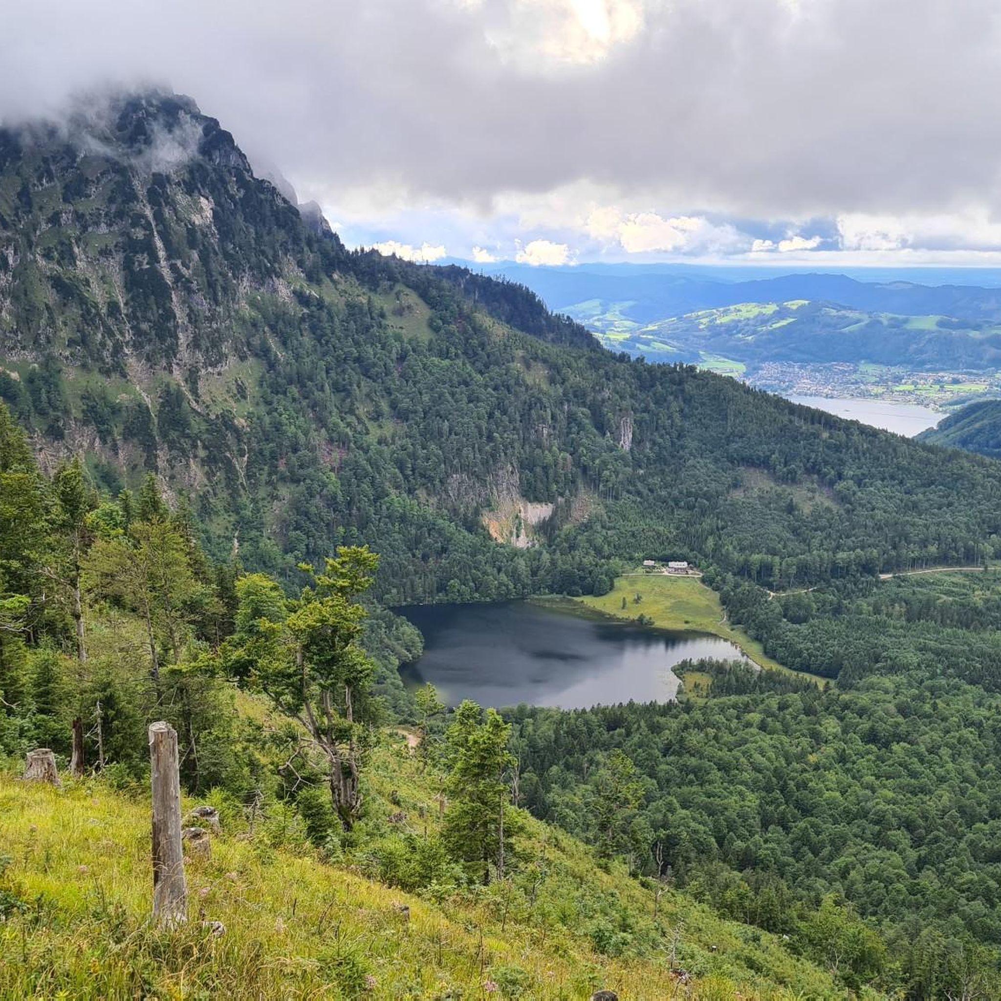
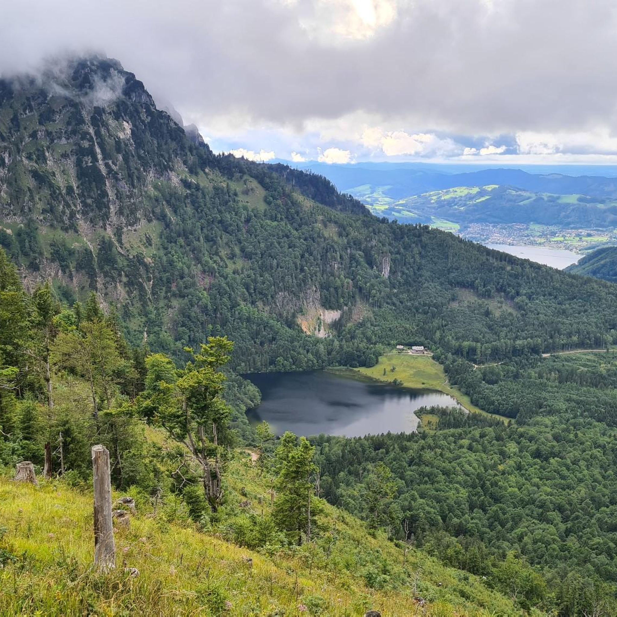
Sankt Konrad is rich in natural beauty and notable landmarks. You can explore the serene Lake Laudach, a picturesque mountain lake perfect for tranquil views and even swimming in summer. The region also boasts prominent summits like Katzenstein and Steineck, offering breathtaking panoramas. Many trails provide views of the distant Traunstein and the stunning Totes Gebirge and Dachstein massifs.
Are there any family-friendly hiking options in Sankt Konrad?
Yes, Sankt Konrad offers several easy trails suitable for families. These routes often follow forest roads and provide gentle gradients, making them enjoyable for all ages. An example is the View of the Almtal Valley – View of Traunstein loop from St. Konrad, which is classified as easy and offers scenic viewpoints.
What do other hikers say about the trails in Sankt Konrad?
The hiking trails in Sankt Konrad are highly regarded by the komoot community, with an average rating of 4.6 stars from over 4,000 reviews. Hikers frequently praise the diverse terrain, from peaceful lake walks to challenging summit ascents, and the magnificent panoramic views of the surrounding mountains and lakes.
What is the best time of year to go hiking in Sankt Konrad?
The hiking season in Sankt Konrad generally extends from spring to autumn. Spring is particularly recommended for visiting Lake Laudach, while summer allows for swimming in the lake. The diverse landscapes ensure beautiful scenery throughout these seasons, with autumn offering vibrant foliage.
Are there any challenging hikes for experienced mountaineers?
Absolutely. For experienced hikers seeking a challenge, Sankt Konrad offers several difficult mountaineering routes. These trails often lead to prominent summits like Katzenstein and Steineck, requiring good fitness and sure-footedness. The Steineck – Jacksonstein 1,471 m loop from St. Konrad is a difficult route that rewards with extensive views.
Can I find viewpoints with scenic vistas in Sankt Konrad?
Many trails in Sankt Konrad are renowned for their scenic viewpoints. You can enjoy magnificent panoramas of the surrounding mountains, including Traunstein, and picturesque lakes. The View of Sankt Konrad – Gasthof Silbermair loop from St. Konrad offers lovely views of the local area.
Are there any castles or historical sites near the hiking trails?
Yes, the broader Traunsee-Almtal region, where Sankt Konrad is located, features several historical sites. You can find castles such as Ort Castle and the Ruins of Scharnstein Castle. Some viewpoints, like View of Schloss Ort, also offer glimpses of these historic structures.
How long do the hiking trails in Sankt Konrad typically take to complete?
The duration of hikes in Sankt Konrad varies significantly depending on the trail's length and difficulty. Easy routes, like the View of the Almtal Valley – View of Traunstein loop from St. Konrad, can be completed in under 2 hours. Moderate trails, such as the Cabin on the Forest Path – Schrattenau Spring loop from St. Konrad, typically take around 3 hours, while difficult summit tours can extend to 3 hours or more.
Is Sankt Konrad a good destination for a multi-day hiking trip?
Sankt Konrad is situated within the larger Traunsee-Almtal region, which is part of the extensive BergeSeen Trail. This long-distance path spans approximately 370 kilometers across the Salzkammergut, with stages passing through this area. This makes Sankt Konrad a great base for exploring longer sections of the trail or combining multiple day hikes into a multi-day adventure.
Most popular routes around Sankt Konrad
Most popular attractions around Sankt Konrad

Get inspired with the komoot mobile app


Explore more
Browse the best Hikes in other regions.
