The best road cycling routes around Sandl
4.8
(94)
1,560
riders
20
rides
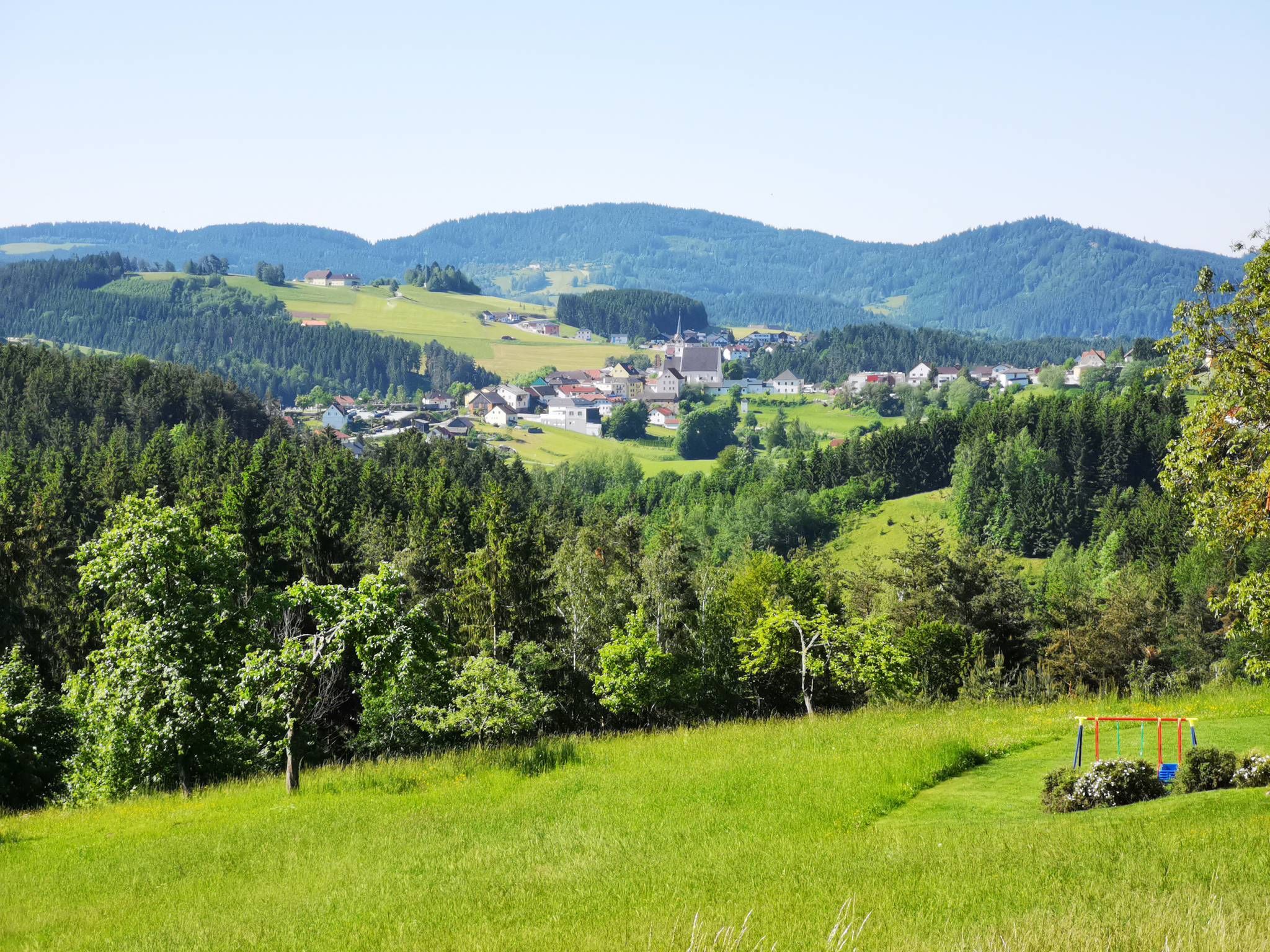
Road cycling routes around Sandl are set within the Austrian part of the Gratzen Mountains in Upper Austria, featuring diverse topography. The region is characterized by picturesque meadows, fields, and forested areas, providing a varied backdrop for road cyclists. The Viehberg, the highest mountain in the Gratzener Bergland, offers challenging terrain and scenic views. Sandl provides a network of largely paved routes suitable for different fitness levels.
Best road cycling routes around Sandl
- The most popular road cycling route is…
Last updated: July 2, 2026
37
riders
50.4km
02:39
730m
730m
Moderate road ride. Good fitness required. Mostly well-paved surfaces and easy to ride.
5.0
(1)
19
riders
50.3km
02:34
750m
750m
Moderate road ride. Good fitness required. Mostly well-paved surfaces and easy to ride.

Sign up for free
12
riders
35.2km
01:50
530m
540m
Moderate road ride. Good fitness required. Mostly well-paved surfaces and easy to ride.
5.0
(1)
6
riders
79.4km
03:56
1,190m
1,190m
Hard road ride. Very good fitness required. Mostly well-paved surfaces and easy to ride.
10
riders
54.9km
02:57
830m
830m
Moderate road ride. Good fitness required. Mostly well-paved surfaces and easy to ride.
Get access to more routes and recommendations from other explorers.
Sign up for free
Already have an account?
Our route recommendations are based on thousands of hikes, rides, and runs completed by other people on komoot.
Start today with a free account
Your next adventure awaits.
Login or Signup



Tips from the Community

Arbesbach Castle is a top highlight that you should definitely plan a visit to. Even from a distance, you can recognize the so-called "Waldviertel's fang" (Stockzahn des Waldviertels). Once you arrive at the site, 126 steps lead up to the entrance where admission (currently €2.50) is payable in coins or by card. Then it continues inside upwards to the platform, which offers a fantastic view. There is also a circular path around the tower, which however requires some surefootedness and suitable shoes.
0
0

The village was first mentioned in 1246 and was originally owned by the Kuenring line of Weitra-Rappottenstein. In 1282, the estate passed to the Lords of Falkenberg, and in 1291 to Ulrich von Kapelln. In the 14th century, Arbesbach is mentioned as a freehold property. From 1326 to 1348, it was owned by the Lords of Klingenberg, who in 1347 mortgaged "the castle and the house at Arbesbach" to Weikart and Katharina von Winkl. From 1348, Arbesbach was owned by the Lords of Dachsberg, and from 1423 by the Lords of Starhemberg. In 1480, the castle was destroyed by a Bohemian raiding party and was not rebuilt. In 1600, the estate passed to the Lords of Tschernembl, and in 1604 to Georg Fenzl von... Grueb and as early as 1605 to Georg Kaspar von Neuhaus. From 1614 owned by the Lords von Hackelberg, from 1675 to 1862 by the Countess Dietrichstein. Afterwards, it passed to the Herberstein, Geusau, and Baron Holtz families, and from 1877 onwards to the Altzinger family, who still own the estate today and reside in part of the castle complex. Text by G.R., K.Ki.
2
0

A very beautiful medieval town square. Highlights include Heini Staudinger's GEA store and the Lubinger pastry shop.
0
0


The patronage of "Our Lady of the Snows" – which, in my experience, is not all that common – indicates that this pilgrimage church was dedicated to the Blessed Virgin Mary, but not, as is usually the case, associated with one of her classic feast days (such as the Name of Mary, the Nativity, the Assumption, or as Queen of the Rosary). Rather, the search for the origin of "Our Lady of the Snows" leads us far back in church history to the fourth or fifth century, and geographically from here across the Alps to the Italian capital. On August 5, 363, at the site where the magnificent church of Santa Maria Maggiore stands today (Pope Francis, who died last month, was laid to rest there), the so-called "Miracle of the Snows" occurred. That is, on that day, in the middle of summer, there was snow there in the morning because Our Lady wanted a church dedicated to her built on that spot. She expressed this wish in a nighttime vision to a wealthy couple who financed the construction and to the Bishop of Rome, Pope Liberius. The Roman church has the status of a patriarchal basilica (papal basilica), and is the origin of all churches and chapels bearing this patronage. In the liturgical calendar of the Catholic Church, the date of August 5, the day of the church's consecration (in the year 432 by Pope Sixtus III), is a "non-obligatory memorial."
0
0

Nice museum with a small café (weekends only and cash), toilets and water
0
0

The Arbesbach Castle ruins, also known as the "Molar Tooth of the Waldviertel," are located in the market town of Arbesbach. It was built at the end of the 12th century, presumably around 1180, by Hadmar II von Kuenring and served as a border fortress to secure the Kuenring family's holdings in the Waldviertel region. The most striking remaining structure is the pentagonal keep, which sits atop a granite rock and was originally about 25 meters high. In 1480, the castle was destroyed by Bohemian troops and was not rebuilt. Instead, the Arbesbach Manor House was later built in 1593 as the new administrative center. On the ruins of the keep, the so-called Alexanderwarte, an 18-meter-high observation tower offering panoramic views across the Waldviertel, was built in 1884.
1
0

The horseshoe and wagon smithy was in operation for over 400 years (1523 - 1923). The bellows are still functional.
1
0
Frequently Asked Questions
How many road cycling routes are available in Sandl?
There are over 20 road cycling routes around Sandl, offering a diverse range of experiences. These routes are largely paved and cater to various fitness levels, from moderate to difficult.
What is the general difficulty level of road cycling routes in Sandl?
The road cycling routes in Sandl are primarily categorized as moderate to difficult. You'll find 11 moderate routes and 9 difficult routes, providing options for cyclists seeking both enjoyable rides and challenging climbs through the mountainous terrain.
Are there any challenging climbs for experienced road cyclists in Sandl?
Yes, Sandl, situated in the Gratzen Mountains, offers challenging terrain. The Viehberg, for instance, is the highest mountain in the Gratzener Bergland and provides demanding climbs with rewarding scenic views. Routes like the Harruck Castle – Arbesbach Castle Ruins loop from Weinviertl bei Sandl feature significant elevation gain, making them suitable for experienced riders.
What kind of terrain can I expect on road cycling routes around Sandl?
Road cycling around Sandl is characterized by a mix of mountainous terrain, open meadows, fields, and forested sections. The routes are largely paved, offering a varied and picturesque backdrop for your ride through the Austrian part of the Gratzen Mountains.
Are there scenic viewpoints along the road cycling routes in Sandl?
Absolutely. The region boasts several stunning viewpoints. You can visit the Hoh-Haus at Buchberg Observation Tower for panoramic views, or climb to the Herzogreitherfelsen, which offers fantastic vistas marked by a summit cross.
What natural features can I see while road cycling in Sandl?
While cycling, you'll encounter picturesque meadows, fields, and extensive forested areas. The Feldaist Stream in the Thury Valley is another beautiful natural feature you might come across, adding to the scenic beauty of the routes.
Are there any historical landmarks or points of interest accessible by road bike?
Yes, several routes pass by historical sites. For example, the Freistadt Castle – Windhaag loop from Sandl takes you past historic castles. You might also encounter the Bründl Chapel and Augenbründl in St. Leonhard, offering a glimpse into the region's heritage.
What is the best time of year for road cycling in Sandl?
The best time for road cycling in Sandl is typically from late spring through early autumn (May to October). During these months, the weather is generally mild, and the landscapes are vibrant, making for ideal cycling conditions. Always check local weather forecasts before heading out.
Are there circular road cycling routes available in Sandl?
Many of the road cycling routes in Sandl are designed as loops, allowing you to start and end your ride in the same location. An example is the Scenic road near Pohorská Ves – Windhaag loop from Sandl, which offers varied landscapes on a circular path.
Is parking available for cyclists in Sandl?
Yes, parking is generally available in and around Sandl, particularly in the town center or near popular trailheads. It's advisable to check specific starting points for routes for the most convenient parking options.
Are there options for food and drink along the road cycling routes?
While cycling, you can find places to refuel. The Braunberg Hut is a popular spot among outdoor enthusiasts and can be a good stop for refreshments. Additionally, Sandl and nearby villages offer cafes and pubs where cyclists can take a break.
What do other road cyclists enjoy most about road cycling in Sandl?
The road cycling experience in Sandl is highly rated by the komoot community, with an average score of 4.8 stars from over 35 reviews. Cyclists often praise the varied terrain, the stunning views of the Gratzen Mountains, and the well-maintained, largely paved routes that cater to different skill levels.
Most popular routes around Sandl
Most popular attractions around Sandl

Get inspired with the komoot mobile app


Explore more
Browse the best Road cycling routes in other regions.
