The best MTB trails around Sandersdorf-Brehna
4.8
(28)
98
riders
20
rides
Mountain bike trails around Sandersdorf-Brehna offer diverse landscapes for outdoor enthusiasts. The region features rolling hills, dense forests, and picturesque riverbanks, providing varied terrain for mountain biking. These natural features contribute to a range of trail experiences, from leisurely paths to more demanding routes. The area also includes lakes and green expanses, making it suitable for different skill levels.
Best mountain bike trails around Sandersdorf-Brehna
- The most popular mountain bike trail is Lober-Leine Canal Path – Goitzsche-Rundweg Asphalt Path loop…
Last updated: August 20, 2026
4.5
(11)
30
riders
Moderate mountain bike ride. Good fitness required. Suitable for all skill levels.
7
riders
Moderate mountain bike ride. Good fitness required. Advanced riding skills necessary.

Sign up for free
4.4
(5)
12
riders
Moderate mountain bike ride. Great for any fitness level. Advanced riding skills necessary.
5
riders
Moderate mountain bike ride. Good fitness required. Suitable for all skill levels.
6
riders
22.5km
01:44
80m
80m
Moderate mountain bike ride. Great for any fitness level. Advanced riding skills necessary.
Get access to more routes and recommendations from other explorers.
Sign up for free
Already have an account?
Our route recommendations are based on thousands of hikes, rides, and runs completed by other people on komoot.
Start today with a free account
Your next adventure awaits.
Login or Signup
Tips from the Community

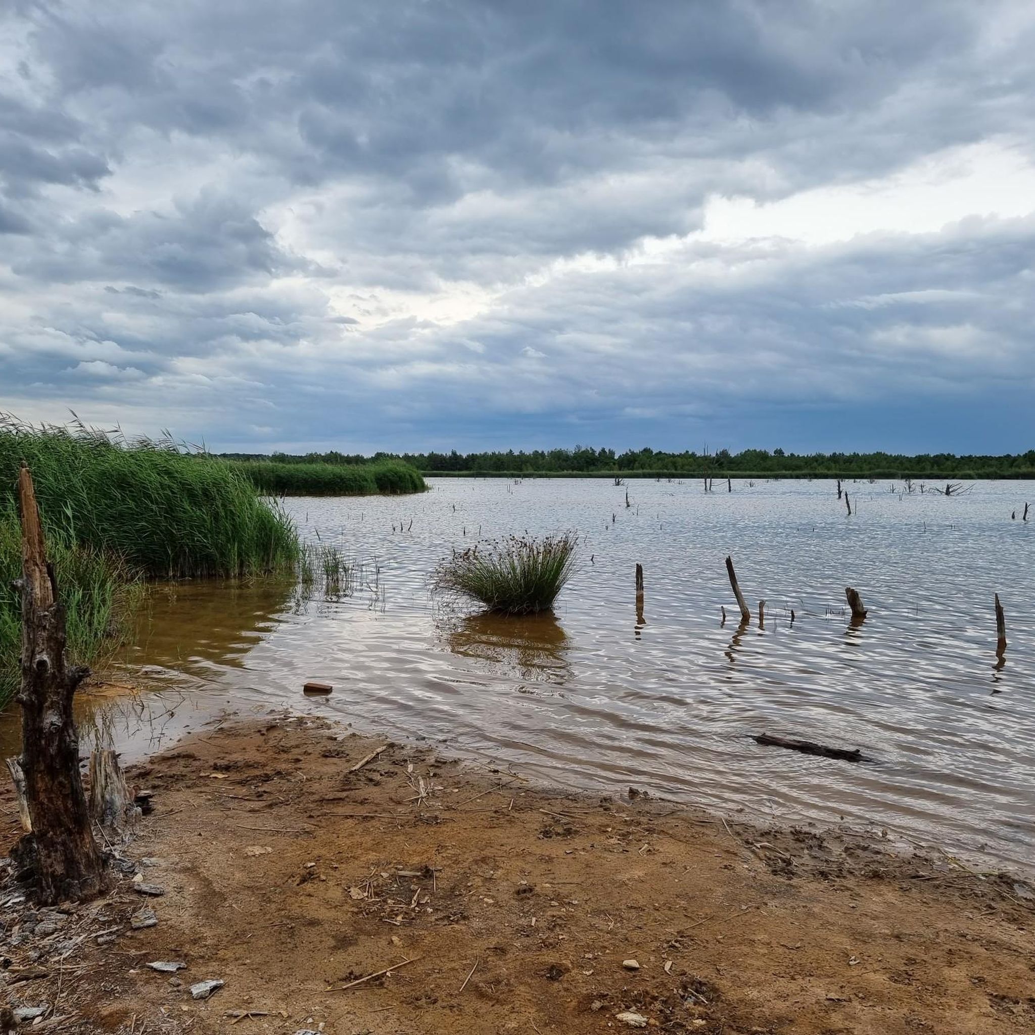
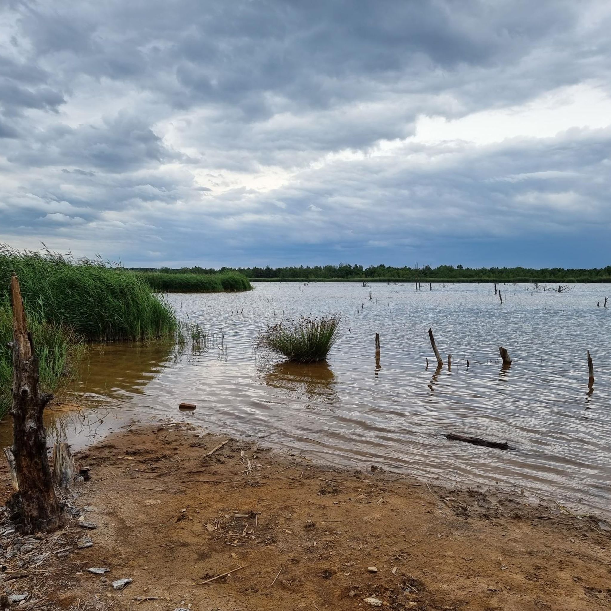
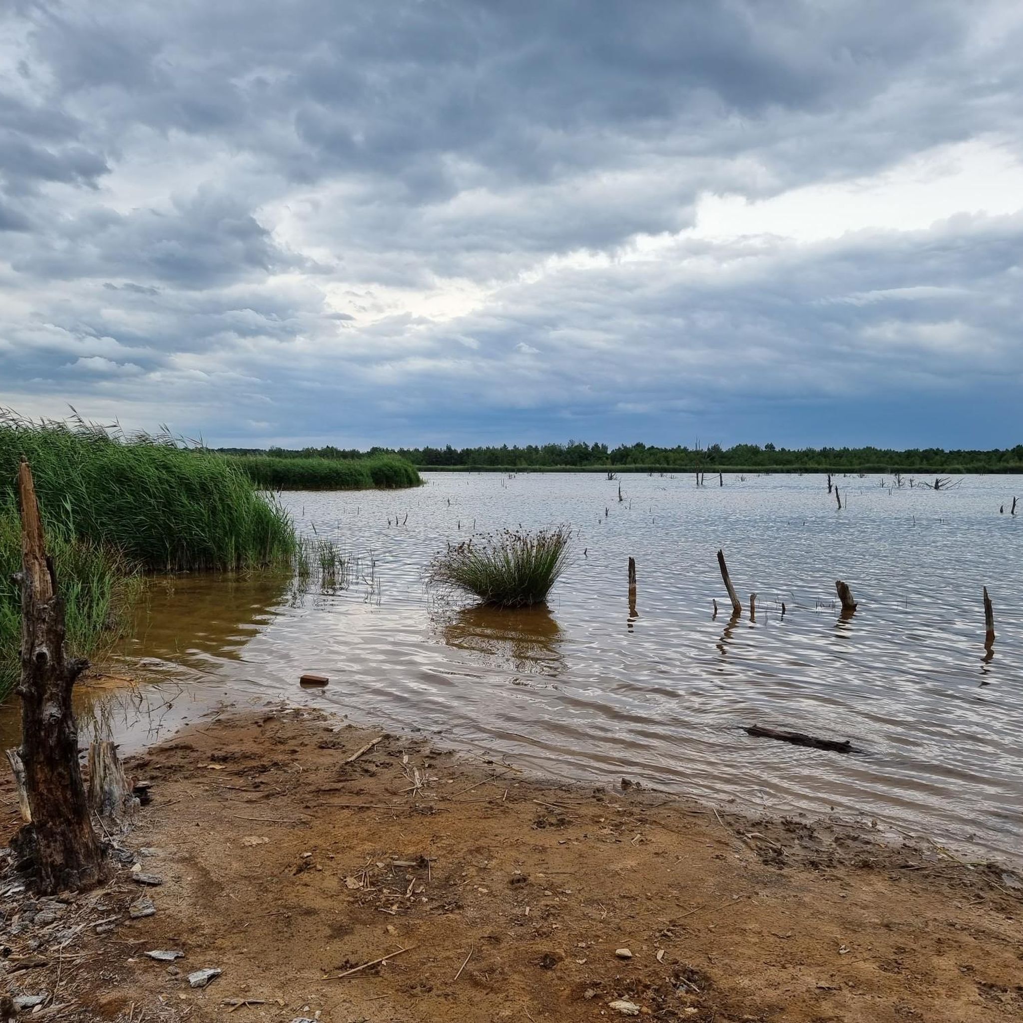
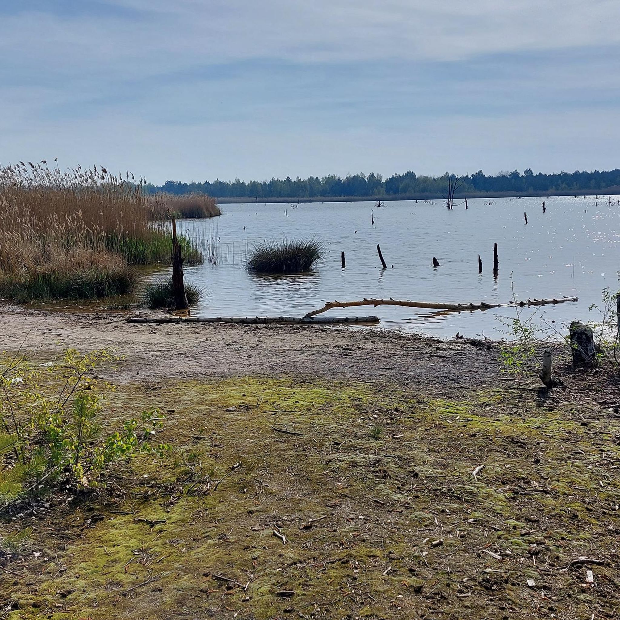
Today, an developed network of cycle paths and hiking trails with viewing platforms and information boards on the formation of the landscape extends along the Neuhäuser See. The 120 km long Kohle-Dampf-Licht cycle path from Lutherstadt Wittenberg to Markkleeberg passes by the lake. Source https://de.wikipedia.org/wiki/Neuh%C3%A4user_See
1
0
In the mid-19th century, the first mining activities began in the southwest of Goitzsche, near the villages of Petersroda and Holzweißig.[3] Following the lignite seam, mining progressed from west to east. Favored by the opening of the current Magdeburg–Leipzig and Trebnitz–Leipzig railway lines, the sales market for lignite expanded to Halle and Leipzig, among other places. The increased demand for electrical energy and fossil fuels in the 19th and 20th centuries led in 1908 to the opening of the Leopold open-cast mine (from 1945 to 1962 Holzweißig–Ost) and in 1958 to the creation of the Holzweißig-West open-cast mine.[3] The Neuhäuser See originated from the former Holzweißig-West lignite open-cast mine. It is named after the Neuhaus estate, which was demolished in 1976 along with the village of Paupitzsch. The Holzweißig-West open-cast mine was operated from 1958 to 1980. Other sources report usage until 1991. The lake was flooded from 1993 to 2005.[1] Overflowing water is channeled via the Goitzsche into the Mulde. Since 1997, the area has been renatured and stable embankments have been created. Source https://de.wikipedia.org/wiki/Neuh%C3%A4user_See
1
0
The Neuhäuser See is located on the northwestern border of the Free State of Saxony with Saxony-Anhalt, at an altitude of about 78 m above sea level. NN. South of the lake is Benndorf, a district of the North Saxon district town of Delitzsch, and to the north is the unified municipality of Bitterfeld-Wolfen in Saxony-Anhalt. It is located in the Central German Lake District, south of the Großer Goitzschesee and the waters Ludwigsee and Paupitzscher See. Quelle https://de.wikipedia.org/wiki/Neuh%C3%A4user_See
1
0
The Neuhäuser See (also Neuhauser See) is an opencast mine residual lake of approximately 155 hectares, which was created by flooding the former Holzweißig-West opencast mine. The lake is located in the Central German Lake District, south of the Goitzsche nature reserve and north of the town of Delitzsch. Source https://de.wikipedia.org/wiki/Neuh%C3%A4user_See
1
0
The Lober-Leine Canal is the artificial outflow of the Lober and Leine rivers into the Mulde River. It begins north of Benndorf and flows into the Mulde between Pouch and Löbnitz (Delitzsch district). The canal was constructed between 1949 and 1951[2] because the original riverbeds had to give way to the Goitzsche open-cast mine. It was approximately 14 kilometers long and was rerouted in 1982[2] to clear the construction site for the Rösa open-cast mine. After the 2002 floods, which destroyed its mouth, it was temporarily used to flood the Seelhauser See, a former open-cast mine lake. In 2004, the canal and its confluence with the Mulde were restored through extensive excavation work. Source: https://de.wikipedia.org/wiki/Lober-Leine-Kanal
2
0
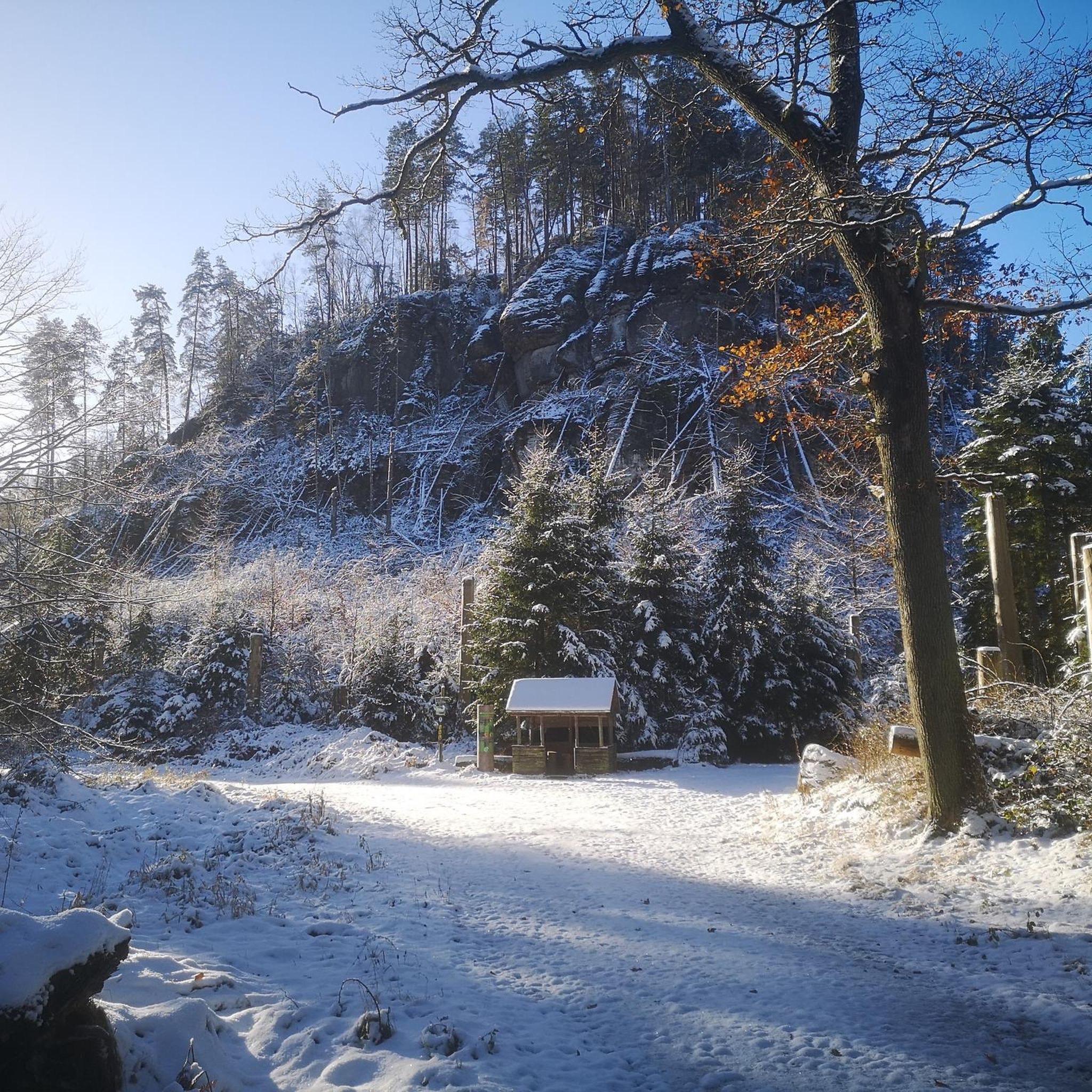
Beautiful rest area above the Lober-Leine Canal with a view of Lake Seelhausen
1
0
Beautiful view of the Alte Mulde river from the Mulde cycle path.
2
0

For the biker lingering before this small, sacred monument, which commemorates a former church, I offer the observer a key quote from Clive Staples Lewis (1898-1963), whom Wikipedia recognizes as "one of the most influential Christian apologists of the modern era": "I believe in Christianity the way I believe the sun has risen, not just because I see it, but because through it I can see everything else."
1
0
Frequently Asked Questions
How many mountain bike trails are available in Sandersdorf-Brehna?
There are over 20 mountain bike trails around Sandersdorf-Brehna. These routes offer a variety of experiences, with 4 easy trails and 17 moderate trails, ensuring options for different skill levels.
What is the best time of year for mountain biking in Sandersdorf-Brehna?
Spring and autumn are generally considered the best seasons for mountain biking in Sandersdorf-Brehna. The weather is mild, and the natural scenery is particularly vibrant during these times, making for enjoyable rides.
What kind of terrain can I expect on mountain bike trails around Sandersdorf-Brehna?
The terrain around Sandersdorf-Brehna is diverse, featuring rolling hills, dense forests, and picturesque riverbanks. You'll find a mix of leisurely paths and more demanding routes, often with scenic views of large lakes like the Great Goitzsche Lake.
Are there mountain bike trails suitable for beginners in Sandersdorf-Brehna?
Yes, Sandersdorf-Brehna offers 4 easy mountain bike trails that are well-suited for beginners or those looking for a more relaxed ride. These routes typically feature less elevation gain and smoother paths.
Are there any challenging mountain bike routes for experienced riders?
While there are no routes officially graded as 'difficult' in our current selection, there are 17 moderate mountain bike trails that offer more demanding passages and longer distances for experienced riders. These routes often include varied terrain and longer durations.
Are there family-friendly mountain bike trails in the area?
For families, the easier trails are a great option. Consider routes that are shorter and have less elevation, allowing for a more relaxed experience. The region's flat canal paths and routes around lakes are often suitable for family outings.
Can I bring my dog on the mountain bike trails in Sandersdorf-Brehna?
Many trails in the Sandersdorf-Brehna region are dog-friendly, especially those through forests and along riverbanks. However, it's always advisable to keep your dog on a leash, particularly in nature reserves or areas with wildlife, and to check local regulations for specific trails.
Are there any circular mountain bike routes?
Yes, many of the mountain bike routes in Sandersdorf-Brehna are circular. For example, the Lober-Leine Canal Path – Goitzsche-Rundweg Asphalt Path loop from Petersroda is a popular circular route that takes you around the Great Goitzsche Lake.
What interesting sights or landmarks can I see along the mountain bike trails?
The region offers several points of interest. You can explore natural monuments like Brodauer Zinken at Lake Werbeliner or Lake Ludwig. The Lake Neuhauser – View over Neuhauser Lake loop from Roitzsch (Kr Bitterfeld) offers scenic lake views, and the Old Mulde Oxbow – Mulde Bridge, Bad Düben loop from Roitzsch (Kr Bitterfeld) explores natural features around the Mulde river.
Are there places to stop for refreshments or rest along the routes?
Yes, you can find places to rest and refresh. For instance, the Almhütte Seensucht and the Pannenkoek Shaft Lodge are available. Additionally, the Bitterfeld City Harbor, near some routes, offers restaurants and a beach in summer.
What do other mountain bikers enjoy most about mountain biking in Sandersdorf-Brehna?
The area is highly rated by the komoot community, with an average score of 4.8 stars from more than 20 reviews. Riders often praise the diverse landscapes, including rolling hills, dense forests, and picturesque riverbanks, as well as the variety of trails suitable for different skill levels.
Are there any routes that offer panoramic views?
While specific viewpoints on trails are not detailed, the region's rolling hills and the presence of large lakes like the Great Goitzsche Lake suggest opportunities for scenic vistas. The Red Tower in Pouch, though not directly on a bike trail, offers panoramic views after a climb and is a notable attraction in the wider area.
How long are the mountain bike trails in Sandersdorf-Brehna?
The mountain bike trails vary significantly in length. For example, the Lake Neuhauser – View over Neuhauser Lake loop from Roitzsch (Kr Bitterfeld) is about 22 km (13.7 miles), while the Old Mulde Oxbow – Mulde Bridge, Bad Düben loop from Roitzsch (Kr Bitterfeld) extends to approximately 67 km (41.7 miles), offering options for both shorter and longer rides.
Most popular routes around Sandersdorf-Brehna
Most popular attractions around Sandersdorf-Brehna

Get inspired with the komoot mobile app


Explore more
Browse the best MTB trails in other regions.
