The best walks and hikes in the San Andres Mountains
4.6
(26)
299
hikers
29
hikes
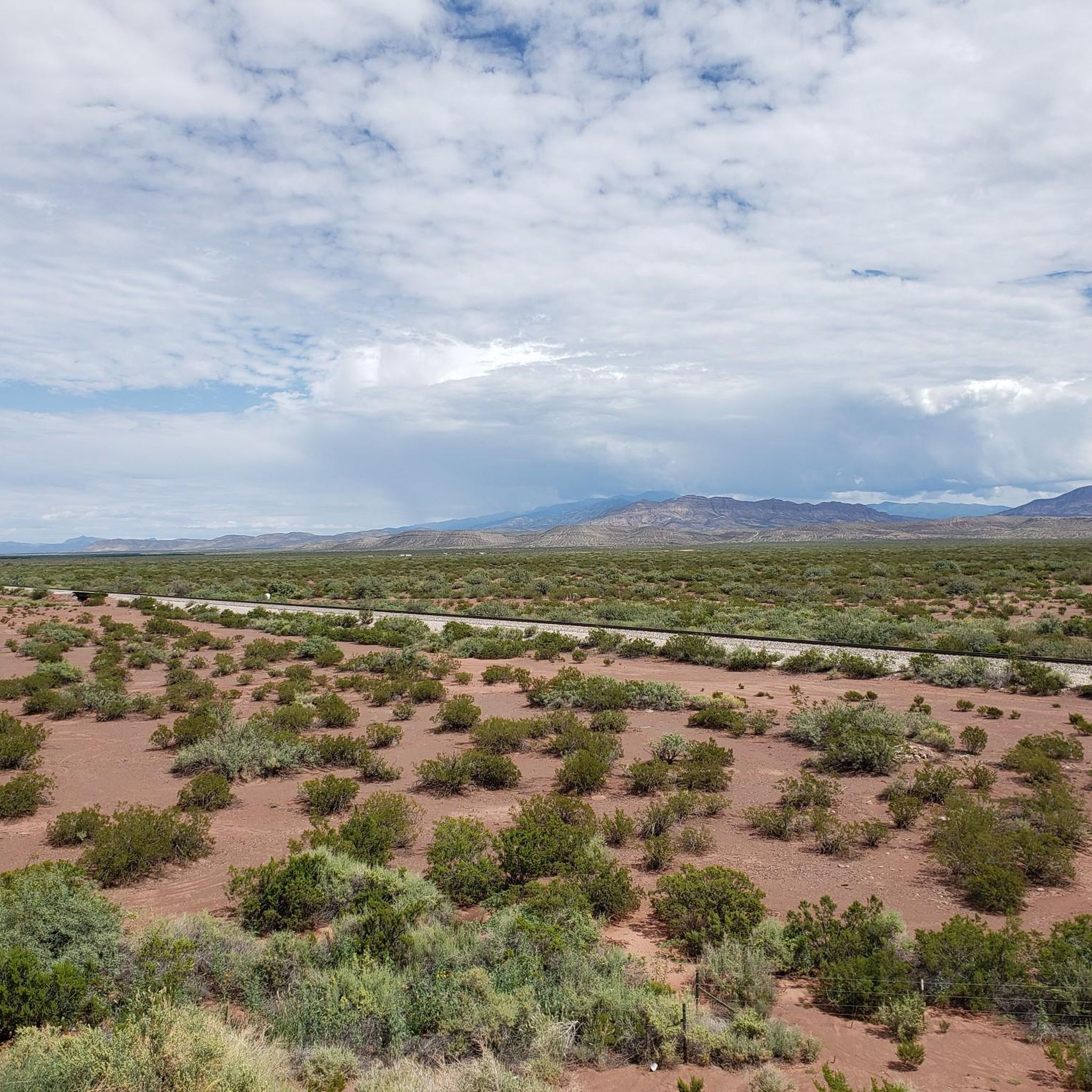
Hiking in the San Andres Mountains offers a rugged and diverse landscape, characterized by its dramatic desert environment and varied ecosystems. The range rises from desert scrubland to higher-elevation pine-oak woodlands, with elevations reaching up to 8,973 feet at Salinas Peak. Geological features include limestone, sandstone, and quartz monzonite, creating a distinct terrain. Isolated spring-fed riparian areas within canyons support unique habitats, adding to the region's biodiversity.
Best hiking trails in the San Andres Mountains
- The most popular hiking route is Pine Tree Trail — Organ Mountain - Desert Peaks National Monument, a 4.3 miles (6.9 km) moderate trail that takes 2 hours 12 minutes to complete. This path offers varied terrain within the Organ Mountain - Desert Peaks National Monument.
- Another top favourite among local hikers is Dripping Springs Trail — Dripping Springs Natural Area, an easy 3.1 miles (5.1 km) path. This trail features historical ruins and natural springs, providing panoramic views of the San Andres Mountains.
- Local hikers also love the Baylor Canyon Pass via Baylor Canyon Road — Organ Mountain - Desert Peaks National Monument, a 6.9 miles (11.1 km) trail leading through a canyon pass, often completed in about 3 hours 28 minutes.
- Hiking in the San Andres Mountains is defined by rugged desert environments, pine-oak woodlands, and dramatic geological features. The network offers options for various ability levels, from easy strolls to more strenuous climbs.
- The routes in San Andres Mountains are highly rated by the komoot community with an average score of 4.7 stars from over 20 reviews. More than 200 hikers have used komoot to explore San Andres Mountains's varied terrain.
Last updated: July 7, 2026
4
hikers
3.48km
01:05
220m
10m
The Baylor Canyon Pass Trail offers a fantastic, albeit short, journey through the Organ Mountains near Las Cruces. This 2.2-mile (3.5 km) hike, rated easy, features a steady climb of 731 feet (223 metres) over about 1 hour and 5 minutes, leading you to the scenic Baylor Canyon Pass. You'll traverse varied terrain, from granite sand to rocky sections, all while enjoying sweeping views of the canyon, the Rio Grande Valley, and the distinctive craggy peaks of the Organ Mountains.
To plan your visit, head to the Baylor Pass Trailhead. While the trail is considered easy in terms of length, the rocky and uneven footing requires deliberate steps, so wear appropriate footwear. Always carry ample water, especially when hiking in the desert climate, and consider an early start to avoid the midday sun. Dogs are permitted on the trail, but remember to keep them leashed.
This trail is notable for being one of the most widely used routes for crossing the Organ Mountain range, offering a unique opportunity to observe the stark contrast in vegetation between the eastern and western sides of the mountains. Historically, it's named after Confederate Lieutenant Colonel John Robert Baylor, who led a regiment through the pass during the Civil War. It's a great option for a quick, scenic outing that provides a taste of the region's natural beauty and history.
1
hikers
5.99km
01:56
330m
150m
Embark on the Achenbach Canyon Trail for a moderate hiking experience through the Chihuahuan Desert. This 3.7-mile (6.0 km) route challenges you with 1070 feet (326 metres) of elevation gain, taking approximately 1 hour and 56 minutes to complete. As you navigate sandy washes and rocky ascents, you'll encounter diverse desert flora like yuccas and ocotillo, leading to impressive cliffs and sweeping views of the Las Cruces valley.
When planning your visit, remember that the Achenbach Canyon Trail is generally accessible, but prepare for varied terrain, including loose scree. Wearing long pants is a good idea to protect yourself from desert plants. Parking is usually available at trailheads that connect to the Sierra Vista Trail, making it convenient to start your adventure.
This trail is a highlight within the Organ Mountains-Desert Peaks National Monument, offering a unique glimpse into the region's natural beauty. Keep an eye out for the 75-foot waterfall, which becomes a spectacular sight after significant rainfall. The area is also home to a variety of Echinocereus species, adding to the rich biodiversity you can discover along the way.

Sign up for free
1
hikers
7.92km
03:17
1,040m
30m
Embark on a challenging hike along the Organ Peak and Filmore Falls Trail, a difficult route that spans 4.9 miles (7.9 km) and demands a significant 3420 feet (1042 metres) of elevation gain. As you ascend, you will traverse pretty upland forests and canyons, eventually reaching striking views of the jagged Organ Mountains. Keep an eye out for Fillmore Waterfall, a seasonal cascade that can transform the canyon into a surprisingly lush landscape after good rains. The varied terrain includes rocky ribs, thick bushes, and higher up, yucca and cactus plants, all leading to panoramic vistas from Organ Peak. Expect this rewarding trek to take around 3 hours and 17 minutes to complete.
Planning your visit requires preparation, as this trail is considered difficult, especially for the full ascent to Organ Peak. You will need good navigational skills and should be ready for scrambling sections. Always bring plenty of water, particularly during warmer months, to stay hydrated on the climb. For amenities and maps, you can stop by the visitor center located in the nearby Dripping Springs Natural Area before you begin your adventure.
This trail is a highlight within the Organ Mountains-Desert Peaks National Monument, offering a unique opportunity to experience its rugged beauty. The seasonal nature of Fillmore Waterfall adds a dynamic element, showcasing how the desert landscape can dramatically shift with rainfall. From the summit of Organ Peak, you will be treated to expansive views across the Mesilla Valley and Tularosa Basin, providing a memorable perspective of this distinctive region. It is a route that truly immerses you in the natural environment of the Organ Mountains.
1
hikers
2.36km
00:45
150m
30m
The Bar Canyon trail offers a delightful introduction to the rugged beauty of the Organ Mountains-Desert Peaks National Monument. You'll traverse varied desert terrain, from smooth paths to rocky sections, all while enjoying expansive views of the central Organ Mountains and the southern Mesilla Valley. Keep an eye out for the seasonal Bar Canyon Waterfall after a good rain, and the historic Soledad Canyon Windmill near the trailhead.
This easy 1.5-mile (2.4 km) hike, with 485 feet (148 metres) of elevation gain, typically takes around 44 minutes to complete. Parking is readily available at the Soledad Canyon Day Use Trailhead, about 10 miles east of Las Cruces. The trail is open year-round, but visiting after rainfall can enhance the experience with the waterfall in flow.
Beyond its scenic appeal, Bar Canyon provides a glimpse into the region's past with historical ruins, including an old stone house from the early 1900s. It's a family-friendly and dog-friendly option, perfect for a quick outing or for those looking for beginner hiking opportunities in the New Mexico desert.
1
hikers
6.47km
03:05
1,110m
0m
The Organ Needle from Baylor Canyon Road is a truly demanding hike, often considered New Mexico's most difficult day trip. You'll gain 3639 feet (1109 metres) over just 4.0 miles (6.5 km), with the route taking around 3 hours and 4 minutes of focused effort. Expect rugged terrain, loose rock, and significant scrambling, especially as you approach the exposed 9,012-foot summit, which offers incredible 360-degree views of White Sands National Park and the surrounding desert.
Planning your visit requires careful consideration. Optimal seasons are April and October to avoid extreme heat or cold, as snow and ice can persist in shaded areas near the summit. The trail often lacks a clear path, making route-finding a constant challenge, and you should be prepared for bushwhacking through thorny desert vegetation. Starting early from Baylor Canyon Road can help you beat the heat and find some shade.
Organ Needle stands as the highest peak in Southern New Mexico and Doña Ana County, making it a defining challenge for experienced hikers. Its unique features include a "maze" of thick vegetation and side trails near Juniper Saddle, along with a Class 4 crux near the summit that demands technical skills. This isn't a hike for beginners; it's for those seeking a true mountaineering-style day out.
5.14km
01:38
220m
220m
The Indian Hollow and Pine Tree Loop Trail offers a unique journey through New Mexico's high desert, transitioning dramatically from arid landscapes to cool ponderosa pine forests. As you ascend, you'll be treated to expansive vistas of the Tularosa Basin and the rugged Organ Mountains, with landmarks like Pine Prominence and a distinctive white rock spire adding to the visual interest. This route is a fantastic way to experience diverse ecosystems and enjoy rare shade in a desert environment.
Planning your visit to this popular route is straightforward, as the trailhead is conveniently located within the Aguirre Springs Campground. There are permit fees to enter the campground, so factor that into your plans. While the trail is rated easy, covering 3.2 miles (5.1 km) with 720 feet (220 metres) of elevation gain in about 1 hour and 38 minutes, it's wise to carry ample water, especially on warmer days. In winter, be prepared for potentially snowy and slippery conditions in higher sections.
This trail is a standout for its ecological diversity, showcasing a rapid shift from desert flora like alligator junipers to forested areas with Gambel's Oaks and Douglas Firs. It's an excellent choice for Indian Hollow and Pine Tree Loop Trail hiking, offering a rewarding experience for families or anyone looking for a scenic, varied hike without a full-day commitment. The trail provides a great opportunity for birding and observing local wildlife.
2.56km
00:50
210m
0m
The West Baylor Canyon Trail offers a quintessential desert hiking experience, guiding you through varied terrain that includes rocky sections and granite sand as you ascend towards the iconic Organ Mountains. You'll be treated to sweeping panoramic views of the valley, the city of Las Cruces, and the distinctive needle-like spires of the Organ Mountains, all while surrounded by unique desert flora like alligator junipers and sotols.
This trail is easily accessible year-round, but planning your visit carefully is key due to the desert climate. There's no shade or water available, so bring plenty of hydration and sun protection. Avoid hiking in summer when temperatures can soar above 100 degrees Fahrenheit. The trailhead is easy to find, and leashed dogs are welcome to join you on this scenic outing.
Part of the larger Baylor Pass National Recreation Trail, this western segment provides a taste of the Organ Mountains-Desert Peaks National Monument. It's an easy 1.6-mile (2.6 km) hike with 680 feet (207 metres) of elevation gain, typically taking about 50 minutes. The continuous climb offers a good workout, making it a popular choice for those seeking rewarding views without a full-day commitment.
4.99km
02:39
1,030m
0m
The Organ Needle Trail is a true test of endurance and skill, widely considered New Mexico's most challenging hike. This difficult route packs 3371 feet (1027 metres) of elevation gain into just 3.1 miles (5.0 km), leading you through rugged desert terrain, brushy gullies, and scree slopes. Expect constant scrambling and loose rock, especially as you approach the Organ Needle summit, where the views of the Chihuahua Desert and White Sands are your hard-earned reward.
Planning your visit requires serious consideration; the Bureau of Land Management (BLM) does not maintain this trail and advises using a guide due to its extreme difficulty and danger. The ascent from the La Cueva Trailhead is relentless, with the final half-mile involving exposed Class 3 or 3+ scrambling. Always check weather conditions and ensure you are fully prepared for a demanding climb that typically takes around 2 hours and 39 minutes for the ascent alone.
This trail isn't just a hike; it's an iconic challenge to the highest southern peak in New Mexico, set within the visually striking Organ Mountains. The range's fluted appearance gives it its name, and the technical nature of the final push sets it apart from many other trails. It offers a unique opportunity to explore the Organ Needles Wilderness Study Area, known for its diverse flora, but only for those with the fitness and technical expertise to tackle its formidable terrain.
2.57km
00:52
200m
20m
Embark on the Achenbach Canyon Trail for an easy hike through the Chihuahuan Desert. This route offers a quick immersion into a landscape dotted with yuccas, cacti, and ocotillo. You will cover 1.6 miles (2.6 km) and gain 652 feet (199 metres) in elevation, taking about 51 minutes to complete. As you hike, look for the impressive cliffs and the distinctive rock spires of the Organ Mountains framing the eastern skyline. The trail itself features sandy washes and rocky passages, leading you past the notable Peña Blanca Rock Shelters.
Before you set out, be aware that some sections of the Achenbach Canyon Trail follow less defined paths. This means you should be prepared for route-finding in places, as trail markings might not always be clear. Due to encroaching desert plants, wearing long pants is advisable to protect your legs. Public access to the trail is secured, and it offers a great option for a short outdoor escape when you are in the area.
The Achenbach Canyon Trail provides a unique opportunity to explore the desert environment within the Organ Mountains-Desert Peaks National Monument. You will experience a classic Chihuahuan Desert setting, complete with its characteristic flora and geological features. The route offers sweeping views of the Las Cruces valley and Soledad Pass, highlighting the vastness of this protected area. It is an excellent choice if you want a brief but immersive desert hiking experience.
2.75km
01:02
320m
0m
The Mine House Spring via Topp Hut Road hiking trails offer a unique blend of desert scenery and historical exploration in the Organ Mountains-Desert Peaks National Monument. You'll traverse rugged, rocky terrain that provides expansive views of the Organ Mountains and the Mesilla Valley, making for a truly immersive experience. The route leads you past the historic Topp Hut and culminates at the intriguing ruins of the Ruby Mine, where you can explore old machinery and abandoned shafts.
Planning your visit to this popular hike in the Mine House Spring area is straightforward. While specific parking information isn't detailed, arriving early is always a good strategy for trailhead access. Remember to bring ample water, as you'll be hiking in a desert environment. The trail is generally accessible throughout the year, but spring and autumn provide the most pleasant conditions for tackling the moderate 1.7-mile (2.7 km) climb, which involves 1041 feet (317 metres) of elevation gain and takes about 1 hour and 2 minutes.
What makes the Mine House Spring via Topp Hut Road hiking difficulty worth it is the rich history embedded in the landscape. This trail isn't just about the views; it's a journey back in time to one of the five mines within the National Monument. Beyond the mining history, you'll also pass the Southern Comfort Wall, a known rock climbing spot, adding another layer of interest to this engaging desert adventure.
Get access to more routes and recommendations from other explorers.
Sign up for free
Already have an account?
Our route recommendations are based on thousands of hikes, rides, and runs completed by other people on komoot.
Start today with a free account
Your next adventure awaits.
Login or Signup
Popular around San Andres Mountains
Tips from the Community

As you ascend the high desert the views start to open up around you. From here you are around halfway to the pass!
0
0
The trail disappears about a half-mile from the summit and you switch to following the arroyo and scrambling up some loose terrain to get to the top. It is good to bring the digital map with you as the GPS route is quite good. The peak sits at 8,753 feet, just shy of the height of Organ Needle, and the views are phenomenal in all directions.
0
0
The trail up to the saddle has some easy scrambling. From here on to Organ Needle you will pass the crux, a small steep scramble with a rope to help hikers up and down. If you are reasonably fit and comfortable with easy scrambling then don't let the crux deter you! It is quite manageable and the rewards from the summit are well worth it.
0
0
This rocky road leads you on a long approach to the Organ Mountains. You can climb the Tooth and the Organ Needle from here. The hike from La Cueva is nicer (and shorter), but the La Cueva lot doesn't open until 8am and for the aforementioned hikes you will want to start much earlier than that. Make sure you bring plenty of water and good navigation for the upper parts of the trail, and have fun!
0
0
There is a day use fee for the Baylor Pass Trail ($3 as of 2024). You can camp at Aguirre Spring or park and hike from here. There is a little shaded picnic table at the trailhead with views out across the desert.
0
0
This is a great turn-around point if you are hiking the Baylor Pass Trail. You can also head up toward Baylor Peak to an overlook or the summit itself. The pass tends to be quite windy so hold onto your hats!
0
0
Frequently Asked Questions
How many hiking trails are available in the San Andres Mountains?
The San Andres Mountains offer a diverse range of hiking experiences, with over 20 routes documented on komoot. These trails cater to various skill levels, from easy strolls to more strenuous climbs.
Are there easy hiking trails suitable for beginners in the San Andres Mountains?
Yes, the region has several easy trails perfect for beginners. For example, the Dripping Springs Trail — Dripping Springs Natural Area is an easy 3.1-mile path featuring historical ruins and natural springs. Another accessible option is the Soledad Canyon loop — Organ Mountains, which is just over 3 miles long.
What are some challenging hikes for experienced trekkers in the San Andres Mountains?
For experienced hikers seeking a challenge, the Organ Peak and Fillmore Falls Trail — Organ Mountain - Desert Peaks National Monument is a difficult 9.4-mile route with significant elevation gain. This trail offers a strenuous climb and rewarding views.
Can I find waterfalls along hiking trails in the San Andres Mountains?
Yes, seasonal waterfalls can be found, particularly during the monsoon season. The Fillmore Waterfall is a notable attraction, and you can explore it via routes like the Fillmore Waterfall & La Cueva Rocks loop — Dripping Springs Natural Area.
Are there any circular hiking routes in the San Andres Mountains?
Several trails offer a loop experience. The Crawford Trail and La Cueva Rocks loop — Dripping Springs Natural Area is an easy 2.9-mile loop. Another option is the Loop through Peña Blanca Wilderness Study Area — Organ Mountains, which covers about 3.7 miles.
What kind of wildlife can I expect to see while hiking in the San Andres Mountains?
The diverse habitats of the San Andres Mountains support a variety of wildlife. Hikers may spot desert bighorn sheep, mule deer, and various bird species. Mountain lions are also present, though less commonly seen. The region's isolated spring-fed riparian areas are crucial for these animals.
What are some interesting landmarks or points of interest to see along the trails?
Beyond the natural beauty, you can discover several points of interest. The Baylor Canyon offers dramatic scenery, while the Juniper Saddle provides unique views. Historical ruins can also be found along trails like the Dripping Springs Trail.
What is the best time of year to hike in the San Andres Mountains?
The San Andres Mountains offer hiking opportunities year-round, but spring and fall generally provide the most pleasant temperatures. Summers can be very hot, with a risk of flash floods during monsoon season, while winters can bring colder conditions at higher elevations. Always check weather forecasts before heading out.
Are there any specific access restrictions or permits required for hiking in the San Andres Mountains?
A significant portion of the San Andres Mountains falls within the White Sands Missile Range and the San Andres National Wildlife Refuge, which have restricted public access. It is crucial to check current access regulations and obtain any necessary permits before planning your visit to ensure you are hiking in permitted areas. Cell service is also limited in remote areas.
What do other hikers enjoy most about the San Andres Mountains?
The San Andres Mountains are highly rated by the komoot community, with an average score of 4.7 stars from over 20 reviews. Hikers frequently praise the rugged desert environments, the stunning contrast with the nearby White Sands, and the varied terrain that offers both easy walks and challenging climbs.
Are there any trails that offer views of White Sands National Park?
While not directly within the San Andres Mountains, the nearby Indian Hollow Trail (a 3.1-mile out-and-back route) provides stunning views of both the San Andres Mountains and the brilliant white dunes of White Sands National Park, offering exceptional photographic opportunities.
What should I consider bringing or wearing for a hike in this region?
Given the rugged desert environment and varied elevations, it's essential to be prepared. Always carry plenty of water, wear sturdy hiking boots, and dress in layers to adapt to temperature changes. Sun protection, including a hat and sunscreen, is crucial. Be aware of potential hazards like rattlesnakes and inform someone of your planned route.
Most popular routes in the San Andres Mountains
Most popular attractions in the San Andres Mountains

Get inspired with the komoot mobile app


