The best running trails around Tavernola Bergamasca
4.3
(245)
11,624
runners
339
runs
Jogging routes around Tavernola Bergamasca offer diverse terrain for runners of all levels. The region is characterized by the picturesque Lake Iseo shoreline, providing flat and scenic routes. Inland, the landscape transitions to hilly and mountainous terrain, including the Bergamasque Prealps, which offer more challenging trails with significant elevation changes. Natural features like Monte Isola and the Rino Stream canyon further contribute to the varied running environment.
Best jogging routes around Tavernola Bergamasca
- The most popular jogging route is Running on the peat bogs — Torbiere del Sebino nature reserve, a 5.7 miles (9.2 km) trail that takes 1 hour 3 minutes to complete. This moderate route offers a unique experience through a protected natural area.
- Another top favourite among local runners is Running loop from Monte Isola, a moderate 5.4 miles (8.7 km) path. This route provides scenic views of Lake Iseo and the surrounding landscape from Europe's largest lake island.
- Local runners also love the Lakeside Promenade of Iseo – Port of Lovere loop from Sulzano, a 6.3 miles (10.2 km) trail leading through lakeside promenades, often completed in about 1 hour 6 minutes.
- Jogging around Tavernola Bergamasca is defined by serene lakeside paths, challenging hilly trails, and routes ascending into mountain flanks. The network offers options for different ability levels, from easy strolls to difficult trail running.
- The routes in Tavernola Bergamasca are highly rated by the komoot community with an average score of 4.3 stars from over 130 reviews. More than 6500 runners have used komoot to explore Tavernola Bergamasca's varied terrain.
Last updated: August 24, 2026
3.7
(10)
101
runners
9.21km
01:03
50m
40m
Embark on a moderate jogging route through the Torbiere del Sebino nature reserve, covering 5.7 miles (9.2 km) with a gentle 151 feet (46 metres) of elevation gain, typically completed in 1 hour and 2 minutes. You will experience a unique wetland environment, jogging along paths that wind through extensive peat bogs and past numerous ponds. Look for wooden walkways and bridges that often stretch directly over the water, offering an immersive view of the reed beds and the
5.0
(1)
231
runners
42.4km
06:10
2,280m
2,280m
Hard run. Very good fitness required. Sure-footedness, sturdy shoes and alpine experience required.

Sign up for free
3.5
(6)
279
runners
10.4km
01:07
70m
70m
Moderate run. Good fitness required. Mostly paved surfaces. Suitable for all skill levels.
45
runners
Moderate run. Good fitness required. Mostly paved surfaces. Suitable for all skill levels.
43
runners
20.3km
02:31
610m
610m
Hard run. Very good fitness required. Mostly paved surfaces. Suitable for all skill levels.
Get access to more routes and recommendations from other explorers.
Sign up for free
Already have an account?
Our route recommendations are based on thousands of hikes, rides, and runs completed by other people on komoot.
Start today with a free account
Your next adventure awaits.
Login or Signup
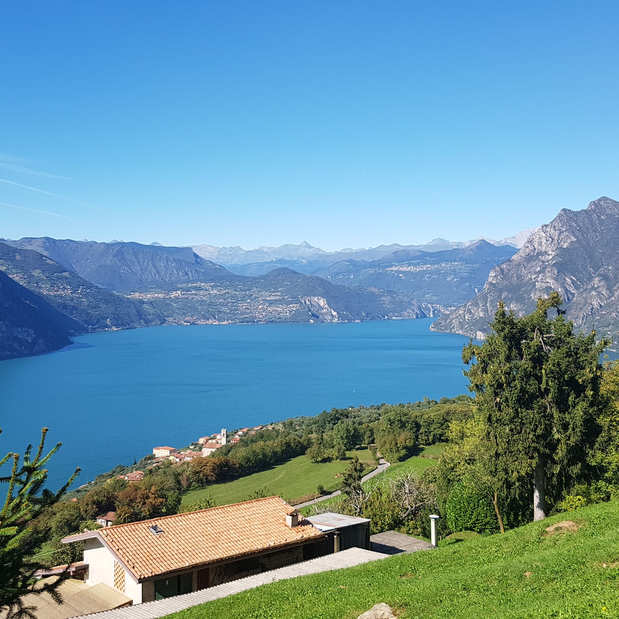
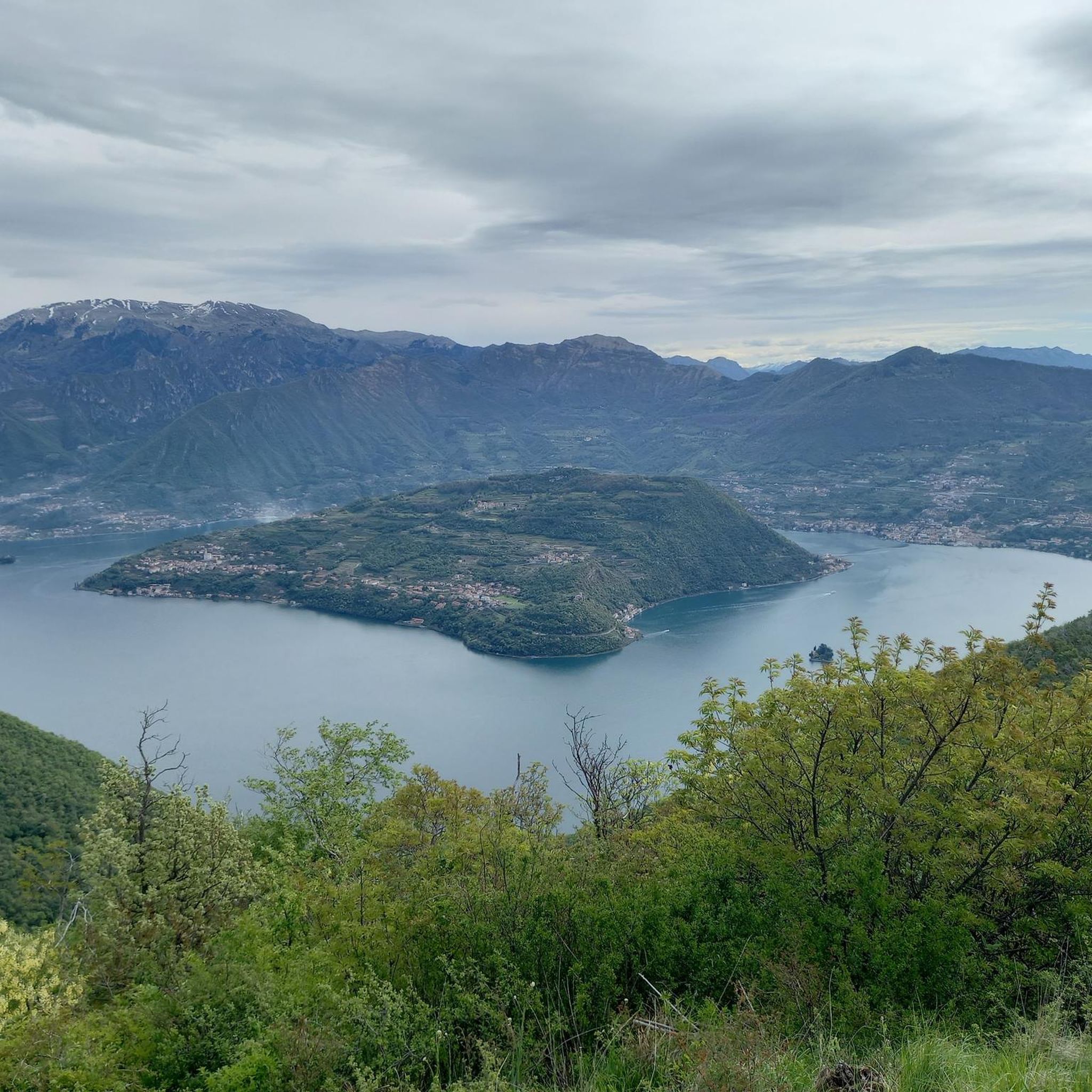
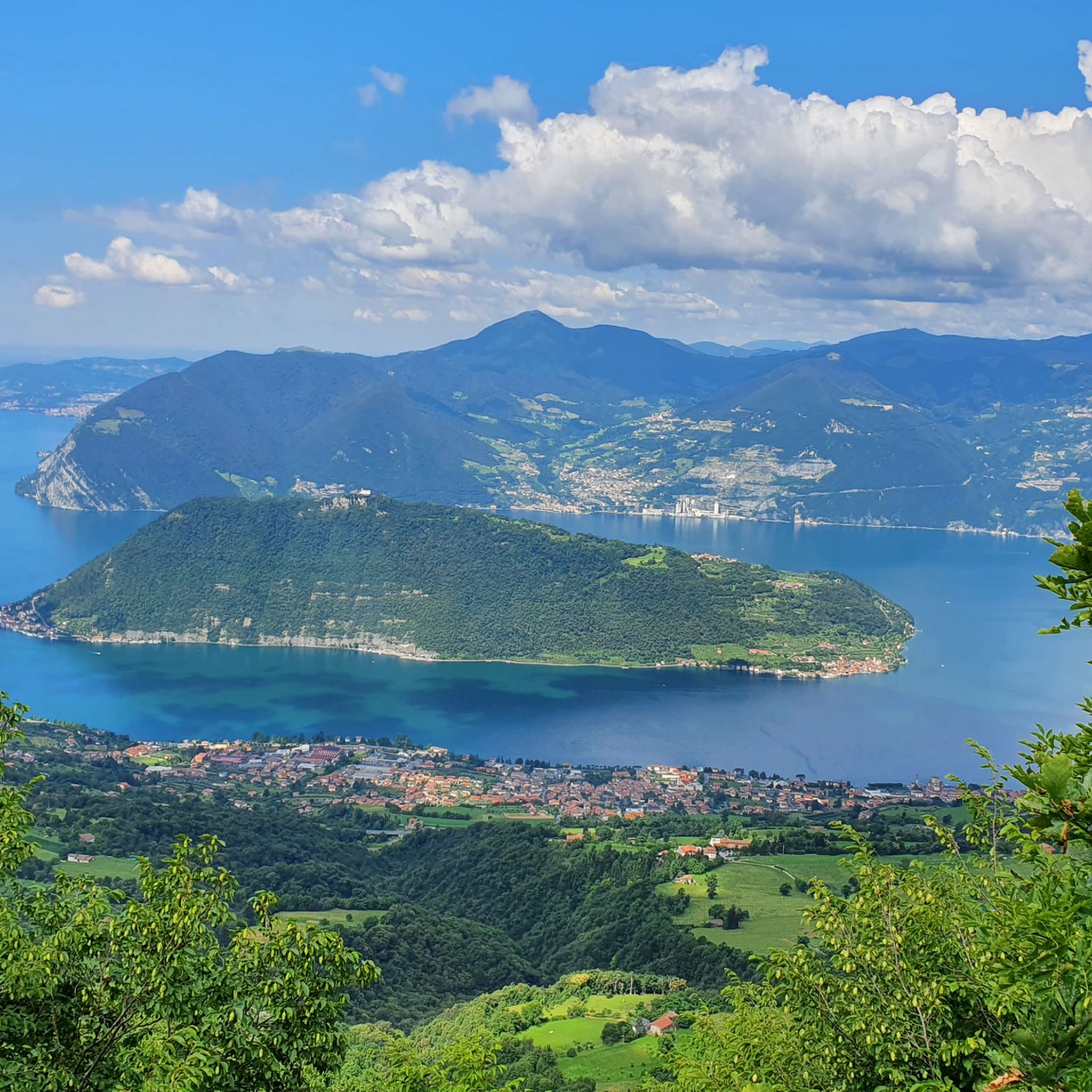
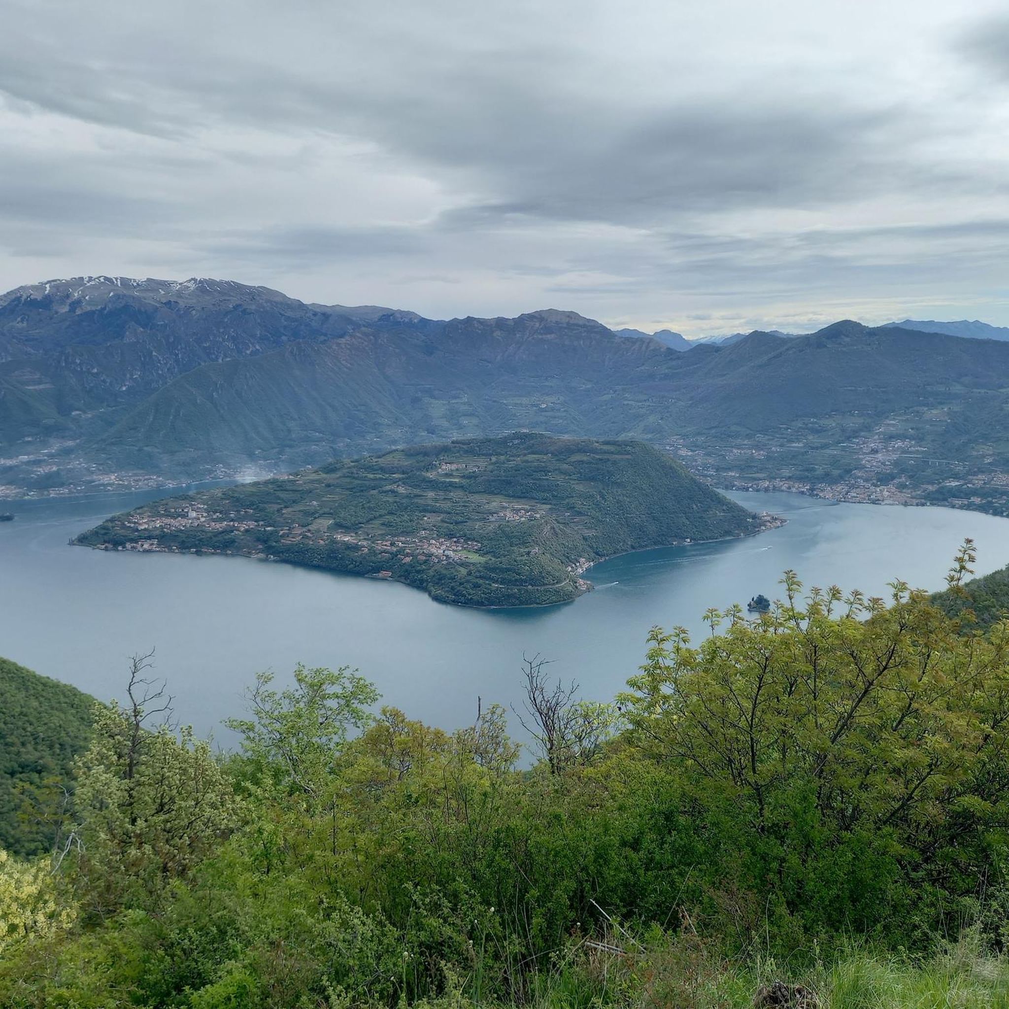

Tips from the Community

Beautiful little church, picturesquely located on a sub-peak with a truly dreamlike view over Marone, Sale Marasino, Lake Iseo and Monte Isola.
0
0

Lake Iseo (or Sebino) is a gem of Lombardy located between the provinces of Bergamo and Brescia. This glacial basin, enclosed by majestic mountains and the hills of Franciacorta, offers the perfect combination of historic villages, pristine nature, and food and wine excellences.
0
0

The Rifugio Croce di Marone is located at 1,166 m on the southern slope of Monte Guglielmo, above Marone, and is one of the most convenient and frequented starting points for climbing the Guglielmo. 🏔️ Hut identity and location The refuge is located in the Croce di Marone area, reachable via the road that climbs from Marone → Cislano → Madonna della Rota, crossing the Valle dell’Opol. It is situated in a panoramic and strategic point for: Monte Guglielmo (1948 m) – classic and very frequented ascent Malga Guglielmo di Sotto and di Sopra Rifugio Almici Piani di Caregno The refuge is open all year round, has a restaurant, electric light, hot water, and about 15 beds. 🚗 How to get there By car from Marone Follow the signs for Zone. After about 4.5 km, past the cable car underpasses, you will find a sharp right turn with a sign for the refuge. The road becomes narrow and steep in the final kilometers. Paid parking with scratch card (3 € up to 4 hours, 5 € for longer). On foot from Zone (Englar) You can leave your car at the Englar restaurant (640 m). Ascent along the road/CAI 226 trail → approx. 1h20’–1h50’ depending on whether you cut corners. 🚶♂️ Main excursions from the refuge 1. Monte Guglielmo (E – approx. 2h) This is the shortest and most direct route to reach the summit of Guglielmo: Initial mule track Junction for Malpensata Section with white-blue 3V trail markers Malga Guglielmo di Sotto → Malga di Sopra Rifugio Almici → summit with the Monument to the Redeemer The panorama over the Sebino and the Prealps is considered one of the most beautiful in the area. 2. Rifugio Almici (1861 m) – 2h Simple and panoramic route along the mule track. 3. Piani di Caregno – 3h30’ Longer but very scenic route. 🏞️ Environment and atmosphere The area is characterized by: beech and fir woods open pastures views of Lake Iseo and Val Trompia presence of the 3V trail nearby It is an ideal spot for short excursions, longer treks, or family days out.
0
0
panorama from Monte Guglielmo
0
0

when they say lose your head, unique landscapes that will steal your heart
0
0
a viewpoint with a balcony overlooking the lake, worth a stop
0
0

Beautiful seafront, very pleasant to walk along
0
0
A beautiful hermitage perched on a panoramic hill. The view is breathtaking, and the churchyard is perfect for a break.
0
0
Frequently Asked Questions
How many running routes are available in Tavernola Bergamasca?
There are over 240 running routes around Tavernola Bergamasca, catering to various fitness levels. You'll find a mix of easy, moderate, and difficult trails to explore.
What kind of terrain can I expect on the running trails in Tavernola Bergamasca?
The region offers diverse terrain. You can enjoy flat, scenic runs along the Lake Iseo shoreline, including the picturesque Vello–Toline Cycle Path. For more challenging runs, the landscape transitions to hilly and mountainous terrain in the Bergamasque Prealps, providing significant elevation changes and continuous lake views. Some routes also explore natural features like the Rino Stream canyon.
Are there any scenic viewpoints or landmarks along the jogging routes?
Absolutely! Many routes offer stunning views of Lake Iseo. For panoramic vistas, consider trails that ascend to points like the Monument to the Redeemer on Monte Guglielmo or the Sanctuary of the Madonna della Ceriola on Monte Isola. You can also discover unique natural monuments such as the Pyramids of Zone.
What do other runners say about the trails in Tavernola Bergamasca?
The running trails in Tavernola Bergamasca are highly rated by the komoot community, with an average score of 4.3 stars from over 130 reviews. More than 6,500 runners have used komoot to explore the varied terrain, often praising the serene lakeside paths and challenging hilly sections.
Are there easy running routes suitable for beginners or families?
Yes, Tavernola Bergamasca offers a good selection of easy running routes. The lakeside promenade provides a flat and scenic option. For a unique experience, consider Running on the peat bogs — Torbiere del Sebino nature reserve, which is a moderate route but generally accessible and offers a protected natural environment.
Are the running trails in Tavernola Bergamasca dog-friendly?
Many trails in the Tavernola Bergamasca area are suitable for running with dogs, especially those in natural settings. However, it's always advisable to keep your dog on a leash and check local regulations, particularly in nature reserves like the Torbiere del Sebino, to ensure a pleasant experience for everyone.
Can I find circular running routes in the area?
Yes, there are several excellent circular running routes. A popular choice is Running loop from Monte Isola, which offers scenic views from Europe's largest lake island. Another option is the Lakeside Promenade of Iseo – Port of Lovere loop from Sulzano, providing a beautiful lakeside experience.
Where can I find parking near the running trails?
Parking is generally available in and around Tavernola Bergamasca, especially near popular starting points for trails. For routes along the lake, you can often find parking in the towns. For trails leading into the hills, look for designated parking areas at trailheads or in nearby villages. It's recommended to check specific route details for parking suggestions.
How can I reach trailheads using public transport?
Tavernola Bergamasca is accessible by public transport, primarily buses and ferries across Lake Iseo. The ferry service is particularly useful for reaching Monte Isola, which offers numerous running opportunities. Check local bus schedules for connections to various villages and trail starting points. For more detailed information on transport, you might find resources like Wikivoyage helpful.
Are there challenging routes for experienced trail runners?
Absolutely. For experienced trail runners seeking a challenge, the Bergamasque Prealps surrounding Tavernola Bergamasca offer numerous difficult routes with significant elevation gains. An example is the Panorama Single Trail loop from Stazione Sulzano - Monte Isola, which features substantial climbing and rewarding views.
What is the best time of year for running in Tavernola Bergamasca?
The spring and autumn months generally offer the most pleasant conditions for running in Tavernola Bergamasca, with mild temperatures and beautiful scenery. Summer can be warm, especially for lakeside routes, so early morning or late afternoon runs are advisable. Winter running is possible, but higher elevation trails may be affected by snow or ice.
Can I find routes that explore Monte Isola?
Yes, Monte Isola, Europe's largest lake island, offers fantastic running opportunities. You can take a ferry from Tavernola Bergamasca to the island. Once there, routes like Running loop from Monte Isola provide scenic paths, including climbs to the Sanctuary of the Madonna della Ceriola for breathtaking views.
Most popular routes around Tavernola Bergamasca
Most popular attractions around Tavernola Bergamasca

Get inspired with the komoot mobile app


Explore more
Browse the best Running Trails & Routes in other regions.
