The best mountain hikes around Castelfondo
4.7
(77)
721
hikers
42
hikes
Mountaineering routes around Castelfondo are set within the rugged, mountainous terrain of the upper Val di Non in Trentino, Italy. This region, known as the "Trentina Valley of the Canyons," features dramatic gorges carved by streams, dense forests, and numerous peaks. The landscape provides a diverse setting for mountaineering, with significant elevation changes and varied natural features.
Best mountaineering routes around Castelfondo
- The most popular mountaineering route is Spitzner Kornigl Summit – Schöngrubspitze loop from Passo Castrin - Hofmahdjoch,…
Last updated: October 8, 2026
5.0
(4)
20
hikers
11.7km
05:56
960m
960m
Hard mountaineering route. Very good fitness required. Sure-footedness, sturdy shoes and alpine experience required.
5.0
(1)
21
hikers
Hard mountaineering route. Very good fitness required. Mostly accessible paths. Sure-footedness required.

5.0
(3)
19
hikers
7.82km
03:53
670m
670m
Hard mountaineering route. Good fitness required. Sure-footedness, sturdy shoes and alpine experience required.
3.0
(2)
15
hikers
Hard mountaineering route. Very good fitness required. Mostly accessible paths. Sure-footedness required.
5.0
(1)
16
hikers
Hard mountaineering route. Good fitness required. Sure-footedness, sturdy shoes and alpine experience required.
Get access to more routes and recommendations from other explorers.
Already have an account?
Our route recommendations are based on thousands of hikes, rides, and runs completed by other people on komoot.
Start today with a free account
Your next adventure awaits.

Tips from the Community

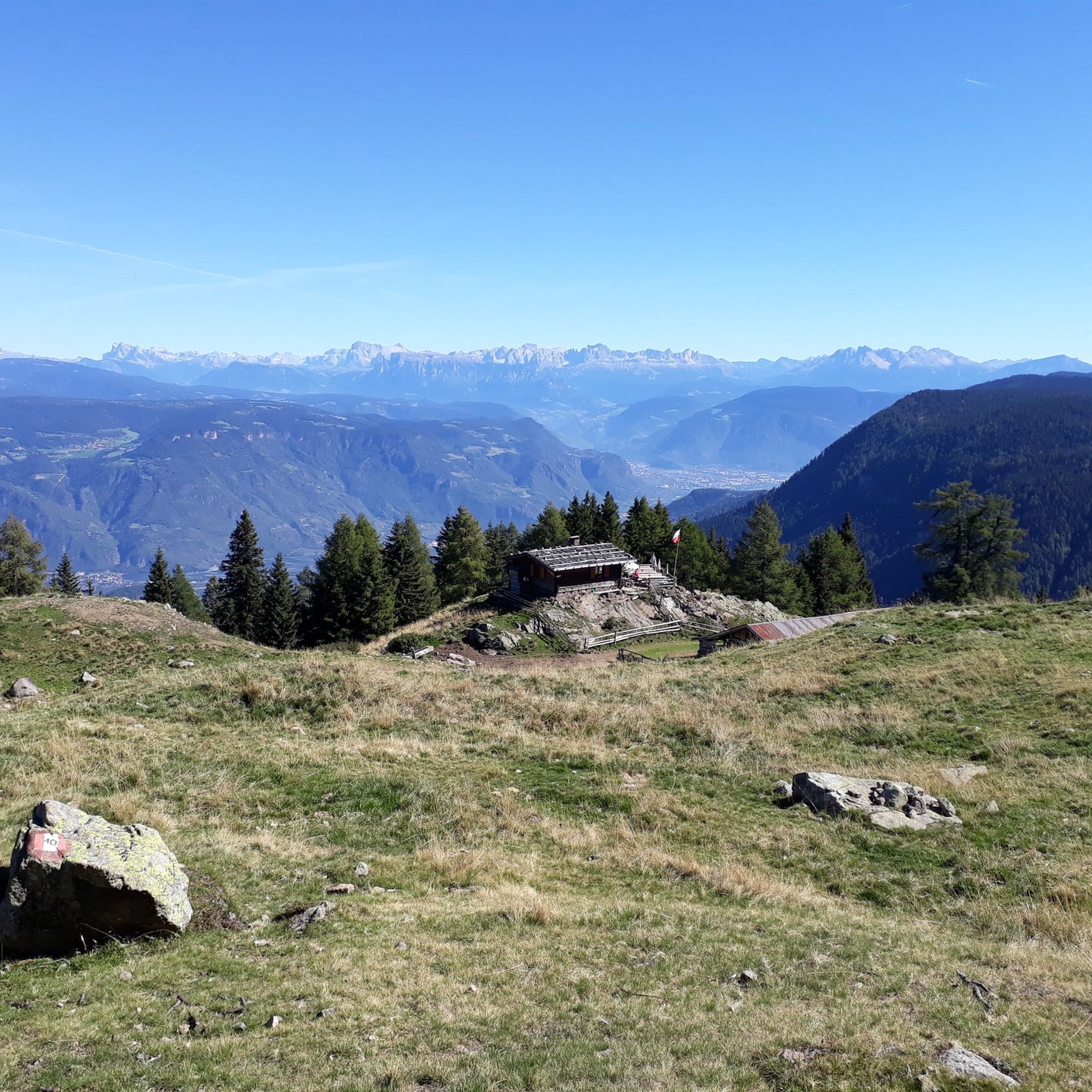
The trail does have exposed sections, but they can be mastered with caution and the necessary sure-footedness. Poles provide security and are helpful. You will be rewarded with magnificent views of the Dolomites, the Brenta Group, and the Trentino.
0
0

The Laugenspitze (Italian: Monte Luco) at 2,434 meters is the highest mountain in the Nonsberg Group in South Tyrol. The striking porphyry double peak consists of the Große Laugen (2,434 m) and the Kleine Laugen (2,297 m), which are separated by the picturesque Laugensee (2,182 m). Due to its freestanding location, it offers an excellent viewing platform over the Etschtal valley, the Meraner Land region, the Vinschgau valley, and as far as the Dolomites.
0
0

Wonderful view, children's playground, very good food
0
0

Great view, delicious Kaiserschmarrn
0
0

Gantkofel in German, Mount Macaion is located on the Mendola coast and stands at an altitude of 1,866 meters. From the top you can enjoy a great view of the surrounding valleys and peaks, in addition to being present a commemorative stone and a high cross.
1
1

Easy hike suitable for everyone... Too bad about the fog that today prevented us from admiring the wonderful view from up here...
0
0
Frequently Asked Questions
What kind of terrain can I expect on mountaineering routes around Castelfondo?
Mountaineering routes in Castelfondo traverse rugged, mountainous terrain within the upper Val di Non. You'll encounter deep gorges carved by streams, dense forests, and significant elevation changes. The region is known as the "Trentina Valley of the Canyons," offering a diverse landscape of woods, rocks, and waterfalls.
Are there any easy mountaineering routes in Castelfondo for beginners?
The mountaineering routes around Castelfondo are generally considered moderate to difficult. Out of 48 routes, 14 are moderate and 34 are difficult, with none classified as easy. This suggests that most routes require a good level of fitness and some mountaineering experience.
What natural landmarks can I see along the mountaineering routes?
The region around Castelfondo is rich in natural beauty. You can explore the deep gorge of the Rio Novella stream, visit beautiful lakes like Lake Luco and Roe Lake, or discover unique natural phenomena such as the Eislöcher Nature Reserve, where cold air persists even in summer. Many routes also offer panoramic views of the surrounding alpine peaks.
Are there any waterfalls to see on the trails?
Yes, the Val di Non is known for its waterfalls. You can find highlights like the Tret Waterfall and the Emerald Lake and Waterfall. There's also a dedicated Trail Along the Novella Stream Waterfalls, offering opportunities to experience these natural features.
What do other mountaineers enjoy most about the routes in Castelfondo?
The mountaineering routes in Castelfondo are highly rated by the komoot community, with an average score of 4.7 stars from over 100 reviews. Mountaineers often praise the challenging ascents, the diverse terrain including canyons and forests, and the expansive views from prominent peaks like the Laugen Summit Cross.
Are there circular mountaineering routes available?
Yes, many of the mountaineering routes around Castelfondo are circular. Examples include the challenging Spitzner Kornigl Summit – Schöngrubspitze loop from Passo Castrin - Hofmahdjoch and the scenic Laugen Summit Cross loop from Passo Castrin - Hofmahdjoch, both offering a complete experience back to the starting point.
What is the typical duration for mountaineering routes in this area?
The duration of mountaineering routes around Castelfondo varies depending on the specific trail and your pace. For example, the Spitzner Kornigl Summit – Schöngrubspitze loop typically takes around 5 hours 42 minutes, while the Hofmahd Parking Lot – Revò Hut loop can be completed in about 3 hours 33 minutes.
Where can I find parking for the mountaineering trails?
Many popular mountaineering routes, such as those leading to Spitzner Kornigl Summit and Laugen Summit Cross, start from Passo Castrin - Hofmahdjoch, which typically offers parking facilities for hikers and mountaineers.
Are there any viewpoints with panoramic views?
Absolutely. The region is known for its impressive alpine peaks that offer magnificent 360-degree views. Routes ascending to the Laugen Summit Cross provide expansive vistas of the surrounding mountains, including the Dolomites and the Ortler Alps. Other areas like Penegal and Naturnser Hochwart / Guardia Alta di Naturno are also noted for their panoramic views.
What is the best time of year for mountaineering in Castelfondo?
The best time for mountaineering in Castelfondo is generally during the warmer months, from late spring to early autumn, when trails are clear of snow and weather conditions are more stable. This period allows for full enjoyment of the diverse landscapes, including canyoning opportunities in the cool waters of the Novella stream.
Are there any routes that lead to mountain huts?
Yes, some routes in the area lead to mountain huts. For instance, the Hofmahd Parking Lot – Revò Hut loop from Passo Castrin - Hofmahdjoch is a difficult route that includes a mountain hut, providing a potential stop or destination for your mountaineering adventure.
Most popular routes around Castelfondo
Most popular attractions around Castelfondo

Get inspired with the komoot mobile app


Explore more
Browse the best Mountain Hikes & Routes in other regions.
