The 20 Most Amazing Peaks around Fuipiano Valle Imagna
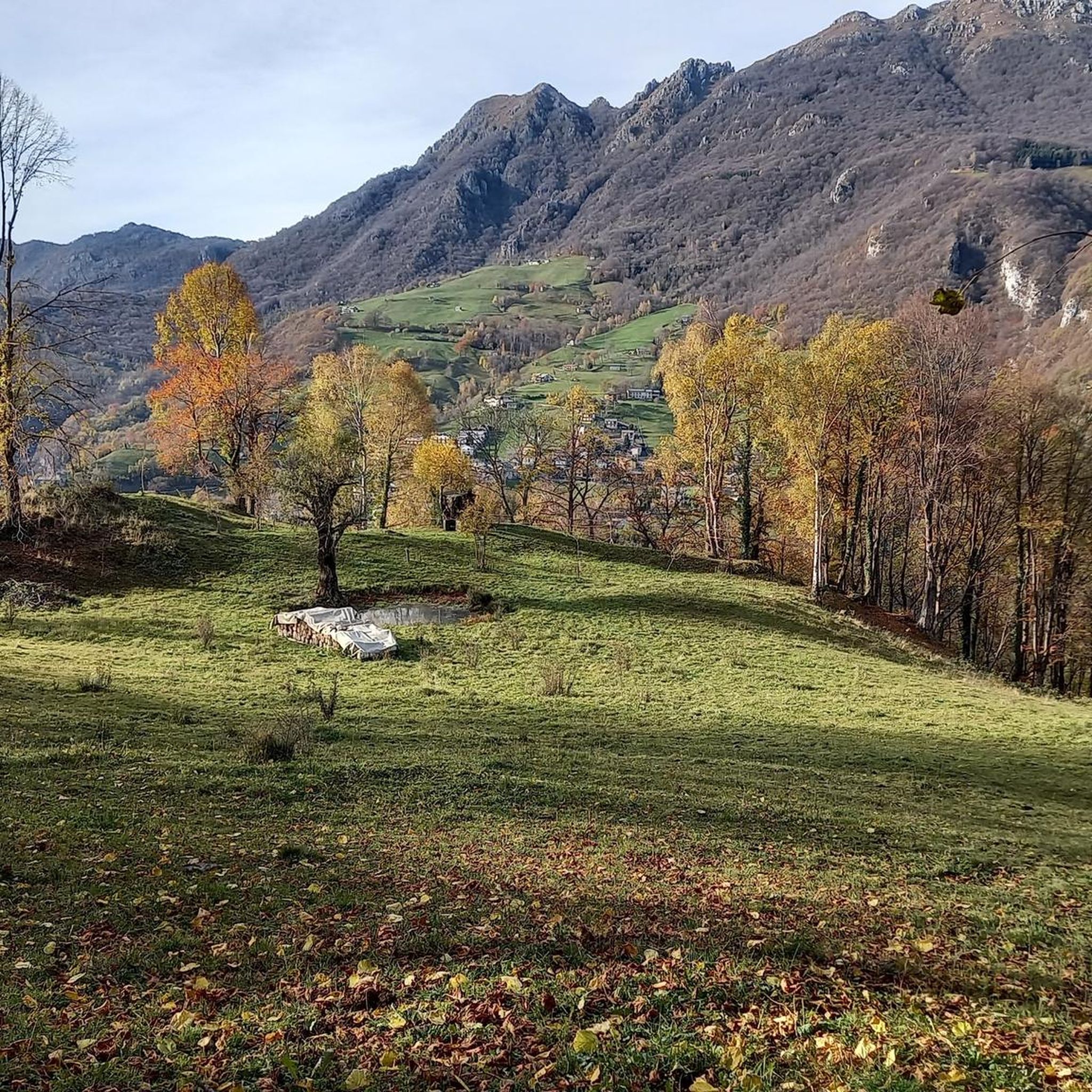
Best mountain peaks around Fuipiano Valle Imagna are found in the Bergamasque Prealps, a region known for its elevated terrain and diverse hiking experiences. This area serves as a starting point for exploring various peaks that offer panoramic views and natural landscapes. The village of Fuipiano Valle Imagna is situated at a high elevation, providing access to trails that lead to significant natural attractions. The region features a mix of challenging climbs and more accessible routes, catering to different hiking…
Last updated: September 27, 2026
Luigi Azzoni Hut (Monte Resegone)
Highlight • Mountain Hut
Translated by Google •
Tip by

Summit of Resegone
Highlight • Summit
Translated by Google •
Tip by

Sign up now to discover places like this
Get recommendations on the best single tracks, peaks, & plenty of other exciting outdoor places.
View from Mount Resegone
Highlight • Summit
Translated by Google •
Tip by

Monte Linzone Summit
Highlight • Summit
Translated by Google •
Tip by

Summit cross and Locatelli–Milani–Scaioli bivouac, Monte Due Mani
Highlight • Summit
Translated by Google •
Tip by

Sign up for free to discover even more peaks around Fuipiano Valle Imagna.
Already have an account?
Start today with a free account
Your next adventure awaits.
Popular around Fuipiano Valle Imagna


Tips from the Community

Monti sorgenti, a wonder.
2
0

Always a show as always
0
0

Watch out for ticks... last year's experience
0
0

Mount Resegone offers one of the most spectacular views in Lombardy! From its summit, at 1,875 meters, you can admire a breathtaking view that embraces the Alpine arch, the Apennines, Brianza and even Milan. What you can see from the top: Southern side: The city of Lecco, Lake Como, the Lombardy plain and, on clear days, even the Apennines. Northern side: Valsassina and the Bergamo valleys, such as Valle Imagna and Val Brembana. Western side: The lakes of Annone, Pusiano and Montorfano. Eastern side: The peaks of the Orobie, with glimpses of Monte Rosa in the distance. The Sentiero delle Creste is one of the most panoramic routes to reach the summit, offering spectacular views along the entire route. If you love photography or simply want to enjoy an unforgettable sunset, Resegone is a perfect destination!
0
0
Mount Resegone, also known as Mount Serrada, is a mountain in the Orobie Prealps, 1,875 meters high. It is located on the border between the provinces of Bergamo and Lecco, and is famous for its serrated profile, which resembles the blade of a saw—hence the name "Resegone". Main characteristics: Main peaks: Punta Cermenati, Punta Stoppani, Punta Manzoni, il Dente, Cima Pozzi, Pizzo Daina and Torre di Valnegra. Geology: Composed mainly of dolomite, a sedimentary rock dating back to the Upper Triassic. Hiking trails: Path no. 1 is the most popular route to reach the summit, starting from Lecco and arriving at the Rifugio Azzoni, located just below the summit. Shelters: The Rifugio Luigi Azzoni, near the summit, is a reference point for hikers. Curiosity: The Resegone is mentioned by Alessandro Manzoni in The Betrothed, where it is described for its characteristic shape
0
0

The Rifugio Luigi Azzoni, located on the summit of Resegone, is a point of reference for hikers in the area. The panoramic view from its position is unparalleled, ranging from the Orobie Prealps to the plain. Open all year on weekends and every day in summer, it offers food and overnight accommodation.
1
1

The 𝗣𝘂𝗻𝘁𝗮 𝗖𝗲𝗿𝗺𝗲𝗻𝗮𝘁𝗶 is the highest peak of the 𝗥𝗲𝘀𝗲𝗴𝗼𝗻𝗲, one of the most characteristic mountains of Lombardy, located in the 𝗣𝗿𝗲𝗮𝗹𝗽𝗶 𝗢𝗿𝗼𝗯𝗶𝗲, between Lecco and Bergamo. The 𝗥𝗲𝘀𝗲𝗴𝗼𝗻𝗲 is known for its unique appearance that resembles a saw with multiple tips. The 𝗣𝘂𝗻𝘁𝗮 𝗖𝗲𝗿𝗺𝗲𝗻𝗮𝘁𝗶 rises to 1875 meters and is one of the most popular destinations for hikers. Features of the 𝗣𝘂𝗻𝘁𝗮 𝗖𝗲𝗿𝗺𝗲𝗻𝗮𝘁𝗶: 𝗔𝗹𝘁𝗶𝘁𝘂𝗱𝗶𝗻𝗲: 1875 m 𝗣𝗼𝘀𝗶𝘇𝗶𝗼𝗻𝗲: part of the 𝗥𝗲𝘀𝗲𝗴𝗼𝗻𝗲 chain 𝗣𝗮𝗻𝗼𝗿𝗮𝗺𝗮: From the summit you can enjoy a spectacular view of Lecco, Lake Como and the Lombard Alps. On clear days you can see the Po Valley and even Milan in the distance. Itineraries to reach the 𝗣𝘂𝗻𝘁𝗮 𝗖𝗲𝗿𝗺𝗲𝗻𝗮𝘁𝗶: Several paths lead to the summit, with varying degrees of difficulty. Some of the most popular include: 𝗦𝗲𝗻𝘁𝗶𝗲𝗿𝗼 𝗱𝗮𝗹 𝗥𝗶𝗳𝘂𝗴𝗶𝗼 𝗔𝘇𝘇𝗼𝗻𝗶: The most popular route to reach the summit. The refuge is at about 1860 meters, almost at the top. From here you can take the last stretch to get to the 𝗣𝘂𝗻𝘁𝗮 𝗖𝗲𝗿𝗺𝗲𝗻𝗮𝘁𝗶 in a few minutes. 𝗦𝗲𝗻𝘁𝗶𝗲𝗿𝗼 𝗱𝗮𝗹𝗹𝗮 𝗖𝗮𝗽𝗮𝗻𝗻𝗮 𝗔𝗹𝗽𝗶𝗻𝗶𝘀𝘁𝗶 𝗠𝗼𝗻𝘇𝗲𝘀𝗶: A more challenging route that starts from Erve and crosses steep sections. It is appreciated by expert hikers. 𝗩𝗶𝗮 𝗱𝗮𝗹𝗹𝗲 𝗽𝗲𝗻𝗱𝗶𝗰𝗶 𝗱𝗶 𝗕𝗿𝘂𝗺𝗮𝗻𝗼: Another route, longer and more panoramic, starts from the Bergamo side of the 𝗥𝗲𝘀𝗲𝗴𝗼𝗻𝗲, ideal for those seeking tranquility. 𝗥𝗶𝗳𝘂𝗴𝗶𝗼 𝗔𝘇𝘇𝗼𝗻𝗶: 𝗥𝗶𝗳𝘂𝗴𝗶𝗼 𝗔𝘇𝘇𝗼𝗻𝗶, at 1860 meters, is a reference point for hikers. It is open all year round and offers an excellent base for rest. The summit can be reached in about 10-15 minutes. Activities in the area: 𝗘𝘀𝗰𝘂𝗿𝘀𝗶𝗼𝗻𝗶𝘀𝗺𝗼: The climb to the 𝗣𝘂𝗻𝘁𝗮 𝗖𝗲𝗿𝗺𝗲𝗻𝗮𝘁𝗶 is popular in both summer and winter. In winter, snowshoes are available. 𝗔𝗿𝗿𝗮𝗺𝗽𝗶𝗰𝗮𝘁𝗮: The 𝗥𝗲𝘀𝗲𝗴𝗼𝗻𝗲 offers interesting climbing routes. 𝗙𝗼𝘁𝗼𝗴𝗿𝗮𝗳𝗶𝗮: The landscape from the summit is one of the most photogenic in Lombardy, with spectacular views of the lake and the mountains. 𝗣𝘂𝗻𝘁𝗮 𝗖𝗲𝗿𝗺𝗲𝗻𝗮𝘁𝗶𝗶𝗻𝗴 is an ideal destination for those who love the mountains and want to experience an excursion in an environment rich in history and breathtaking views.
0
0

Take-off point for paragliding enthusiasts
0
0
Frequently Asked Questions
What are the most popular mountain peaks and viewpoints around Fuipiano Valle Imagna?
The region offers several highly-rated peaks and viewpoints. Among the most popular are Monte Linzone Summit, known for its spectacular views of the Po Valley, and Luigi Azzoni Hut (Monte Resegone), which provides unparalleled panoramic views from the summit of Resegone. Another significant peak is Summit cross and Locatelli–Milani–Scaioli bivouac, Monte Due Mani, offering extensive vistas of the Grigne, Valsassina, and the lakes of Brianza.
What kind of hiking experiences can I expect in the mountains near Fuipiano Valle Imagna?
You can find a diverse range of hiking experiences, from moderate trails to challenging climbs. Peaks like Monte Resegone offer various routes, some less frequented when starting from Fuipiano. Corna Camozzera provides tranquil trails with sections involving rocky scrambles, ideal for experienced hikers seeking solitude. Many routes lead through forests and open, rocky terrain, offering stunning views.
Are there any challenging mountain climbs for experienced hikers?
Yes, for experienced hikers, Corna Camozzera offers challenging sections with rocky scrambles, especially along its crest, and is often combined with Monte Ocone for a scenic loop. Monte Resegone also presents challenging routes, particularly towards its summit. The descent from Monte Due Mani towards Morterone can also be very technical and exposed in parts.
What unique natural landmarks can I visit in the area?
A significant natural landmark is The Three Beeches of Fuipiano Imagna. These imposing, centuries-old beech trees are a popular destination, offering panoramic views of Valle Imagna and Val Taleggio. Another notable site is Madonna dei Canti, found along hiking trails, which provides magnificent landscapes surrounded by the Grigna and Resegone mountains.
What is the best time to visit the mountain peaks around Fuipiano Valle Imagna?
The region is enjoyable across seasons. The Rifugio Luigi Azzoni on Monte Resegone is open year-round on weekends and daily in summer, suggesting good conditions for hiking during these periods. Clear days offer the best panoramic views, especially from higher peaks like Monte Resegone and Monte Linzone.
Are there any historical points of interest on the mountain trails?
Yes, along the route to Corna Camozzera, you can find 'The Passata,' a stone marker indicating the ancient border between the Venetian Republic and the State of Milan, offering a glimpse into the region's historical significance.
Are there family-friendly hiking options in the mountains?
Yes, The Three Beeches of Fuipiano Imagna is listed as a family-friendly highlight. This site, with its impressive centuries-old trees and panoramic views, can be included in circular routes from Fuipiano, making it suitable for families.
What outdoor activities can I do near these mountain peaks?
Besides hiking, the area around Fuipiano Valle Imagna offers various outdoor activities. You can explore gravel biking routes, such as the 'Nicola Hut – Artavaggio Plateau loop from Moggio,' or enjoy cycling tours like the 'Climb to Fuipiano Valle Imagna – Imagna Beach loop.' For more hiking, consider routes like the 'Periplo della Valle Imagna Trail' or the 'Start of Sentiero Tre Faggi – Madonna dei Canti Summit loop.' You can find more details on these activities in the Gravel biking around Fuipiano Valle Imagna, Hiking around Fuipiano Valle Imagna, and Cycling around Fuipiano Valle Imagna guides.
What makes Monte Resegone a significant peak in the region?
Monte Resegone is iconic for its distinctive saw-tooth profile, which gives it its name. It offers spectacular 360-degree views, including the lakes of Brianza and the city of Lecco. The Rifugio Luigi Azzoni, located just below its summit, serves as a key resting point with food and accommodation, making it a popular destination for hikers.
What can I expect at the Luigi Azzoni Hut on Monte Resegone?
The Rifugio Luigi Azzoni is a crucial reference point for hikers, situated at 1,860 meters just below the summit of Resegone. It provides a place to rest and enjoy extensive panoramic views of the Orobie Prealps and the plain. The hut is open on weekends year-round and daily in summer, offering both food and overnight accommodation.
What are the characteristics of Monte Linzone Summit?
Monte Linzone Summit, at 1392 meters, is known for its spectacular views, particularly of the Po Valley. Its summit features a large grassy lawn, making it an ideal spot for enjoying sunrises and sunsets. It's a moderate hike, surrounded by woods, offering a rewarding experience.
What do visitors appreciate most about the mountain peaks around Fuipiano Valle Imagna?
Visitors highly appreciate the stunning panoramic views from peaks like Monte Resegone and Monte Linzone, the tranquility of less-frequented trails such as those leading to Corna Camozzera, and the unique natural landmarks like The Three Beeches. The diverse hiking experiences, ranging from intermediate to challenging, and the opportunity to immerse oneself in natural beauty are also frequently highlighted.
Most popular routes around Fuipiano Valle Imagna
Most popular attractions around Fuipiano Valle Imagna

Get inspired with the komoot mobile app


Explore more
See even more amazing summits around Fuipiano Valle Imagna with these guides:
