The best walks and hikes in the Rincon Mountains
4.8
(87)
940
hikers
65
hikes
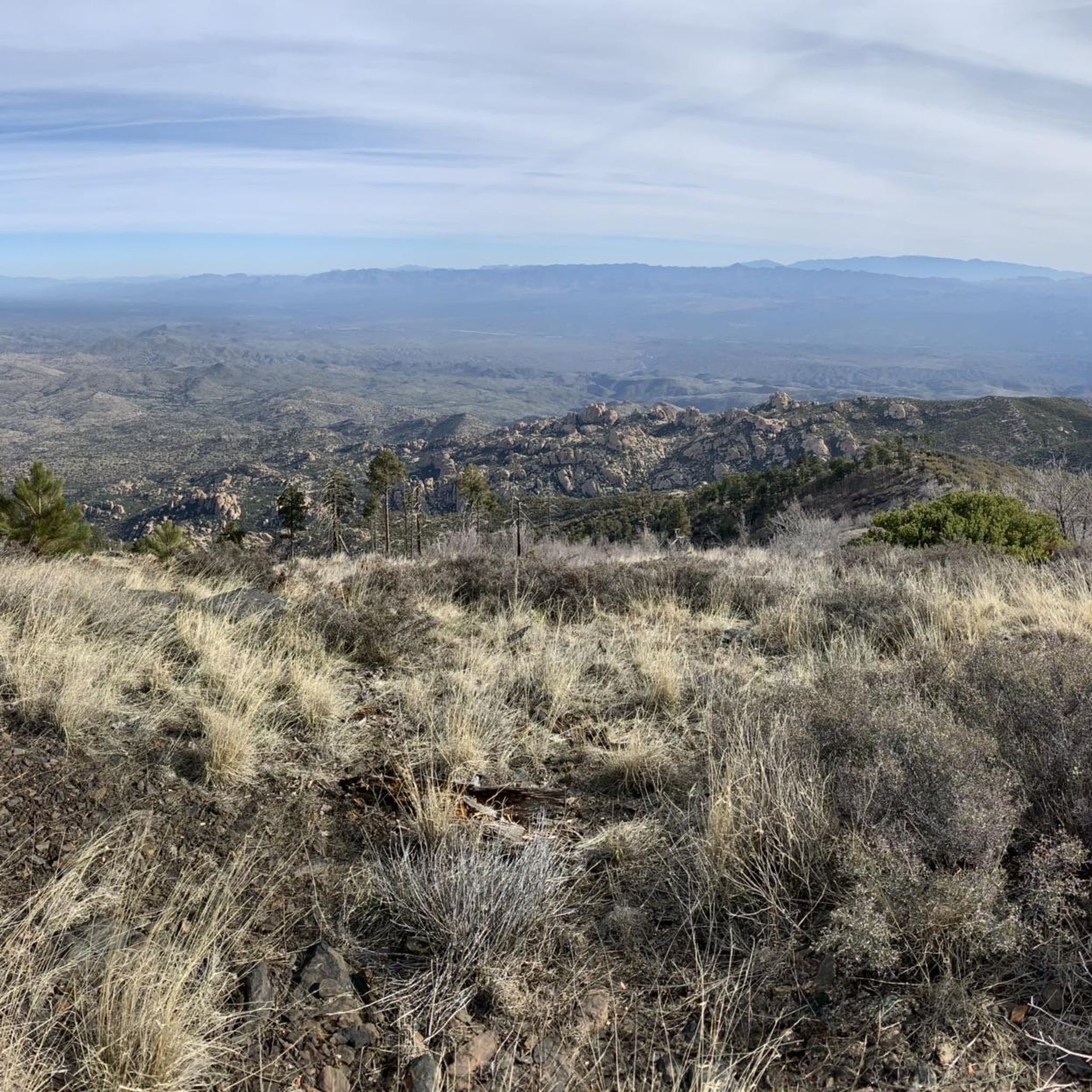
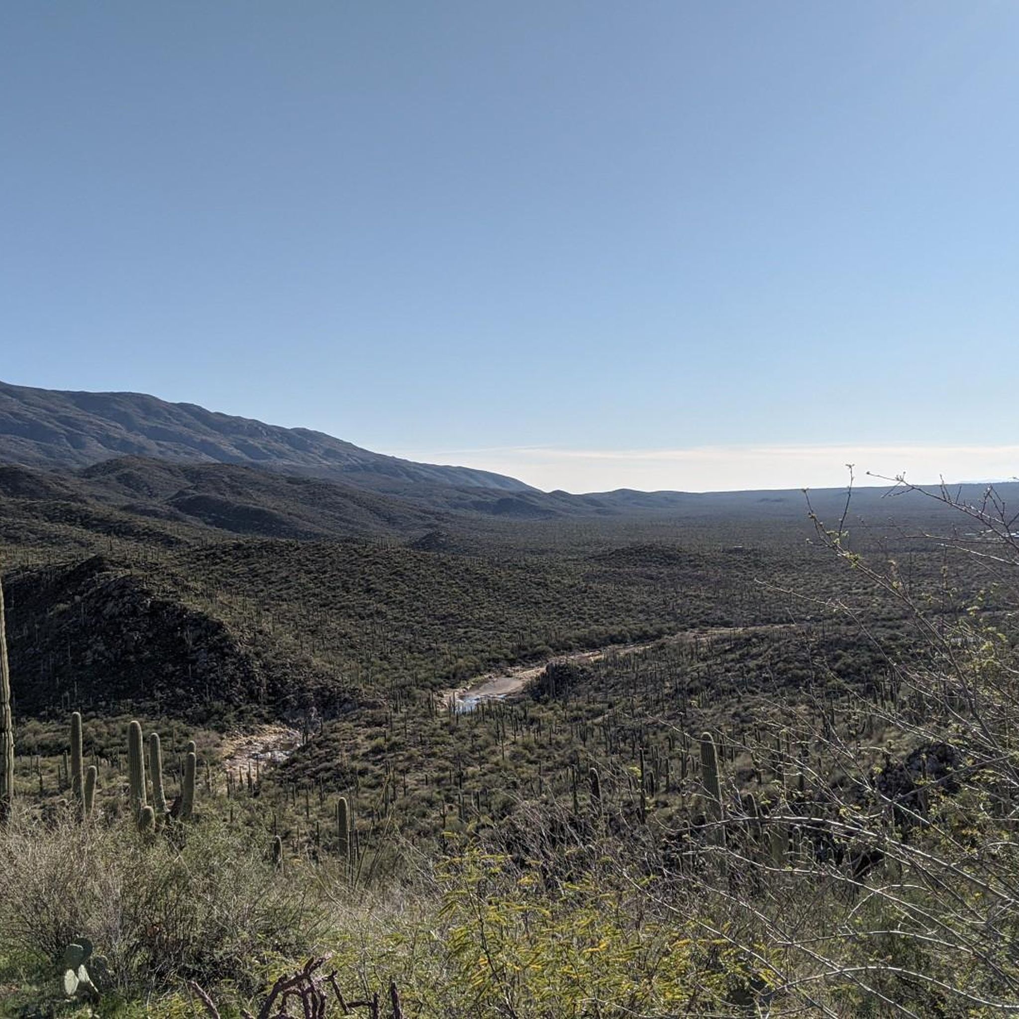
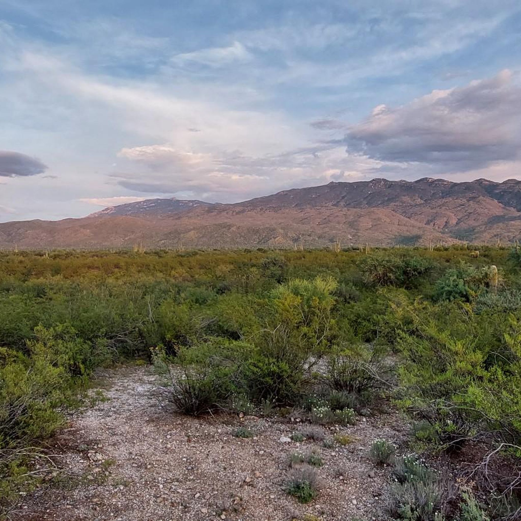
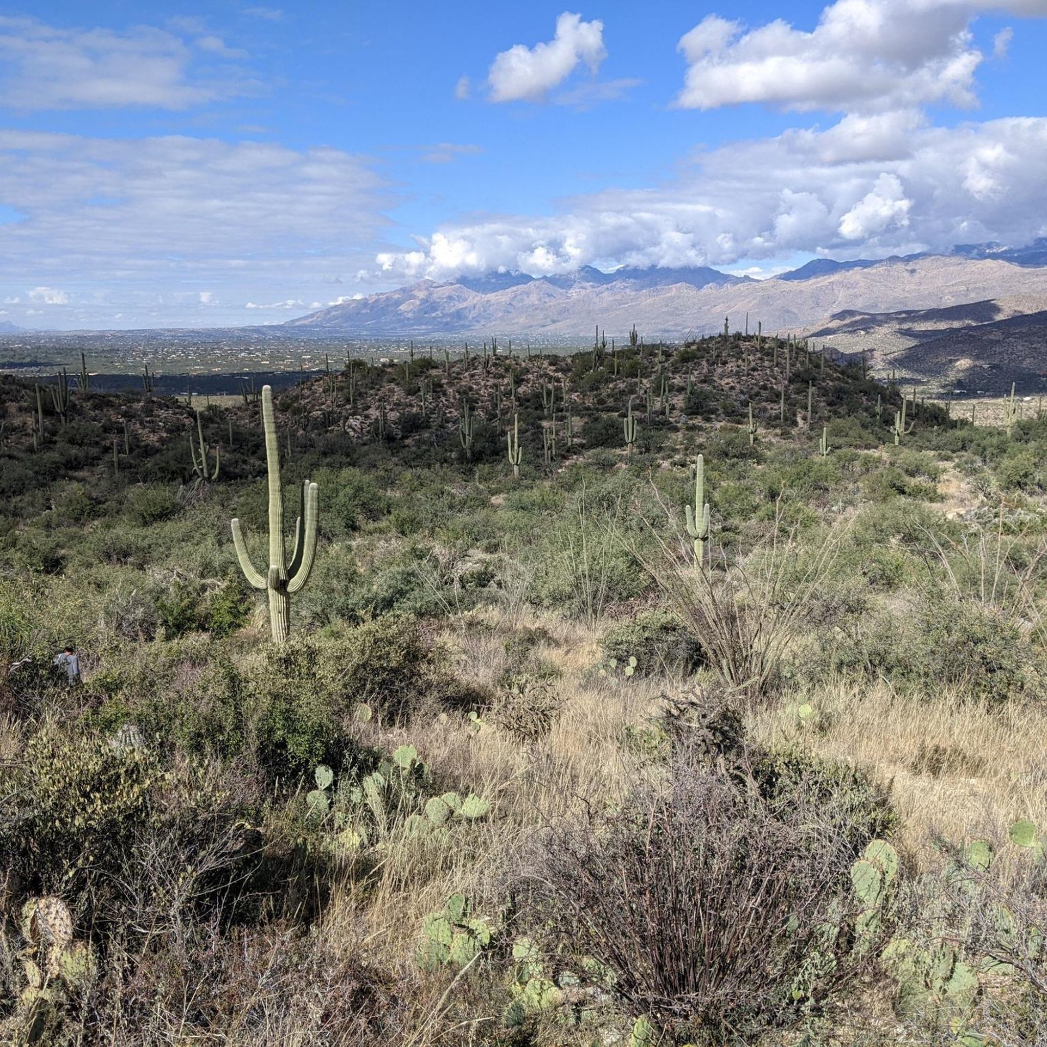
Hiking in the Rincon Mountains, located east of Tucson, Arizona, presents diverse landscapes from the Sonoran Desert floor to pine-covered peaks. This "sky island" mountain range features six distinct biotic communities, including arid desert scrub, oak woodlands, and mixed-conifer forests. The terrain is characterized by rugged topography, deep canyons, and iconic saguaro cacti at lower elevations, transitioning to cooler, higher elevations. Geological formations are also a notable feature, with elevations ranging significantly across the range.
Best hiking trails in the Rincon Mountains
- The most popular hiking route is Cactus Forest & Mica View Trail loop, an easy 1.8 miles (3.0 km) trail that takes about 45 minutes to complete. This loop offers views of the saguaro forest within Saguaro National Park East.
- Another top favourite among local hikers is Tanque Verde Ridge Trail, a difficult 13.2 miles (21.2 km) path. This strenuous trail provides significant elevation gain and expansive views across the desert landscape.
- Local hikers also love the Tanque Verde Falls Trail, a 2.0 miles (3.3 km) trail leading through a desert riparian habitat to seasonal waterfalls, often completed in about 1 hour.
- Hiking in the Rincon Mountains is defined by towering saguaro cacti, rugged canyons, and diverse ecosystems from desert to pine forests. The network offers options for various ability levels, from easy loops to challenging mountain ascents.
- The routes in Rincon Mountains are highly rated by the komoot community with an average score of 4.9 stars from over 70 reviews. More than 700 hikers have used komoot to explore Rincon Mountains's varied terrain.
Last updated: September 27, 2026
5.0
(7)
24
hikers
8.91km
02:47
230m
230m
The Stock, Douglas Spring, Three Tank, and Wildhorse Loop offers a quintessential Saguaro National Park hiking experience, immersing you in a landscape dominated by the majestic Giant Saguaro Cactus. This moderate 5.5-mile (8.9 km) loop takes you through varied desert terrain, with a total elevation gain of 757 feet (231 metres) over an estimated 2 hours and 47 minutes. You'll traverse trails like Douglas Spring and Wildhorse, providing a comprehensive tour of the Saguaro Wilderness's unique flora and expansive views.
When planning your visit to this circular walk in the Stock Douglas Spring area, aim for early mornings to beat the desert heat, especially outside of the cooler winter months. The trailhead is typically easy to access, but always ensure you have ample water, as resources are scarce along the route. This loop is a great option for those seeking a substantial hike without requiring an entire day, offering a rewarding experience for family friendly hikes near Douglas Spring.
This particular loop is notable for its concentration of iconic saguaros, making it an excellent choice for wildlife spotting and photography within the Saguaro Wilderness. The combination of trails, including Stock Pass Trail Saguaro National Park and Three Tank Trail Saguaro National Park, creates a diverse route that showcases the best of the park's desert ecosystem. It's a fantastic way to experience the natural beauty and solitude of this protected area, providing a memorable adventure for hikers of all moderate skill levels.
5.0
(3)
16
hikers
11.5km
03:56
330m
320m
The Garwood Loop offers a fantastic opportunity to explore the iconic Sonoran Desert, winding through a landscape dominated by towering saguaro cacti. You'll traverse classic desert terrain, passing by impressive specimens like the "Giant Saguaro Cactus in Saguaro Wilderness" and enjoying the quiet expanse of the "Desert Trail in Saguaro Wilderness." This moderate 7.2-mile (11.5 km) hike, with its 1099 feet (335 metres) of elevation gain, provides a rewarding experience for those seeking a true desert immersion.
Planning your trip to the Garwood Loop is straightforward, though preparation is key for desert hiking. Ensure you bring ample water, especially if you're visiting outside of the cooler winter months. The trailhead parking is generally available, but arriving early is recommended to secure a spot and enjoy the tranquility of the morning desert. The route typically takes around 3 hours and 55 minutes to complete, making it a great half-day adventure.
This trail is a prime example of the unique ecosystem found within the Saguaro Wilderness, home to the magnificent saguaro cactus, which can live for over 150 years. The Garwood Loop allows you to witness these natural monuments up close, offering excellent photography spots and opportunities for wildlife spotting. It's a great choice for anyone wanting to experience the distinctive beauty and quiet grandeur of the Arizona desert.

11
hikers
4.44km
01:10
30m
30m
The Shantz and Mica View Trail loop offers a quintessential Sonoran Desert experience, perfect for a relaxed outing. You'll wander through a dense "cactus forest" featuring iconic saguaros, mesquite, and palo verde trees, with the Shantz Trail providing views of the Rincon Mountains and the Mica View Trail showcasing the Santa Catalina Mountains. It's an easy 2.8-mile (4.4 km) hike with just 115 feet (35 metres) of elevation gain, taking about 1 hour and 9 minutes, making it a great option for family friendly hikes.
For planning your visit, the trail is easily accessible from the Broadway Trailhead, which has free parking, or the Mica View Picnic Area. The Mica View Trailhead also features amenities like shaded picnic tables and vault toilets. While you can hike year-round, the best time to hike is in the cooler mornings or evenings, especially during warmer months, and remember to bring plenty of water. Dogs are welcome, but only on the paved sections of the trail.
This Shantz and Mica View Trail loop is a fantastic introduction to the wildlife on Shantz and Mica View Trail, where saguaros often host birds like Gila woodpeckers. A significant portion of the Mica View Trail is paved and ADA accessible, ensuring that many can enjoy the desert scenery. It's a gentle, beginner hiking route that provides a peaceful escape into Saguaro National Park East's unique ecosystem.
6
hikers
22.4km
07:09
700m
700m
The Douglas Spring Trail to Douglas Spring Campground offers a deep dive into the Saguaro Wilderness, presenting a classic desert hiking experience. You'll traverse diverse terrain, from open saguaro forests to more rugged mountain slopes, with the potential reward of seeing Bridal Wreath Falls in season. This difficult 13.9-mile (22.4 km) hike involves a significant 2305 feet (702 metres) of elevation gain and typically takes around 7 hours and 8 minutes, making it a substantial day trip or an excellent overnight backpacking option.
To plan your visit, head to the Douglas Spring Trailhead in Saguaro National Park East. Parking is available, but it's wise to arrive early, especially during peak seasons, to ensure a spot. Given the desert climate, always carry plenty of water, and consider starting your hike early in the morning to avoid the midday heat. The cooler months from fall to spring are generally the best time to tackle this route.
This trail is a prime example of the rugged beauty found in Saguaro National Park's Rincon Mountain District. It provides a challenging yet rewarding journey into a protected desert ecosystem, showcasing the resilience of desert flora and fauna. The remote Douglas Spring Campground at the end of the trail offers a peaceful backcountry setting, perfect for those seeking solitude away from more crowded areas.
8
hikers
8.48km
02:11
40m
40m
The Cactus Forest, Squeeze Pen, and Pink Hill Loop offers a quintessential Sonoran Desert experience, winding through a landscape rich with diverse cactus species and desert flora. You'll enjoy expansive views of the unique vegetation and wildlife, with the trail occasionally dipping into the Loma Verde Wash, providing varied terrain underfoot. It's a fantastic way to connect with the desert's natural beauty without a demanding ascent.
This moderate 5.3-mile (8.5 km) hike, with its gentle 145 feet (44 metres) of elevation gain, is best tackled in the cooler parts of the day, especially during warmer seasons. The estimated duration of 2 hours and 11 minutes makes it a perfect half-day adventure. Always bring sufficient water, and check local conditions before heading out.
This loop is an ideal choice for those seeking a relaxed yet immersive desert walk, offering a chance to observe the delicate ecosystem of the Sonoran Desert. Its accessibility and manageable length make it suitable for a wide range of hikers, providing a peaceful escape into nature.
5.0
(3)
9
hikers
5.54km
01:25
20m
20m
The Loma Verde Loop offers a delightful immersion into the Sonoran Desert, showcasing its iconic saguaros and diverse plant life. As you walk this easy 3.4-mile (5.5 km) route, you'll traverse gentle terrain, passing through mesquite groves and spotting various cacti. The trail provides excellent views of Sonoran Desert vegetation and wildlife, making it a quintessential Saguaro National Park experience.
Planning your visit to the Loma Verde Loop is straightforward, though timing is key. With minimal shade, it's best to hike in the early morning or late evening, especially during warmer periods, and always carry ample water. The trailhead is easily accessible, and while the paths are well-marked, a map can be useful given the area's interconnected trails. Expect to spend about 1 hour and 25 minutes on this loop, which has a gentle 74 feet (23 metres) of elevation gain.
This trail is particularly notable for its historical significance, featuring the Loma Verde Mine Site, an abandoned copper mine that adds a layer of intrigue to your desert exploration. It's an ideal choice for families or those seeking a relaxed hike, offering a chance to spot desert wildlife like Gila woodpeckers and jackrabbits. The Loma Verde Loop serves as a fantastic introduction to the unique biodiversity of the Rincon Mountain District.
5
hikers
5.17km
01:25
40m
40m
Step into the heart of the Sonoran Desert with the Douglas Spring, Converse, Garwood and Wildhorse Loop, a delightful and accessible hiking experience. This moderate 3.2-mile (5.2 km) route offers a gentle 137 feet (42 metres) of elevation gain, making it a perfect choice for a quick 1 hour and 24 minute stroll through classic desert scenery. You'll wander among impressive giant Saguaro cactus in the Saguaro Wilderness, providing a true taste of Saguaro National Park East's unique ecosystem.
Planning your visit to this popular trail is simple; you'll find convenient parking at the Douglas Spring trailhead. To make the most of your hike and avoid the desert's intense heat, aim for an early morning start or an afternoon excursion during the cooler seasons, typically fall through spring. Remember to bring plenty of water, even for this shorter loop, to stay hydrated in the arid environment.
This loop is an excellent option for those seeking a family-friendly trail or a relaxed introduction to hiking in Saguaro National Park. Its minimal difficulty and stunning natural features, like the towering saguaros, make it a rewarding experience without demanding strenuous effort. It's a great way to immerse yourself in the desert's beauty and spot local wildlife without committing to a longer, more challenging trek.
4
hikers
15.5km
04:48
790m
130m
Embark on a rewarding journey from the Alta Loma Trailhead to Grass Shack Camp, a moderate 9.6-mile (15.5 km) hike that offers a dramatic ecological transition. You'll start among towering Giant Saguaros in the Sonoran Desert, gradually ascending through diverse terrain until you reach cooler pine forests near Grass Shack Camp. The route provides expansive views of the Rincon Mountains and Tucson Valley, making the 2592 feet (790 metres) of elevation gain well worth the effort over approximately 4 hours and 48 minutes.
Planning your visit requires a few considerations. As the trail is within Saguaro National Park, expect park regulations and potential entrance fees. If you intend to camp overnight at Grass Shack Camp, a backcountry permit from the National Park Service is mandatory. Parking is available at the Alta Loma Trailhead, but it's advisable to arrive early, particularly during busy periods, to ensure you find a spot.
This trail is notable for its unique shift from desert to pine forest, showcasing the rich biodiversity of the region. Portions of the route are also part of the larger Arizona Trail, so you might encounter thru-hikers. Keep an eye out for diverse wildlife, including foxes and coyotes, and appreciate the historical elements like old ranch roads that hint at the area's past.
1
hikers
1.99km
00:47
70m
100m
Embark on a difficult hiking adventure along the Lower Tanque Verde Falls Trail, a challenging route that takes you through a rugged desert landscape to a surprising oasis. This 1.2-mile (2.0 km) trail involves navigating a rough creek bed with loose rock and boulders, requiring some scrambling and boulder hopping. You will gain 241 feet (74 metres) in elevation, with an estimated duration of 47 minutes, as you make your way to the impressive 80-foot cascade of Tanque Verde Falls, surrounded by majestic saguaro cacti.
When planning your visit, be aware that the trail is prone to flash floods, especially during the monsoon season from July to September. Always check weather conditions before you go and avoid the canyon if there is any risk of storms or flooding. Parking is available at the trailhead, which you can access off Redington Road, making it easy to start your desert exploration.
This unique route offers a refreshing contrast to the arid surroundings, showcasing panoramic views of the Rincon Mountains. The falls are particularly beautiful after winter rains or during the monsoon season when water levels are at their highest, transforming the canyon into a vibrant desert haven. It is a popular destination for those seeking a rewarding and challenging experience in the Coronado National Forest.
2
hikers
7.88km
02:02
40m
40m
The Shantz, Vanover, Loma Verde, Cholla, and Cactus Forest Loop offers a delightful immersion into the Sonoran Desert's iconic landscape. You'll wander through dense stands of saguaro cacti, ocotillo, and prickly pear, with the trail providing excellent Views of Sonoran Desert Vegetation and Wildlife throughout. The terrain is generally smooth and well-trodden, making for an enjoyable walk as you connect these distinct sections of Saguaro National Park East. It's a fantastic way to experience the desert's unique flora and fauna up close without a strenuous climb. This route is perfect for those seeking a relaxed yet rewarding desert exploration.
This moderate 4.9-mile (7.9 km) hike, with a gentle 129 feet (39 metres) of elevation gain, typically takes around 2 hours and 1 minute to complete. Parking is readily available at the trailhead, but arriving early is advisable, especially on weekends, to ensure a spot. The best time of year for Shantz Vanover Loma Verde Cholla Cactus Forest Loop hike is during the cooler months, from October to April, to avoid the intense summer heat. Always bring ample water, as shade is limited.
One of the notable landmarks along the way is the Loma Verde Mine Site, offering a glimpse into the region's past. This loop is an excellent option for families or beginners looking for a manageable yet scenic hike within Saguaro National Park East. It provides a comprehensive tour of the desert's beauty, showcasing its diverse ecosystem and offering plenty of opportunities for photography and wildlife spotting. Consider combining it with a visit to the park's visitor center for more insights into the area.
Get access to more routes and recommendations from other explorers.
Already have an account?
Our route recommendations are based on thousands of hikes, rides, and runs completed by other people on komoot.
Start today with a free account
Your next adventure awaits.


Other adventures in the Rincon Mountains


Tips from the Community

The bed of the seasonal wash is sandy and filled with scattered river stones. Here the mesquite trees that take advantage of the wash offer some brief partial shade along the trail.
0
0

The Sonoran Desert encompasses parts of Mexico and the Southwestern U.S., including Southern Arizona. Enjoy views of Saguaro and Barrel cacti, Yucca, Cholla, Marigold, Ocotillo, and Brittlebrush. Keep an eye out for desert wildlife, including Gila monsters, Cactus wrens, Roadrunners, Rattlesnakes, and Tarantulas. Remember to always keep a respectful distance from wildlife, for your safety as well as theirs.
0
0
If you hike to Bridal Wreath Falls during the wet season, you will hear them before you see them. Surrounded by large boulders, these small but charming falls are the perfect oasis to rest and recover after hiking in the hot sun. Try making the hike right after it rains, when the falls will be at their fullest.
0
0
Start on the Loma Verde Trail and hike through a grove of mature Mesquite trees. You will come across this seasonally flowing wash. Continue on to Pink Hill and Squeeze Pen.
1
0
On the Carillo Trail and Douglas Spring Loop, after turning onto the Garwood Trail, you can observe the cactus forests that inspired the creation of Saguaro National Park.
0
0

Depending on the season the Tanque Verde Falls can be enjoyed in different ways. The canyon/beach in front of the falls is a great place to hang out and enjoy the refreshment of the falls. But you can also enjoy climbing on the rocks surrounding the falls. If the water is higher than usual it can be quite the scramble to make it all the way to the falls and definitely be prepared to wade and get your feet wet.
1
0

Douglas Spring Campground is one of the campgrounds in Saguaro Nationalpark, where you are allowed to stay overnight with a permit. An overnight stay is 8 dollars per person and night. The camp is located at 6,200 feet. recreation.gov/camping/campgrounds/10028678 There are 3 sites with a maximum number of 6 persons per site. It is a perfect hike for the summer and hot days, since you will find plenty of shade from cottonwoods and oaks. At 4,800 feet it is the lowest of all campgrounds in Saguaro Nationalpark. You will find more water than along the Tanque Verde Ridge, but it is still seasonal, so be prepared.
2
0
These huge cacti are the typical symbol for Arizona and Mexico. The giants are hundreds of years old, one arms needs decades to grow. The right pronunciation is suh·waa·row. If you thruhike the Arizona Trail, they will be your companions until you reach the Four Peaks Wilderness.
4
0
Frequently Asked Questions
How many hiking trails are available in the Rincon Mountains?
There are over 40 hiking trails in the Rincon Mountains, offering a wide range of experiences from easy strolls through saguaro forests to challenging ascents into higher elevations. You'll find 13 easy routes, 29 moderate, and 2 difficult trails.
What is the best time of year to hike in the Rincon Mountains?
The Rincon Mountains offer diverse experiences throughout the year. Lower elevations are best explored in the cooler months, from late fall to early spring. Higher elevations, which can be snow-covered in winter, are ideal for hiking during spring, summer, and fall, providing a cooler escape from the desert heat.
What do other hikers enjoy most about the Rincon Mountains?
The Rincon Mountains are highly rated by the komoot community, with an average score of 4.9 stars from over 60 reviews. Hikers frequently praise the stunning transition of ecosystems, from the iconic saguaro forests to pine-covered peaks, and the panoramic views of the surrounding desert.
Are there easy, family-friendly hikes in the Rincon Mountains?
Yes, the Rincon Mountains offer several easy, family-friendly options, particularly within Saguaro National Park East. A great choice is the Freeman Homestead Trail loop, which is just under 2 km (1.1 miles) and takes about 30 minutes to complete, offering a gentle introduction to the desert landscape.
Are there any trails with waterfalls in the Rincon Mountains?
Yes, seasonal waterfalls are a highlight, especially after rainfall. The Tanque Verde Falls Trail is a popular 3.3 km (2.0 miles) route leading to a series of falls. Another notable waterfall is Bridal Wreath Falls, accessible via the Douglas Spring Trail.
What kind of terrain and ecosystems can I expect while hiking?
The Rincon Mountains are a 'sky island' range, meaning you'll experience a dramatic change in ecosystems as you gain elevation. Trails range from arid desert scrub and iconic saguaro forests at lower levels to oak woodlands, pinyon-juniper, and even mixed-conifer forests at higher altitudes. Expect rugged and steep topography with deep canyons and rocky ridges.
Are there any loop trails for a varied hiking experience?
Absolutely. Many trails in the Rincon Mountains are designed as loops, providing a diverse experience without retracing your steps. For example, the Loma Verde, Pink Hill & Squeeze Pen trail loop offers a moderate 10.5 km (6.5 miles) journey through Saguaro National Park.
Can I hike with my dog in the Rincon Mountains?
Dog policies vary by area within the Rincon Mountains. In Saguaro National Park, dogs are generally permitted on paved roads, picnic areas, and designated trails, but often not on backcountry trails. Always check specific regulations for the trail or park district you plan to visit, as rules can change.
What interesting landmarks or attractions can I see near the trails?
Beyond the natural beauty, you can explore several points of interest. The Douglas Spring Trail offers access to the Rincon Mountain Wilderness. You can also find the Freeman Homestead Trail, which provides a glimpse into the area's history, and enjoy Views of Sonoran Desert Vegetation and Wildlife.
Is parking available at the trailheads in the Rincon Mountains?
Yes, most major trailheads, especially within Saguaro National Park East and Coronado National Forest, offer designated parking areas. However, during peak seasons or popular times, parking lots can fill up quickly, so it's advisable to arrive early.
Are permits required for hiking in certain areas of the Rincon Mountains?
While many trails do not require a permit for day hiking, backcountry camping in areas like Saguaro National Park East (e.g., Grass Shack and Manning Camp) does require a permit. Always check with the specific park or forest service for the latest permit requirements for your intended activity and location.
What kind of wildlife might I encounter on the trails?
The diverse ecosystems of the Rincon Mountains support a wide array of wildlife. You might spot desert creatures like javelina, coyotes, and various reptiles and birds in the lower elevations. As you ascend, you could encounter deer, black bears, and a different set of bird species in the woodlands and forests. Always observe wildlife from a distance and do not feed them.
Most popular routes in the Rincon Mountains
Most popular attractions in the Rincon Mountains

Get inspired with the komoot mobile app


Explore more
Browse the best Hikes in other regions.
