The best walks and hikes around Faenza
4.4
(270)
2,412
hikers
159
hikes
Hiking around Faenza offers access to a diverse landscape situated between the sea and the Romagna Apennines. The region is characterized by the unique Vena del Gesso Romagnola Regional Park, featuring gypsum cliffs and karst formations. Hikers can explore rolling hills, distinctive clay gullies, and scenic river valleys like the Senio and Lamone. This varied terrain provides a range of hiking trails suitable for different experience levels.
Best hiking trails around Faenza
- The most popular hiking route is Monte Riccio…
Last updated: August 17, 2026
4.3
(3)
23
hikers
11.2km
03:12
270m
270m
Embark on a moderate hike along the Monte Riccio e Monte Brullo - Parco Sentiero delle Ginestre trail, covering 7.0 miles (11.2 km) with an elevation gain of 880 feet…
1
hikers
27.8km
07:09
130m
130m
Hike Dante's Way - Stage 2, a difficult 17.2-mile route with 437 feet of elevation gain, passing calanchi and cultivated fields.

Sign up for free
4.8
(19)
166
hikers
8.24km
02:15
130m
130m
Moderate hike. Good fitness required. Easily-accessible paths. Suitable for all skill levels.
4.7
(9)
105
hikers
6.53km
01:39
10m
10m
Easy hike. Great for any fitness level. Easily-accessible paths. Suitable for all skill levels.
4.6
(16)
94
hikers
Moderate hike. Good fitness required. Easily-accessible paths. Suitable for all skill levels.
Get access to more routes and recommendations from other explorers.
Sign up for free
Already have an account?
Our route recommendations are based on thousands of hikes, rides, and runs completed by other people on komoot.
Start today with a free account
Your next adventure awaits.
Login or Signup

Tips from the Community


The Chiesa di Santa Maria foris portam, also known as Santa Maria Vecchia, dates back to the 6th-7th century and was originally located outside the city walls of Faenza. The church, possibly the city's first cathedral, still retains parts of the original structure, such as the upper parts of the side walls and two beautiful African breccia columns with finely carved capitals from the 6th century. In 1655 the church was extensively renovated by Bartolomeo Sauli, who enlarged the interior and reversed its orientation. The church contains works of art by Gaspare Sacchi and Niccolò Paganelli, among others. The bell tower, built in the 9th century by the Benedictines, is unique in its kind and was rebuilt in the 20th century after being damaged during World War II.
0
0
The “Prospettiva” or “Fontanone” is an architectural feature at the end of one of Faenza’s main avenues, the Stradone. The design of Viale Stradone dates back to 1816 and took its present form in 1860. In 1823, the Deputazione del Pubblico Passeggio, together with Antonio Margotti, decided to complete the avenue with a building that would serve as a meeting place, similar to a similar building in Parma. A collection was held to raise 1200 scudi for the construction, but less than half of that was raised. The monument was finally built in the summer of 1824 under the direction of Pietro Tomba. The building included a room for serving coffee and drinks and became a popular meeting place for the aristocracy and upper bourgeoisie of Faenza.
0
0

Splendid View of the Calanques
1
0

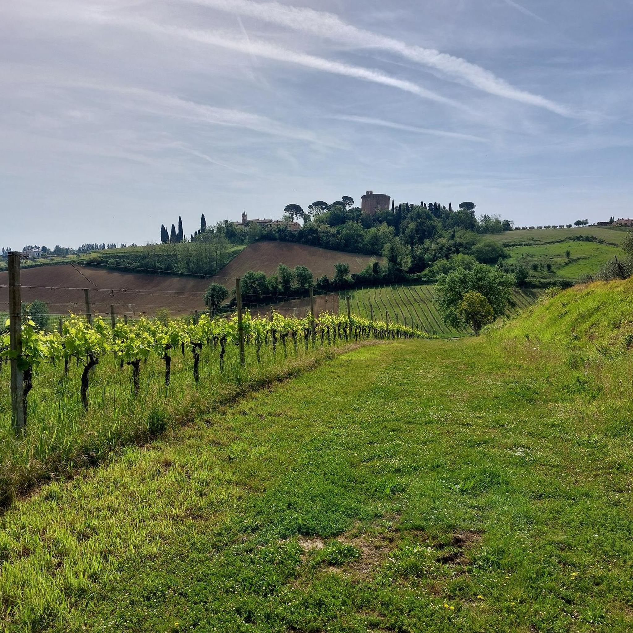
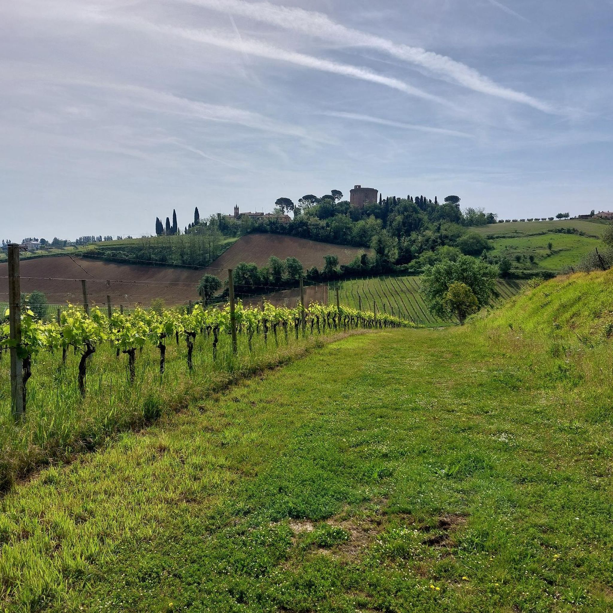
The Parco delle Ginestre, a luxuriant naturalistic oasis, in the shadow of the Oriolo dei Fichi tower
1
0

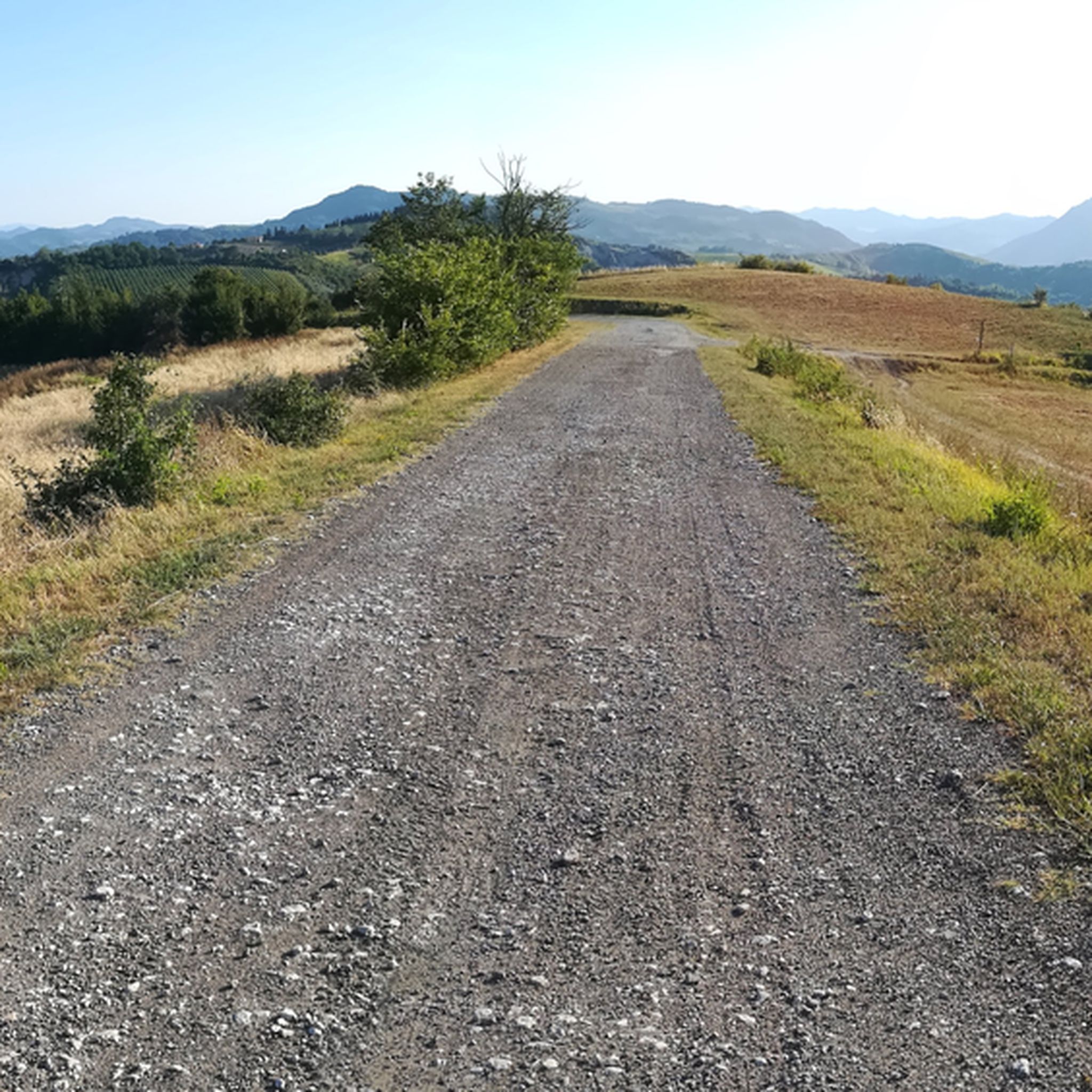
first hills of Faenza, it is very comfortable
0
0

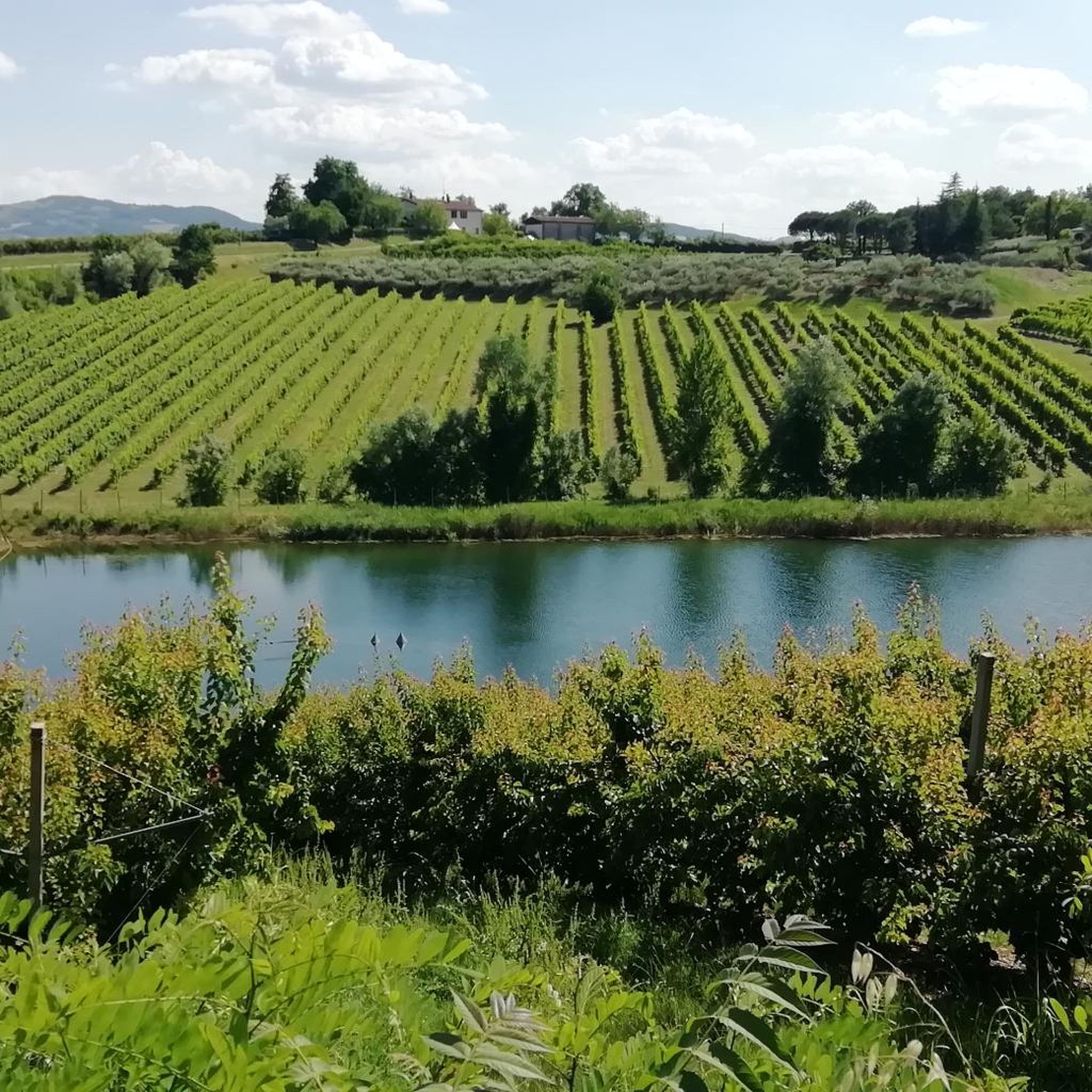
Oriolo dei Fichi is a small inhabited center located on the first foothills of the Romagna Apennines: about ten kilometers south-east of Faenza with an altitude of 141m above sea level. The surrounding area, scattered with ancient farmhouses, is mainly cultivated with vines and arable land that alternate with wooded slopes. The first evidence of the place comes from the distant 898 AD. when a certain Aghinolfo was a lord. In 1017, the Emperor Henry II assigned it to Arnaldo II, Archbishop of Ravenna. Forty years later, it was the latter who built a castle that, throughout the Middle Ages, was disputed between the lords of Faenza, Forlì and the Ravenna Church, its legitimate owner. Starting from 1300 and up to 1689, Oriolo enjoyed the status of a Rural Municipality: while remaining under the control of those who owned the castle, it meant being endowed with a certain administrative autonomy. At the time, the territory of the Municipality of Oriolo had an approximate area of 5-6 sq km and included three parishes. The population numbered about 500 people who subsequently decreased to the current 200. From those ancient times, the fifteenth-century tower remains today: perched on top of a slope and surrounded by a small park owned by the municipality of Faenza. (Source: https://www.torredioriolo.it/storia/)
1
1
Frequently Asked Questions
How many hiking trails are available around Faenza?
The Faenza area offers a wide variety of hiking opportunities, with over 140 routes recorded on komoot. These range from easy strolls to more challenging long-distance treks, ensuring there's something for every hiker.
What makes the hiking landscape around Faenza unique?
Hiking around Faenza is characterized by its diverse landscape, nestled between the sea and the Romagna Apennines. You'll encounter the unique Vena del Gesso Romagnola Regional Park with its spectacular gypsum cliffs and karst formations, distinctive clay gullies (calanchi), and scenic river valleys. The area also features rolling hills dotted with vineyards and olive groves.
Are there easy hiking trails suitable for beginners or families in Faenza?
Yes, Faenza offers many easy trails perfect for beginners or families. For a pleasant and accessible walk, consider the Oriolo dei Fichi Tower loop from Petrignone, which is about 5.9 km and leads through scenic countryside to a medieval tower. Bucci Park, just outside Faenza's historic center, also provides easy walking trails and a green oasis for leisurely strolls.
Are there challenging long-distance hikes available for experienced hikers?
Absolutely. For those seeking a challenge, Faenza is a great starting point. A notable difficult route is Dante's Way - Stage 2, a 27.8 km path that traverses distinctive clay gullies and cultivated fields. The region also provides access to sections of the Alta Via dei Parchi, a long-distance trail along the Apennine ridge, suitable for experienced hikers.
Can I find circular hiking routes in Faenza?
Yes, there are several excellent circular hiking routes around Faenza. Popular options include the Oriolo dei Fichi Tower loop from Petrignone, which offers a scenic countryside experience. Another great choice is the Sangiovese Wine Route – Start of CAI Trail 505 loop from PalaCattani, a 15 km moderate loop through the local wine region.
What kind of natural attractions or landmarks can I explore on a hike?
The Faenza area is rich in natural and historical landmarks. You can explore unique geological formations like the gypsum cliffs in the Vena del Gesso Romagnola Regional Park. Highlights include the Grotta Tanaccia and Grotta della Toresina. For historical sites, consider visiting the Oriolo Tower or the Manfredian Fortress (Brisighella), both offering insights into the region's past.
Are there any trails that offer panoramic views?
Many trails in the Faenza region boast stunning panoramic views. Monte Mauro, the highest peak in the Vena del Gesso Romagnola Regional Park, offers expansive vistas. The Olmatello panoramic point provides fantastic views of the distinctive clay gullies. From the Oriolo Tower, on clear days, you can see Faenza, Forlì, Ravenna, and even parts of the Romagna coast.
What do other hikers say about the trails in Faenza?
The hiking routes in Faenza are highly rated by the komoot community, with an average score of 4.5 stars from nearly 200 reviews. Hikers often praise the diverse landscapes, from the unique gypsum formations to the rolling hills and picturesque clay gullies, as well as the well-maintained paths and the variety of options for all skill levels.
Can I hike with my dog in the Faenza area?
Generally, many trails in the Faenza area are dog-friendly, especially those in natural parks and countryside. It's always recommended to keep your dog on a leash, especially in protected areas or near livestock, and to carry water for both yourself and your pet. Always check local regulations for specific trails or parks before heading out.
What is the best time of year for hiking around Faenza?
The best time for hiking around Faenza is typically spring (April to June) and autumn (September to October). During these seasons, the weather is mild and pleasant, and the landscapes are particularly beautiful, with blooming wildflowers in spring and vibrant foliage in autumn. Summer can be hot, especially in July and August, making early morning or late afternoon hikes preferable.
Are there any trails that pass through vineyards or offer a wine-related experience?
Yes, the Faenza region is known for its wine production, and you can certainly combine hiking with a taste of local wines. The Sangiovese Wine Route – Start of CAI Trail 505 loop from PalaCattani is a prime example, offering scenic views through the local wine region. Many trails in the Romagna Apennines also wind through hillsides dotted with vineyards and olive trees.
Are there any trails near Faenza that are easily accessible by public transport?
Faenza is a well-connected city, and some trailheads might be accessible via local bus services, especially those closer to urban centers or larger villages. For routes deeper into the Vena del Gesso Romagnola Regional Park or the Apennines, a car might be more convenient. It's advisable to check local bus schedules and routes in advance for specific trail access points.
Most popular attractions around Faenza

Get inspired with the komoot mobile app


Explore more
Browse the best Hikes in other regions.
