The best walks and hikes around Bisenti
4.1
(99)
366
hikers
20
hikes
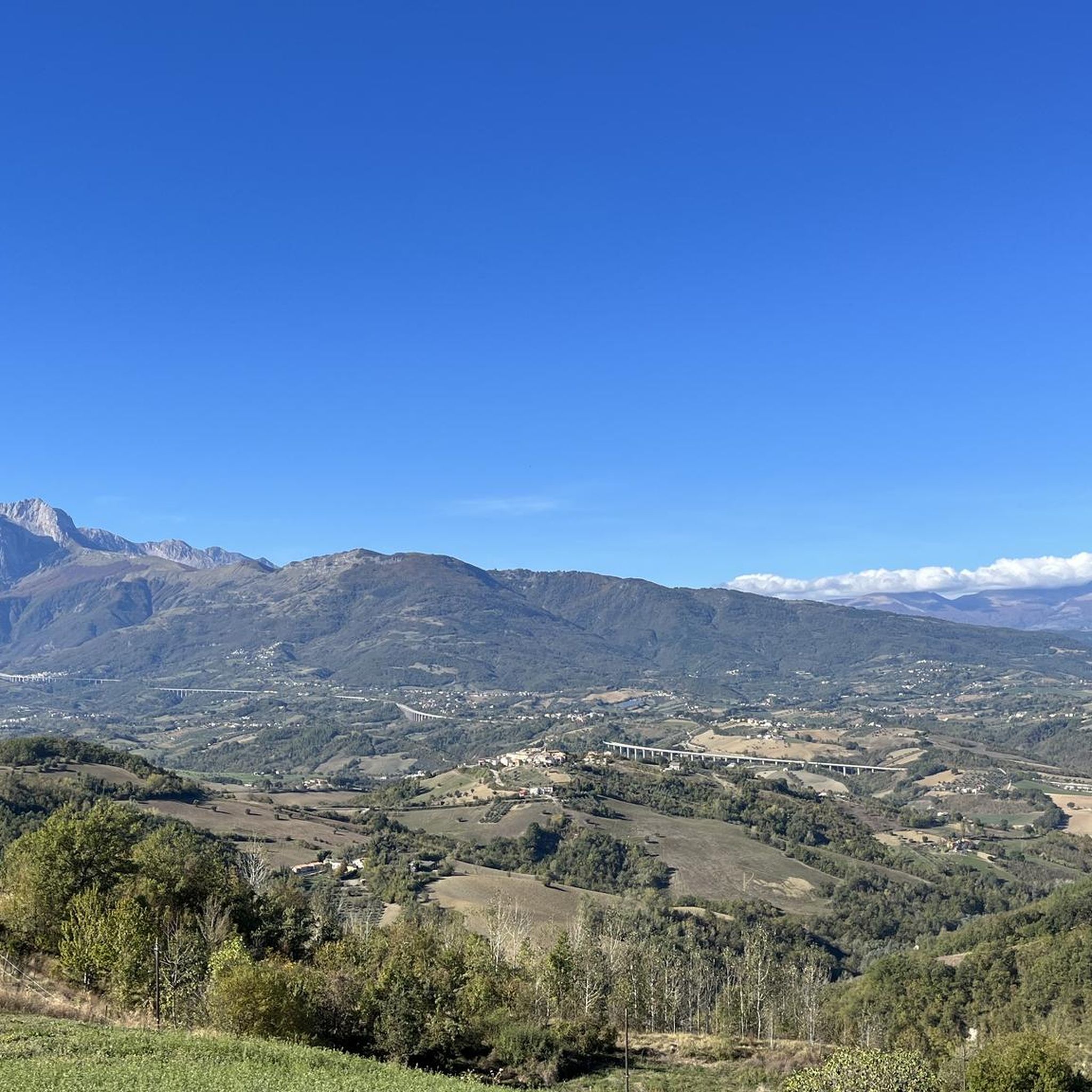
Hiking around Bisenti offers access to diverse natural landscapes within Italy's Abruzzo region. The village is situated in the upper Fino river valley, approximately 35 kilometers from the Adriatic Sea. This location places it near the Gran Sasso mountain massif and within the Gran Sasso and Monti della Laga National Park. The terrain features rugged Apennine mountains, verdant valleys, and a network of trails.
Best hiking trails around Bisenti
- The most popular hiking route is From Colle Rustico to Fondo…
Last updated: October 25, 2026
4.7
(11)
51
hikers
Moderate hike. Good fitness required. Easily walkable paths.
4.1
(13)
27
hikers
8.37km
02:43
390m
390m
Moderate hike. Good fitness required. Easily walkable paths.

4.5
(2)
13
hikers
6.75km
02:30
420m
420m
Moderate hike. Good fitness required. Easily walkable paths.
3.8
(5)
22
hikers
6.65km
02:17
380m
380m
Moderate hike. Good fitness required. Easily walkable paths.
5.0
(1)
7
hikers
9.20km
02:44
290m
290m
Moderate hike. Good fitness required. Easily walkable paths.
Get access to more routes and recommendations from other explorers.
Already have an account?
Our route recommendations are based on thousands of hikes, rides, and runs completed by other people on komoot.
Start today with a free account
Your next adventure awaits.
Tips from the Community

Is the trail covered? Is it doable in summer with sun?
0
0

Very cold water, I do not recommend bathing in it
0
0
Nice walk even with children... eating al fresco under the waterfalls is wonderful
0
0

Very well maintained small lake with clear water. Ideal for lovers of sport fishing. https://www.facebook.com/pietralungafarindola/
0
0

Since the route is constantly changing due to the snowmelt and meltwater, it is best to start at the car park near the small Colle Rustico pass behind the ceramic village of Castelli. Take the forest path at the picnic area and always follow the yellow-red markings to the end of the path. But be careful: when the snow melts, crossing the cirque, which has to be done several times, is very dangerous!!!
0
0
There is no restaurant or anything like it in this place.
0
0

Beautiful rocks that welcome the thunderous water to create majestic waterfalls, you can see them flooding on Saturday and Sunday. 🥰
5
0
Frequently Asked Questions
What kind of hiking terrain can I expect around Bisenti?
The hiking terrain around Bisenti is diverse, ranging from the rugged Apennine mountains to verdant valleys. You'll find trails within the Gran Sasso and Monti della Laga National Park, offering everything from moderate walks through hilly regions to challenging ascents in the Gran Sasso d'Italia massif.
Are there any easy hiking trails suitable for beginners near Bisenti?
Yes, Bisenti offers several easier options. Out of 15 available routes, 3 are classified as easy. These trails provide a gentle introduction to the region's natural beauty without demanding significant physical exertion.
Can I find circular hiking routes in the Bisenti area?
Absolutely. Many trails around Bisenti are designed as loops, allowing you to start and end at the same point. An example is the View of Fondo della Salsa loop from Castelli, which covers 4.2 miles (6.8 km) through varied terrain.
Are there any hikes that feature waterfalls near Bisenti?
Yes, the region is known for its beautiful water features. You can explore the Vitella d'Oro Waterfall loop from Farindola, a moderate 8.6 km hike. The Gran Sasso and Monti della Laga National Park also boasts the Cesacastina Valley of the Hundred Waterfalls, offering another spectacular option.
What are some notable natural landmarks or viewpoints to see while hiking around Bisenti?
The area is rich in natural landmarks. You can hike to the Monte Camicia summit or Monte Tremoggia for expansive panoramas. The View of Fondo della Salsa is another popular viewpoint. The Gran Sasso d'Italia Massif, with Corno Grande, the highest peak in the Apennines, offers breathtaking scenery.
What is the best season for hiking in Bisenti?
The best season for hiking around Bisenti generally spans from spring to autumn, when the weather is mild and the trails are most accessible. During winter, higher elevations within the Gran Sasso and Monti della Laga National Park may require specialized gear for ski mountaineering or snowshoeing.
Are there any challenging hikes for experienced trekkers near Bisenti?
For experienced hikers, there are challenging routes available. For example, the Monte Tremoggia – Monte Camicia summit loop from Rigopiano is a difficult 12.8 miles (20.6 km) path, providing a demanding summit experience within the Gran Sasso d'Italia massif.
What do other hikers say about the trails in Bisenti?
The trails around Bisenti are highly rated by the komoot community, with an average score of 4.2 stars from over 60 reviews. Hikers often praise the diverse terrain and the stunning views within the Gran Sasso and Monti della Laga National Park.
Are there any historical or cultural attractions near the hiking trails in Bisenti?
Beyond natural beauty, you can find historical and cultural sites. Consider visiting the Porta di San Francesco or the Sanctuary of Saint Gabriel of Our Lady of Sorrows. The Tibetan Bridge Over the Tavo Stream also offers a unique experience.
Are there options for long-distance hiking around Bisenti?
While Bisenti offers numerous day hikes, the broader Gran Sasso and Monti della Laga National Park provides an extensive network of trails, including sections of longer routes. The park is recognized as a 'hiker's paradise' with hundreds of kilometers of trails, allowing for multi-day treks if planned appropriately.
What kind of wildlife might I encounter on the trails?
The Gran Sasso and Monti della Laga National Park is known for its unique biodiversity. While specific sightings are never guaranteed, hikers might encounter various species of birds, mammals, and diverse flora typical of the Apennine mountains and alpine pastures like Campo Imperatore.
Are there any specific trails that offer views of the Adriatic Sea?
Yes, some of the higher peaks in the Gran Sasso d'Italia massif, such as Monte Camicia and Monte Tremoggia, offer expansive panoramas that can include views stretching all the way to the Adriatic coast on clear days.
Most popular attractions around Bisenti

Get inspired with the komoot mobile app


Explore more
Browse the best Hikes in other regions.
