The best road cycling routes around Archi
4.2
(30)
1,219
riders
92
rides
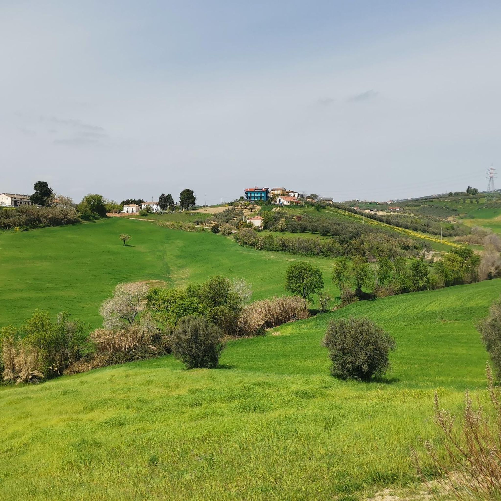
Road cycling routes around Archi are situated in the Abruzzo region of southern Italy, characterized by its dramatic position on a rocky outcrop overlooking the Val di Sangro and Valle dell'Aventino. The landscape features extensive olive groves and vineyards, with the Sangro River winding through the valley below. The area offers varied terrain, from rolling hills to significant elevation changes, providing diverse road cycling experiences.
Best road cycling routes around Archi
- The most popular road cycling route is Trabocco Punta…
Last updated: July 5, 2026
5.0
(3)
52
riders
55.1km
02:20
250m
250m
Moderate road ride. Good fitness required. Some segments of this route may be unpaved and difficult to ride.
14
riders
60.0km
02:57
810m
810m
Moderate road ride. Good fitness required. Some segments of this route may be unpaved and difficult to ride.

Sign up for free
5.0
(1)
13
riders
34.8km
01:52
540m
540m
Moderate road ride. Good fitness required. Mostly well-paved surfaces and easy to ride.
14
riders
60.5km
04:28
1,300m
1,300m
Hard road ride. Very good fitness required. Some segments of this route may be unpaved and difficult to ride.
8
riders
61.2km
03:58
1,520m
1,520m
Hard road ride. Very good fitness required. Mostly well-paved surfaces and easy to ride.
Get access to more routes and recommendations from other explorers.
Sign up for free
Already have an account?
Our route recommendations are based on thousands of hikes, rides, and runs completed by other people on komoot.
Start today with a free account
Your next adventure awaits.
Login or Signup



Tips from the Community


beautiful view of the mouth of the Sangro River.
0
0


Via Verde dei Trabocchi Francavilla - San Salvo
0
0
Via Verde dei Trabocchi Francavilla - San Salvo
0
0

Easy road that follows the Sagno river.
0
0

Baronial palace of Archi dating back to the 11th century now reduced to ruins. Its current appearance is the result of the damage done by the Nazis in 1943. In fact, the Germans used the castle as a military outpost above the Val di Sangro to watch over the arrival of allied troops from Perano.
1
0
The position of the castle is strategic, perched on top of a rocky ledge. Legend has it that, in 1646, the then baron of the castle (Corvo de Corvis) demanded the application in the town of the Ius primae noctis (all the women of the town to spend their wedding night with him instead of with their newly married consort ). For this reason he was assassinated.
1
0
Frequently Asked Questions
How many road cycling routes are available around Archi?
The Archi area offers a wide selection of road cycling routes, with over 85 options to explore. These routes cater to various skill levels, ranging from easy rides to more challenging ascents.
What kind of terrain can I expect on road cycling routes near Archi?
Road cycling around Archi is characterized by its dramatic position on a rocky outcrop, offering panoramic views of the Val di Sangro and Valle dell'Aventino. You'll encounter varied terrain, from rolling hills through extensive olive groves and vineyards to significant elevation changes, with the Sangro River winding through the scenery below.
Are there road cycling routes suitable for beginners in Archi?
Yes, while many routes in Archi feature significant elevation, there is at least one easy road cycling route available. For those looking for a moderate challenge, there are 22 routes that offer a balanced experience without extreme difficulty.
What are some challenging road cycling routes for experienced cyclists?
Experienced cyclists will find plenty of demanding routes around Archi, with 62 difficult options available. A particularly challenging route is the Pretoro – Climb to Passo Lanciano loop from Piane d'Archi, which covers over 102 km with significant elevation gain. Another difficult option is the Ortona's Aragonese Castle – Rolling Hills Route loop from Archi, spanning nearly 100 km.
Can I find circular road cycling routes in the Archi area?
Yes, many of the road cycling routes around Archi are designed as loops, allowing you to start and finish in the same location. Examples include the popular Trabocco Punta Cavalluccio – Trabocco Punta Torre loop from Chieti and the scenic Views of Tornareccio – Baronial Palace loop from Archi.
What historical landmarks or natural attractions can I see along the road cycling routes?
The region around Archi is rich in history and natural beauty. You can cycle past impressive sites like the Castello di Roccascalegna, a striking castle perched on a cliff. Other notable attractions include the Convent of San Pasquale (Atessa) and the Baronial Palace. For natural features, some routes offer views of the scenic Waterfall in Gola di Pennadomo.
Are there any routes that offer coastal views?
Yes, some road cycling routes extend towards the Adriatic coast, offering beautiful sea views. The Trabocco Punta Cavalluccio – Trabocco Punta Torre loop from Chieti is a moderate route that provides views of the Adriatic coast and its traditional fishing structures.
What is the best time of year for road cycling in Archi?
The Abruzzo region generally offers pleasant conditions for cycling. Spring and autumn are often ideal, with milder temperatures and beautiful landscapes. Summer can be warm, especially in the valleys, but higher elevation routes might offer cooler air. It's always advisable to check local weather forecasts before heading out.
What do other road cyclists enjoy most about cycling in Archi?
The road cycling routes in Archi are highly rated by the komoot community, with an average score of 4.3 stars from over 30 reviews. Cyclists often praise the diverse terrain, the stunning panoramic views from the rocky outcrops, and the charming agricultural landscapes of olive groves and vineyards.
Are there options for longer road cycling tours in the region?
Yes, beyond the immediate vicinity of Archi, the broader Abruzzo region offers longer road cycling options. For instance, routes like the 'Giro dei Peligni' can extend to nearly 125 km, providing extensive exploration opportunities for those seeking longer distances.
Can I find places to eat or stay near the cycling routes in Archi?
Archi and the surrounding towns in Abruzzo are known for their hospitality. You'll find various accommodations that cater to cyclists, and the region's rich agricultural heritage means there are many opportunities to enjoy local cuisine, including extra virgin olive oil and truffles, in cafes and restaurants along or near the routes.
Are there any routes that pass through significant natural features like river valleys or lakes?
Absolutely. Archi is situated above the Val di Sangro and Valle dell'Aventino, with the Sangro River winding through. Routes often traverse these scenic river valleys. The region also features various lakes, such as Lago di Bomba, which are popular choices for cyclists and offer picturesque views.
Most popular attractions around Archi

Get inspired with the komoot mobile app


Explore more
Browse the best Road cycling routes in other regions.
