The best road cycling routes around Montazzoli
3.8
(21)
678
riders
60
rides
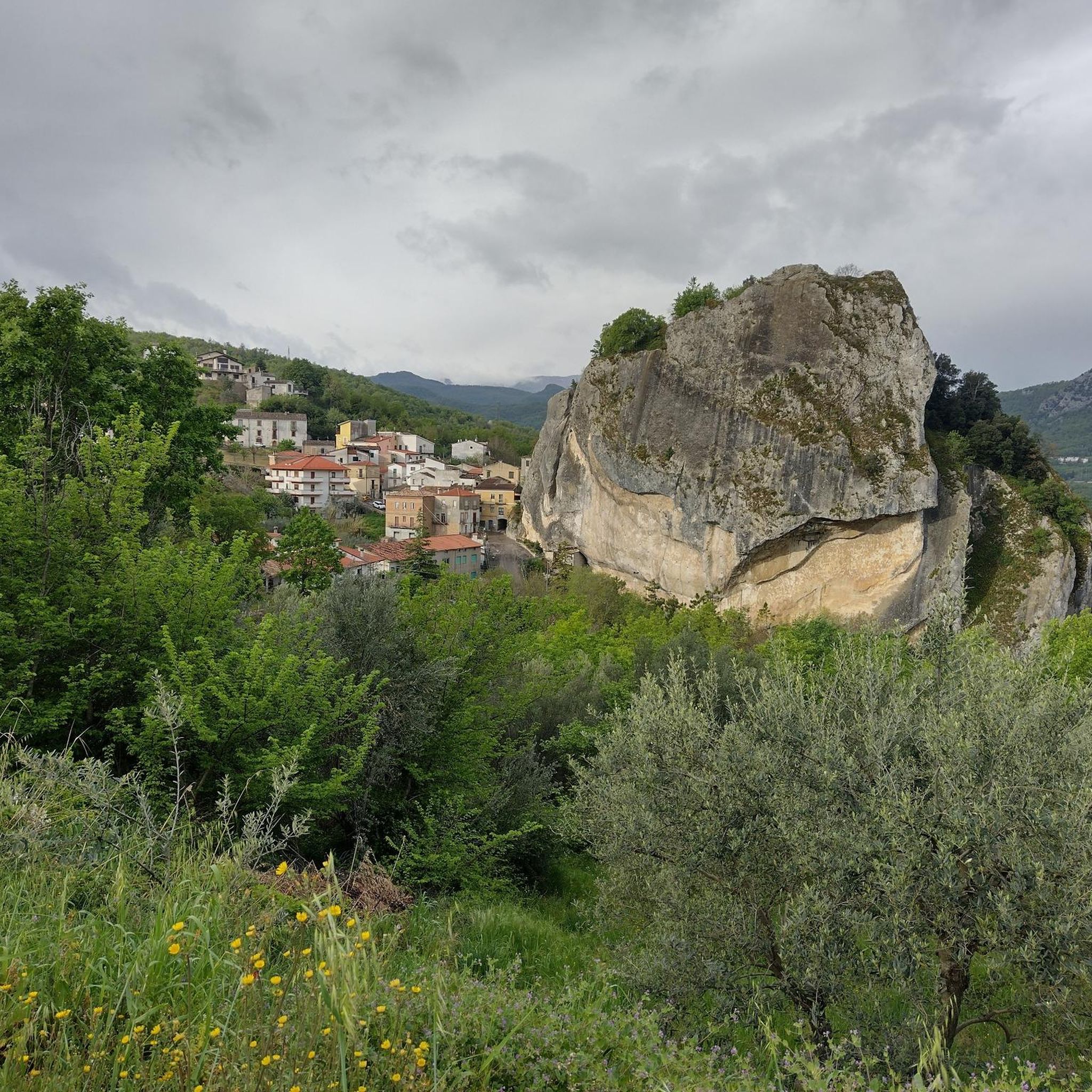
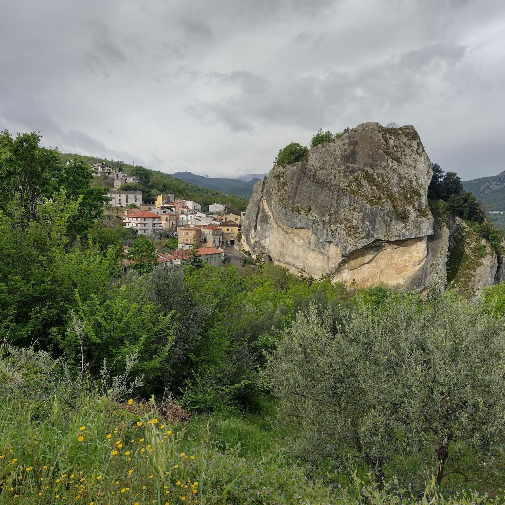
Road cycling routes around Montazzoli traverse a landscape characterized by rolling hills, significant elevation changes, and views of local lakes and river valleys. The region features a mix of open countryside and areas with natural water bodies like Lake Casoli and Lake Bomba. Road cyclists can expect varied terrain, including climbs towards plateaus and descents into river basins. The area offers challenging routes with substantial elevation gains, suitable for experienced riders.
Best road cycling routes around Montazzoli
- The most popular…
Last updated: November 5, 2026
3.5
(2)
51
riders
79.2km
04:01
1,230m
1,230m
Hard road ride. Very good fitness required. Mostly well-paved surfaces and easy to ride.
29
riders
82.0km
04:13
1,350m
1,360m
Hard road ride. Very good fitness required. Mostly well-paved surfaces and easy to ride.

4.5
(2)
23
riders
97.1km
04:37
1,240m
1,240m
Hard road ride. Very good fitness required. Mostly well-paved surfaces and easy to ride.
17
riders
148km
07:32
2,500m
2,510m
Hard road ride. Very good fitness required. Mostly well-paved surfaces and easy to ride.
2.0
(2)
16
riders
63.8km
03:06
960m
960m
Hard road ride. Very good fitness required. Mostly well-paved surfaces and easy to ride.
Get access to more routes and recommendations from other explorers.
Already have an account?
Our route recommendations are based on thousands of hikes, rides, and runs completed by other people on komoot.
Start today with a free account
Your next adventure awaits.


Tips from the Community

Historic Franciscan monastery in an oasis of peace. The Convento di San Pasquale (officially the monastery of Santa Maria degli Angeli) is hidden in the greenery on the hill of Vallaspra, just outside the medieval town of Atessa. This impressive complex was founded as early as 1408 by the blessed Tommaso da Firenze. It is built entirely of natural stone and exudes a serene, historic atmosphere. Although the interior and the beautiful monastery garden with the central well (from 1709) are unfortunately often closed to the public due to varying opening hours, the complex is an absolute sight to behold from the outside. Under the large portico at the front, you can still admire a centuries-old fresco of the Pietà. Moreover, the quiet, shady surroundings are perfect for a well-deserved break during your sporting tour. Fun fact: the monastery used to lend its name to the well-known local herbal liqueur "Amaro San Pasquale", which was originally prepared by the monks with herbs from this valley.
2
0
Ex-Fossacesia Station – The historic railway heart by the sea. The old Fossacesia Marina train station is a fascinating cultural-historical stop right along the route. Today, this nostalgic building marks the spot where the historic Adriatic Railway (Ferrovia Adriatica) thundered along since 1862, until the railway was moved inland in 2005 to make way for the current Via Verde. Although the characteristic building was a symbol of bygone glory for many years, the place breathes pure railway history. It is also the place where the 19th-century industrial revolution and the ancient fishing tradition literally shook hands. The historical significance behind this stop: the backbone of the trabocchi: When workers laid the tracks for this station in the 19th century, they left heavy materials lying around. Resourceful fishermen used the abandoned, heavy railway sleepers, iron bolts, and telegraph cables to anchor nearby trabocchi (like Punta Rocciosa) indestructibly into the seabed. The train thus gave the fishing spiders their iron backbone! Climb to the Goddess of Love: this station was historically the gateway for travelers making pilgrimages to the higher-lying 12th-century San Giovanni in Venere Abbey. Future Tourist Hub! There's a breath of fresh air blowing through the heritage! In May 2026, the final expropriation process will be completed. The province of Chieti is currently transforming this old station into a modern tourist hub and co-working space. Komoot tip: use the ample parking around the old station as the ideal starting point for your bike tour, or pause here to capture the contrasts between the old architecture and the modern cycling infrastructure.
5
0
The Trabucchi cycle path (officially known as the Via Verde dei Trabocchi) is a beautiful, largely flat cycle path over 50 kilometers long that runs along the Adriatic coast of the Italian region of Abruzzo on a former railway line. The path owes its name to the trabocchi (singular: trabocco): unique, monumental wooden fishing platforms on stilts that tower over the water like giant spiders.
5
0
The Ciclovia Adriatica in Abruzzo (better known as Bike to Coast) is a 131-kilometer cycle path that covers the entire coastline of the Abruzzo region. The route runs from Martinsicuro (coastal border with Marche) to San Salvo (border with Molise). The route is mostly flat, mostly car-free, and crosses 19 coastal municipalities.
5
0

Pleasant cycle path on the Abruzzo coast
1
0


beautiful view of the mouth of the Sangro River.
0
0

Frequently Asked Questions
What kind of terrain can I expect on road cycling routes around Montazzoli?
Road cycling around Montazzoli is characterized by rolling hills, significant elevation changes, and scenic views of local lakes and river valleys. You'll encounter a mix of open countryside and areas with natural water bodies like Lake Casoli and Lake Bomba, offering challenging climbs and descents.
Are there many easy road cycling routes in Montazzoli?
The road cycling network in Montazzoli primarily offers routes for advanced riders, with 50 difficult routes and 8 moderate options. There are no routes specifically categorized as easy, so cyclists should be prepared for substantial elevation gains.
What are some of the longer road cycling routes available?
For those seeking a long-distance challenge, the Quarto Grande Plateau – View of Palena loop from Atessa is a notable option, covering nearly 150 km with significant elevation gain. Another substantial route is the View of Lake Casoli – Sources of the Verde River loop from Atessa, which is about 80 km long.
What are the typical durations for road cycling routes in Montazzoli?
Route durations vary significantly based on distance and elevation. For example, the View of Lake Casoli – Sources of the Verde River loop from Atessa typically takes around 4 hours, while the Monte Pizzuto loop from Roccaspinalveti can be completed in about 3 hours 23 minutes. Longer routes, like the Quarto Grande Plateau loop, can take over 7 hours.
Are there any circular road cycling routes in the Montazzoli area?
Yes, many of the routes around Montazzoli are designed as loops. Popular circular routes include the View of Lake Casoli – Sources of the Verde River loop from Atessa, the Lake Bomba – Views of Tornareccio loop from Atessa, and the Monte Pizzuto loop from Roccaspinalveti.
What kind of views and scenery can I expect while road cycling in Montazzoli?
Cyclists can enjoy extensive views of natural water bodies such as Lake Casoli and Lake Bomba, as well as the surrounding river valleys and open rural landscapes. The routes often provide panoramic vistas, including those near Tornareccio and the Quarto Grande Plateau.
What do other road cyclists say about the routes in Montazzoli?
The road cycling routes in Montazzoli are highly rated by the komoot community, with an average score of 4.3 stars from over 24 reviews. Cyclists often praise the challenging terrain and the beautiful, varied landscapes that include lakes and river valleys.
Are there any specific landmarks or attractions to see along the road cycling routes?
While cycling, you might pass by interesting points such as the Convent of San Pasquale in Atessa. For natural sights, consider visiting the Waterfall in Gola di Pennadomo or the San Michele Arcangelo Cave in Liscia. There are also several scenic viewpoints, like the Scenic Road between Castiglione and Schiavi, offering great photo opportunities.
What is the best time of year for road biking in Montazzoli?
Given the significant elevation changes and open landscapes, spring and autumn generally offer the most pleasant conditions for road cycling in Montazzoli, with milder temperatures and less extreme weather. Summer can be hot, especially on climbs, while winter might bring colder temperatures and potentially icy conditions at higher elevations.
Where can I find parking when starting a road cycling route in Montazzoli?
Many popular routes start from towns like Atessa or Roccaspinalveti. While specific parking details for each route are not provided in this guide, these towns typically offer public parking options where you can begin your ride.
Are there any hidden gem road cycling routes in Montazzoli?
While the guide highlights popular routes, exploring the network of 58 routes on komoot can reveal less-trafficked paths. The San Rocco Fountain – Quiet Country Road loop from Gissi offers a taste of the region's quieter, scenic roads away from the main attractions.
Most popular attractions around Montazzoli

Get inspired with the komoot mobile app


Explore more
Browse the best Road cycling routes in other regions.
