The best road cycling routes around Rangendingen
4.6
(492)
6,335
riders
25
rides
Road cycling routes around Rangendingen offer varied terrain at the foot of the Swabian Alb and adjacent to the Upper Danube Nature Park. The region features rolling hills, scenic valleys, and extensive forests, providing diverse conditions for road cyclists. Paved roads are common, allowing for both gentle ascents through valleys and more challenging climbs with significant elevation gains. This landscape provides a range of options suitable for different fitness levels.
Best road cycling routes around Rangendingen
- The most popular road…
Last updated: October 8, 2026
25
riders
22.8km
01:16
130m
130m
Easy road ride. Great for any fitness level. Mostly well-paved surfaces and easy to ride.
5.0
(1)
14
riders
Moderate road ride. Good fitness required. Mostly well-paved surfaces and easy to ride.

5.0
(1)
18
riders
32.3km
01:30
320m
320m
Moderate road ride. Good fitness required. Mostly well-paved surfaces and easy to ride.
16
riders
Moderate road ride. Good fitness required. Some segments of this route may be unpaved and difficult to ride.
4.0
(1)
10
riders
Moderate road ride. Good fitness required. Mostly well-paved surfaces and easy to ride.
Get access to more routes and recommendations from other explorers.
Already have an account?
Our route recommendations are based on thousands of hikes, rides, and runs completed by other people on komoot.
Start today with a free account
Your next adventure awaits.
Tips from the Community

As a hiker, you have to be a bit careful - Bicycle Highway - Between Hemmendorf and Hirrlingen - District of Tübingen
0
0

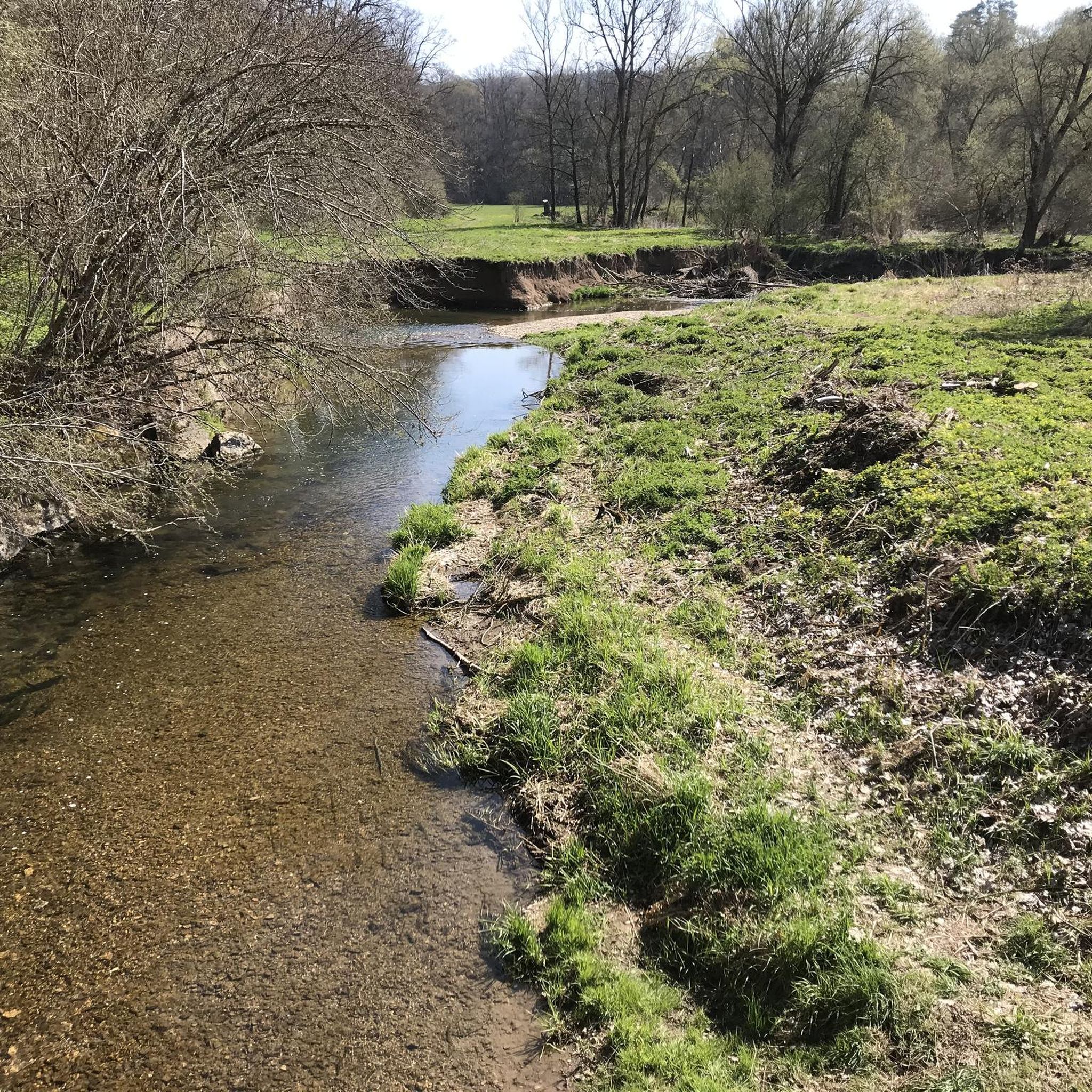
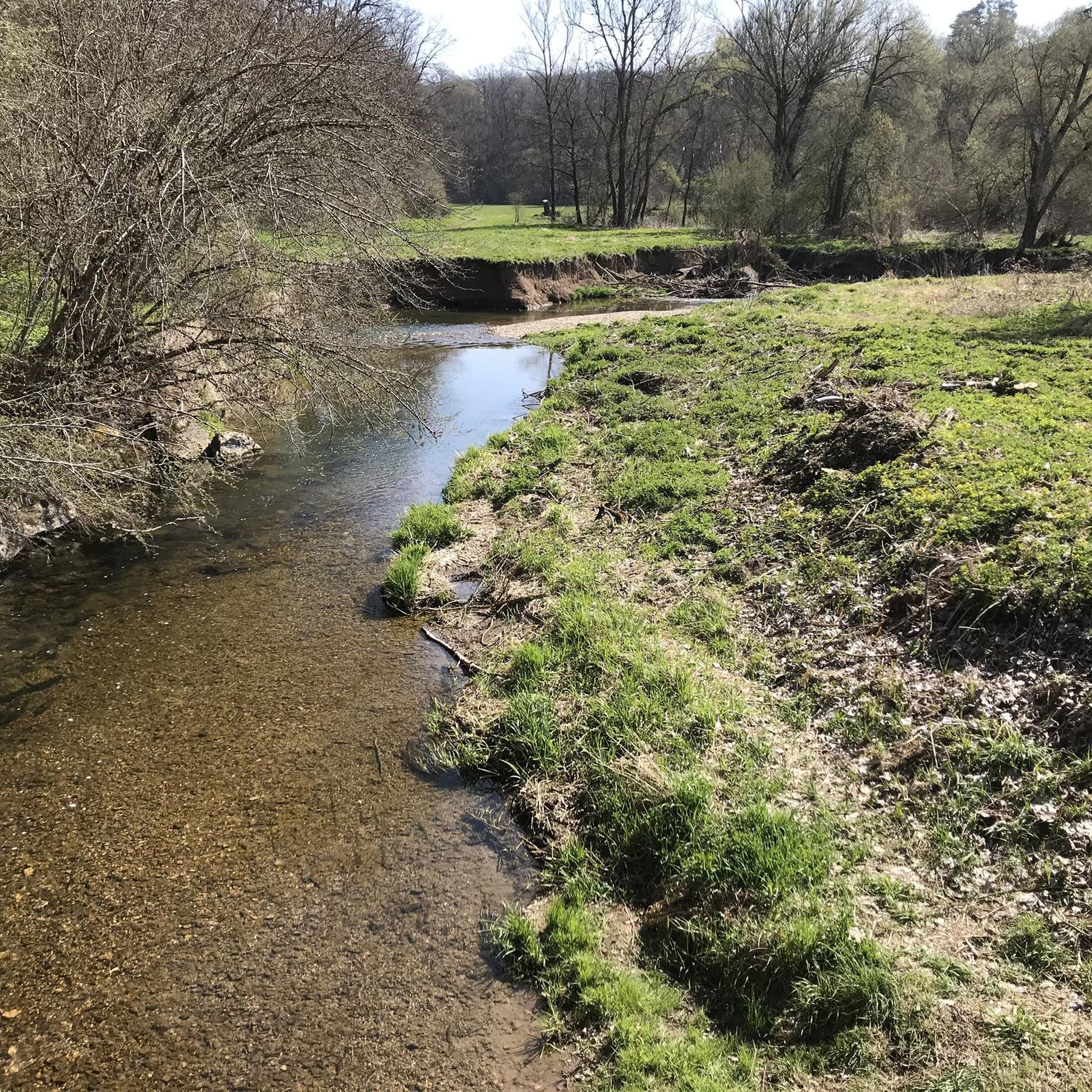
A beautiful spot where you have the opportunity to go directly to the bank of the Starzel river from the relatively nearby path. Fish can also occasionally be seen in the crystal-clear water.
7
0
Burg Hohenzollern 🏰👑 a real eye-catcher in the Zollernalbkreis
0
0

There are of course countless beautiful views of the Hohenzollern.
1
0
There are, of course, countless beautiful views of Hohenzollern Castle.
1
0
There are, of course, countless beautiful views of the Hohenzollern.
1
0
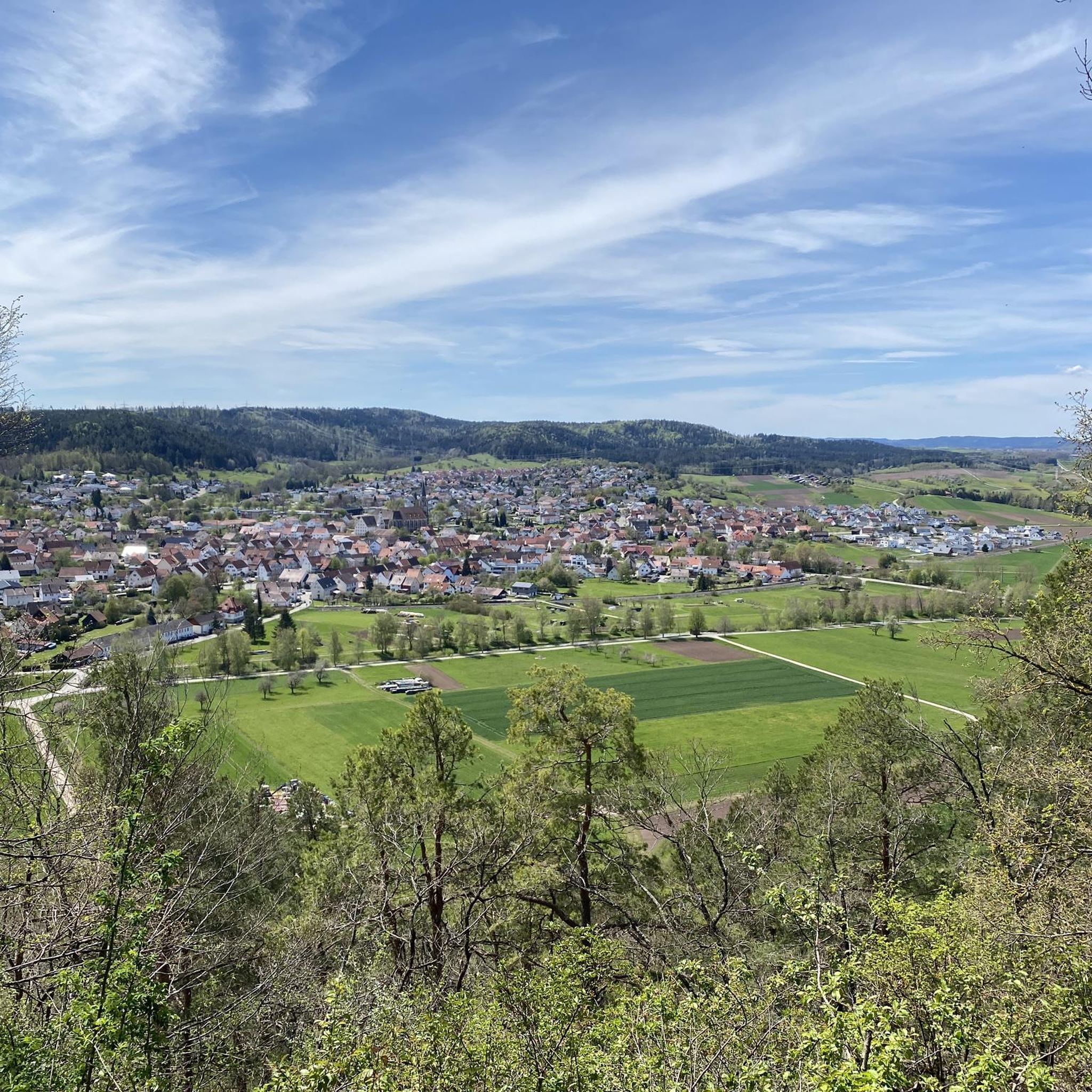
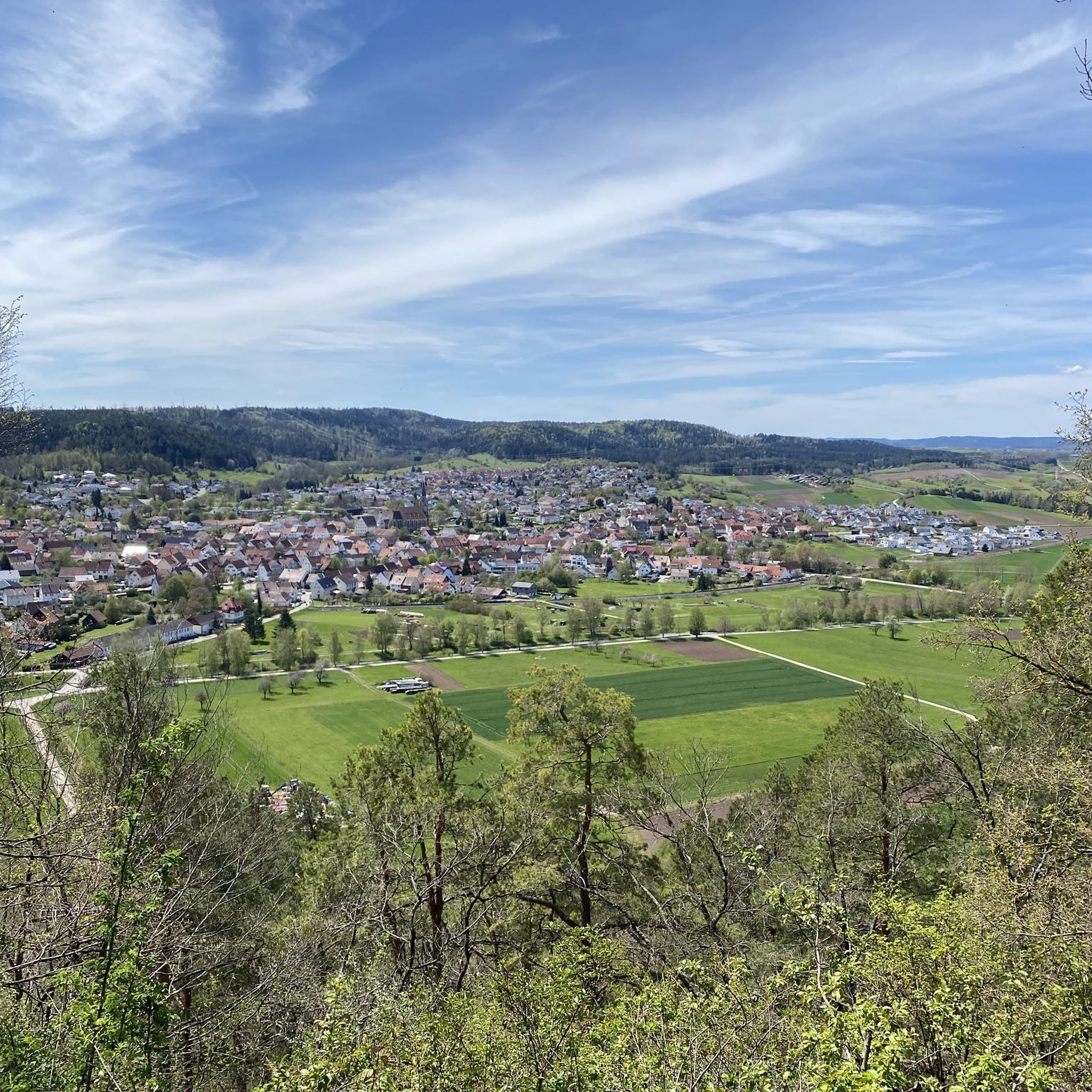
Beautiful view of Haigerloch Castle 🏰 and the lower town church of St. Nicholas ⛪ - Haigerloch - Zollernalb district
0
0
The cycle path overall is very nice
0
0
Frequently Asked Questions
What kind of terrain can I expect for road cycling around Rangendingen?
Road cycling around Rangendingen offers a diverse landscape, from rolling hills and scenic valleys to extensive forests. You'll encounter varied terrain, including gentle ascents through valleys and more challenging climbs with significant elevation gains, especially towards the Swabian Alb. The roads are generally paved, providing good conditions for road bikes.
Are there road cycling routes suitable for beginners in Rangendingen?
Yes, Rangendingen offers several road cycling routes suitable for beginners. There are 9 easy routes available, such as the Starzelufer – Café Piccola Venezia loop from Höfendorf, which is 14.2 miles (22.8 km) long and traverses the scenic Starzel Valley.
Are there challenging road cycling routes for experienced cyclists?
Absolutely. For experienced cyclists seeking a challenge, there are 5 difficult routes around Rangendingen. The region's proximity to the Swabian Alb means you can find routes with substantial elevation gains, offering demanding climbs and rewarding panoramic views.
Can I cycle past Hohenzollern Castle?
Yes, Hohenzollern Castle is a prominent landmark in the region and can be incorporated into road cycling tours. Routes like the Hohenzollern View – Neckar Bridge in Rottenburg loop from Rangendingen offer views towards the castle. The wider area also features routes like the 'Zollern-Tour am Fuße der Burg Hohenzollern', which specifically highlight the castle as a backdrop.
What natural features or landmarks can I see along the road cycling routes?
Road cycling routes in Rangendingen often feature the idyllic Starzel Valley and offer views of the Swabian Alb's distinctive escarpment. You can also find routes that provide stunning views of Hohenzollern Castle, such as from the Zeller Horn or Trauffelsen East. The region is also close to the Upper Danube Nature Park, offering routes through diverse natural landscapes.
Are there circular road cycling routes available in Rangendingen?
Many road cycling routes around Rangendingen are designed as loops, allowing you to start and end in the same location. Examples include the Eyach Valley Scenic Road – Hohenzollern View loop from Rangendingen, which is a moderate 35.5 miles (57.2 km) trail.
What do other road cyclists enjoy most about road cycling in Rangendingen?
The area is highly rated by the komoot community, with an average score of 4.9 stars from over 8 reviews. Road cyclists often praise the varied terrain, the scenic beauty of the Starzel Valley, and the rewarding views of Hohenzollern Castle. The network offers options for different ability levels, from easy rides to more challenging climbs.
What is the typical elevation gain for road cycling routes in the area?
The elevation gain varies significantly depending on the route. While some routes through valleys might have gentler ascents, routes venturing into the Swabian Alb can feature climbs with elevation gains of up to 400 meters or more. For example, the View of the A81 Bridge – View of the Neckar and Mühlen loop from Kapfhalde has an elevation gain of over 740 meters.
Are there any long-distance road cycling options near Rangendingen?
Rangendingen's location provides access to longer cycling networks. The Hohenzollern Cycle Route, for instance, is a significant long-distance option that traverses the former ancestral home of the Hohenzollern dynasty, offering varied and eventful landscapes with paved sections and cultural highlights. You can find more information about the Zollern-Tour at the foot of Hohenzollern Castle here.
Is Rangendingen a good base for exploring the Swabian Alb by road bike?
Yes, Rangendingen is ideally situated at the foot of the Swabian Alb, making it an excellent starting point for road cycling tours into this low mountain range. The region's diverse landscape of rolling hills and valleys provides varied terrain, from gentle rides to more challenging climbs, all on mostly paved roads.
What is the best time of year for road cycling in Rangendingen?
The spring, summer, and early autumn months generally offer the most favorable conditions for road cycling in Rangendingen. During these seasons, the weather is typically mild, and the landscapes are vibrant, making for enjoyable rides through the valleys and over the hills of the Swabian Alb.
Most popular routes around Rangendingen
Most popular attractions around Rangendingen

Get inspired with the komoot mobile app


Explore more
Browse the best Road cycling routes in other regions.
