The best walks and hikes around San Vito Romano
4.4
(244)
921
hikers
61
hikes
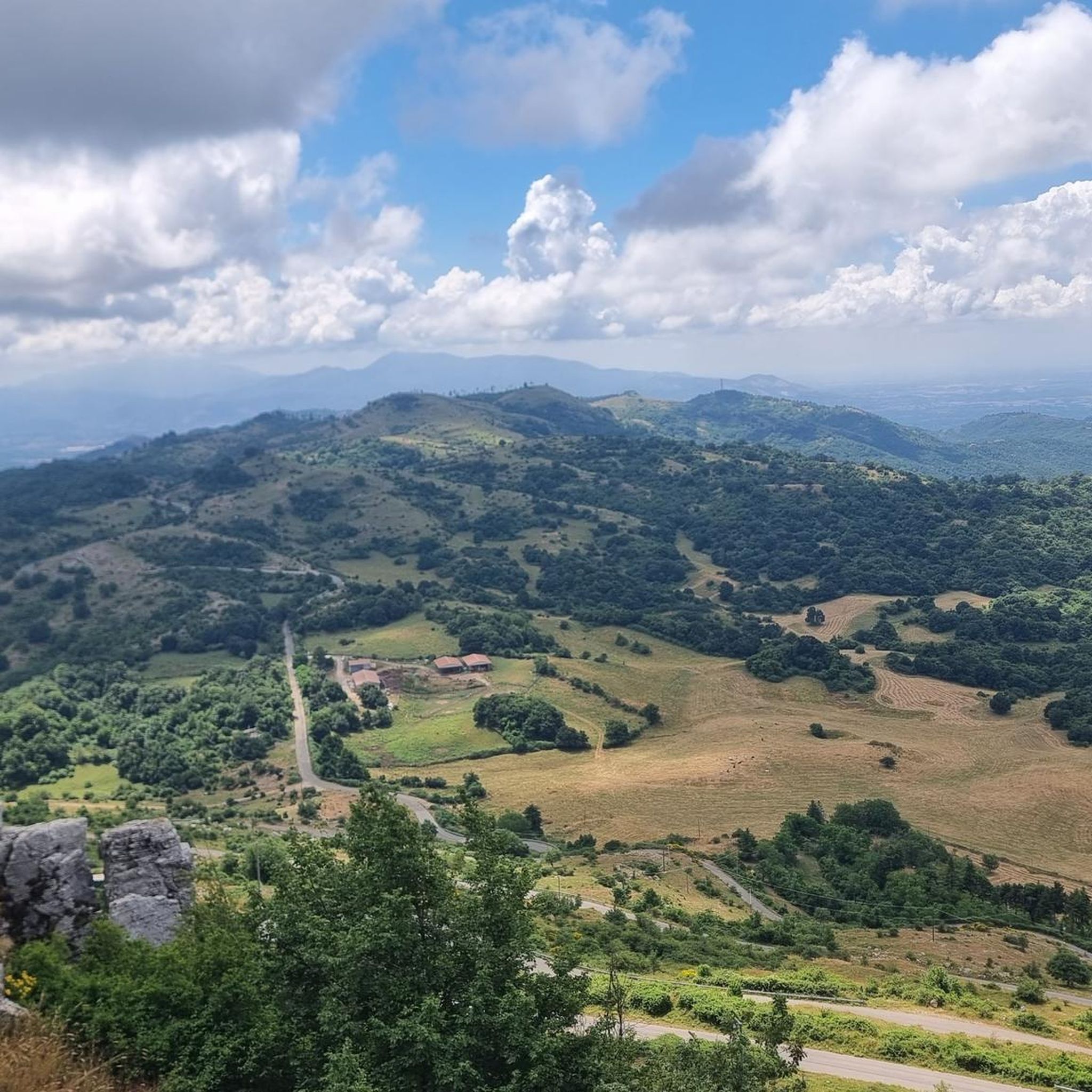
Hiking around San Vito Romano offers diverse landscapes within the Prenestini Mountains, located east of Rome. The town itself sits on a hill at an elevation of 655 meters, providing a starting point for elevated routes. The region features rolling hills, extensive wooded areas, and prominent peaks like Monte Calo, which reaches 1,152 meters. Ancient chestnut groves, such as the Castagneto Prenestino Natural Monument, also characterize the terrain, offering varied environments for exploration.
Best hiking trails around San Vito Romano
…Last updated: July 2, 2026
4.3
(23)
54
hikers
10.1km
03:11
320m
320m
Moderate hike. Good fitness required. Mostly accessible paths. Sure-footedness required.
4.8
(16)
59
hikers
13.7km
05:59
920m
920m
Hard hike. Very good fitness required. Mostly accessible paths. Sure-footedness required.

Sign up for free
4.8
(6)
17
hikers
15.8km
06:11
960m
960m
Hard hike. Very good fitness required. Mostly accessible paths. Sure-footedness required.
4.9
(8)
28
hikers
10.4km
04:37
740m
740m
Moderate hike. Good fitness required. Mostly accessible paths. Sure-footedness required.
5.0
(2)
13
hikers
23.2km
07:59
800m
800m
Hard hike. Very good fitness required. Mostly accessible paths. Sure-footedness required.
Get access to more routes and recommendations from other explorers.
Sign up for free
Already have an account?
Our route recommendations are based on thousands of hikes, rides, and runs completed by other people on komoot.
Start today with a free account
Your next adventure awaits.
Login or Signup


Tips from the Community

really really very tiring
0
0

From the starting point of the trail there's a view of the east side, here you can easly recognise the profile of the Simbruini Mountains and the Ruffi too
0
0
The route ends at the village centre where you can rest in the shade on a bench and drink from the fountain in the square. Moreover, there are two great restaurants here (Ristorante da Peppe e Ristorante da Romano) where you can eat delicious local food.
1
1
Looking west you can see the vast area of the city of Rome and its province. In the valley below the town of San Gregorio da Sassola and, following on the right side, the city of Tivoli in the middle of the valley.
0
0
The starting point of the trail there's a view of the east side, here you can easly recognise the profile of the Simbruini Mountains and the Ruffi too.
0
0

It is a challenging but absolutely wonderful path, to be followed like the ancient pilgrims, in silence and prayer...
1
0

The path is dedicated to Pope John Paul II who used to take walks in the little frequented areas of the Prenestini mountains. The route is not very demanding, except in the final part at the foot of the sanctuary, and crosses a wooded area of considerable interest. It is recommended to walk it especially in spring when the bottom of the wood is covered with many species of flowers and the Falconara ditch is full of water.
4
0
Frequently Asked Questions
How many hiking trails are available around San Vito Romano?
There are over 60 hiking routes in the San Vito Romano area, offering a wide range of options for different skill levels and preferences. The komoot community has explored these trails over 800 times.
What kind of terrain can I expect when hiking near San Vito Romano?
The terrain around San Vito Romano, nestled in the Prenestini Mountains, is quite varied. You'll find rolling hills, extensive wooded areas, and prominent peaks like Monte Calo. The region is also known for its ancient chestnut groves, such as the Castagneto Prenestino Natural Monument, providing diverse environments for exploration.
What are the difficulty levels of hikes in San Vito Romano?
The trails cater to various fitness levels. You can find around 10 easy routes, over 40 moderate trails, and about 10 difficult hikes. This ensures options for casual strolls, family outings, and more strenuous treks.
What do other hikers say about the trails in San Vito Romano?
The hiking routes in San Vito Romano are highly rated by the komoot community, with an average score of 4.4 stars from over 200 reviews. Hikers often praise the diverse landscapes, panoramic views, and the natural beauty of the Prenestini Mountains.
Are there any easy hiking trails suitable for beginners or families?
Yes, there are approximately 10 easy hiking routes around San Vito Romano. These trails are generally shorter with less elevation gain, making them suitable for beginners or families looking for a relaxed outdoor experience. Many of the wooded paths offer pleasant strolls.
Where can I find more challenging hikes in the San Vito Romano area?
For those seeking a challenge, routes like the San Benedetto Cave – Monte Cerella loop from Pisoniano offer significant elevation gain and rugged terrain. This particular route is rated as difficult and takes approximately 6 hours to complete, providing expansive vistas of the surrounding mountains.
Are there circular hiking routes available?
Yes, many of the trails around San Vito Romano are circular, allowing you to start and end at the same point. An example is the Capranica Prenestina – Monte Calo Summit loop from Capranica Prenestina, a moderate 10.1 km route that offers panoramic views from Monte Calo.
What are some scenic viewpoints or panoramic spots on the trails?
Many trails offer stunning views. The summit of Monte Calo (1,152 meters) provides panoramic views stretching towards Rome and the rocky walls of Monte Guadagnolo. You can also find excellent viewpoints like Ascents and views, which offer broad perspectives of the surrounding area, including the city of Rome and Tivoli.
Are there any historical or natural landmarks to explore while hiking?
Absolutely. The region is rich in landmarks. You can hike to the Sanctuary of Mentorella via the Karol Wojtyła Trail, which includes the unique San Benedetto Cave. Other points of interest include the ancient chestnut groves of the Castagneto Prenestino Natural Monument, and historical sites like the Villa of Nero Ruins.
What is the best season for hiking in San Vito Romano?
San Vito Romano is suitable for hiking throughout all seasons. Spring is particularly beautiful when the forest floor is covered with flowers, making wooded trails like the Karol Wojtyła Trail especially appealing. The elevated positions also offer cooler temperatures during warmer months.
Are there dog-friendly hiking options in the area?
While specific trails are not explicitly marked as 'dog-friendly' in the data, generally, most natural hiking paths in the Prenestini Mountains are suitable for dogs, provided they are kept on a leash and owners follow local regulations. It's always advisable to check for any specific restrictions on individual routes or protected areas.
Can I find trails that lead to significant natural features?
Yes, several trails will take you through significant natural features. For instance, the San Benedetto Cave – Mountain hut loop from Pisoniano leads through dense wooded areas of the Prenestini Mountains, allowing you to experience the region's natural beauty firsthand.
Most popular attractions around San Vito Romano

Get inspired with the komoot mobile app


Explore more
Browse the best Hikes in other regions.
