The best cycling routes around Santa Croce Di Magliano
3.7
(3)
30
riders
7
rides
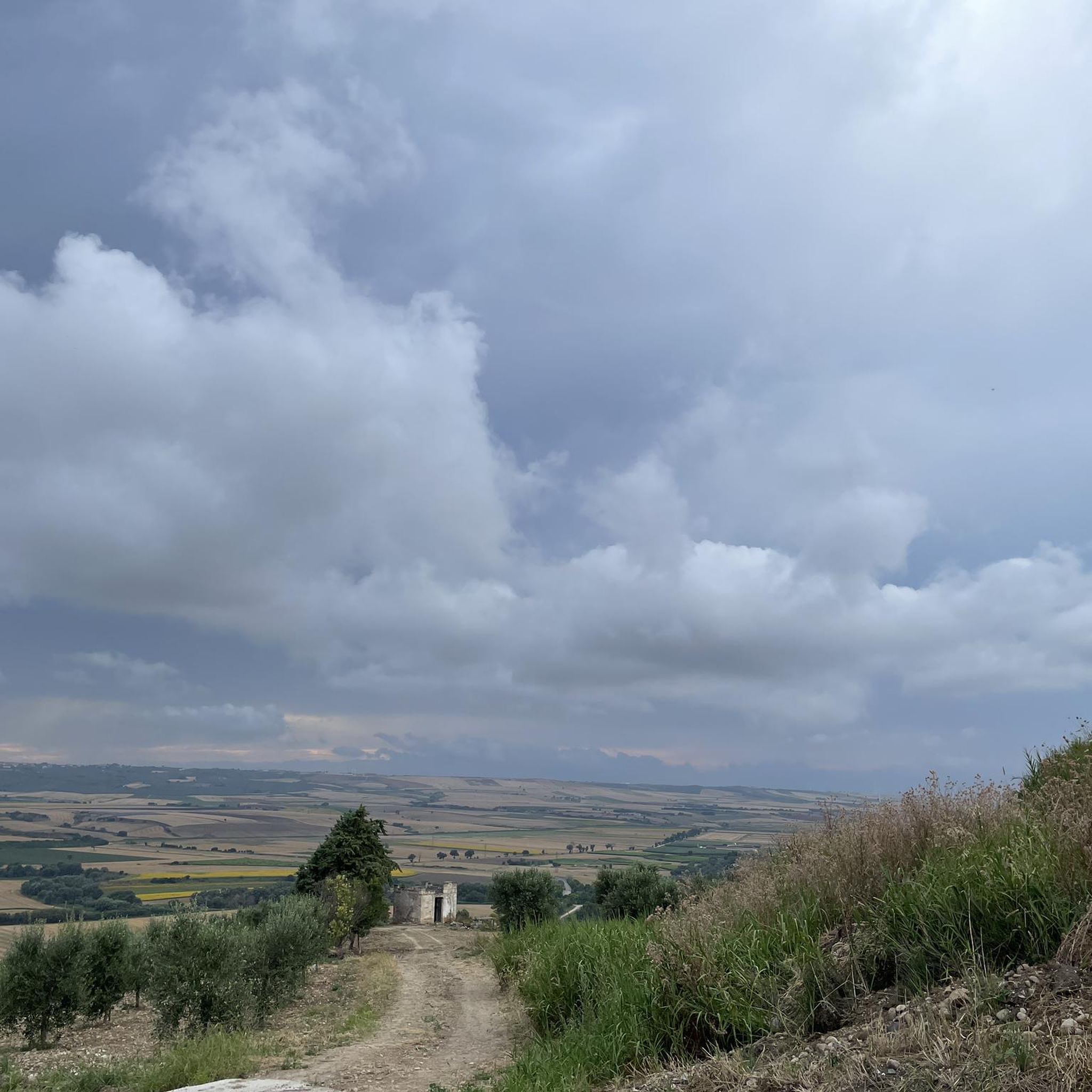
Touring cycling routes around Santa Croce di Magliano traverse a landscape characterized by rolling hills, green plains, and cultivated fields. Situated on a hilltop at 608 meters above sea level, the area offers panoramic views stretching towards the Majella mountains and the Adriatic Sea. The region features ancient "tratturi," historical grassy pathways suitable for cycling, alongside paved roads. These diverse elevations provide varied terrain for touring cyclists.
Best touring cycling routes around Santa Croce di Magliano
- The most popular touring…
Last updated: July 5, 2026
11
riders
69.5km
06:13
1,390m
1,390m
Hard bike ride. Very good fitness required. You may need to push your bike for some segments of this route.
3.0
(1)
6
riders
50.5km
03:33
980m
980m
Hard bike ride. Very good fitness required. Mostly paved surfaces. Suitable for all skill levels.

Sign up for free
3.0
(1)
5
riders
68.1km
04:43
1,280m
1,280m
Hard bike ride. Very good fitness required. Mostly paved surfaces. Suitable for all skill levels.
4
riders
66.3km
04:40
1,300m
1,290m
Hard bike ride. Very good fitness required. Mostly paved surfaces. Suitable for all skill levels.
5.0
(1)
4
riders
34.0km
02:25
710m
710m
Hard bike ride. Very good fitness required. Mostly paved surfaces. Suitable for all skill levels.
Get access to more routes and recommendations from other explorers.
Sign up for free
Already have an account?
Our route recommendations are based on thousands of hikes, rides, and runs completed by other people on komoot.
Start today with a free account
Your next adventure awaits.
Login or Signup
Popular around Santa Croce Di Magliano

Tips from the Community

Free admission from Villa Zappone, on Via Mazzini. Worth a visit, truly beautiful!
1
0

The Fortore river before diving into Lake Occhito
0
0
It was once an important Roman Municipium
0
0

Let me start by saying that I did a complete tour of the lake starting from the crossroads on the state road to Tufara and then going back up towards Celenza Valfortore. As far as I'm concerned, I preferred the Apulian side to the Molise side, both for the panorama and for the "quality" of the road. I suggest turning around at the barrier (Puglia side) since at a certain point there is no practicable route. We took absurd gambles in the middle of bushes full of thorns. Furthermore, according to the operators of the barrier, you have to call the consortium and get a permit to be able to cross.
0
0
Let me start by saying that I did a complete tour of the lake. The Apulian side is more beautiful than the Molise side. I suggest turning around at the barrier as at a certain point there is no viable route. We took absurd gambles in the middle of bushes full of thorns. Furthermore, according to the operators of the barrier, you have to call the consortium and get a permit to be able to cross.
0
0

Lago di Occhito is a fascinating artificial lake located in the Molise region of Italy. Surrounded by stunning landscapes and a variety of flora and fauna, it offers an ideal location for outdoor activities such as bird watching and fishing. https://puglia.com/celenza-valforte-e-lago-di-occhito
0
0
Casacalenda is a charming comune located in the Molise region of Italy. This picturesque village is characterized by narrow streets and charming alleyways, and is nestled in the surrounding hills, offering a breathtaking view of the Biferno river valley. With its ancient origins, Casacalenda is rich in history and tradition, with historical monuments and places of interest to discover. The Bosco Casale Regional Nature Reserve is one of the main attractions of the area, offering the opportunity to immerse yourself in the natural beauty of the woods, trails and local fauna. An ideal place for nature lovers and for those who wish to have an authentic experience in the heart of Molise.
1
0
Lago di Occhito is a fascinating artificial lake located in the Molise region of Italy. Surrounded by stunning landscapes and a variety of flora and fauna, it offers an ideal location for outdoor activities such as bird watching and fishing. puglia.com/celenza-valforte-e-lago-di-occhito
0
0
Frequently Asked Questions
What kind of terrain can I expect when touring cycling around Santa Croce di Magliano?
The area is characterized by rolling hills, green plains, and cultivated fields, offering diverse terrain. From its hilltop position, you'll encounter varied elevations, providing both scenic, gentler rides and more demanding climbs. You can also find ancient 'tratturi' – grassy pathways historically used by shepherds – which are ideal for gravel or mountain biking, alongside paved roads.
How many touring cycling routes are available in Santa Croce di Magliano?
There are 8 touring cycling routes documented on komoot for the Santa Croce di Magliano area. These routes are generally considered difficult, featuring significant elevation gains and varied distances.
Are there any circular touring cycling routes in the region?
Yes, many of the touring cycling routes around Santa Croce di Magliano are designed as loops. For example, you can explore the Fiume Fortore loop from Colletorto, the Castello loop from Larino, or the Casacalenda – Historic center of Larino loop from Colletorto, all offering a return to your starting point.
What are some notable landmarks or attractions I can see while cycling?
Cycling through the region offers opportunities to see historical and natural attractions. You might pass by the ancient Roman Amphitheatre of Larino, or the historic Dragonara Castle. The Bosco Casale Regional Nature Reserve also provides a natural point of interest. The town of Santa Croce di Magliano itself has churches like Sant'Antonio da Padova and San Giacomo Apostolo, and a unique Greek Church.
What is the best time of year for touring cycling in Santa Croce di Magliano?
Molise generally offers pleasant cycling conditions from spring through autumn. Spring brings lush green landscapes, while autumn provides cooler temperatures and beautiful colors. Summer can be warm, especially in July and August, but the hilltop location of Santa Croce di Magliano may offer some relief. Always check local weather forecasts before heading out.
Are there any routes that offer panoramic views?
Absolutely. Given Santa Croce di Magliano's elevated position at 608 meters above sea level, many routes provide spectacular panoramic views. You can expect expansive vistas stretching towards the Majella mountains to the northwest and the Adriatic Sea to the southeast, with the Tremiti Islands visible on clear days. The rolling hills inherently offer many scenic viewpoints.
What is the general difficulty level of touring cycling routes here?
The touring cycling routes around Santa Croce di Magliano are generally considered difficult. They feature significant elevation gains and varied terrain, making them suitable for cyclists with good fitness levels looking for a challenge. For example, the Roman Amphitheatre of Larino loop from Montelongo, while shorter, still involves over 700 meters of ascent.
Can I find routes that incorporate historical sites?
Yes, several routes allow you to combine cycling with historical exploration. The Historic center of Larino – Roman Amphitheatre of Larino loop from Colletorto is a great example, taking you past significant historical points. The Molise region is rich in medieval villages and ancient pathways, offering a deep dive into its past.
What do other cyclists say about touring cycling in Santa Croce di Magliano?
The touring cycling routes in Santa Croce di Magliano are highly rated by the komoot community, with an average score of 3.7 stars from 3 reviews. Over 30 touring cyclists have used komoot to explore the varied terrain, often praising the challenging climbs and the rewarding panoramic views.
Are there specific routes that pass through cultivated fields or green plains?
Yes, the landscape around Santa Croce di Magliano is characterized by green plains and cultivated fields. Routes like the Casacalenda – Historic center of Larino loop from Colletorto will lead you through these agricultural areas, offering a picturesque and immersive experience of the local scenery.
What are 'tratturi' and how do they relate to cycling in this area?
Tratturi are ancient, grassy pathways historically used by shepherds for seasonal livestock migration. Santa Croce di Magliano is near a section of the 'braccio tratturale Celano-Foggia.' These unique routes offer a distinct cycling experience, particularly for those interested in gravel or mountain biking, allowing you to cycle through historical paths and unspoiled nature.
Most popular routes around Santa Croce Di Magliano
Most popular attractions around Santa Croce Di Magliano

Get inspired with the komoot mobile app


Explore more
Browse the best Cycling routes in other regions.
