The best walks and hikes around Rignano Garganico
4.0
(96)
396
hikers
64
hikes
Hiking around Rignano Garganico offers exploration through a landscape characterized by limestone hills, deep valleys, and Mediterranean scrub. The region features varied terrain, including ancient pathways and forested sections. Elevation changes are common, providing panoramic views of the surrounding Gargano area. This environment supports a range of hiking experiences, from gentle strolls to more challenging ascents.
Best hiking trails around Rignano Garganico
- The most popular hiking route is Monte Nero - Fajarama Loop, a 8.2 miles (13.2 km) trail…
Last updated: July 5, 2026
4.3
(3)
16
hikers
13.2km
03:50
340m
340m
Moderate hike. Good fitness required. Mostly accessible paths. Sure-footedness required.
5.0
(3)
3
hikers
Easy hike. Great for any fitness level. Easily-accessible paths. Suitable for all skill levels.

Sign up for free
5.0
(4)
15
hikers
6.41km
01:53
180m
180m
Easy hike. Great for any fitness level. Easily-accessible paths. Suitable for all skill levels.
4.0
(7)
13
hikers
14.6km
04:06
280m
280m
Moderate hike. Good fitness required. Easily-accessible paths. Suitable for all skill levels.
4.9
(7)
15
hikers
14.0km
04:29
570m
570m
Moderate hike. Good fitness required. Easily-accessible paths. Suitable for all skill levels.
Get access to more routes and recommendations from other explorers.
Sign up for free
Already have an account?
Our route recommendations are based on thousands of hikes, rides, and runs completed by other people on komoot.
Start today with a free account
Your next adventure awaits.
Login or Signup

Tips from the Community

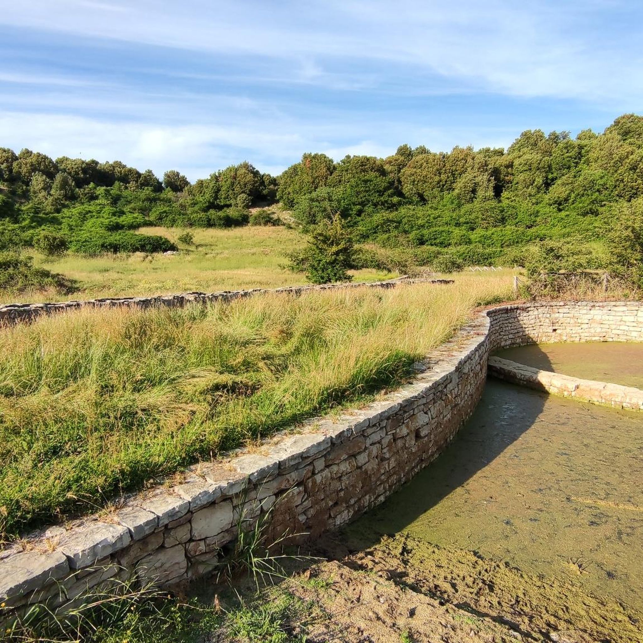
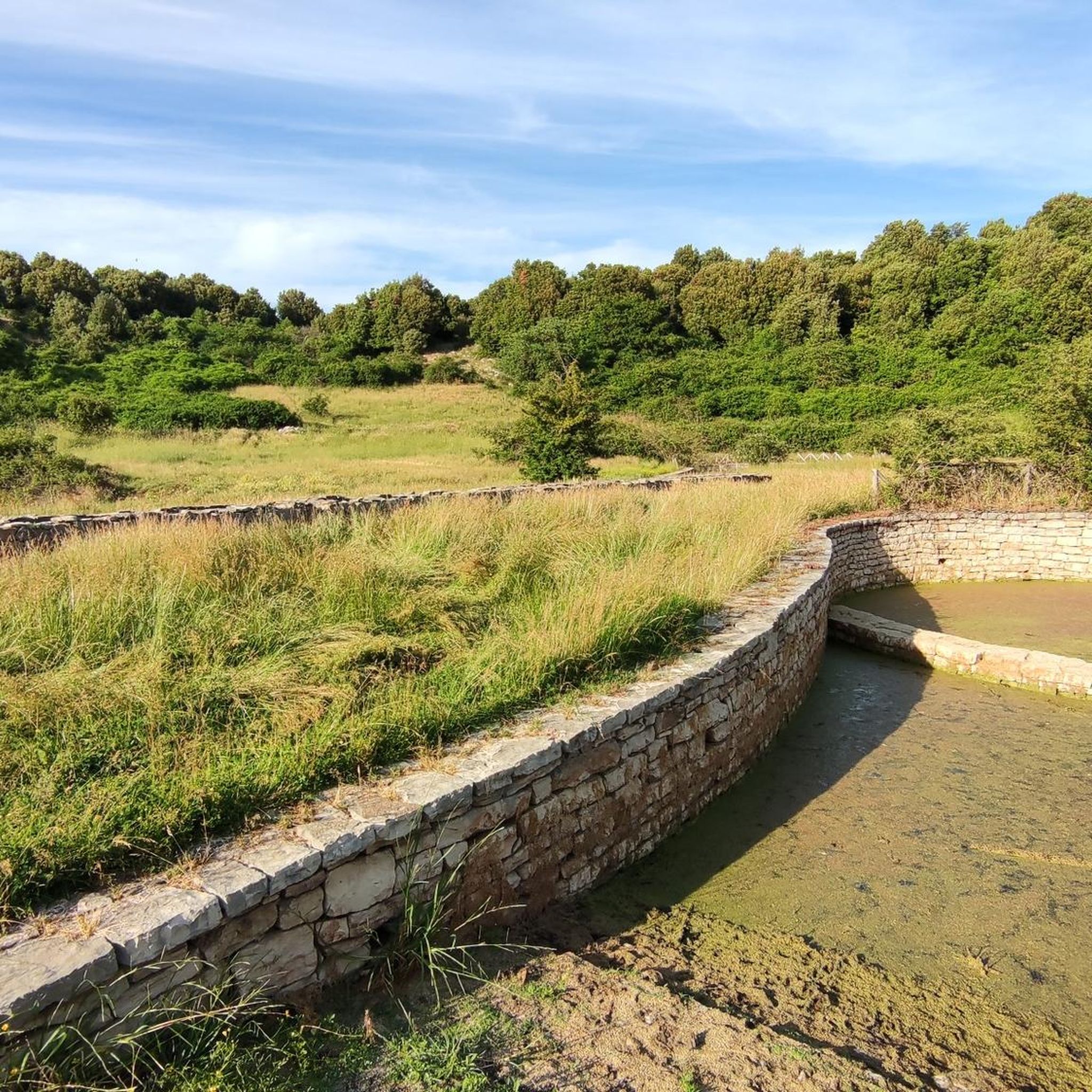
Interesting to read how the "ancestors" could preserve the snow. The "NEVIERA" is a depression that was worked until to have a shaped like an upside-down bell. Then the snow was thrown into, pressed, and then isolated with leave and dried grass. Then they repeated the operation until to reach the top. The snow was then transported by mule or carts.
0
0
All the Fajarama woods is magic: for the hikers and for the mountainbikers. For the hiker: you can easily do it down or uphill: just enjoy and feel the sensations the tha woods gives you. You can easily see some wild animals. With a MTB is better to go downhill: super fun (but you lose the surrounding nature if you go too fast)
0
0

Perhaps before this summit cross, which crowns the summit of Monte Celano, the following thoughts of Pope Francis – who passed away on Easter Monday 2025 – may be helpful to one or the other who lingers at the summit after the ascent: + "In the resurrection of Christ, each of our destinies finds its place in the infinite horizon of eternity. Only from his death and resurrection does the certainty arise that nothing can separate us from the love of God [as the Apostle Paul writes in his letter to the Romans, chapter 8]. From this great hope comes every other glimmer of light with which we can overcome the trials and obstacles of life. And not only that: the Risen One also walks with us and becomes our traveling companion, as with the disciples at Emmaus."
0
0


BEAUTIFUL PATH rich in vegetation. in addition the CAI signs are very good even if not always indicated at human height but on stumps placed in the ground
0
0
Ancient Benedictine abbey inhabited later and still today home to the Capuchin Friars Minor. You can visit the church with altar and wooden statue of St. Matthew the Apostle where you can admire the wonderful wooden "Choir". Also noteworthy is the Franciscan "BiblioLab".
1
0
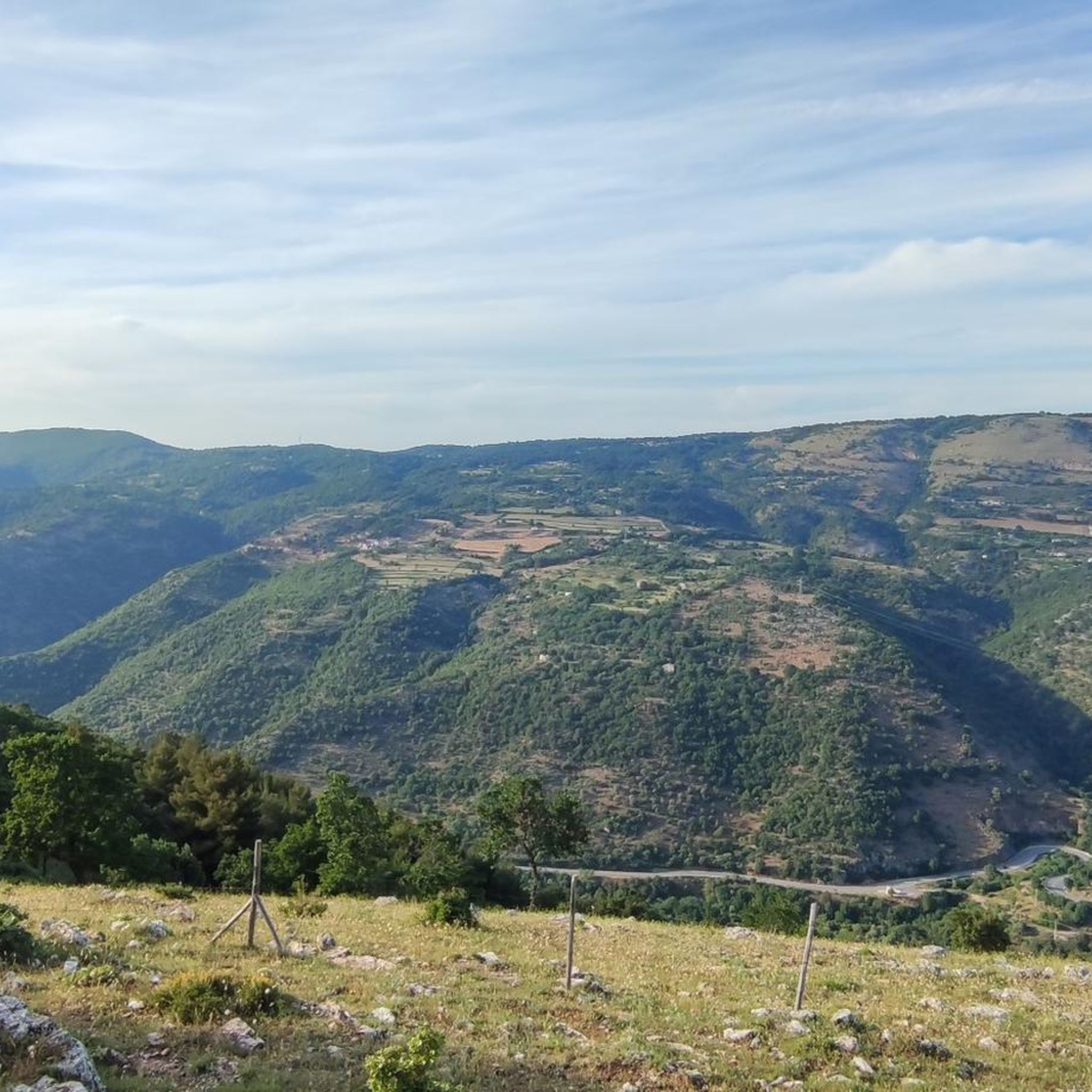
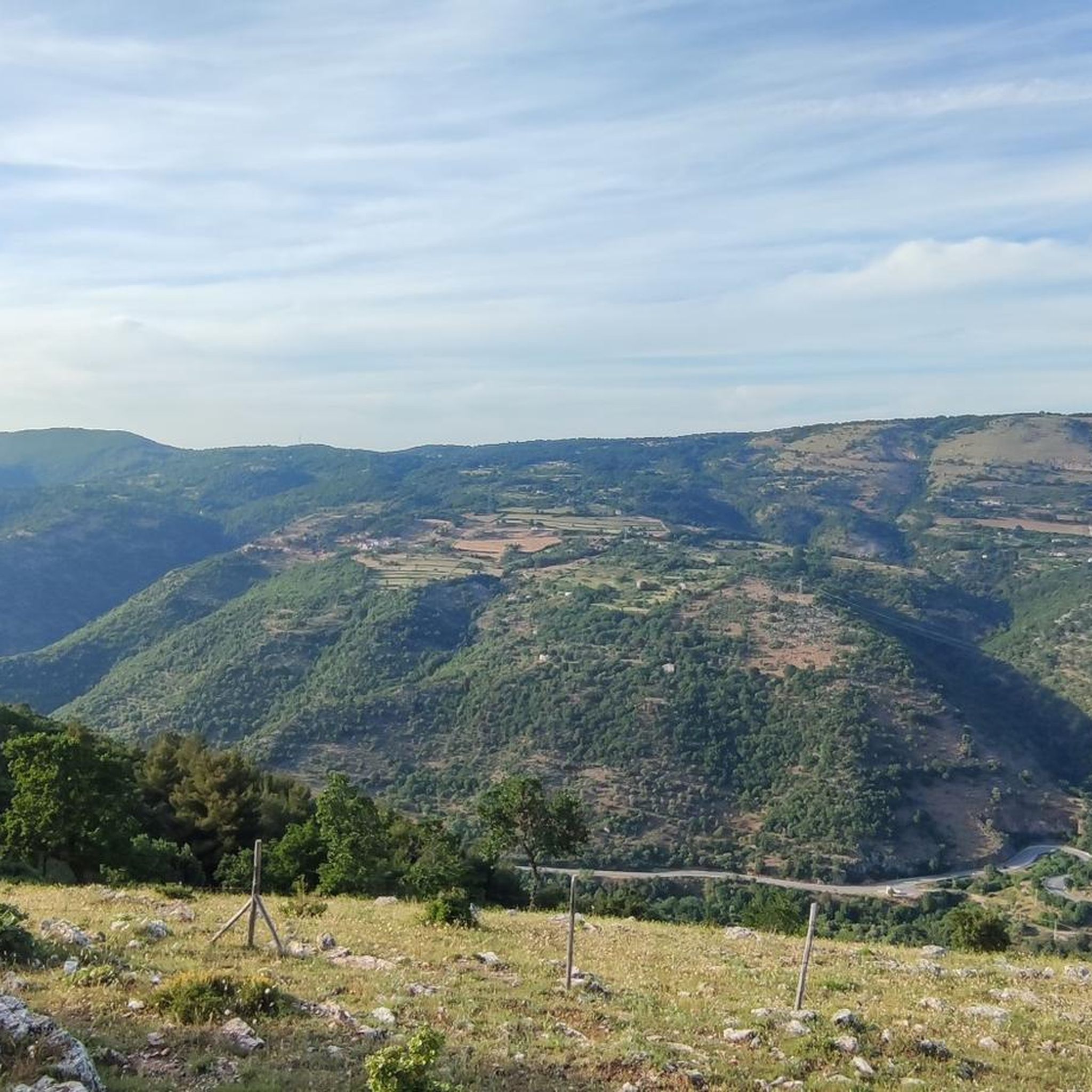
panoramic view of San Marco in Lamis
0
0
This is an ancient way of "conserving snow" inside a specially prepared depression in the ground which allowed the pressed snow to remain for a longer period of time to be used for refrigeration purposes elsewhere.
0
0
Frequently Asked Questions
How many hiking trails are available around Rignano Garganico?
There are over 50 hiking trails in the Rignano Garganico area, offering a diverse range of experiences. These include easy strolls, moderate treks, and some more challenging routes for experienced hikers.
Are there easy hiking trails suitable for beginners or families in Rignano Garganico?
Yes, Rignano Garganico offers several easy hiking options perfect for beginners or families. For example, The hermitages of the Valle di Stignano from the Sanctuary of Santa Maria di Stignano is an easy 3.0-mile (4.8 km) path exploring historical sites in a tranquil valley.
Are there any longer or more challenging hikes in the Rignano Garganico area?
For those seeking a greater challenge, Rignano Garganico has several moderate to difficult trails. The Monte Nero - Fajarama Loop is a moderate 8.2-mile (13.2 km) route featuring rolling hills and scenic viewpoints. There are also 7 difficult routes available for experienced hikers.
What kind of natural attractions or landmarks can I see along the hiking trails?
The trails around Rignano Garganico lead to various natural and historical landmarks. You can explore the Castel Pagano Ruins, visit the Sanctuary of Santa Maria di Stignano, or discover the Grotta di Montenero. Many routes also pass through the San Matteo Defense Forest, offering lush Mediterranean vegetation.
Are there circular hiking routes available in Rignano Garganico?
Yes, many of the trails in Rignano Garganico are designed as circular routes, allowing you to start and end at the same point. Examples include the popular Sentiero Fajarama – Neviera della Fajarana loop from San Marco in Lamis and the View of Castel Pagano – Castel Pagano Ruins loop from Eremo della Trinità.
What is the best time of year to go hiking in Rignano Garganico?
The best time for hiking in Rignano Garganico is typically during spring (April-May) and autumn (September-October). During these seasons, the weather is mild and pleasant, and the landscape is vibrant. Summer can be very hot, making early morning or late afternoon hikes preferable, while winter offers cooler temperatures but some trails might be muddy after rain.
Is parking available at the trailheads in Rignano Garganico?
Parking availability varies by trailhead. Many popular starting points, especially near villages or attractions, offer designated parking areas. It's advisable to check the route details on komoot for specific parking information before you go, as some more remote trails might require roadside parking.
Can I reach hiking trails in Rignano Garganico using public transport?
While Rignano Garganico is a smaller town, some local bus services connect it to nearby larger centers. However, direct public transport access to specific trailheads can be limited. For most hiking routes, having a car or arranging local transport is often the most convenient option.
Are dogs allowed on the hiking trails in Rignano Garganico?
Generally, dogs are welcome on hiking trails in the Rignano Garganico area. However, it is always recommended to keep them on a leash, especially in protected areas, near livestock, or when encountering other hikers. Always carry water for your dog and clean up after them.
What do other hikers enjoy the most about hiking in Rignano Garganico?
The hiking routes in Rignano Garganico are highly rated by the komoot community, with an average score of 4.4 stars from over 90 reviews. Hikers often praise the diverse landscape, including limestone hills and Mediterranean scrub, the historical sites like hermitages, and the panoramic views of the Gargano area.
What kind of gear or clothing is recommended for hiking in Rignano Garganico?
Given the varied terrain and Mediterranean climate, comfortable hiking shoes with good grip are essential. Layers of clothing are recommended, as temperatures can change, especially between shaded valleys and open hillsides. Always carry sufficient water, sun protection (hat, sunscreen), and a map or GPS device.
Most popular routes around Rignano Garganico
Most popular attractions around Rignano Garganico

Get inspired with the komoot mobile app


Explore more
Browse the best Hikes in other regions.
