The best MTB trails around Pietracatella
4.0
(3)
22
riders
7
rides
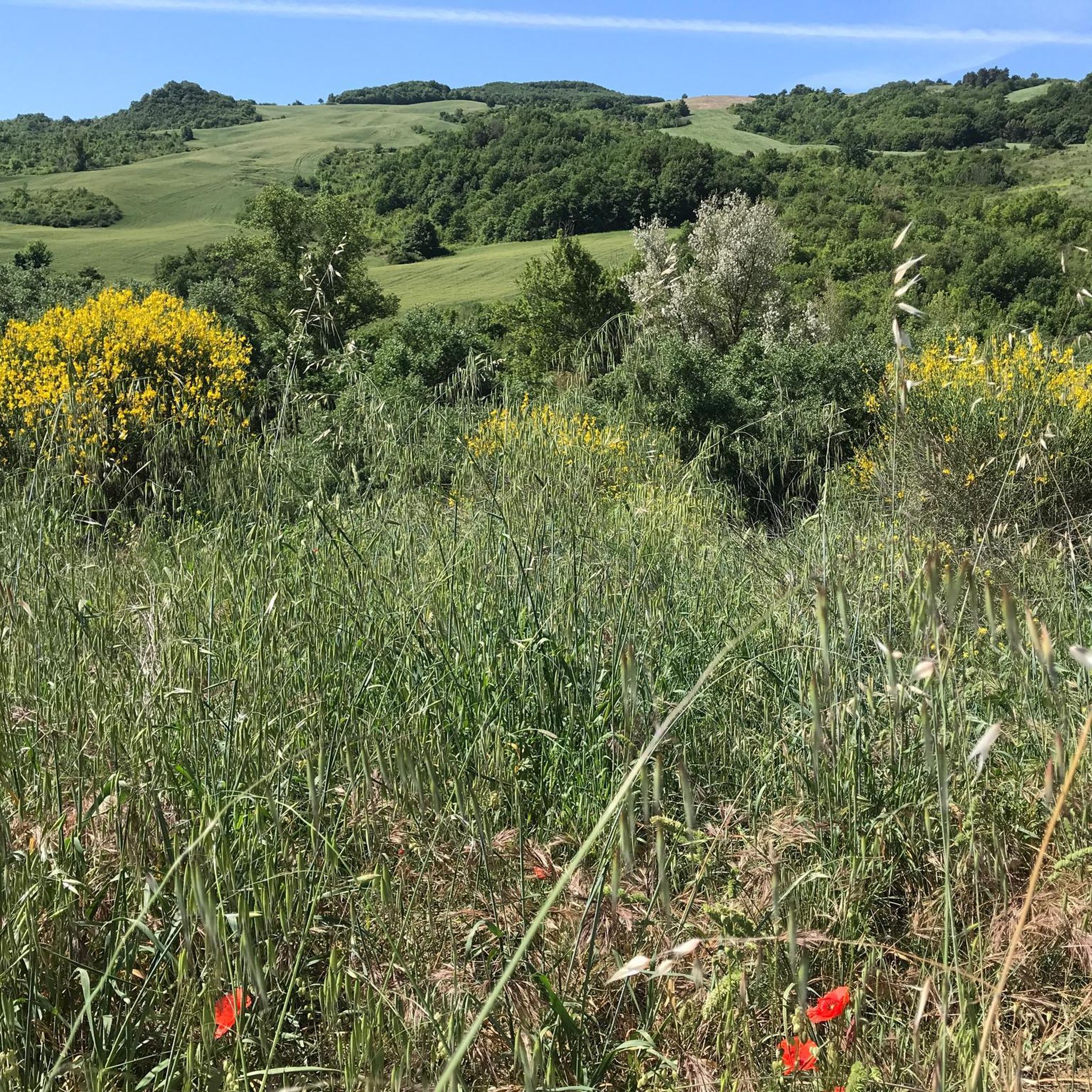
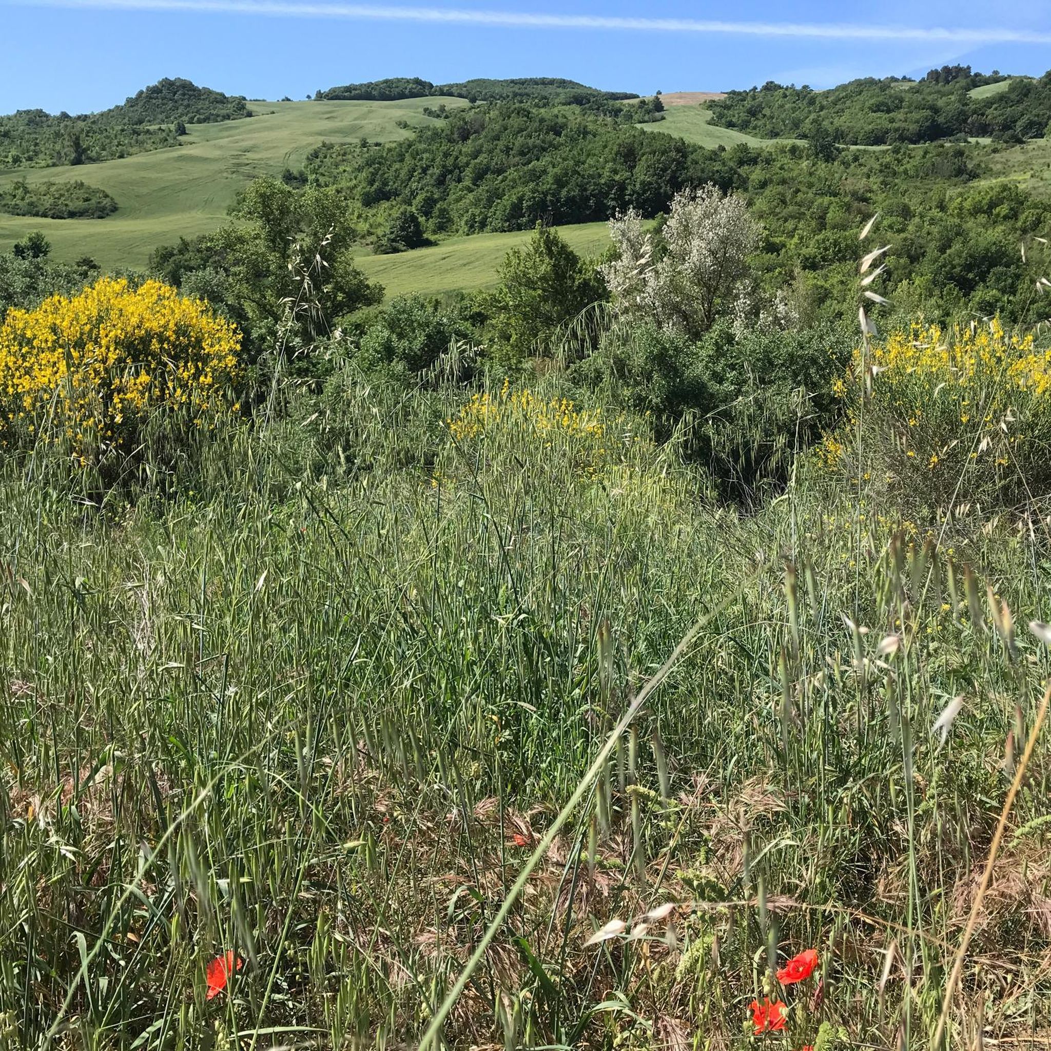
Mountain bike trails around Pietracatella traverse a diverse landscape characterized by hilly and mountainous terrain. The area features extensive cereal fields, vineyards, and olive groves, alongside fluvial vegetation along the Tappino stream. Riders can expect to encounter white willow woods and potential white oak woods, providing varied natural settings. The town itself is situated on a rocky spur, offering elevated perspectives of the surrounding countryside.
Best mountain bike trails in Pietracatella
- The most popular mountain bike trail is Lago di Occhito, Celenza Valfortore e Carlantino – giro ad anello, a 25.1 miles (40.3 km) moderate trail that takes 3 hours 22 minutes to complete, circling Lago di Occhito.
- Another top favourite among local mountain bikers is Tour of Lago di Occhito and Sant'El, a difficult 26.6 miles (42.8 km) path exploring the varied terrain around Lago di Occhito.
- Local mountain bikers also love the Tufara, Gambatesa, and Lake Occhito Loop, a 19.5 miles (31.3 km) trail leading through agricultural fields and woodlands, often completed in about 3 hours 5 minutes.
- Mountain biking around Pietracatella is defined by hilly and mountainous topography, agricultural fields, and woodlands. The network offers options for different ability levels, from moderate to difficult.
- The routes in Pietracatella are highly rated by the komoot community with an average score of 3.0 stars from more than 2 reviews. More than 10 mountain bikers have used komoot to explore Pietracatella's varied terrain.
Last updated: May 19, 2026
5
riders
40.3km
03:23
790m
790m
Moderate mountain bike ride. Good fitness required. Advanced riding skills necessary.
1
riders
42.8km
03:33
930m
930m
Hard mountain bike ride. Very good fitness required. Advanced riding skills necessary.

Sign up for free
31.3km
03:05
1,000m
1,000m
Hard mountain bike ride. Very good fitness required. Advanced riding skills necessary.
17.1km
01:32
460m
460m
Moderate mountain bike ride. Good fitness required. Advanced riding skills necessary.
3.0
(2)
11
riders
56.5km
05:01
1,180m
1,190m
Hard mountain bike ride. Very good fitness required. Advanced riding skills necessary. Some portions of the route may require you to push your bike.
Get access to more routes and recommendations from other explorers.
Sign up for free
Already have an account?
Our route recommendations are based on thousands of hikes, rides, and runs completed by other people on komoot.
Start today with a free account
Your next adventure awaits.
Login or Signup
Popular around Pietracatella
Tips from the Community

Let me start by saying that I did a complete tour of the lake starting from the crossroads on the state road to Tufara and then going back up towards Celenza Valfortore. As far as I'm concerned, I preferred the Apulian side to the Molise side, both for the panorama and for the "quality" of the road. I suggest turning around at the barrier (Puglia side) since at a certain point there is no practicable route. We took absurd gambles in the middle of bushes full of thorns. Furthermore, according to the operators of the barrier, you have to call the consortium and get a permit to be able to cross.
0
0
Let me start by saying that I did a complete tour of the lake. The Apulian side is more beautiful than the Molise side. I suggest turning around at the barrier as at a certain point there is no viable route. We took absurd gambles in the middle of bushes full of thorns. Furthermore, according to the operators of the barrier, you have to call the consortium and get a permit to be able to cross.
0
0

Lago di Occhito is a fascinating artificial lake located in the Molise region of Italy. Surrounded by stunning landscapes and a variety of flora and fauna, it offers an ideal location for outdoor activities such as bird watching and fishing. https://puglia.com/celenza-valforte-e-lago-di-occhito
0
0
Tufara is a picturesque village in the heart of Molise, with a medieval atmosphere that fascinates visitors. Its jewel is the Castello di Tufara, an imposing fortress dating back to the 12th century, which majestically dominates the surrounding valley. With its ancient walls and thousand-year history, the castle offers a fascinating experience and a breathtaking panorama, transporting visitors back in time.
0
0
Bosco Pianelle is a splendid protected natural area located in Molise, Italy. Characterized by large wooded extensions, it offers the opportunity to immerse yourself in nature and to enjoy the local flora and fauna. Ideal for excursions and outdoor activities.
1
0
Campodipietra is an Italian town with 2 433 inhabitants, located in the province of Campobasso, Molise. Its historic center rests on a rock overhanging a ravine called "fosso a basso". The area is rich in watercourses and springs, with a hilly landscape. Campodipietra was a strategic crossroads for the Lucera-Castel di Sangro tratturo, a transhumance route between Abruzzo and Puglia. https://it.wikipedia.org/wiki/Campodipietra
0
0
The convent of Santa Maria di Loreto in Toro, branch house of San Giovanni ai Gelsi in Campobasso, was founded in 1592 with donations from the people and subsequently suppressed in 1866. The friars returned there in 1918 and since 1979 have pastorally assisted the parish of SS. Savior. Currently, the convent houses a motor rehabilitation centre. https://www.ofmpugliamolise.it/convents/11-santa-maria-di-loreto
0
0
The "Italic Temple of San Giovanni in Galdo" is an ancient Italic temple located outside the center of San Giovanni in Galdo, in the province of Campobasso. Built around the 3rd century BC, it features a quadrangular plan with a pronaos and a single row of columns surrounding the sacred cell. Discovered in the 1990s, it was abandoned in the 3rd century AD, when a new medieval center was rebuilt further downstream. https://it.wikipedia.org/wiki/Tempio_italico_di_San_Giovanni_in_Galdo
0
0
Frequently Asked Questions
How many mountain bike trails are available around Pietracatella?
There are 6 mountain bike trails available around Pietracatella on komoot. These routes offer a diverse range of experiences, from moderate to difficult, exploring the region's varied landscapes.
What kind of terrain can I expect on mountain bike trails in Pietracatella?
Mountain bike trails in Pietracatella traverse a diverse landscape. You can expect hilly and mountainous topography, extensive cereal fields, vineyards, and olive groves. Routes also follow the Tappino stream, featuring fluvial vegetation like white willow woods and potential white oak woods. The town itself is perched on a rocky spur, offering elevated perspectives of the surrounding countryside.
What are the difficulty levels of mountain bike trails in Pietracatella?
The mountain bike trails around Pietracatella offer a range of difficulty levels. You'll find 3 moderate routes and 3 difficult routes, catering to different skill sets. There are currently no easy routes listed.
When is the best time of year to go mountain biking in Pietracatella?
The region offers splendid views, particularly during the spring and summer months, making these seasons ideal for mountain biking. The pleasant weather and vibrant natural scenery enhance the riding experience.
Are there any circular mountain bike routes in Pietracatella?
Yes, many of the trails around Pietracatella are circular. For example, you can explore the Lago di Occhito, Celenza Valfortore e Carlantino – giro ad anello, a moderate 40.3 km loop, or the more challenging Tufara, Gambatesa, and Lake Occhito Loop, which is 31.3 km.
What can I see along the mountain bike trails around Pietracatella?
Many trails offer scenic views and pass by notable landmarks. You can ride around Lago di Occhito, a significant lake in the area, or pass through charming settlements like Campodipietra Village. There are also viewpoints such as Santa Maria Regina della Pace viewpoint, offering panoramic vistas of the landscape.
Are there any longer, more challenging mountain bike routes for experienced riders?
Yes, for experienced riders seeking a challenge, routes like the Lago di Occhito – Castello Di Capua loop from Gambatesa offer a difficult 57.3 km ride with significant elevation changes. Another demanding option is the Tour of Lago di Occhito and Sant'El, a difficult 42.8 km path exploring varied terrain.
What do other mountain bikers enjoy most about mountain biking in Pietracatella?
The routes in Pietracatella are rated by the komoot community with an average score of 3.0 stars. Riders often appreciate the diverse terrain, from agricultural fields to woodlands, and the scenic beauty around Lago di Occhito.
Are there any shorter or moderate mountain bike trails suitable for a quicker ride?
Yes, for a quicker, moderate ride, consider the Campodipietra and Italic Temple Loop. This route is 17.1 km long and can typically be completed in under 2 hours, offering a good option for a shorter excursion.
What are some natural features to look out for while mountain biking in the area?
The region is rich in natural beauty. You'll encounter extensive cereal fields, vineyards, and olive groves. Along the Tappino stream, look for fluvial vegetation, including white willow woods, and potentially white oak woods. The hilly and mountainous topography itself provides dynamic landscapes and splendid views.
Are there any historical points of interest accessible by mountain bike?
While specific routes to historical sites are not detailed, the region around Pietracatella is dotted with historical elements. The town itself is on the ancient 'Morgia' rocky spur. You might encounter remnants of ancient buildings, such as the monastery of Villa Grimaldi or old taverns along historic sheep-tracks, providing intriguing destinations for those exploring the countryside.
Most popular routes around Pietracatella
Most popular attractions around Pietracatella

Get inspired with the komoot mobile app


Explore more
Browse the best MTB trails in other regions.
