The best road cycling routes around Gambatesa
4.3
(6)
34
riders
5
rides
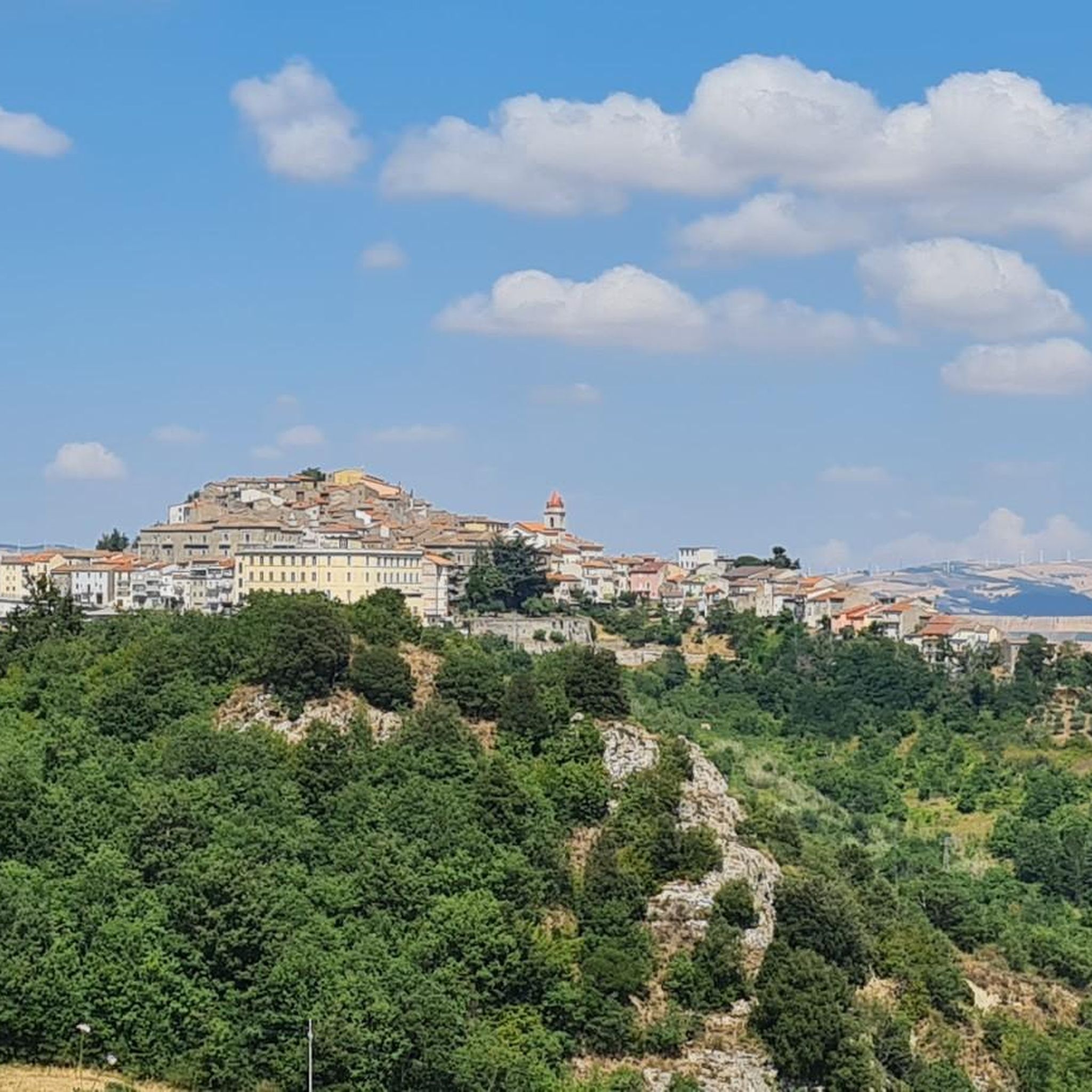
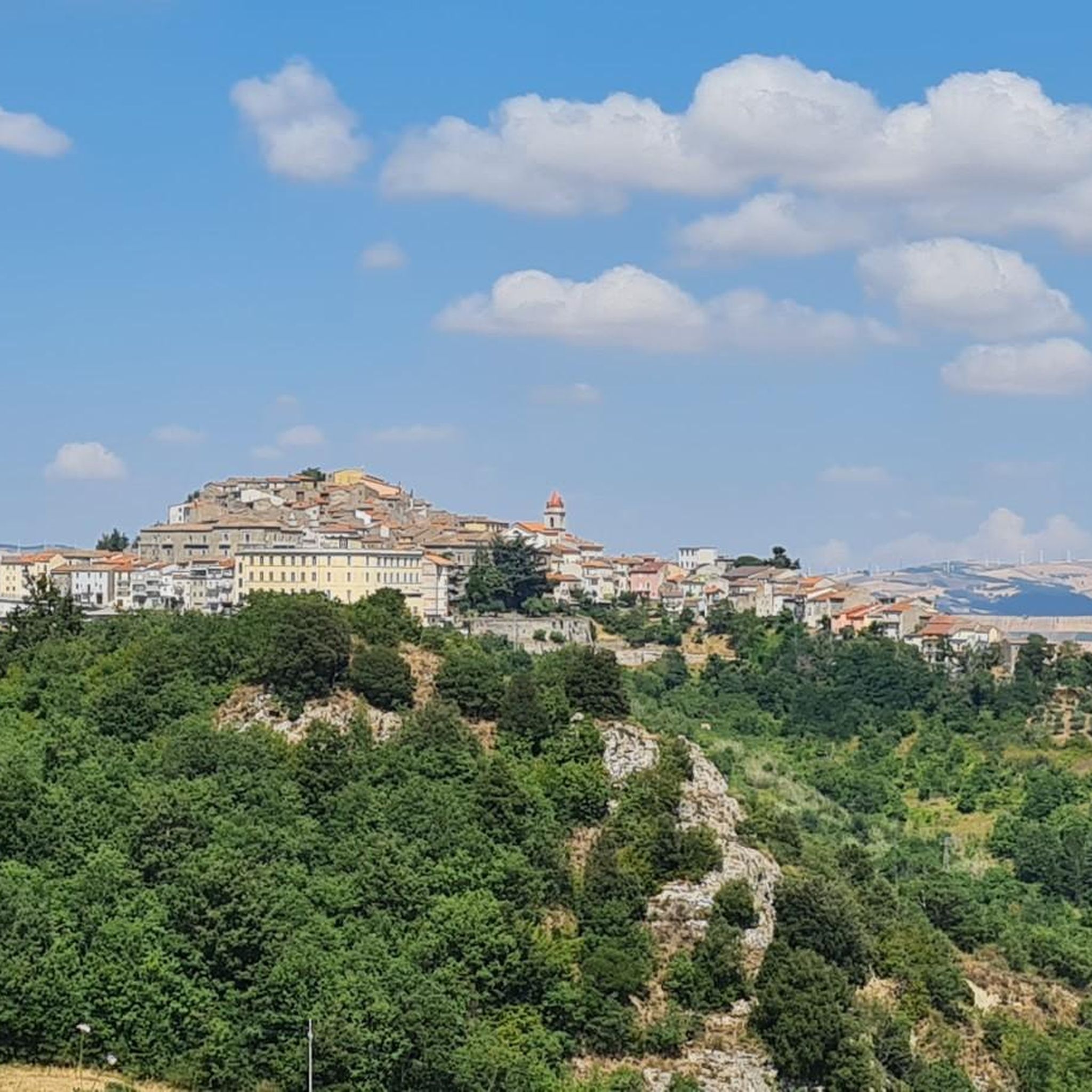
Road cycling routes around Gambatesa are characterized by a hilly topography, offering varied terrain with both challenging ascents and scenic descents. The region features prominent natural attractions such as Lake Occhito, one of Europe's largest artificial reservoirs, surrounded by diverse flora including oaks and maritime pines. The landscape also includes the Fortore River and ancient drovers' tracks, indicating extensive, undulating paths. This combination of natural features provides a diverse environment for road cyclists.
Best road cycling routes around Gambatesa
- The…
Last updated: July 4, 2026
4.5
(2)
9
riders
88.2km
04:35
1,590m
1,590m
Hard road ride. Very good fitness required. Mostly well-paved surfaces and easy to ride.
5
riders
40.1km
02:03
680m
680m
Moderate road ride. Good fitness required. Mostly well-paved surfaces and easy to ride.

Sign up for free
7
riders
47.1km
02:31
870m
870m
Moderate road ride. Good fitness required. Mostly well-paved surfaces and easy to ride.
5.0
(2)
4
riders
25.3km
01:23
490m
490m
Moderate road ride. Good fitness required. Mostly well-paved surfaces and easy to ride.
6
riders
50.5km
02:35
810m
810m
Moderate road ride. Good fitness required. Mostly well-paved surfaces and easy to ride.
Our route recommendations are based on thousands of hikes, rides, and runs completed by other people on komoot.
Start today with a free account
Your next adventure awaits.
Login or Signup
Popular around Gambatesa

Tips from the Community

Small bridge near Mirabello Sannitico where you can see the Tappino river
0
0
Molise village surrounded by greenery, it has small challenging climbs in the surrounding area that make it interesting to see by bike
0
0

Campodipietra is an Italian town with 2 433 inhabitants, located in the province of Campobasso, Molise. Its historic center rests on a rock overhanging a ravine called "fosso a basso". The area is rich in watercourses and springs, with a hilly landscape. Campodipietra was a strategic crossroads for the Lucera-Castel di Sangro tratturo, a transhumance route between Abruzzo and Puglia. https://it.wikipedia.org/wiki/Campodipietra
0
0
Sant'Elia a Pianisi is an Italian comune in Molise, with a population of 1,554 inhabitants. It is famous for a Franciscan convent dedicated to Padre Pio, who visited it in the early 1900s as a boarding school. https://www.comune.santeliaapianisi.cb.it/hh/index.php
1
0

Hills and cultivated fields, the typical characteristic landscape of Molise. Gildone can be reached easily from Campobasso by tackling easy slopes.
0
0
Most important city of Molise and capital of the region. Built at the foot of the Monforte hill where the homonymous castle stands, symbol of the city.
1
0

Beautiful stretch of 5 hairpin bends overlooking Gambatesa. Road surface in fair condition. I've done it downhill, but I promised myself to do it uphill
0
0
Jelsi is a village to be discovered. Famous for the grain festival.
0
0
Frequently Asked Questions
How many road cycling routes are available around Gambatesa?
There are 6 road cycling routes around Gambatesa listed on komoot, offering a variety of experiences for cyclists.
What kind of terrain can I expect on road cycling routes in Gambatesa?
The region is characterized by a hilly topography, providing varied terrain with both challenging ascents and rewarding descents. You can expect scenic vistas of the surrounding countryside, including views of the Fortore and Tappino valleys, and the serene Lago di Occhito.
Are there any routes suitable for advanced road cyclists seeking a challenge?
Yes, Gambatesa offers several challenging routes. For instance, the Arch of Trajan (Benevento) – Arch of Trajan (Benevento) loop from Bosco Mazzocca is a difficult 107.9 km trail with significant elevation gain. Another demanding option is the View of Gildone – Morcone loop from Riccia, a 95.1 km path known for its extensive views and challenging climbs.
What natural attractions can I see along the road cycling routes?
Many routes offer views of the stunning Lago di Occhito, one of Europe's largest artificial reservoirs. The surrounding area is lush, thanks to the Fortore River, providing a verdant backdrop for your rides. You might also encounter the ancient Lucera–Castel di Sangro Drovers' Track, a historical route through rural landscapes.
Are there any historical landmarks or villages to explore on a road cycling trip?
Absolutely. The village of Gambatesa itself boasts a charming historic center, including the medieval Capua Castle with its 16th-century frescoes. Other notable sites include the parish Church of San Bartolomeo Apostolo, the Church of San Nicola, and the Sanctuary of Maria SS della Vittoria. The castle's terrace offers incomparable views of Lago di Occhito and nearby villages, making it a rewarding stop.
Are there any circular road cycling routes in the area?
Yes, all the road cycling routes listed for Gambatesa are designed as loops. For example, the Baselice loop from Bosco Mazzocca is a 64.5 km trail that takes you through hilly terrain and brings you back to your starting point.
What is the best time of year for road cycling in Gambatesa?
Given the region's climate, spring (April-May) and autumn (September-October) are generally the most pleasant times for road cycling in Gambatesa. Temperatures are milder, and the landscapes are particularly beautiful, with blooming flora in spring and vibrant colors in autumn.
What do other road cyclists enjoy most about cycling in Gambatesa?
The area is highly rated by the komoot community, with an average score of 3.5 stars. Cyclists often praise the diverse and challenging hilly terrain, the panoramic views, and the opportunity to combine athletic engagement with visits to historical sites and natural beauty like Lago di Occhito.
Are there any shorter or moderate road cycling options available?
While many routes are challenging, you can find moderate options. The Gildone Village – View of Gildone loop from Toro is a moderate 39.5 km route, and the View of Campobasso – Road Closed Due to Landslide loop from Toro is another moderate 38.5 km option, both offering a good workout without the extreme distances of the more difficult trails.
Can I find places to eat or drink along the road cycling routes?
While specific cafes directly on every route are not detailed, the charming village of Gambatesa and other small towns you pass through are likely to offer local eateries and cafes where you can refuel and experience local Molise hospitality. Planning your route to include stops in these villages is recommended.
Is there information on parking availability for road cyclists?
Specific parking information for each route start is not provided in detail. However, as many routes start from or pass through villages like Bosco Mazzocca or Riccia, you can typically find public parking in these areas. It's advisable to check local parking regulations upon arrival.
Most popular routes around Gambatesa
Most popular attractions around Gambatesa

Get inspired with the komoot mobile app


Explore more
Browse the best Road cycling routes in other regions.
