The best walks and hikes around Irsina
4.6
(41)
203
hikers
26
hikes
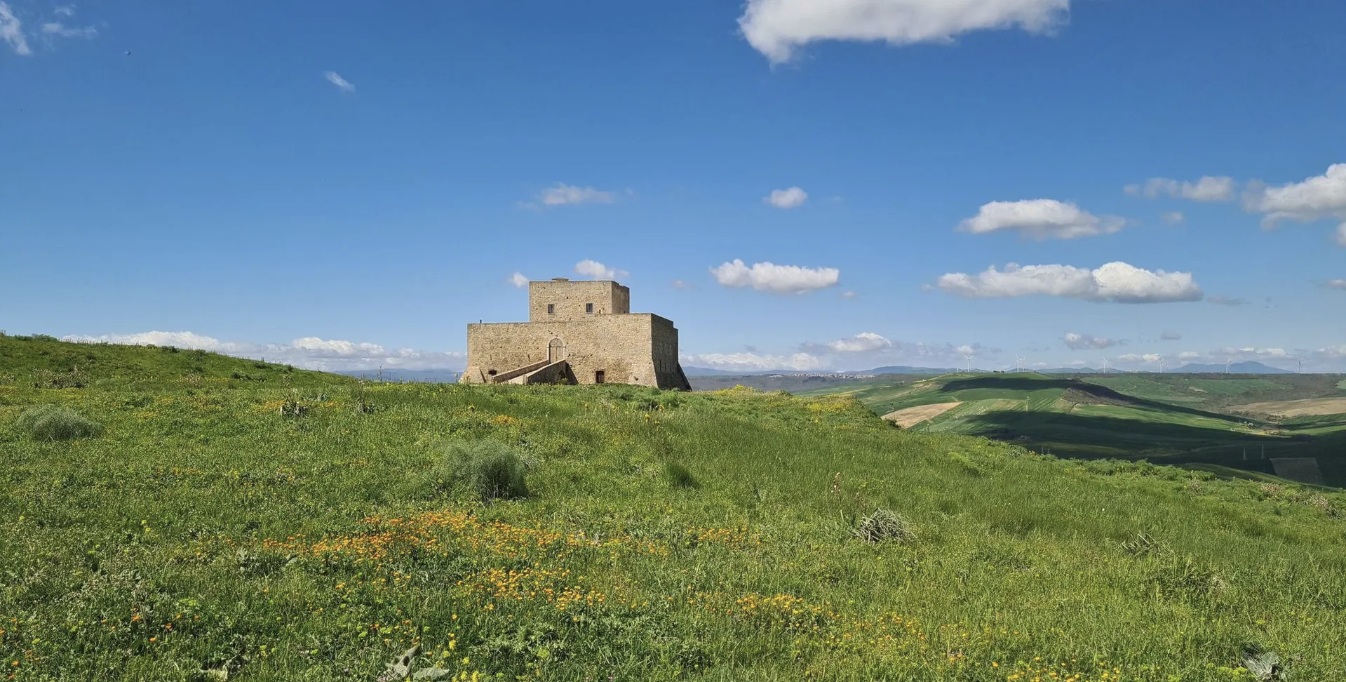
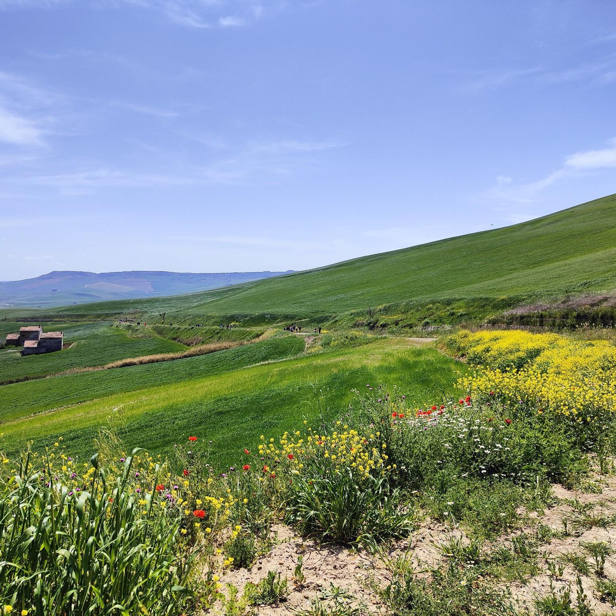
Hiking around Irsina offers diverse landscapes, including rolling hills, expansive olive groves, and vineyards characteristic of the Basilicata region. The town is situated on a hilltop, providing views of the Bradano Valley and the Murgia plateau. Prominent natural features include Monte Irsi, a wooded hill rising above wheat fields, and the Bradano River. The Verrutoli Woods, located approximately 10 kilometers from Irsina, provide a secluded environment for walks.
Best hiking trails around Irsina
- The most popular hiking route is Piazza…
Last updated: October 24, 2026
3
hikers
Hard hike. Very good fitness required. Easily walkable paths.
5.0
(2)
7
hikers
9.30km
02:34
160m
160m
Moderate hike. Good fitness required. Easily walkable paths.

5.0
(3)
19
hikers
25.6km
07:07
460m
460m
Hard hike. Very good fitness required. Easily walkable paths.
5.0
(2)
2
hikers
6.33km
01:44
100m
100m
Easy hike. Easily walkable paths.
2
hikers
8.84km
02:22
100m
100m
Moderate hike. Good fitness required. Easily walkable paths.
Get access to more routes and recommendations from other explorers.
Already have an account?
Our route recommendations are based on thousands of hikes, rides, and runs completed by other people on komoot.
Start today with a free account
Your next adventure awaits.

Other adventures around Irsina

Tips from the Community

There are no sources of water supply unless you find the QUERCUS refuge open, which we found closed (Sunday, around 1.20pm).
0
0
After an initial section of scrub and scorched woods (starting from the Pedicotta farmhouse), a path finally begins inside a forest: shade, animal and insect tracks.
0
0

The Sanctuary of Santa Maria di Picciano, located near Matera, is a place of profound spirituality and history. It houses an ancient image of the Madonna, a place of pilgrimage. Its architecture, blending Romanesque and Baroque elements, and its panoramic location make it a site of great charm, evoking centuries of devotion and meditation.
0
0

Route suitable for everyone
0
0
The sanctuary stands on a height of 440 meters on the border between Puglia and Basilicata. It is a place of worship managed by the Olivetan Benedictine monks.
1
0

One of the oldest towns in Basilicata, which stands on top of a rocky hill overlooking the Bradano and Basentello valleys. In the town there are several small churches and historic buildings built between the 16th and 17th centuries. The majestic cathedral of Santa Maria Assunta, dating back to the 13th century, is one of the most important monuments in the region, both for its architecture and for the works that adorn its interiors. Until the end of the nineteenth century, Irsina was called Montepeloso, a name that seems to derive from the Greek "plusus" ("fertile and rich land").
1
0

Arrival point 6th day Materan Way
0
2
Frequently Asked Questions
What types of landscapes can I expect to see while hiking around Irsina?
Hiking around Irsina offers diverse scenery, including picturesque rolling hills, expansive olive groves, and lush vineyards, characteristic of the Basilicata region. The town itself is perched on a hilltop, providing panoramic views of the Bradano Valley and the Murgia plateau. You'll also encounter natural features like Monte Irsi, a wooded hill rising above vast wheat fields, and the meandering Bradano River.
Are there hiking trails suitable for beginners or those looking for an easy walk?
Yes, Irsina offers several easy trails. Out of the 19 available routes, 6 are classified as easy, providing gentle strolls through the rural landscape. These paths are perfect for enjoying the tranquil surroundings without significant elevation changes.
What are some notable landmarks or attractions I can see along the hiking routes near Irsina?
Several routes incorporate interesting landmarks. For instance, the Piazza Benedetto XIII – Gravina Aqueduct Bridge loop from Serra Carvotta features the majestic 17th-century Aqueduct Bridge of Gravina in Puglia. Other nearby attractions include the Historic Center of Grottole, Monteserico Castle, and the Gravina in Puglia Historic Center and Roman Aqueduct.
Are there any circular hiking routes available in the Irsina area?
Yes, many of the trails around Irsina are designed as loops, allowing you to start and end in the same location. Examples include the Irsina – First Summit of Monte Pollino loop from Irsina and the Grassano Historical Center – Nativity Scene of Grassano loop from Grassano, offering convenient options for exploration.
What do other hikers say about the trails in Irsina?
The hiking trails around Irsina are highly regarded by the komoot community, with an average rating of 4.6 stars from over 35 reviews. Hikers often praise the varied terrain, the stunning panoramic views from the hilltop town, and the peaceful atmosphere of the olive groves and vineyards.
Can I find longer, more challenging hikes around Irsina?
Absolutely. For those seeking a greater challenge, there are 3 difficult routes available, including the Piazza Benedetto XIII – Gravina Aqueduct Bridge loop from Rifugio Bosco Difesa Grande, which spans over 24 kilometers with significant elevation gain. Another demanding option is the Hiking loop from Serra Carbonara, covering over 25 kilometers.
Are there any specific areas for a more secluded hiking experience near Irsina?
Yes, approximately 10 kilometers from Irsina, you can find the Verrutoli Woods. This area offers a more secluded and tranquil environment, ideal for those looking for a quieter walk or a peaceful day trip away from the main routes.
What is the best time of year to go hiking in Irsina?
The region's landscape, particularly the vast wheat fields, shifts in color from vibrant green to golden yellow throughout the seasons, offering a visually stunning spectacle. Spring and autumn generally provide the most comfortable temperatures for hiking, with pleasant weather and beautiful natural colors. Summer can be warm, but early mornings or late afternoons are still enjoyable.
Are there any trails that offer views of Monte Irsi?
Yes, Monte Irsi itself is a prominent natural feature, a wooded hill rising above vast wheat fields. Trails in the vicinity, such as the Irsina – First Summit of Monte Pollino loop from Irsina, offer views of this distinctive landmark and the surrounding agricultural landscape.
How many hiking routes are there in total around Irsina?
There are 19 hiking routes available around Irsina, catering to various fitness levels. These include 6 easy, 10 moderate, and 3 difficult trails, ensuring options for every type of hiker.
Can I combine hiking with exploring the local culture or history in Irsina?
Absolutely. The historic center of Irsina itself, with its medieval structure, narrow cobbled streets, and ancient walls, is a scenic starting point or a delightful destination after a day of outdoor exploration. Many routes pass through or near historical sites, allowing you to combine physical activity with an exploration of Irsina's rich history.
Are there any trails that follow the Bradano River?
The Bradano River meanders through the region, with vineyards and olive groves sloping down towards its banks. While specific named trails directly along the river are not detailed, many countryside walks in the area will bring you close to its course, offering views of the river and its surrounding agricultural landscape.
Most popular attractions around Irsina

Get inspired with the komoot mobile app


Explore more
Browse the best Hikes in other regions.
