The best walks and hikes around Bagnara Calabra
4.2
(163)
758
hikers
27
hikes
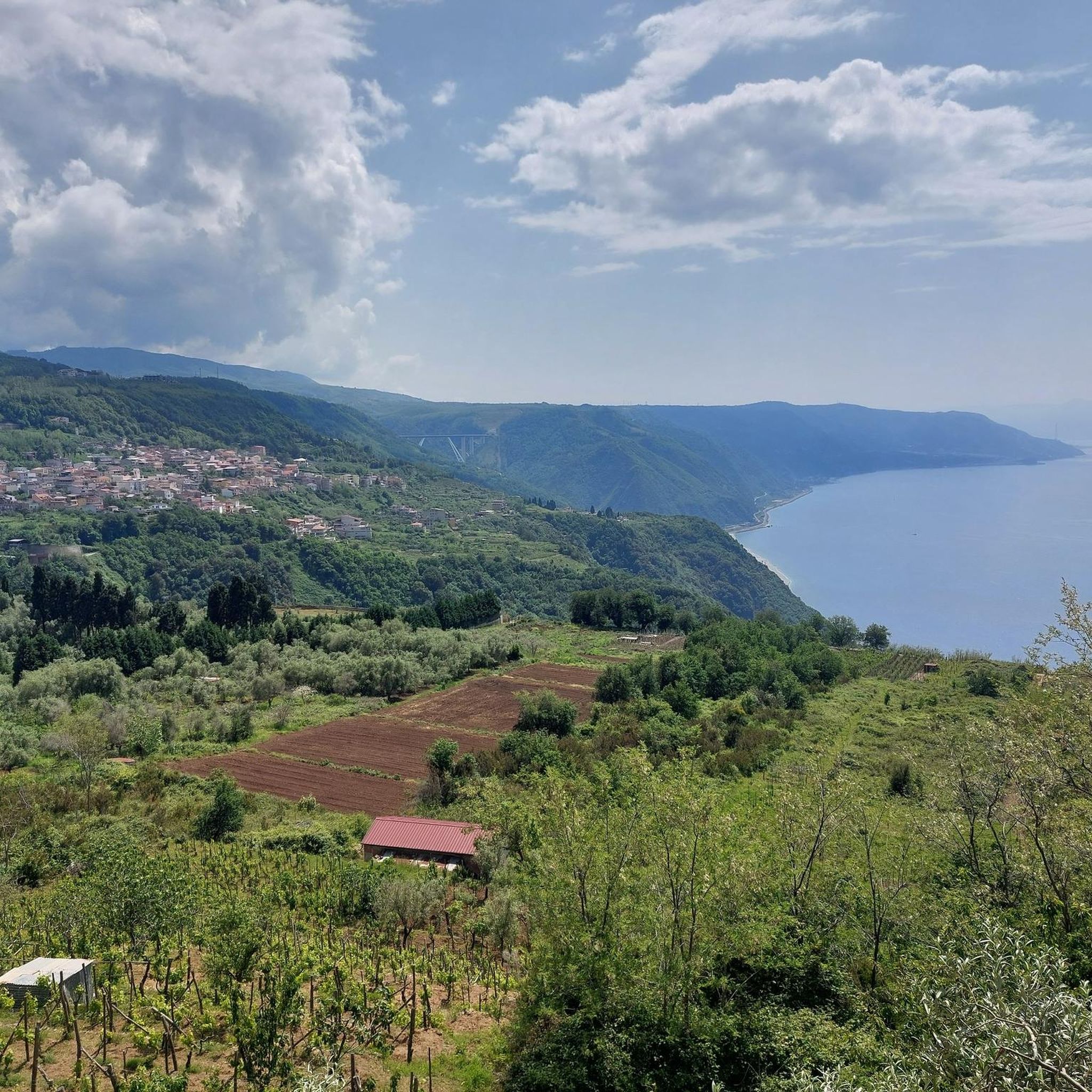
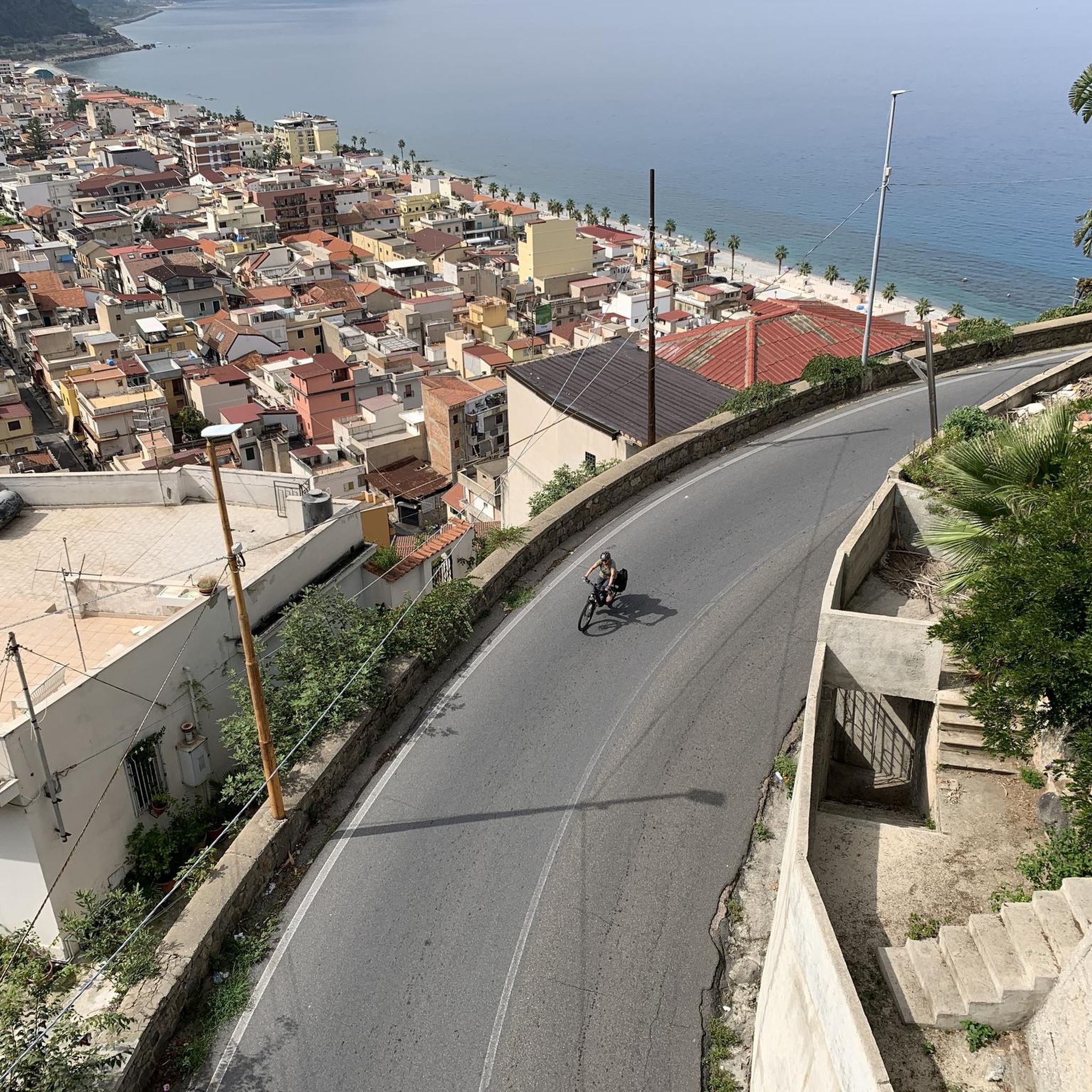
Hiking around Bagnara Calabra offers diverse terrain where the Aspromonte mountains meet the Tyrrhenian Sea. The region features dramatic coastal cliffs, dense forests, and deep river canyons. Trails provide access to both the rugged mountain landscapes of Aspromonte National Park and the scenic coastline known as Costa Viola. This unique geography allows for varied hiking experiences, from challenging mountain ascents to coastal walks.
Best hiking trails around Bagnara Calabra
- The most popular hiking route is Monte Sant'Elia – loop tour, a 6.1 miles (9.8 km) trail that takes 3 hours 1 minute to complete. This moderate route offers panoramic views and is a popular choice for a moderate challenge.
- Another top favourite among local hikers is View of Marinella di Palmi – Sant'Elia Church, Palmi loop from Palmi, an easy 2.8 miles (4.5 km) path. This trail provides views of Marinella di Palmi and the Sant'Elia Church.
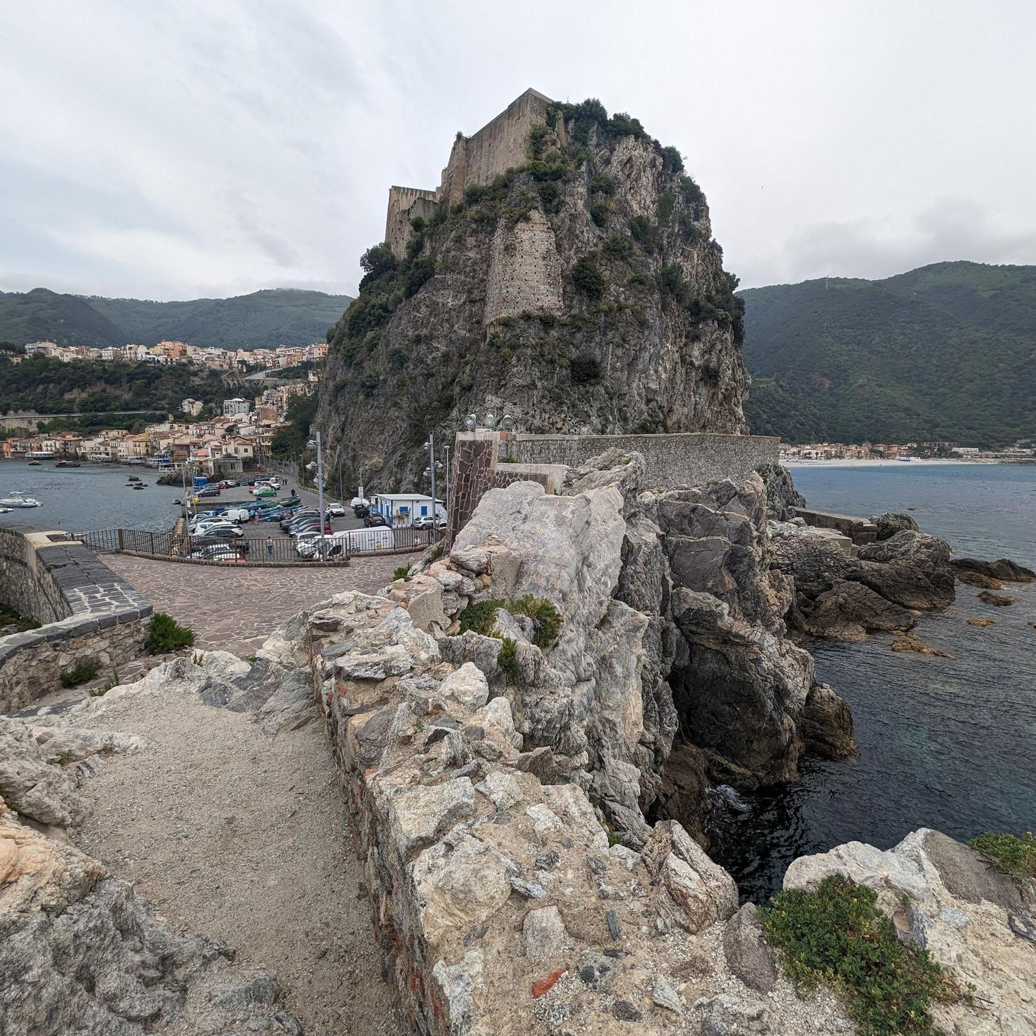
- Local hikers also love the Scilla and Castello Ruffo – Scilla Fishing Harbor loop from Scilla, a 1.7 miles (2.7 km) trail leading through coastal areas and historic sites, often completed in about 49 minutes.
- Hiking around Bagnara Calabra is defined by coastal paths, mountain trails within Aspromonte National Park, and routes offering views of the Tyrrhenian Sea. The network offers options for different ability levels, from easy walks to more challenging climbs.
- The routes in Bagnara Calabra are highly rated by the komoot community with an average score of 4.2 stars from over 90 reviews. More than 400 hikers have used komoot to explore Bagnara Calabra's varied terrain.
Last updated: August 14, 2026
4.7
(73)
255
hikers
9.83km
03:02
360m
360m
Embark on the Monte Sant'Elia loop tour, a moderate hike that rewards you with spectacular panoramic views over the Costa Viola. This route covers 6.1 miles (9.8 km) with an elevation gain of 1167 feet (356 metres), taking approximately 3 hours and 1 minute to complete. You will traverse varied terrain, from Mediterranean scrub and wooded areas with maritime pines to narrow paths, all leading to exceptional vistas of Sicily and active volcanoes like Etna and Stromboli from the lookout point with three crosses.
This trail requires good fitness and sure-footedness, as you will encounter sections with easy climbing and potentially overgrown paths. Some parts of the route, particularly during the descent towards Palmi, can be narrow and dense with fern or thorny brambles. Recent reports suggest that certain sections might be impassable due to collapses or very high vegetation, so it is wise to check current conditions before you plan your visit. Consider hiking in June to experience dreamlike flower meadows.
Monte Sant'Elia is famously known as the "balcony on the Tyrrhenian Sea," offering one of the world's most beautiful panoramas thanks to its unique geological conformation. Historically, the mountain, once called "Aulinas," holds significance with the Byzantine monk Elias the Younger, who founded a coenoby here in the 9th century AD. The trail's path along the Costa Viola, a designated Special Protection Area, also highlights its ecological value, while ancient tales like the "Legend of the Devil's Stone" enrich the cultural journey.
4.7
(41)
156
hikers
12.5km
03:39
340m
340m
Moderate hike. Good fitness required. Easily-accessible paths. Suitable for all skill levels.

Sign up for free
4.3
(3)
31
hikers
2.77km
00:50
90m
90m
Easy hike. Great for any fitness level. Easily-accessible paths. Suitable for all skill levels.
4.5
(2)
9
hikers
4.46km
01:35
270m
270m
Easy hike. Great for any fitness level. Easily-accessible paths. Suitable for all skill levels.
4.0
(4)
18
hikers
6.07km
01:43
120m
120m
Easy hike. Great for any fitness level. Easily-accessible paths. Suitable for all skill levels.
Get access to more routes and recommendations from other explorers.
Sign up for free
Already have an account?
Our route recommendations are based on thousands of hikes, rides, and runs completed by other people on komoot.
Start today with a free account
Your next adventure awaits.
Login or Signup

Tips from the Community

In Greek mythology, Scylla is a terrifying man-eating sea monster that resides in a cave within a cliff in the Strait of Messina, on the Calabrian side, exactly opposite the destructive whirlpool of Charybdis. Her name derives from the Greek Skýlla, linked to the root for "bitch" or "shark", evoking the sinister sound of waves crashing against the rocks.
1
0
Scilla, defined as the "Pearl of the Violet Coast", is one of the most fascinating and myth-rich villages in all of Calabria, dominated by the majestic Ruffo Castle which stands on an imposing rocky promontory overlooking the Strait of Messina. This rocky spur divides the coastline into the two souls of the town: the splendid beach of Marina Grande on one side and the ancient fishing village of Chianalea on the other.
1
0
The Church of Maria Santissima Immacolata (also known as Chiesa Matrice) is the main religious building in Scilla, located in an exceptional panoramic position in Piazza Castello, right below Ruffo Castle and with a direct view of the Calabrian sea.
0
0
Chianalea di Scilla is a charming fishing village in the province of Reggio Calabria, famous as the "little Venice of the South". Here, the ancient fishermen's houses rise directly on the rocks and the sea waves lap at the thresholds, creating a suggestive landscape where boats are moored where streets would otherwise be. Beating heart of the Costa Viola, this Calabrian jewel offers an authentic experience and a dive into history and myth
2
0

Beautiful church
5
0
Chiana is very beautiful to look at
5
0

Truly suggestive view of the coast from this square where three enormous Crosses are erected. The whole thing is reminiscent, with the necessary differences in type and structure, of the view enjoyed from Christ the Redeemer in Rio de Janeiro. A pity about the enormous radiotelephone antennas that spoil it a bit
0
0
Frequently Asked Questions
What types of hiking trails can I expect around Bagnara Calabra?
Bagnara Calabra offers a diverse range of hiking experiences, from coastal paths along the stunning Costa Viola to rugged mountain trails within the Aspromonte National Park. You'll find routes that combine sea views with forest exploration, and trails that lead through deep river canyons.
Are there easy hiking options suitable for beginners or families?
Yes, there are several easy hiking options. For example, the Scilla and Castello Ruffo – Scilla Fishing Harbor loop from Scilla is a shorter, easy coastal walk. Another accessible option is the View of Marinella di Palmi – Sant'Elia Church, Palmi loop from Palmi, which offers pleasant views with an easy difficulty grade. Overall, 13 of the 19 available routes are rated as easy.
What are some notable natural features or viewpoints to see while hiking?
The region is famous for its 'Violet Coast' (Costa Viola) with breathtaking sea views, especially of the Strait of Messina, Sicily, and the Aeolian Islands. You can explore the dramatic landscapes of the Aspromonte mountains and its national park, which features dense forests and river canyons. Don't miss the View of the Strait of Messina for panoramic vistas.
Are there any challenging hikes for experienced trekkers?
While many routes are easy to moderate, the Aspromonte mountains offer opportunities for more challenging excursions. The 'Sentiero dei Francesi' (The French Path) from Ceramida, for instance, is a challenging 6 km path with a significant elevation gain, leading to the historic Tunnel Murat and offering stunning views. There is 1 difficult route available in the area.
What is the best time of year to go hiking in Bagnara Calabra?
The best time for hiking in Bagnara Calabra is typically during the spring (April to June) and autumn (September to October). During these seasons, the weather is milder, making coastal walks and mountain trails more comfortable. Summers can be very hot, especially along the coast, while winters can bring cooler temperatures and occasional rain to the mountains.
Are there any circular hiking routes available?
Yes, many of the trails around Bagnara Calabra are designed as loops. A popular moderate circular route is the Monte Sant'Elia – loop tour, offering panoramic views. Another option is the Monte Sant'Elia – View of Marinella di Palmi loop from Palmi.
What attractions or landmarks can I visit near the hiking trails?
Beyond the natural beauty, you can explore historical sites and charming villages. The nearby picturesque fishing village of Scilla is a must-see, with its Chianalea district and the impressive Ruffo Castle of Scilla. The Tracciolino Trail itself is a notable attraction, offering spectacular coastal panoramas.
Is public transport available to reach hiking trailheads?
Bagnara Calabra is served by local transport, but access to specific trailheads, especially those deeper in the Aspromonte National Park, might require a car. For coastal trails or those starting from towns like Scilla or Palmi, local buses or trains might be an option. It's advisable to check local schedules for specific routes.
What do other hikers say about the trails in Bagnara Calabra?
The hiking trails in Bagnara Calabra are highly rated by the komoot community, with an average score of 4.2 stars from over 90 reviews. Hikers often praise the stunning coastal views, the diverse landscapes where mountains meet the sea, and the variety of routes suitable for different fitness levels.
Are there any dog-friendly trails in the area?
Many natural trails in the Aspromonte National Park and along the coast are generally dog-friendly, provided dogs are kept on a leash and owners clean up after them. It's always recommended to check specific trail regulations or local signage, especially in protected areas, to ensure a pleasant experience for everyone.
How long do hikes in Bagnara Calabra typically take?
Hike durations vary significantly depending on the route's length and difficulty. Shorter, easy coastal walks like the Scilla and Castello Ruffo – Scilla Fishing Harbor loop from Scilla can be completed in under an hour. Moderate trails, such as the Monte Sant'Elia – loop tour, typically take around 3 hours. Longer or more challenging routes in the mountains could take half a day or more.
Most popular attractions around Bagnara Calabra

Get inspired with the komoot mobile app


Explore more
Browse the best Hikes in other regions.
