The best walks and hikes in Serra Da Enciña Da Lastra
4.5
(423)
2,278
hikers
29
hikes
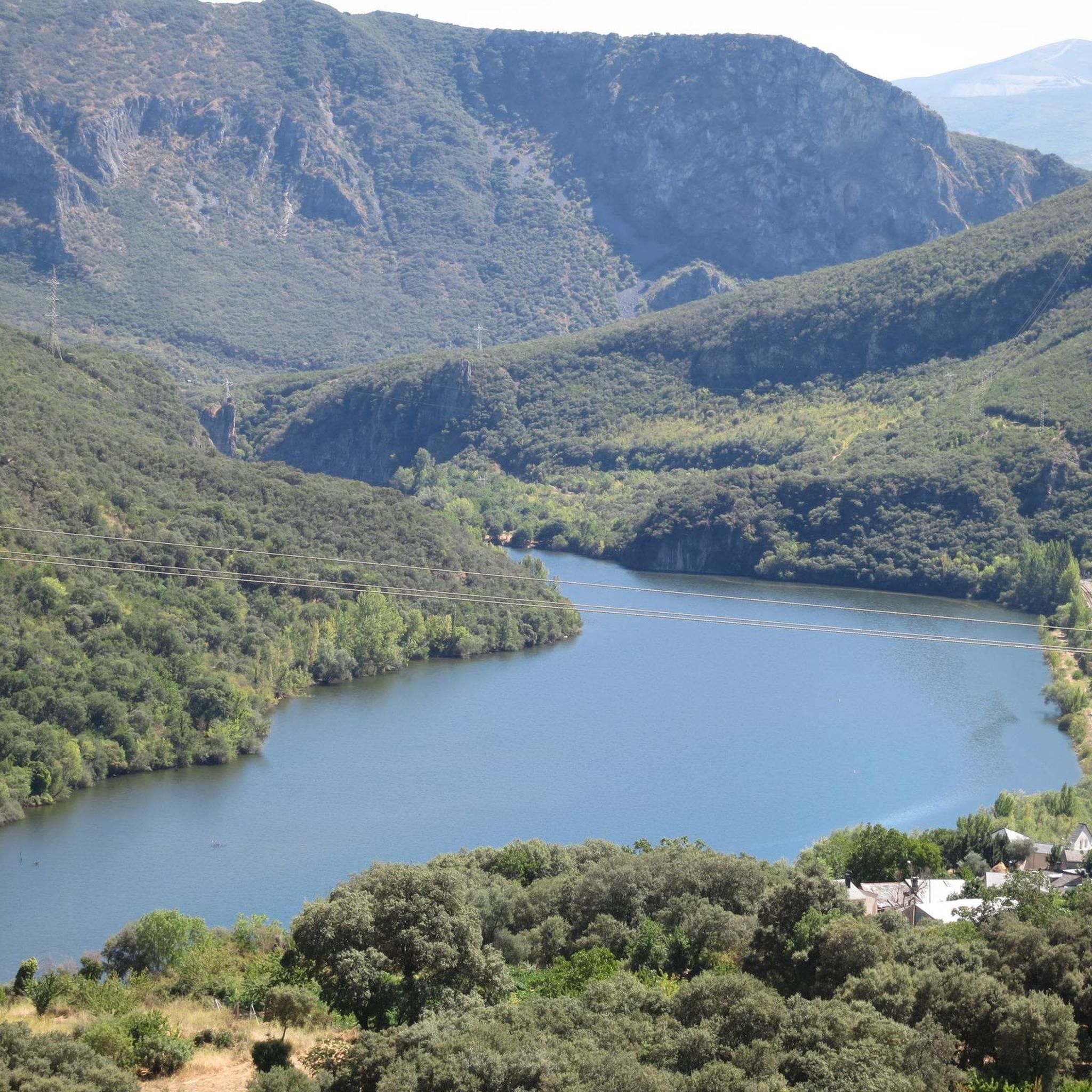
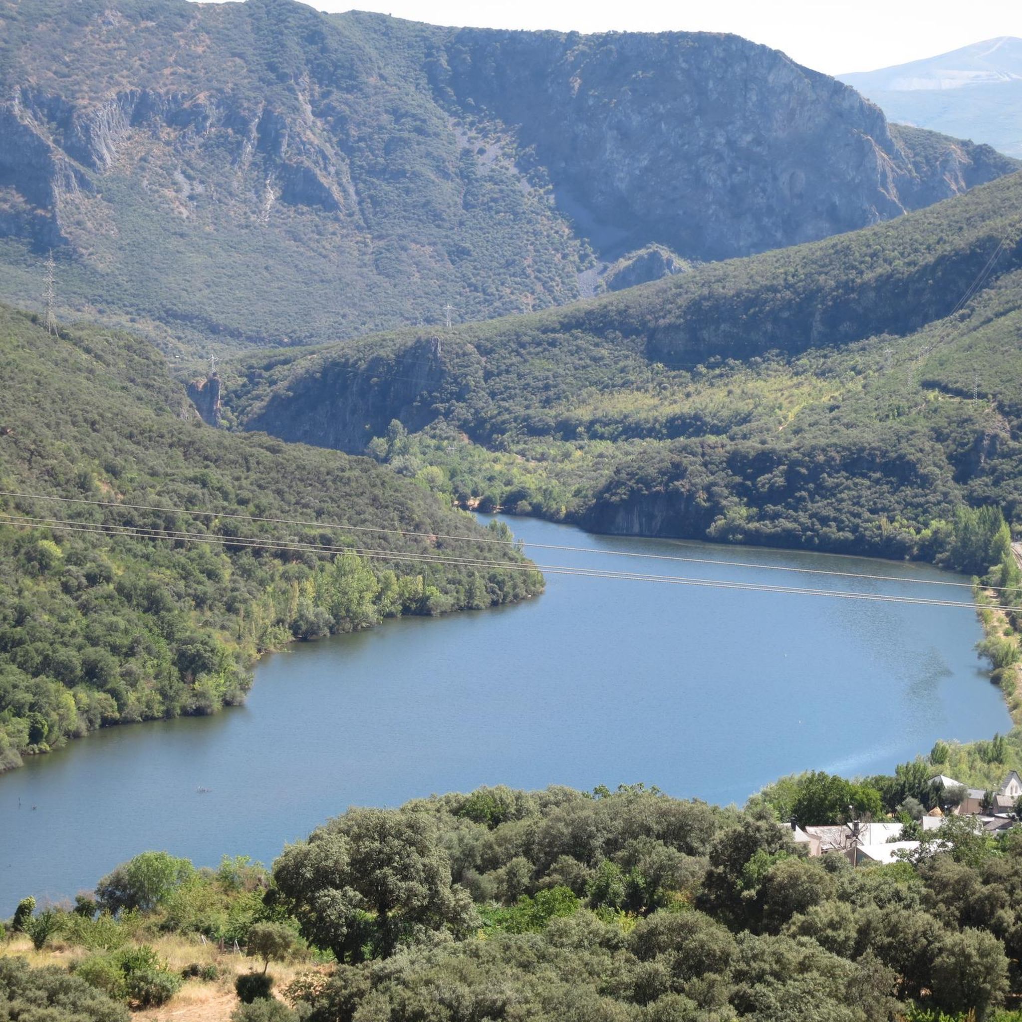
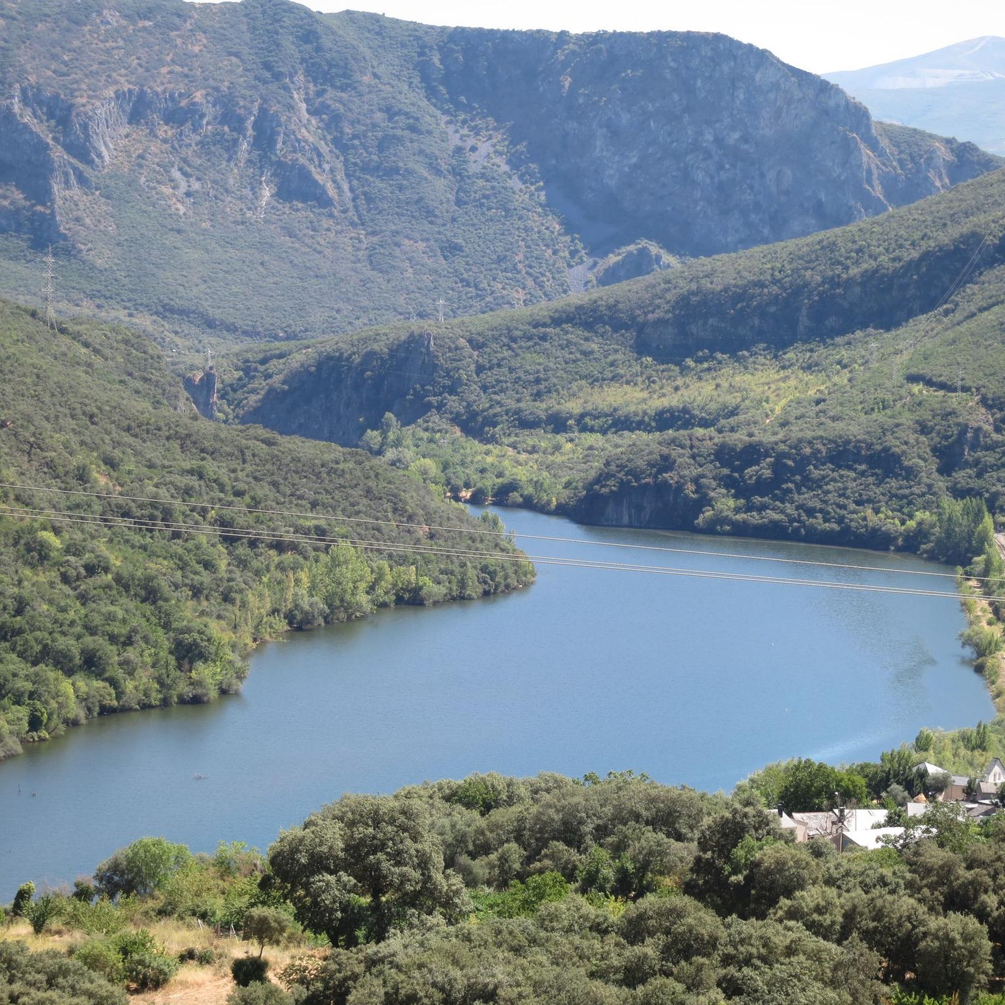
Hiking in Serra Da Enciña Da Lastra reveals a landscape distinct from much of Galicia, characterized by dramatic limestone peaks and deep valleys. The Sil River carves impressive gorges with cliffs up to 500 meters, creating a Mediterranean-like environment. This region features extensive holm oak woods, ancient chestnut groves, and diverse flora supported by its unique geology.
Best hiking trails in Serra Da Enciña Da Lastra
- The most popular hiking route is Sierra da Encina da Lastra – circular from…
Last updated: June 30, 2026
1
hikers
Moderate hike. Good fitness required. Mostly accessible paths. Sure-footedness required.
5.0
(1)
7
hikers
Easy hike. Great for any fitness level. Easily-accessible paths. Suitable for all skill levels.

Sign up for free
5.0
(2)
7
hikers
6.70km
02:00
210m
210m
Easy hike. Great for any fitness level. Easily-accessible paths. Suitable for all skill levels.
4.8
(87)
439
hikers
10.2km
03:28
350m
350m
Moderate hike. Good fitness required. Mostly accessible paths. Sure-footedness required.
3.7
(3)
35
hikers
3.79km
00:59
20m
20m
Easy hike. Great for any fitness level. Easily-accessible paths. Suitable for all skill levels.
Get access to more routes and recommendations from other explorers.
Sign up for free
Already have an account?
Our route recommendations are based on thousands of hikes, rides, and runs completed by other people on komoot.
Start today with a free account
Your next adventure awaits.
Login or Signup
Tips from the Community

The Mirador de Orellán is a spectacular observation point located in the town of Orellán, in the municipality of Borrenes, León. This viewpoint offers stunning panoramic views of the cultural landscape of Las Médulas, an ancient Roman gold mining complex declared a World Heritage Site by UNESCO. Near the viewpoint, you can visit the underground galleries that were part of the Roman gold mining system. Entry costs €3 and a helmet with headlamp is provided for the visit.
7
0
La Cuevona and La Encantada are two impressive places in Las Médulas, an area with a rich mining history and a unique landscape. The Cave: It is a gallery dug into the mountain, part of the ancient network of tunnels and galleries used in Roman mining exploitation. It has the highest height of all the existing galleries in Las Médulas. It is an important reference point for those exploring the Las Valiñas path. As you pass in front of La Cuevona, you will climb a small slope protected by a railing of wooden logs. The enchanted: It is also part of the old mining network. Upon arriving at La Encantada, you will be surprised by its unusual luminosity due to the entry of light from a hole at the top. There are two tunnels that branch off to the left and right, and from inside, you can see a beautiful landscape. Both caves are witnesses of Roman mining activity and offer a unique experience for visitors. I hope you enjoy exploring La Cuevona and La Encantada! 🏞️🚶♂️
9
0
It is located near Las Médulas, an ancient Roman gold mine. You can get to the viewpoint through the Perimeter Path. It begins in the town of Las Médulas and follows the Senda de las Valiñas until you reach the Mirador de las Pedrices. From the viewpoint, you will enjoy impressive views of Las Médulas and the remains of the peaks. You will also be able to see the Campañana Reservoir and the town of Lago. I hope you have the opportunity to visit this beautiful place! 😊
9
0
Las Médulas are the result of the greed of the Roman Empire to extract every last gram of gold that the Leonese mountains contained. The Romans used the aggressive “ruina montium” method to extract gold for 250 years, creating a radical and surprising landscape. As you tour Las Médulas, you will discover caves, pinnacles, ravines and vertical slopes of a remarkable reddish color.
9
0
The Zufreiros del Frade are giant cork oaks that have lived for a long time. In the El Bierzo area, cork oaks are known as “zufreiros”, “zofreros” or “zufreros”, depending on the region. If you decide to visit this place, I hope you enjoy the experience surrounded by the majesty of the Zufreiros del Frade! 😊
9
0
If you are interested in hiking and nature, these caves are fascinating places to explore. I hope you enjoy your visit! 😊
10
0
Also known as Mirador do Xuguiño, this viewpoint is located on the slope of Mount Meda, almost 1000 meters high. It was added to the network of viewpoints of the Parada de Sil municipality in 2019. From here, you will be able to appreciate the grandeur of the valley and its vertical canyons, including the meander that forms Os Cotarros in Belmonte, an emblematic image of the Sil Valley and the entire Ribeira Sacra. The Chao de Maseiros Viewpoint is an excellent place to learn about the peculiarities of the Las Médulas Natural Monument. I hope you enjoy the stunning views from this viewpoint! 🌿🏞️
10
0
The Saliencia Lakes are located in the heart of the Somiedo Natural Park, in the south of Asturias and almost on the border with Castilla y León. These four lakes of glacial origin (Cueva, Calabazosa, Cerveriz and Almagrera) were declared Natural Monuments and are part of the Somiedo Biosphere Reserve. The circular route through the Saliencia Lakes is quite simple and suitable for all audiences. It begins in Alto de la Farrapona, on the SD-1 highway, right at the border point between Asturias and León.
10
0
Frequently Asked Questions
What makes hiking in Serra Da Enciña Da Lastra unique?
Serra Da Enciña Da Lastra stands out from much of Galicia due to its dramatic limestone peaks and valleys, creating a rare Mediterranean-like environment. The Sil River carves impressive gorges with cliffs reaching up to 500 meters, offering spectacular views. The park is also known for its extensive holm oak woods, ancient chestnut groves, and a rich diversity of flora, including over 25 species of orchids.
What kind of terrain can I expect on the hiking trails?
The terrain in Serra Da Enciña Da Lastra is characterized by limestone formations, deep river gorges, and holm oak forests. You'll find a mix of landscapes, from the dramatic cliffs along the Sil River to more gentle paths through wooded areas and aromatic Mediterranean scrubland. Trails can range from easy strolls to more challenging treks with significant elevation changes.
Are there any easy hiking trails suitable for beginners or families?
Yes, Serra Da Enciña Da Lastra offers several easy trails. For instance, the Church of San Miguel de Biobra loop from Parque Natural da Serra da Enciña da Lastra is an easy 4.1 km path that explores the area around the natural park's entrance and a historic church. Another easy option is the Zufreiros of Frade – round trip from Lake Carucedo, which is 6.7 km long.
What are the best viewpoints in Serra Da Enciña Da Lastra?
The park boasts several strategically located viewpoints offering panoramic vistas of the valleys, rivers, and cliffs. Notable viewpoints include Alto da Escrita-Biobra, A Petada-Oulego, A Portela-Vilardesilva, Caprada, Fuente N-120-Covas, Pardollán, and Tanque-Covas. These spots are perfect for appreciating the dramatic landscapes of the Sil River gorges and the surrounding mountains.
Can I find circular hiking routes in the park?
Yes, there are several circular routes available. A popular moderate option is the Sierra da Encina da Lastra – circular from Embalse de Penarrubia via Biobra, an 13.4 km trail that takes about 4 hours 10 minutes. Another moderate circular trail is the La Mirada Circular Nature Trail, spanning 10.2 km.
What kind of wildlife can I expect to see?
Serra Da Enciña Da Lastra is a haven for biodiversity. It's an important ornithological refuge, home to the largest concentration of nesting birds in Galicia, including various birds of prey. The park's numerous caves harbor large colonies of bats, and nearly 50 species of mammals have been identified, such as wild cats, otters, and roe deer.
Are there any historical or cultural sites to explore?
Yes, the park has a rich history. The presence of ancient chestnut trees hints at a Roman past, as they are believed to have been introduced by the Romans. You can also explore charming villages within the park, such as Oulego, Covas, Biobra, and Vilardesilva, some of which feature historic churches and hermitages. The Visitors' Centre is located in Covas and Biobra.
What do other hikers say about the trails in Serra Da Enciña Da Lastra?
The routes in Serra Da Enciña Da Lastra are highly rated by the komoot community, with an average score of 4.5 stars from nearly 400 reviews. Hikers often praise the unique limestone landscapes, the dramatic river gorges, and the diverse flora and fauna. Many appreciate the variety of trails available for different fitness levels.
How many hiking trails are available in Serra Da Enciña Da Lastra?
There are over 30 hiking trails documented in Serra Da Enciña Da Lastra. These include 13 easy routes, 13 moderate routes, and 4 more challenging difficult routes, offering options for all experience levels.
Are there any challenging routes for experienced hikers?
Yes, for experienced hikers seeking a challenge, the park offers more difficult routes. An example is the Church of San Miguel de Biobra loop from Sobrado, a 20.6 km trail that typically takes around 6 hours 20 minutes to complete, leading through varied and demanding landscapes.
What kind of flora can I observe while hiking?
The park's unique geology supports an extraordinary botanical diversity. You'll find extensive holm oak woods, ancient chestnut groves, and Mediterranean scrubland featuring fragrant wild thyme. It's also home to over 25 species of orchids and more than 450 known vascular flora species, many of which are endemic to the park or the Iberian Peninsula. Other Mediterranean species like cork trees, almond trees, and olive trees can also be found.
Most popular routes in Serra Da Enciña Da Lastra

Get inspired with the komoot mobile app


Explore more
Browse the best Hikes in other regions.
