The best road cycling routes in Sierra Alhamilla
4.8
(56)
3,598
riders
37
rides
Road cycling routes in Sierra Alhamilla traverse a rugged, semi-arid mountainous terrain, characterized by steep slopes and deep gullies formed from schist and quartzite. The region, an 8,500-hectare protected natural area, offers significant elevation gains and panoramic views, including the Mediterranean Sea and distant Sierra Nevada mountains from peaks like Colativí (1,387 meters). Cyclists encounter diverse landscapes, from "forest oasis" areas with holm oak woodlands to vistas of the neighboring Tabernas Desert. The road network provides challenging ascents and scenic stretches, ideal for experienced road cyclists.
Best road cycling routes in Sierra Alhamilla
- The most popular road cycling route is Tabernas Desert - Olula de Castro Loop, a 40.0 miles (64.4 km) trail that takes 3 hours 42 minutes to complete. This difficult route features significant elevation gain and views across the Tabernas Desert.
- Another top favourite among local road cyclists is Pico Colativí Loop from Tabernas, a difficult 43.2 miles (69.5 km) path. This route includes challenging ascents towards the highest points of the Sierra Alhamilla, offering expansive vistas.
- Local road cyclists also love the Tabernas Village and Desert – Tahal Castle loop from Tabernas, a 43.6 miles (70.2 km) trail leading through varied desert and village landscapes, often completed in about 3 hours 46 minutes.
- Road cycling in Sierra Alhamilla is defined by rugged mountainous terrain, views of the Tabernas Desert, and challenging ascents through deep gullies. The network offers options for various ability levels, from moderate to very difficult.
- The routes in Sierra Alhamilla are highly rated by the komoot community with an average score of 4.4 stars from over 40 reviews. More than 1,800 road cyclists have used komoot to explore Sierra Alhamilla's varied terrain.
Last updated: July 4, 2026
7
riders
78.5km
05:25
2,110m
2,110m
Hard road ride. Very good fitness required. Mostly well-paved surfaces and easy to ride.
5.0
(1)
39
riders
64.4km
03:42
1,300m
1,290m
Challenging 40-mile road cycling route through the Tabernas Desert, famous for Spaghetti Western films, with 4255 feet of climbing.

Sign up for free
15
riders
69.5km
03:46
1,160m
1,160m
The Pico Colativí Loop from Tabernas is a difficult 43.2-mile road cycling route with 3799 feet of elevation gain.
5.0
(2)
21
riders
70.2km
03:46
1,220m
1,220m
Hard road ride. Very good fitness required. Some segments of this route may be unpaved and difficult to ride.
4.5
(2)
14
riders
55.7km
03:15
1,040m
1,040m
Hard road ride. Very good fitness required. Mostly well-paved surfaces and easy to ride.
Get access to more routes and recommendations from other explorers.
Sign up for free
Already have an account?
Our route recommendations are based on thousands of hikes, rides, and runs completed by other people on komoot.
Start today with a free account
Your next adventure awaits.
Login or Signup

Tips from the Community

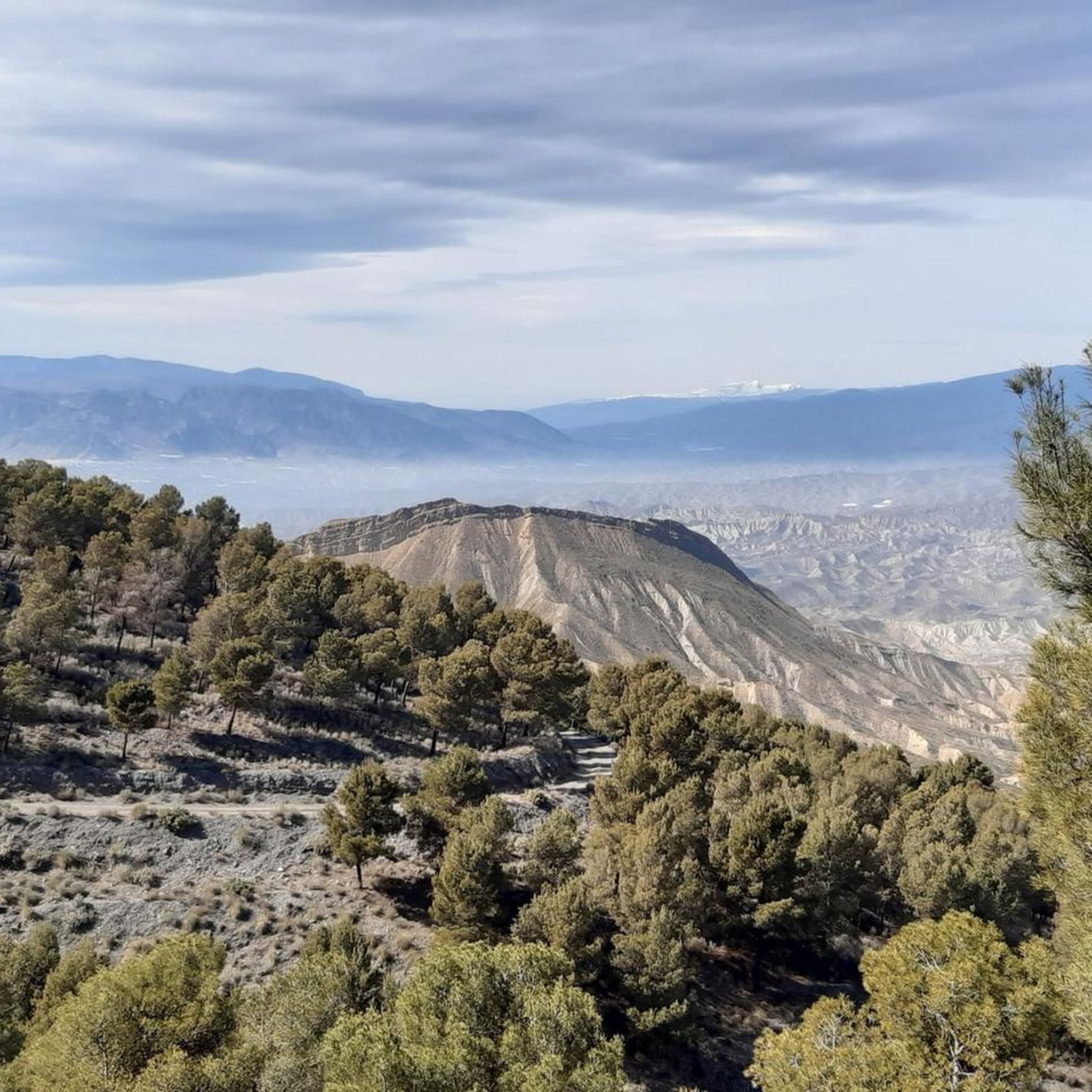
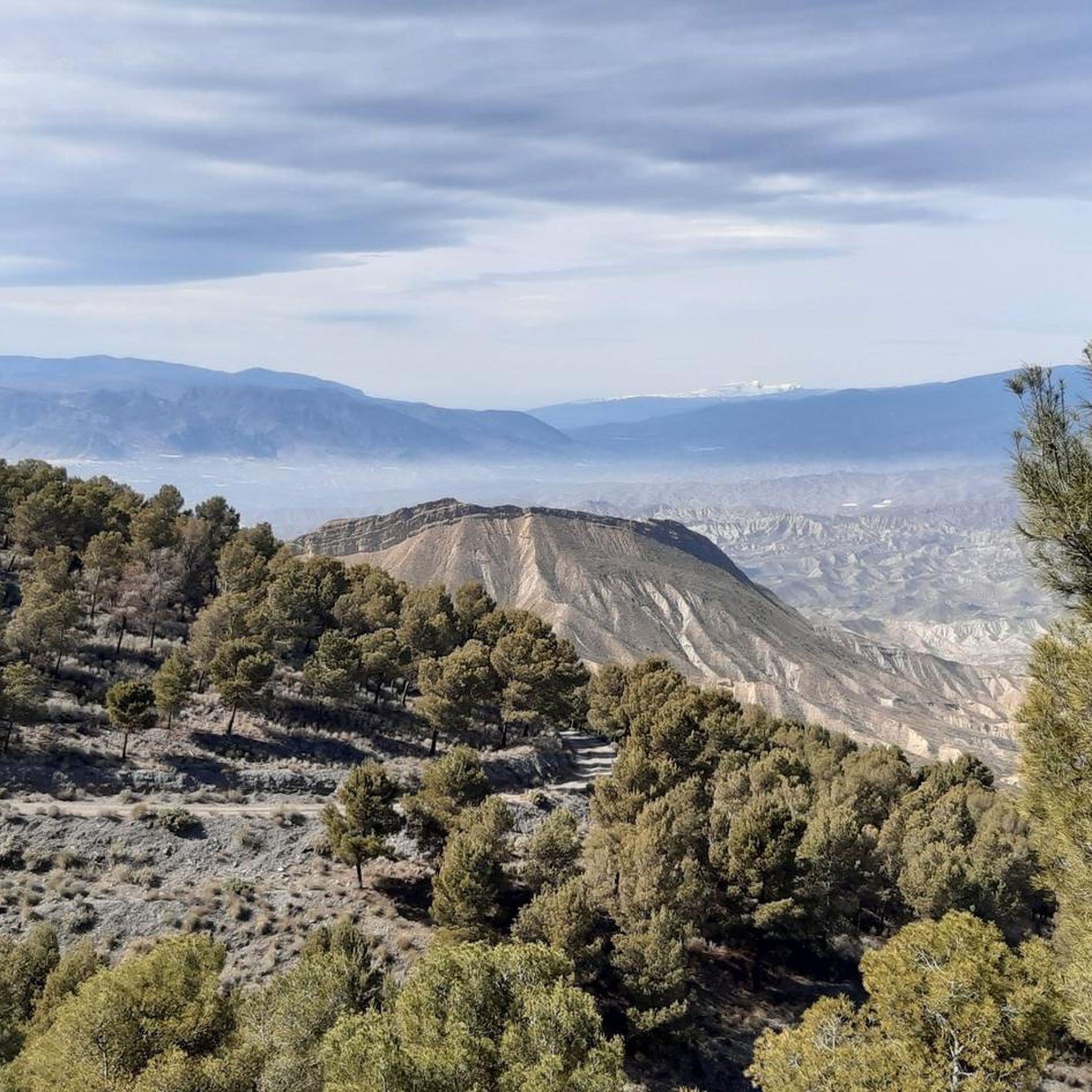
If you are passing through the Sierra de los Filabres near the summit of Calar Alto, the Fuente La Merendera is an almost mandatory stop at 1882 meters above sea level. This spring is famous for its fresh water that gushes from the metamorphic rocks of the mountains. Officially, there is a sign warning that it is not drinkable, but that does not stop locals and many passers-by from queuing with jugs, attracted by its water. Although, it is a good idea to filter the water before drinking it. If you need a long break, just across the road you will find a recreational area complete with tables, barbecues, and a viewpoint with spectacular views.
1
0

The García pass offers endless views, both during the ascent and once at the summit.
0
0

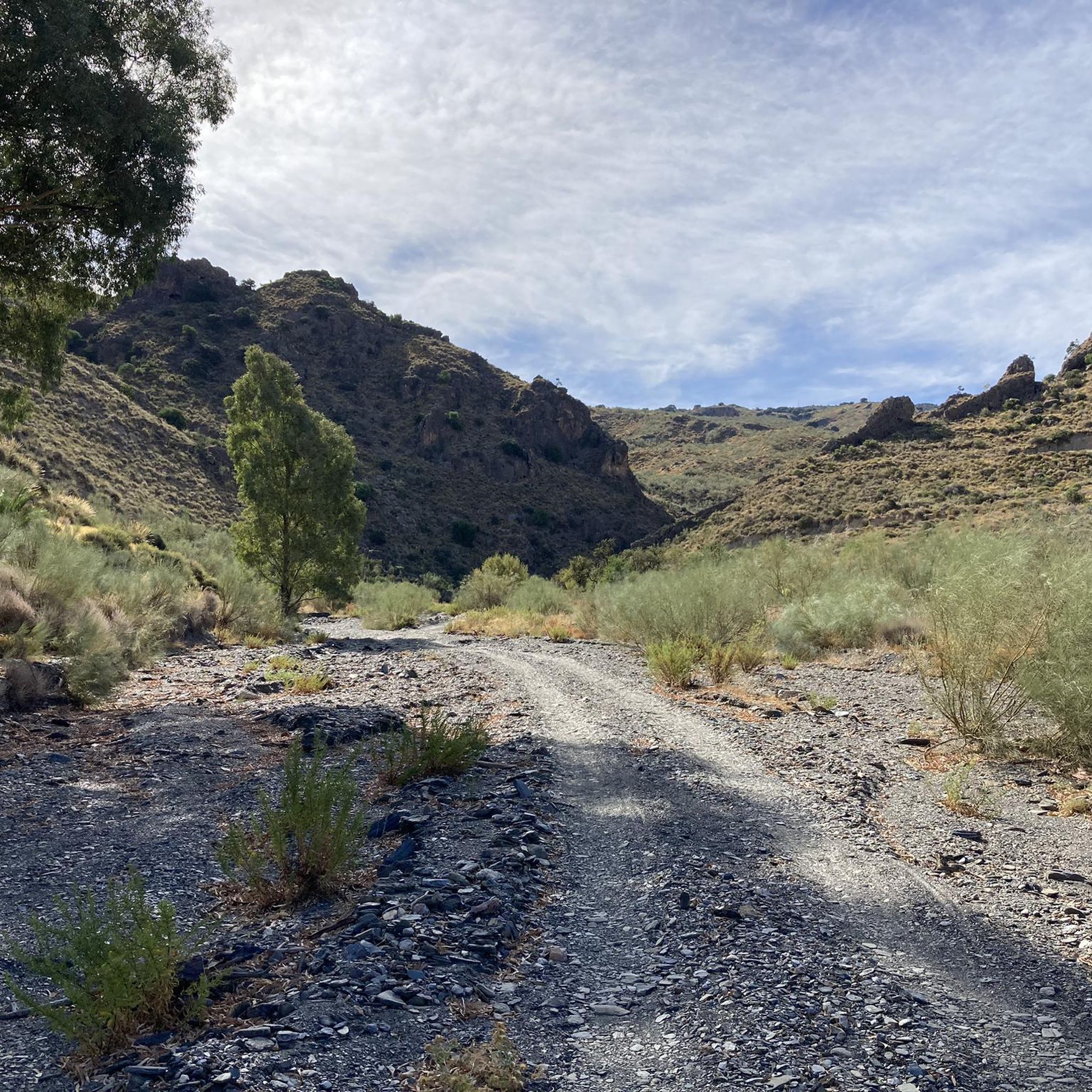
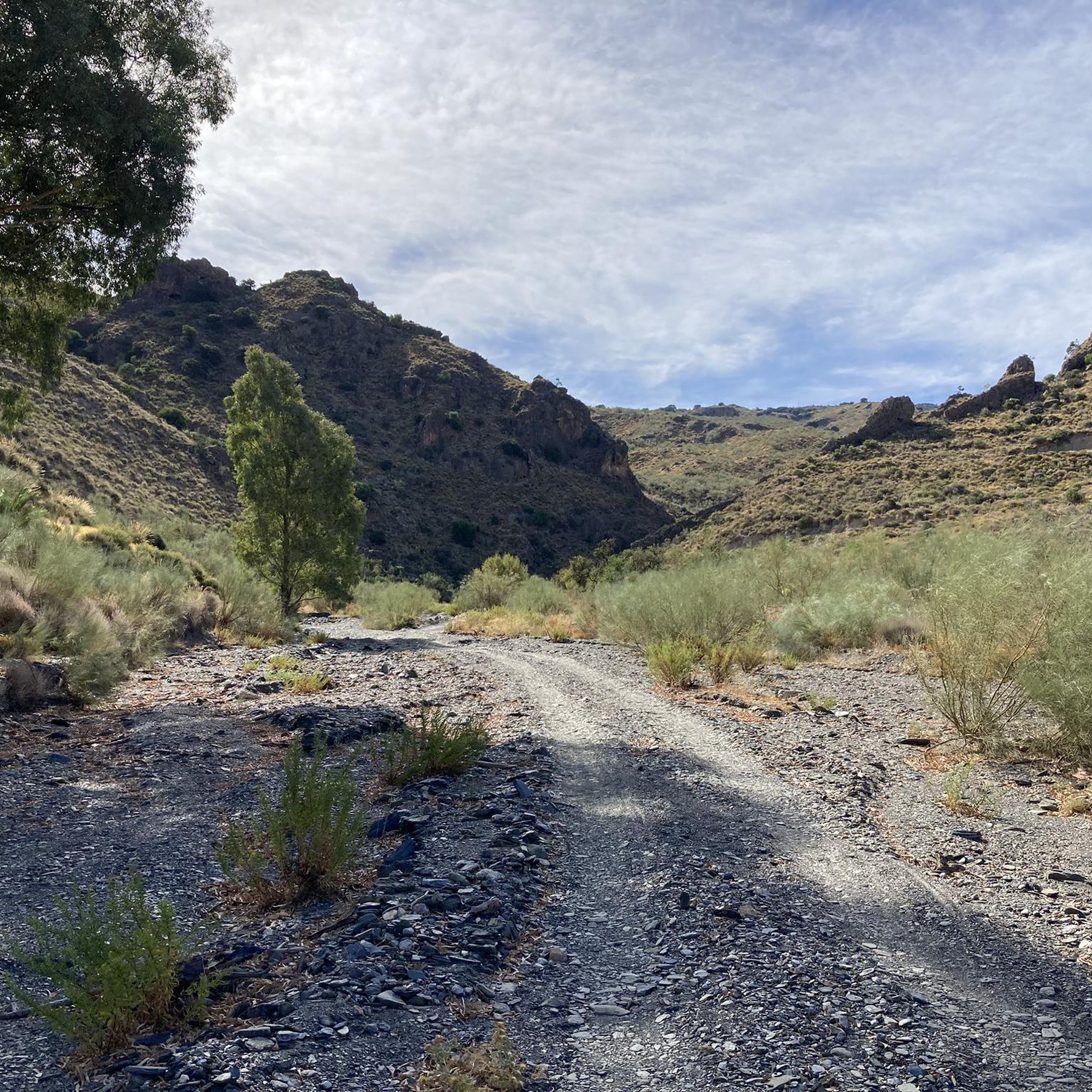
Beautiful piece of rambla ideal for mtb and gravel bikes, enjoy.
14
0
Currently (Feb 2026) the castle is closed indefinitely for maintenance and historical research.
0
0

The castle of Tabernas, built in the 11th century, is one of the most important Nasrid fortresses in Almería. Located on top of a hill, it offers spectacular views over the Tabernas desert and retains part of its walls despite centuries of abandonment and destruction. The Catholic Monarchs stayed here and the Capitulations of Almería were signed in 1489, giving it great historical weight. Access is free and, although the site is in ruins, it is recommended to wear comfortable footwear to explore it and enjoy the unique landscape that surrounds it.
3
0
Tahal Castle, nestled in the Sierra de los Filabres, was built in the 15th and 16th centuries to control the routes between the Almanzora Valley and Tabernas. Although it remains in a state of consolidated ruin today, its large rectangular keep, with its elevated entrance and masonry walls, is still impressive. Next to it, you can see the remains of a circular tower, the walled enclosure, and a cistern that provided water in the event of a siege. Freely accessible, it is an interesting place to combine history and hiking in this part of Almería.
1
0

It is a small Andalusian village of medieval origin, with white and quiet streets, dominated by the ruins of an Arab castle and surrounded by the unique desert that bears its name.
0
0

A small village, ideal for filling up water bottles at 900 m above sea level
0
0
Frequently Asked Questions
How challenging are the road cycling routes in Sierra Alhamilla?
Road cycling in Sierra Alhamilla is known for its rugged, mountainous terrain and significant elevation gains. The routes range from moderate to very difficult, with 20 out of 32 routes classified as difficult. You can expect challenging ascents, particularly towards peaks like Colativí, offering rewarding panoramic views.
What natural features and views can I expect on road cycling routes in Sierra Alhamilla?
Cyclists will experience a dramatic transition of landscapes, from arid mountains and semi-arid steppe to pine forests and holm oak woodlands. Routes often provide breathtaking vistas of the Tabernas Desert, distant Sierra Nevada mountains, and the Mediterranean Sea from higher elevations. The mountains are also characterized by deep gullies, adding to the dynamic scenery.
Are there any interesting landmarks or villages to see along the routes?
Yes, several routes pass through or near charming villages and offer views of historical sites. For example, the Tabernas Village and Desert – Tahal Castle loop from Tabernas leads through varied desert and village landscapes, including views of Tahal Castle. Other scenic villages in the wider area include Lucainena de las Torres and Níjar, which can be explored on longer rides.
What is the best time of year for road cycling in Sierra Alhamilla?
The region experiences a semi-arid climate. Spring and autumn generally offer the most pleasant temperatures for road cycling, avoiding the intense heat of summer. These seasons provide comfortable conditions for tackling the challenging climbs and enjoying the scenic views.
Are there any family-friendly road cycling routes in Sierra Alhamilla?
While many routes in Sierra Alhamilla are challenging with significant elevation, there are a few easier options. Out of 32 routes, 3 are classified as easy and 9 as moderate. These might be more suitable for families with older, experienced children or those looking for a less strenuous ride. Always check the route details for distance and elevation before setting out.
Are there many loop road cycling routes available?
Yes, many of the popular road cycling routes in Sierra Alhamilla are designed as loops, allowing you to start and finish in the same location. Examples include the Tabernas Desert - Olula de Castro Loop and the Pico Colativí Loop from Tabernas, which offer circular journeys through the diverse landscapes.
Is parking available near the road cycling trailheads?
Many road cycling routes in Sierra Alhamilla start from towns like Tabernas, where parking facilities are generally available. It's advisable to check specific starting points for parking options when planning your ride, especially for longer routes that might begin in smaller villages.
What do other road cyclists say about the routes in Sierra Alhamilla?
The road cycling routes in Sierra Alhamilla are highly rated by the komoot community, with an average score of 4.4 stars from over 40 reviews. Cyclists often praise the challenging ascents, the quiet roads, and the stunning, varied landscapes, particularly the desert views and panoramic vistas from the peaks.
Are there places to eat or stay near the road cycling routes?
Yes, towns like Tabernas, which serve as common starting points for many routes, offer various amenities including cafes, restaurants, and accommodation options. After a challenging ride, you might also find unique spots like the Balneario de Sierra Alhamilla, known for its thermal pools, offering a relaxing respite.
How long are the road cycling routes in Sierra Alhamilla?
The road cycling routes in Sierra Alhamilla vary significantly in length. For instance, the Tabernas Desert - Olula de Castro Loop is approximately 64.4 km (40.0 miles), while the Tabernas Village and Desert – Barranco del Cautivo loop from Tabernas extends to about 129.3 km (80.3 miles). You can find routes suitable for various time commitments and fitness levels.
Are road cycling routes in Sierra Alhamilla dog-friendly?
While Sierra Alhamilla is a natural park, road cycling routes typically follow paved roads where dogs may not be as suitable as on dedicated hiking or gravel trails. If you plan to bring a dog, ensure they are well-trained, can keep pace, and are accustomed to road environments. Always adhere to local regulations regarding pets in public areas and natural parks.
Are there any specific regulations or permits required for cycling in Sierra Alhamilla Natural Park?
Sierra Alhamilla is an 8,500-hectare protected natural area. While general road cycling on public roads typically doesn't require specific permits, it's always important to respect the natural environment. Stay on marked roads, do not disturb wildlife, and carry out all your waste. For specific regulations regarding off-road cycling or protected zones, consult local park authorities.
Most popular routes in Sierra Alhamilla

Get inspired with the komoot mobile app


Explore more
Browse the best Road cycling routes in other regions.
