The best walks and hikes in Barrancos Del Río De Aguas Blancas
4.5
(1010)
5,341
hikers
176
hikes
Hiking in Barrancos Del Río De Aguas Blancas offers diverse trails through a protected natural environment in Granada, Spain. The region is characterized by its riverine ecosystems, deep ravines (barrancos), and a mix of pine forests, scrubland, and riparian vegetation along the Río Aguas Blancas. This area serves as a transitional zone between the Sierra Nevada and Sierra de Huétor Natural Parks, providing varied terrain and rich biodiversity. Hikers can explore paths alongside the river, through wooded areas, and across…
Last updated: July 9, 2026
4.7
(3)
12
hikers
Moderate hike. Good fitness required. Easily-accessible paths. Suitable for all skill levels.
5.0
(1)
5
hikers
15.9km
04:34
380m
380m
Moderate hike. Good fitness required. Easily-accessible paths. Suitable for all skill levels.

Sign up for free
4.5
(2)
7
hikers
Moderate hike. Good fitness required. Easily-accessible paths. Suitable for all skill levels.
5.0
(1)
4
hikers
26.8km
08:00
790m
790m
Hard hike. Very good fitness required. Easily-accessible paths. Suitable for all skill levels.
5.0
(1)
3
hikers
6.75km
01:59
190m
190m
Easy hike. Great for any fitness level. Easily-accessible paths. Suitable for all skill levels.
Get access to more routes and recommendations from other explorers.
Sign up for free
Already have an account?
Our route recommendations are based on thousands of hikes, rides, and runs completed by other people on komoot.
Start today with a free account
Your next adventure awaits.
Login or Signup
Popular around Barrancos Del Río De Aguas Blancas

Tips from the Community

I did this route in the summer and there were a lot of mosquitoes.
0
0

From this green mountain you suddenly get a beautiful view over the desert plain below towards the east at Gorafe. It is a breathtakingly beautiful view and the perfect place for a break.
1
0

Beautiful views from the Peña Bermeja viewpoint, located at an altitude of 1,572 meters. From this point you can enjoy a privileged panoramic view of the Sierra de Huétor y Arana, the Hoya de Guadix, the Sierras de Baza and the entire Sierra Nevada.
2
0
Nice viewpoint with the opportunity to rest and sit on one of the walls.
2
0
From the top of the Juan Díaz Hill, the panoramic view is truly marvelous, with views of the Sierra Nevada in the background.
2
0
Low difficulty path where you can pedal quietly enjoying the views. There is a fork in the path: to the left the path continues through the Aguas Blancas Recreational Area and, to the right, the climb runs near Cerro de Martín García.
3
0

If you have drunk a lot of water in some of the big climbs that you find near Tocón, you have the possibility of refilling your bottles in this source.
0
0
The Peña Bermeja viewpoint has incredible views of the north faces of the Sierra Nevada. In addition, right in front, you will be able to glimpse the geopark.
1
0
Frequently Asked Questions
How many hiking trails are available in Barrancos Del Río De Aguas Blancas?
Barrancos Del Río De Aguas Blancas offers a wide variety of hiking experiences, with over 160 trails available. These range from easy strolls to more challenging routes, catering to different fitness levels.
What are the difficulty levels of hikes in Barrancos Del Río De Aguas Blancas?
The region provides a diverse range of trails. You'll find 27 easy routes, 97 moderate routes, and 45 difficult routes, ensuring there's a suitable option for every hiker's ability.
What do other hikers say about the trails in Barrancos Del Río De Aguas Blancas?
The trails in Barrancos Del Río De Aguas Blancas are highly regarded by the komoot community, holding an average rating of 4.6 stars from over 900 reviews. Hikers often praise the diverse landscapes, the tranquility of the riverine ecosystems, and the well-defined paths.
Are there any notable landmarks or natural features to see while hiking?
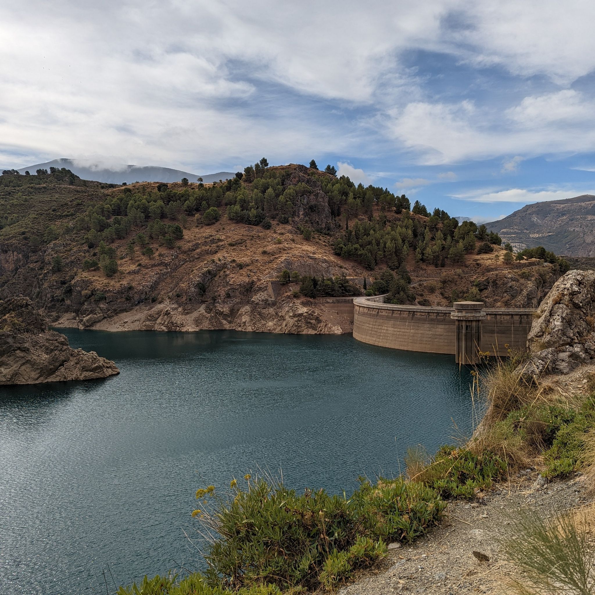
Yes, the area is rich in natural beauty. You can visit the scenic Quéntar Reservoir, explore the unique Aguas Blancas Spring, or discover the various ravines and riverine ecosystems that define the landscape. The region also offers stunning views towards the Sierra Nevada.
Can I find waterfalls or places to swim along the trails?
While specific large waterfalls are not prominent, the river's course features pools and refreshing spots. The Área Recreativa Aguas Blancas, particularly along the Barranco Cañogeo, offers sections where bathing in the river is possible, providing a great way to cool down during your hike.
What kind of wildlife might I encounter in Barrancos Del Río De Aguas Blancas?
The protected environment is home to diverse wildlife. Keep an eye out for species like the native river crab, the Betic midwife toad, and various reptiles. Birdwatchers might spot large birds of prey such as Bonelli's eagle, golden eagle, and peregrine falcon. Mammals like the Spanish ibex and wildcat also inhabit the area.
Are there family-friendly hiking options in the area?
Yes, many trails are suitable for families. The Área Recreativa Aguas Blancas offers accessible sections and facilities, making it a great starting point for shorter, easier walks. Look for routes with lower elevation gain and shorter distances for a pleasant family outing.
Are dogs allowed on the trails in Barrancos Del Río De Aguas Blancas?
Generally, dogs are welcome on many trails in the region. However, it's always advisable to keep them on a leash, especially in protected areas or near wildlife habitats, and to respect local regulations regarding pet access.
Are there circular routes available for hiking?
Absolutely. Many popular routes are circular, allowing you to start and end at the same point. An example is the Aguas Blancas Recreation Area – Aguas Blancas Recreation Area loop from Cerro Secanillo, which is a moderate 6.0-mile trail.
Where can I park when visiting Barrancos Del Río De Aguas Blancas?
Parking is typically available near popular trailheads and recreational areas. The Área Recreativa Aguas Blancas is a common starting point and usually has designated parking facilities. It's recommended to check specific route descriptions for detailed parking information.
What is the best time of year to go hiking in Barrancos Del Río De Aguas Blancas?
Spring and autumn are generally the most pleasant seasons for hiking, offering mild temperatures and vibrant natural colors. Summer can be hot, so early morning or late afternoon hikes are recommended. Winter provides a different charm, though some higher elevation paths might be cooler.
Are there any recreational areas with facilities for hikers?
Yes, the Área Recreativa Aguas Blancas is a key facility in the region. It provides amenities such as tables, barbecues, and shaded areas, making it an ideal spot for a picnic or a rest stop before or after your hike. Some sections even allow for river bathing.
Where does the Río Aguas Blancas originate, and can I visit it?
The Río Aguas Blancas originates from a place called Fuente Loca, located in the municipality of La Peza. While not a specific hiking trail, it can be a point of interest for those curious about the river's source.
Can I find routes with views of the Sierra Nevada?
Yes, the region's position as a transitional zone between the Sierra Nevada and Sierra de Huétor Natural Parks means many trails offer spectacular vistas. For example, the View of Sierra Nevada – Aguas Blancas Recreation Area loop from Cerro Secanillo provides excellent views of the Sierra Nevada mountains.
Are there any longer, more challenging routes for experienced hikers?
For those seeking a greater challenge, routes like the Peña Bermeja Viewpoint loop from Tocón offer a moderate 9.9-mile path with varied terrain and significant elevation changes, providing a rewarding experience for more seasoned hikers.
Most popular routes in Barrancos Del Río De Aguas Blancas
Most popular attractions in Barrancos Del Río De Aguas Blancas

Get inspired with the komoot mobile app


Explore more
Browse the best Hikes in other regions.
