The best MTB trails in Sierras Almagrera, De Los Pinos Y El Aguilón
4.4
(181)
1,161
riders
123
rides
Mountain biking in Sierras Almagrera, De Los Pinos Y El Aguilón offers routes through a pre-coastal mountain range in Almería, Spain. The region is characterized by rugged and abrupt topography, featuring five interconnected mountain ranges with elevated slopes and steep profiles. The landscape includes dramatic coastal cliffs and small coves, alongside semi-arid Mediterranean ecosystems with pine forests and unique cornical communities. This varied terrain, combined with a rich mining history, provides diverse mountain bike trails.
Best mountain bike trails in…
Last updated: November 4, 2026
4.5
(6)
21
riders
67.3km
04:23
390m
390m
Moderate mountain bike ride. Good fitness required.
5.0
(2)
12
riders
49.0km
03:36
630m
630m
Moderate mountain bike ride. Good fitness required.

4.0
(1)
6
riders
38.3km
02:41
470m
470m
Moderate mountain bike ride. Good fitness required.
4
riders
68.0km
05:10
790m
790m
Hard mountain bike ride. Very good fitness required.
5.0
(1)
3
riders
18.8km
01:17
230m
230m
Easy mountain bike ride.
Get access to more routes and recommendations from other explorers.
Already have an account?
Our route recommendations are based on thousands of hikes, rides, and runs completed by other people on komoot.
Start today with a free account
Your next adventure awaits.
Popular around Sierras Almagrera, De Los Pinos Y El Aguilón


Tips from the Community

The Castle of San Juan de los Terreros is an 18th-century fortress located 109 meters above the Mediterranean. Built between 1760 and 1764 as part of the defensive system against pirates and rival powers. Its characteristic horseshoe shape and bastions offer a fine example of military architecture of the time. What most attracts visitors are its panoramic views, as from the top you can contemplate the open sea, and the coast stretching towards Águilas and the Sierra Almagrera to the south.
1
0

Top beach, running, swimming, climbing, everything is possible
2
0

It's interesting how many houses were built.
0
0

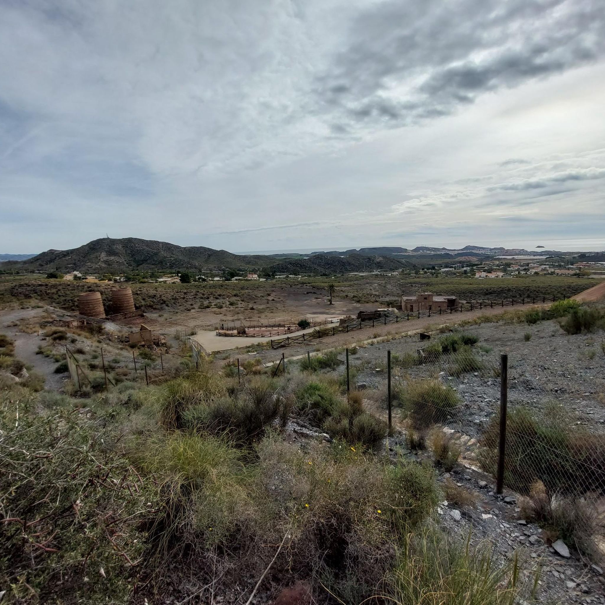
The El Arteal Mining Village, located in Cuevas del Almanzora (Almería), is one of the most unique industrial complexes in the Sierra Almagrera, with a history linked to lead and silver mining since the 19th century. The village was built in 1944 by Minas de Almagrera, S.A. (MASA), in collaboration with the National Institute of Industry (INI), to revive mining in the area after decades of decline.
2
0


Mining village built in 1952 to house miners and their families. There are 200 houses in ten symmetrical blocks, 5 of 20 houses and another 5 of 16. The miners had a dining room, showers, a commissary, a hospital with a consultation and treatment room, a clinical analysis laboratory, an X-ray room, an operating room, an orthopaedic room and 10 beds for the sick.
0
0
Playa de los Cocedores, also known as Cala Cerrada, is a small beach located between the municipality of Pulpí, in the province of Almería, and the municipality of Águilas, in the Region of Murcia. It belongs to the Murcia section of the Cuatro Calas protected natural area. It has a length of 150 meters and a semicircular shape. Its sand is fine and yellow, and its waters are calm because they are protected by a small, almost closed natural bay. The bottoms are sandy.
7
0

The beach is not exactly quiet, because it is embedded between the rocks, the water is calm, and in winter you can paddle and swim there.
17
0
Frequently Asked Questions
What kind of terrain can I expect when mountain biking in Sierras Almagrera, De Los Pinos Y El Aguilón?
The region features rugged and abrupt topography, with five interconnected mountain ranges offering elevated slopes and steep profiles. You'll encounter diverse landscapes, from dramatic coastal cliffs and small coves to semi-arid Mediterranean ecosystems and Aleppo pine forests. This variety provides a dynamic and scenic mountain biking experience.
Are there mountain bike trails for all skill levels in Sierras Almagrera, De Los Pinos Y El Aguilón?
Yes, the area offers a good range of trails for various skill levels. Out of 110 available routes, you'll find 24 easy trails, 49 moderate trails, and 37 difficult trails, ensuring options for beginners to experienced riders.
What natural features or landmarks can I see while mountain biking in the Sierras Almagrera, De Los Pinos Y El Aguilón?
The region is rich in natural beauty and historical sites. You can enjoy stunning views like Cala Cristal Views and explore the Scenic Coastal Stretch. The area also has historical mining remnants, such as Mina La Luna (Sierra Almagrera), reflecting its past as a significant mining region.
What do other mountain bikers enjoy most about mountain biking in Sierras Almagrera, De Los Pinos Y El Aguilón?
The komoot community highly rates the mountain biking experience here, with an average score of 4.3 stars from over 150 reviews. Riders frequently praise the varied terrain, from coastal paths to challenging mountain ascents, and the dramatic scenery that combines sea views with rugged inland landscapes.
Are there any easy mountain bike routes suitable for families or beginners?
Yes, there are 24 easy mountain bike routes in the region. An example of an easy route is the Playa Bellavista loop from Los Baldíos, which covers about 12.1 miles (19.5 km) with moderate elevation gain, making it suitable for those looking for a less strenuous ride.
Can I find mountain bike routes that offer coastal views?
Absolutely. Many routes in the Sierras Almagrera, De Los Pinos Y El Aguilón region hug the coastline, offering spectacular sea views. For instance, the Los Cocedores Beach – Águilas Promenade and Beach loop from Carrefour Express is a moderate 22.4 miles (36.1 km) path that follows a coastal route connecting Los Cocedores Beach with Águilas Promenade.
Are there mountain bike trails that form a loop?
Yes, many mountain bike trails in the region are designed as loops, allowing you to start and finish at the same point. A popular moderate loop is the Los Cocedores Beach loop from Pozo del Esparto, which is 24.2 miles (38.9 km) long and takes you through coastal landscapes.
What is the typical elevation gain on mountain bike trails in this area?
The elevation gains vary significantly depending on the trail's difficulty. For example, a moderate route like the View of Isla del Fraile – Cope Tower loop from Carrefour Express involves an ascent of approximately 1,119 feet (341 meters). More challenging routes will feature greater climbs, reflecting the region's rugged topography.
What kind of wildlife might I encounter while mountain biking?
The semi-arid Mediterranean landscape is a vital refuge for diverse wildlife. You might spot the Spur-thighed tortoise, Moorish hedgehog, or Ocellated lizard. The area also hosts various reptiles, steppe birds, bat communities, and a rich array of invertebrates.
Are there any mountain bike routes that explore the historical mining areas?
While specific routes dedicated solely to mining areas aren't highlighted, the region's history as a significant mining area means you may encounter remnants of past activity. The Sierra Almagrera, in particular, was known for silver and lead mining. You can visit Mina La Luna (Sierra Almagrera), a historical highlight in the area.
What is the best time of year to go mountain biking in Sierras Almagrera, De Los Pinos Y El Aguilón?
Given its semi-arid Mediterranean climate, spring and autumn are generally the most pleasant seasons for mountain biking. Temperatures are milder, making for more comfortable rides. Summers can be very hot, and while winters are mild, some routes might be affected by occasional rain.
Are there any long-distance mountain bike routes available?
Yes, you can find longer routes for more endurance-focused rides. For example, the View of Isla del Fraile – Cope Tower loop from Carrefour Express is a substantial 30.3 miles (48.7 km) route, offering a significant challenge and extensive exploration of the area.
Most popular routes in Sierras Almagrera, De Los Pinos Y El Aguilón
Most popular attractions in Sierras Almagrera, De Los Pinos Y El Aguilón

Get inspired with the komoot mobile app


Explore more
Browse the best MTB trails in other regions.
