Pfaffenschlag bei Waidhofen an der Thaya
Pfaffenschlag bei Waidhofen an der Thaya
The best walks and hikes around Pfaffenschlag bei Waidhofen an der Thaya
4.6
(307)
2,280
hikers
252
hikes
Hiking around Pfaffenschlag bei Waidhofen an der Thaya offers diverse landscapes at the edge of the Waldviertel region and bordering the Thayatal National Park. The area features dense forests, river gorges along the Thaya River, and gently rolling hills. Its geological bedrock consists of granite, gneiss, and schist, forming part of Austria's oldest mountain range.
Best hiking trails around Pfaffenschlag bei Waidhofen an der Thaya
- The most popular hiking route is Gemeindeau Moor Boardwalk – Hanging Stone loop from Heidenreichstein…
Last updated: July 2, 2026
4.7
(26)
166
hikers
Easy hike. Great for any fitness level. Easily-accessible paths. Suitable for all skill levels.
5.0
(5)
23
hikers
11.6km
03:06
140m
140m
Moderate hike. Good fitness required. Easily-accessible paths. Suitable for all skill levels.

Sign up for free
5.0
(4)
6
hikers
Moderate hike. Good fitness required. Easily-accessible paths. Suitable for all skill levels.
6
hikers
Easy hike. Great for any fitness level. Easily-accessible paths. Suitable for all skill levels.
4
hikers
Easy hike. Great for any fitness level. Easily-accessible paths. Suitable for all skill levels.
Get access to more routes and recommendations from other explorers.
Sign up for free
Already have an account?
Our route recommendations are based on thousands of hikes, rides, and runs completed by other people on komoot.
Start today with a free account
Your next adventure awaits.
Login or Signup
Popular around Pfaffenschlag bei Waidhofen an der Thaya

MTB Trails around Pfaffenschlag bei Waidhofen an der Thaya

Cycling around Pfaffenschlag bei Waidhofen an der Thaya
Running Trails around Pfaffenschlag bei Waidhofen an der Thaya

Road Cycling Routes around Pfaffenschlag bei Waidhofen an der Thaya
Gravel biking around Pfaffenschlag bei Waidhofen an der Thaya
Tips from the Community

Fisherman's hut
0
0

The Moor and Peat Museum, which has won national and international awards, is unique in Europe. Among other things, it was awarded a European museum prize in Helsinki in 1991. As a complement to the Heidenreichsteiner Moor nature park, the museum aims to illustrate the formation of moors in Central Europe. The flora and fauna in these areas are presented, as is the economic use and medical importance of peat. Other sections are dedicated to nature conservation, fairy tales and legends relating to moorland landscapes. There is also a replica of a bog body, along with a description of the accidents that can become fatal in the moor.
2
0
Heidenreichstein Castle is partially open to the public. It has been privately owned by the Kinsky family since 1961 and is still inhabited. Guided tours are offered, during which you can also look at some of the rooms inside the castle. The castle, like the whole town, owes its name to one of the first burgraves, who was called Heidenreich. The moated castle, the oldest part of which dates back to the second half of the 12th century, is considered a landmark of the town of 3,800 inhabitants.
2
0


A huge granite remnant, impressive what shapes nature creates
1
0
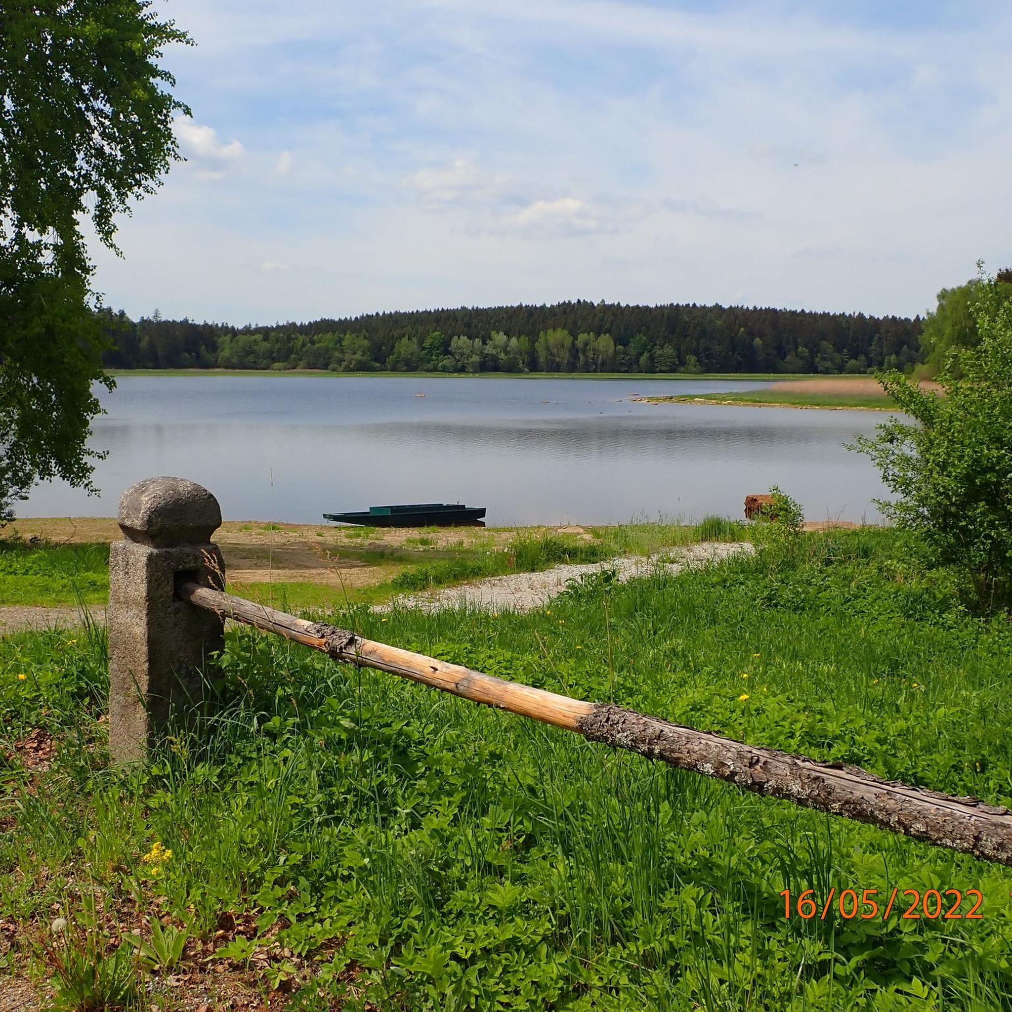
Small swimming pond with the Teichheuriger snack station. Open from May to September.
2
0
The heart of the nature park is the raised moor near the town of Heidenreichstein in the northwestern Waldviertel. The open moor areas and the forest on the edge of the Winkelauer Pond bear witness to a vegetation history that goes back more than 10,000 years. Areas of peat moss, sundew and cotton grass give an idea of the original moorland landscape.
2
0
In the nature park, the preservation of the “moor” habitat has the highest priority alongside climate protection. Moors are not characterized by a very large variety of plants and animals, but by relatively few but extremely specialists, such as the northern moss damsel (a type of dragonfly) and the moor frog.
2
0
Frequently Asked Questions
How many hiking trails are available around Pfaffenschlag bei Waidhofen an der Thaya?
There are over 260 hiking trails in the Pfaffenschlag bei Waidhofen an der Thaya area, offering a wide range of options for all skill levels. This includes more than 160 easy routes, nearly 100 moderate trails, and a few challenging options for experienced hikers.
What kind of terrain and difficulty levels can I expect on hikes in this region?
The region offers diverse terrain, from dense forests and the dramatic river gorges of the Thayatal National Park to the gently rolling hills of the Waldviertel landscape. You'll find paths ranging from easy, flat walks suitable for families to moderate trails with some elevation changes, and a few more difficult routes. The geological bedrock, consisting of granite, gneiss, and schist, adds to the unique character of the landscape.
When is the best time of year to go hiking in Pfaffenschlag bei Waidhofen an der Thaya?
Spring and autumn are particularly recommended for hiking in Pfaffenschlag bei Waidhofen an der Thaya. During these seasons, the climate is pleasantly mild, and the landscape is vibrant with blossoming flowers or colorful foliage, making for a beautiful hiking experience.
Are there family-friendly hiking options in Pfaffenschlag bei Waidhofen an der Thaya?
Yes, the region offers several family-friendly hiking options, including easier paths and a dedicated 'Children's Hiking Trail' that incorporates playful elements and various stations to keep young explorers engaged. Many of the 160+ easy routes are suitable for families.
What are some notable natural attractions or landmarks I can see while hiking?
While hiking, you can explore several natural attractions. The Gemeindeau Moor Boardwalk offers a unique experience through moorland. You might also encounter the impressive Wackelstein, a natural rock formation. The Thayatal National Park itself is a major draw, with its unique valley landscape and potential for wildlife sightings.
Are there any circular hiking routes available?
Yes, many of the trails in the area are circular routes. For example, the Gemeindeau Moor Boardwalk – Hanging Stone loop from Heidenreichstein is an easy 4.1-mile (6.7 km) circular trail that takes you through moorland. Another option is the Hanging Stone – Gemeindeau Moor Boardwalk loop from Heidenreichstein, an easy 2.4-mile (3.8 km) path exploring moorland and forested areas.
What do other hikers enjoy most about hiking in Pfaffenschlag bei Waidhofen an der Thaya?
The area is highly rated by the komoot community, with an average score of 4.7 stars from nearly 300 reviews. Hikers often praise the diverse landscapes, from dense forests to river gorges, and the well-maintained network of trails that cater to all skill levels. The serene environment of the Waldviertel and the natural beauty of the Thayatal National Park are frequently highlighted.
Are there any long-distance hiking trails that pass through or near Pfaffenschlag bei Waidhofen an der Thaya?
Yes, a section of the significant Eastern Austrian Border Trail (Grenzlandweg 07) passes through the area, offering hikers the opportunity to explore a wider region and experience a longer-distance adventure.
Are there any trails that feature lakes or water bodies?
Yes, the region features tranquil ponds and lakes. You can find trails that lead past the Schrems Moor Bath or the Geissbach Pond. The Thayatal National Park itself is defined by the meandering Thaya River, offering beautiful riverside walks.
Are there opportunities to see wildlife in the region?
The Thayatal National Park, bordering Pfaffenschlag bei Waidhofen an der Thaya, is known for its untouched nature and diverse habitats. Hikers have the potential to observe rare wildlife such as otters and black storks, particularly along the Thaya River.
Are there any trails that offer scenic viewpoints?
Yes, the region's diverse terrain and undulating landscape mean that many trails lead to breathtaking viewpoints. While not directly in Pfaffenschlag, the wider Waidhofen an der Thaya district, including destinations like the Predigtstuhl Summit, offers expansive vistas of the surrounding areas.
What is a good moderate hike in the area?
A good moderate option is the Gemeindeau Moor Boardwalk – Moor Trail Gemeindeau loop from Heidenreichstein. This 7.0-mile (11.3 km) trail leads through moorland and typically takes about 3 hours to complete, offering a more extended experience than the easier loops.
Most popular routes around Pfaffenschlag bei Waidhofen an der Thaya
Most popular attractions around Pfaffenschlag bei Waidhofen an der Thaya

Get inspired with the komoot mobile app


Explore more
Browse the best Hikes in other regions.
