The best road cycling routes around Río Guadalbarbo
90
riders
5
rides
Road cycling routes around Río Guadalbarbo traverse the northern part of Córdoba province, Spain, through the Sierra Morena mountain range. This region is characterized by undulating terrain with significant elevation changes, offering challenging and rewarding rides. The landscape transitions from mountainous areas towards the Guadalquivir valley, featuring well-surfaced asphalt roads with minimal traffic. A significant portion of the river's course is designated as a Special Area of Conservation, preserving its natural beauty and diverse riparian vegetation.
Best road cycling routes…
Last updated: July 10, 2026
45
riders
104km
05:26
1,860m
1,860m
Hard road ride. Very good fitness required. Mostly well-paved surfaces and easy to ride.
19
riders
102km
05:35
2,040m
2,040m
Hard road ride. Very good fitness required. Mostly well-paved surfaces and easy to ride.

Sign up for free
18
riders
62.5km
03:08
760m
760m
Moderate road ride. Good fitness required. Some segments of this route may be unpaved and difficult to ride.
4
riders
81.1km
04:06
1,270m
1,270m
Hard road ride. Very good fitness required. Mostly well-paved surfaces and easy to ride.
2
riders
37.6km
02:15
900m
900m
Hard road ride. Very good fitness required. Mostly well-paved surfaces and easy to ride.
2
riders
83.9km
05:38
1,970m
1,970m
Hard road ride. Very good fitness required. Some segments of this route may be unpaved and difficult to ride.
Our route recommendations are based on thousands of hikes, rides, and runs completed by other people on komoot.
Start today with a free account
Your next adventure awaits.
Login or Signup
Popular around Río Guadalbarbo
Tips from the Community

This small road is located very close to the city of Córdoba, right in the Sierra Morena. The asphalt winds through a beautiful holm oak forest, making it ideal for cycling. Proof of this is the fact that La Vuelta usually passes through here.
1
0

On Doctor Ochoa Street in Pozoblanco, you'll find restaurants and cafes, as well as the Abastos market and accommodations.
0
0
The Hermitage of San Antonio, located at the northern end of Pozoblanco, dates back to the 16th century and was restored in the 18th century, preserving its portico and lintelled doorway. From this spot, you can enjoy beautiful sunsets and it houses historical and cultural artifacts of great interest.
1
0
The Merendero de las Serranas, near Villaharta, is a recreational area along the Mozarabic Way of St. James, ideal for relaxing and enjoying the scenery. Surrounded by meadows and streams, it combines nature, history, and rural Cordoba tradition.
0
0

The Villares Peri-Urban Park is nestled in the heart of the Sierra Morena Mountains. This peaceful spot is a place where walking and cycling along its trails make it a truly special experience. It also has barbecue grills where you can spend some quality time recharging your batteries.
1
0

Rest area on the Camino Mozarabe
0
0

Villaviciosa de Córdoba is a Spanish municipality in the province of Córdoba, Andalusia. In 2016 it had 3,374 inhabitants. Its surface area is 468.75 km² and it has a density of 7.2 inhabitants/km².
0
0

This mountain pass is located on the CO-6410 highway between the towns of Villaharta and Pozoblanco in the heart of the Sierra Morena. The road is in perfect condition and well signposted, with little traffic. It is advisable to stock up on water, since there is no fountain along the way and there is very little shade.
0
0
Frequently Asked Questions
What is the typical terrain and difficulty level for road cycling around Río Guadalbarbo?
Road cycling routes in the Río Guadalbarbo area, particularly through the Sierra Morena mountain range, are characterized by undulating terrain with significant elevation changes. Most routes are considered difficult, offering challenging and rewarding rides for experienced cyclists. For example, the Assuan-Trasierra Road – Artafi Pass - Trassierra loop from Villaharta features substantial climbs.
Are there any easier road cycling routes available in the Río Guadalbarbo region?
While many routes in the Río Guadalbarbo area are challenging, there are options that might be more manageable. For instance, the El Quijote Sculpture – Pozoviejo Square loop from Cerro de las Obejuelas is rated as moderate, leading through rolling hills and open landscapes, making it a good choice for those seeking a less strenuous ride compared to the more difficult options.
What natural features or landmarks can I expect to see while cycling near Río Guadalbarbo?
The region offers diverse natural beauty. You'll cycle through the Sierra Morena mountain range, known for its varied geology. A significant portion of the Río Guadalbarbo's course is a Special Area of Conservation, meaning you'll encounter pristine environments with dense riparian vegetation, including willow groves and ash trees along the riverbanks. You might also spot diverse wildlife, such as kingfishers and even otters, indicating a healthy ecosystem.
What do other road cyclists enjoy most about cycling in Río Guadalbarbo?
Cyclists often praise the region for its quiet, well-surfaced asphalt roads and the stunning natural scenery. The challenging climbs and descents through the Sierra Morena provide a rewarding experience, and the protected natural areas offer a tranquil and immersive ride away from heavy traffic. Over 80 road cyclists have used komoot to explore this varied terrain, highlighting its appeal.
Are there any loop routes for road cycling around Río Guadalbarbo?
Yes, many of the road cycling routes in the area are designed as loops, allowing you to start and finish at the same point. Examples include the Obejo – Obejo Water Fountain loop from Villaharta and the Villaharta – Pozoviejo Square loop from Villaharta, both offering extensive ascents and descents through the region's varied topography.
What is the best time of year to go road cycling in the Río Guadalbarbo area?
While specific seasonal conditions are not detailed, the climate in Andalusia generally makes spring and autumn ideal for cycling. Temperatures are milder, and the landscape is often at its most vibrant. Summers can be very hot, and winters can bring cooler temperatures, so checking local weather forecasts is always recommended for optimal riding conditions.
Is the Río Guadalbarbo area suitable for family-friendly road cycling?
Given that most routes in the Río Guadalbarbo area feature significant elevation changes and are rated as difficult or moderate, they might be more suitable for families with older, experienced cyclists. For younger children or beginners, it would be advisable to seek out specific, shorter, and flatter sections if available, or consider other types of cycling routes.
Are there any cafes or places to stop for refreshments along the road cycling routes?
The region includes several municipalities such as Belmez, Espiel, Obejo, and Villaharta. While specific cafes directly on the routes are not detailed, these towns and villages would be the best places to find local establishments for refreshments, food, or a quick break during your ride. Planning your route to pass through these points is advisable.
Where can I find parking when planning a road cycling trip to Río Guadalbarbo?
Many routes start from towns and villages like Villaharta, Cerro de las Obejuelas, or El Vacar. These locations typically offer public parking options. It's recommended to check the specific starting point of your chosen route on komoot for detailed information on parking availability in that particular village or town.
How many road cycling routes are available in the Río Guadalbarbo area?
There are over 5 dedicated road cycling routes detailed for the Río Guadalbarbo area, offering a variety of challenging rides through the Sierra Morena landscape. These routes have been explored by over 80 komoot users.
Can I expect to see any wildlife while cycling along the Río Guadalbarbo?
Yes, the Río Guadalbarbo area is rich in diverse fauna, especially within the Special Area of Conservation. Along the riverbanks, you might spot various invertebrates, amphibians, and aquatic birds like the kingfisher. The presence of otters is also an indicator of a healthy river ecosystem, offering a chance to observe wildlife in its natural habitat.
Are there any routes that pass by the Guadalmellato Reservoir?
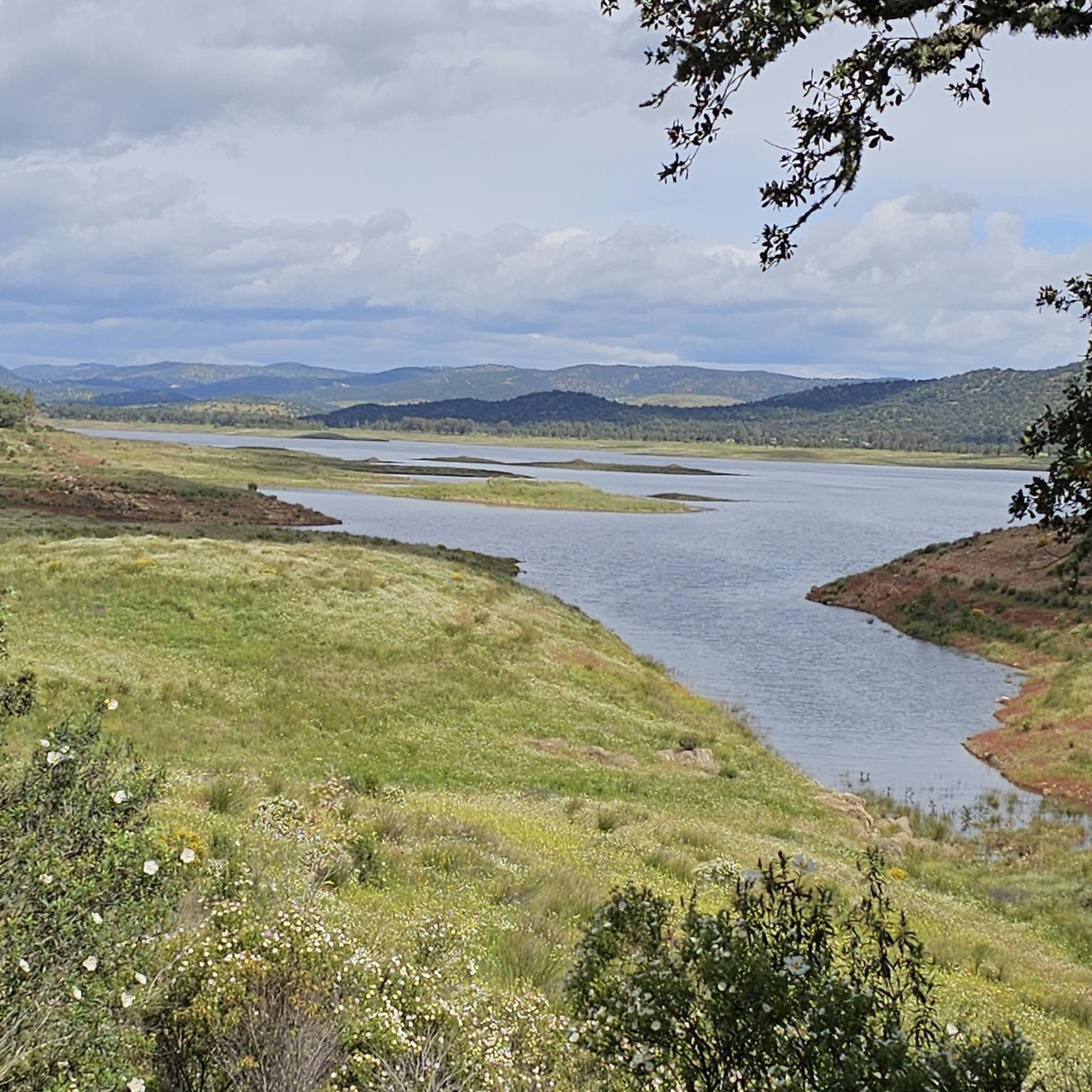
Yes, some routes in the area will bring you close to or along the Guadalmellato Reservoir, where the Río Guadalbarbo merges. For example, the Guadalmellato Reservoir – Sierra de los Puntales loop from Obejo offers views of this significant body of water and the surrounding landscape.
Most popular routes around Río Guadalbarbo

Get inspired with the komoot mobile app


Explore more
Browse the best Road cycling routes in other regions.
