The best walks and hikes in Sierra Calderona
4.5
(1753)
11,440
hikers
224
hikes
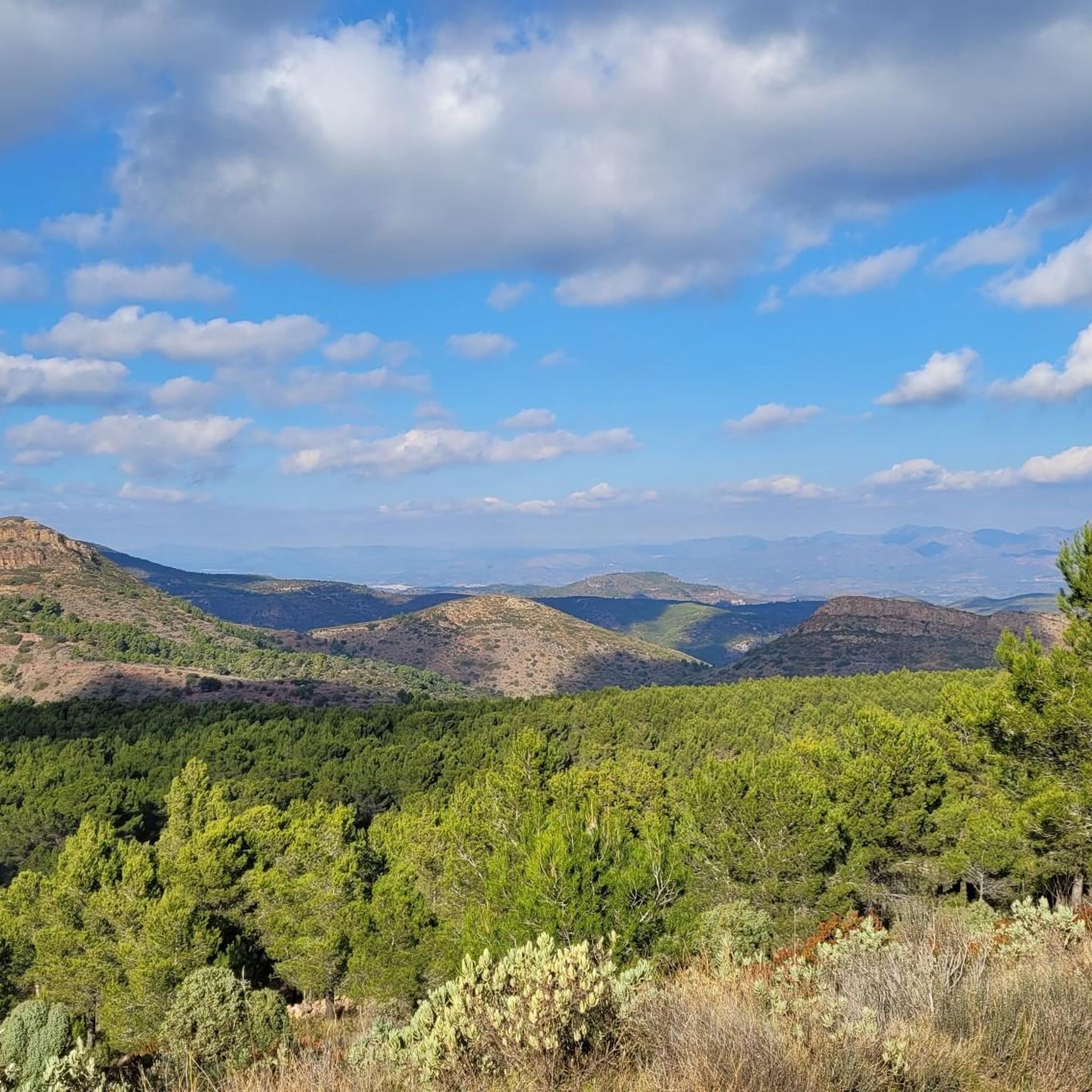
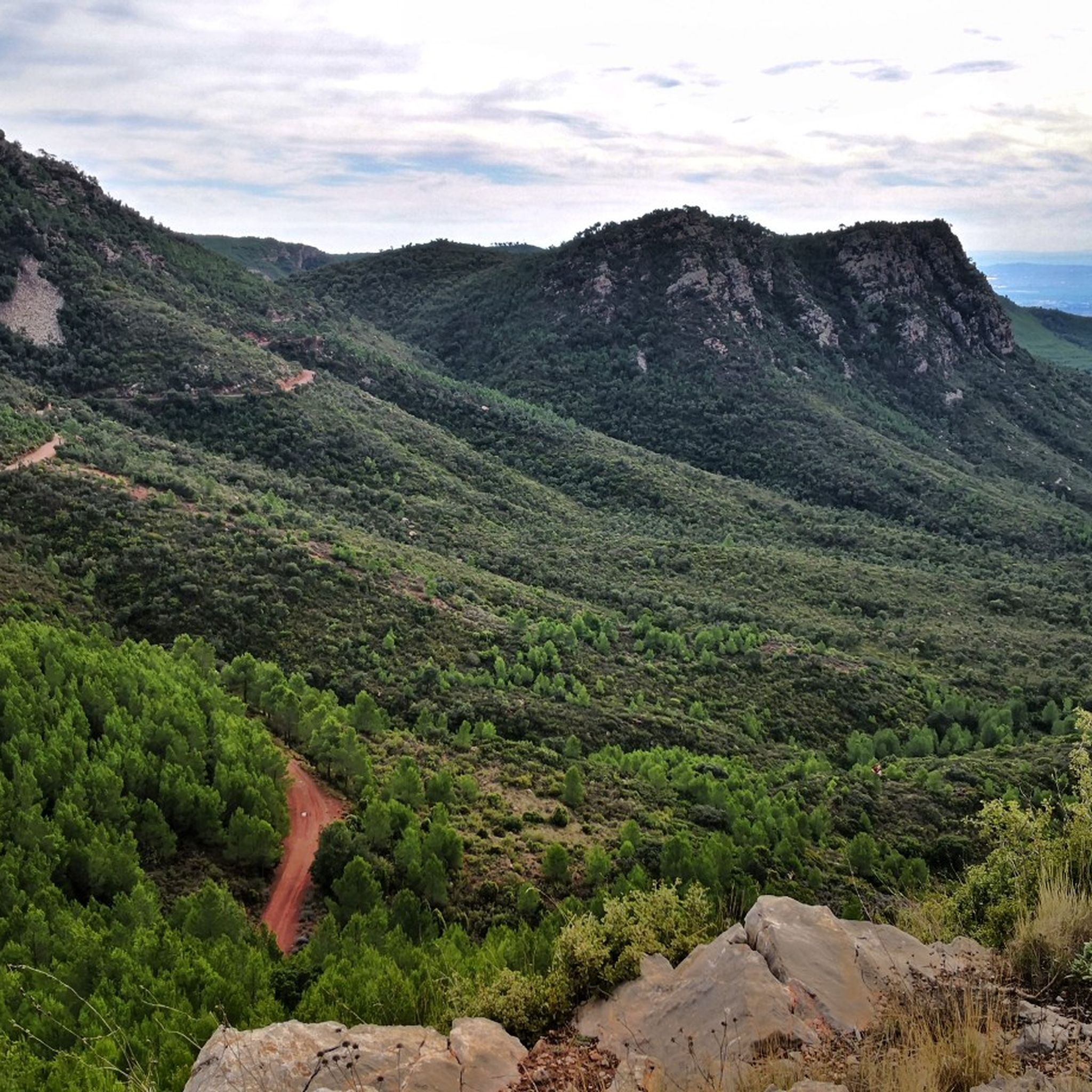
Hiking in Sierra Calderona offers diverse landscapes within the Valencian Community of Spain. The natural park is characterized by mountainous terrain, featuring pine-forested areas, deep gorges, and unique "rodeno" stone formations. These geological features contribute to varied ecosystems and provide numerous opportunities for outdoor activities. The region's trails cater to different skill levels, from accessible paths to more challenging routes.
Best hiking trails in Sierra Calderona
- The most popular hiking route is The route of the Garbí chains - Circular from Segart, a 4.5 miles (7.3 km) trail that takes 2 hours 40 minutes to complete. This difficult circular route offers panoramic views from Segart.
- Another top favourite among local hikers is Ascent to Castillo del Real via the Frare spring — circular route through the Parc Natural de la Serra Calderona, a moderate 4.5 miles (7.3 km) path. This route includes an ascent to Castillo del Real, offering historical interest and scenic views.
- Local hikers also love the Mirador de Rebalsadors — Circular from Serra, a 11.7 miles (18.8 km) trail leading through varied terrain to a prominent viewpoint, often completed in about 5 hours 42 minutes.
- Hiking in Sierra Calderona is defined by mountainous terrain, pine-forested areas, and unique "rodeno" stone formations. The network offers options for different ability levels, from easy loops to more challenging trails.
- The routes in Sierra Calderona are highly rated by the komoot community with an average score of 4.5 stars from over 800 reviews. More than 5000 hikers have used komoot to explore Sierra Calderona's varied terrain.
Last updated: October 7, 2026
4.8
(67)
463
hikers
7.09km
02:40
390m
390m
The Garbí Chains Route - Circular from Segart immerses you in the mountainous landscapes of the Sierra Calderona Natural Park, offering a unique hiking experience. The trail winds through pine forests and rocky ravines, culminating in the famous Garbí Chains section, where an exciting ascent assisted by fixed chains awaits you. From the Mirador del Garbí, the views of the Gulf of Valencia are spectacular, a well-deserved reward after your effort.
For this 7.3-kilometer route, with 382 meters of elevation gain and an estimated duration of 2 hours and 40 minutes, it is essential to be well prepared. It is classified as difficult, so you will need good physical fitness, sturdy footwear, and experience on rocky terrain. It is not recommended for people with vertigo or young children, and it is advisable to carry enough water and start early to avoid the heat.
This route is particularly notable for its assisted scrambling section, which distinguishes it from other trails in the region. The Sierra Calderona, with its Buntsandstein and Muschelkalk geological formations, offers a diverse backdrop rich in Mediterranean flora. It is an excellent option for those seeking a technical challenge and stunning panoramic views near Valencia.
4.7
(75)
210
hikers
Moderate hike. Good fitness required. Easily-accessible paths. Suitable for all skill levels.

4.2
(10)
44
hikers
18.8km
05:42
640m
640m
Hard hike. Very good fitness required. Easily-accessible paths. Suitable for all skill levels.
4.9
(18)
70
hikers
5.94km
01:46
150m
150m
Moderate hike. Great for any fitness level. Mostly accessible paths. Sure-footedness required.
4.2
(14)
39
hikers
Moderate hike. Good fitness required. Easily-accessible paths. Suitable for all skill levels.
Get access to more routes and recommendations from other explorers.
Already have an account?
Our route recommendations are based on thousands of hikes, rides, and runs completed by other people on komoot.
Start today with a free account
Your next adventure awaits.

Tips from the Community

Known in the area as Mirador de Rebalsadores. A good point to set a route goal.
0
0
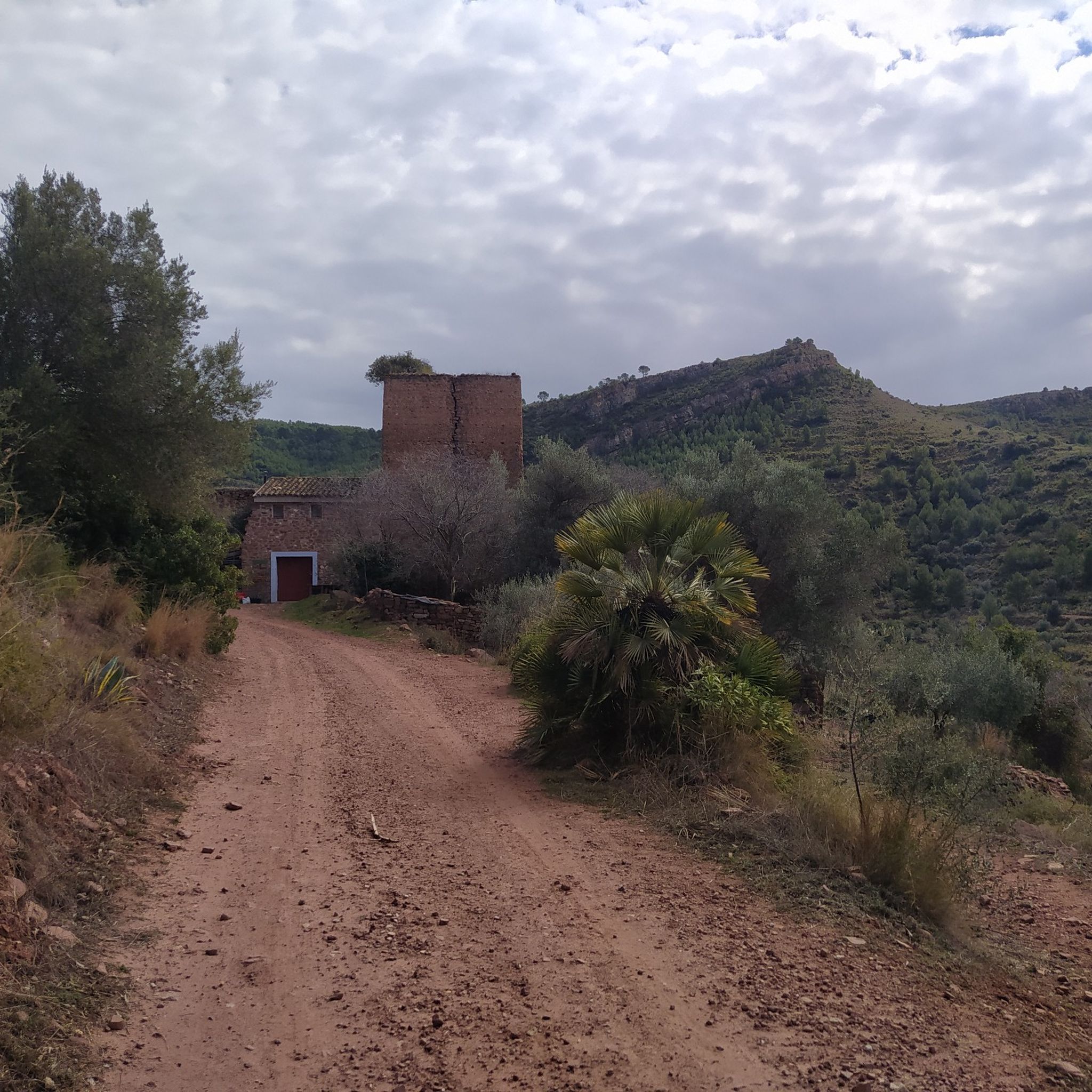
Old Aljive, In the mountains there are many of these constructions, in this case it is quite well preserved and has an explanatory sign. Curious.
0
0
Fuente, you find it on the descent from Rebalsadores to Serra, and a good place to take a breather if you go in the opposite direction. If you make a route to the crossing that goes up to Rebalsadores, you can extend it here and then do some climbing on the way back ;)
0
0

Garbí Viewpoint: Spectacular views of the Gulf of Valencia and, on clear days, as far as the Columbretes Islands. Ideal for sunrises and sunsets.
1
0

Very beautiful route, on clear days you can see the entire Gulf of Valencia from the viewpoint.
0
1

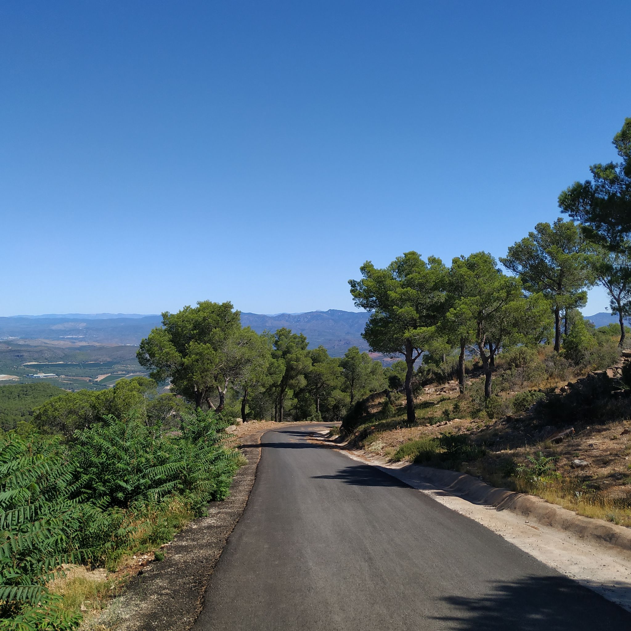
Very pleasant and beautiful route.
0
1
Frequently Asked Questions
What kind of terrain can I expect when hiking in Sierra Calderona?
Sierra Calderona is characterized by its diverse mountainous terrain. You'll find serene pine-forested areas, deep gorges, and unique "rodeno" stone formations. Some routes also feature rivers, caves, and even suspension bridges, offering a varied and engaging hiking experience.
Are there hiking trails suitable for beginners or families with children?
Yes, Sierra Calderona offers a range of trails for different skill levels. There are over 45 easy routes available, perfect for beginners or families. The park has also made efforts to provide accessible routes for people with reduced mobility, utilizing specialized all-terrain wheelchairs.
What are some notable natural features or landmarks to look out for on the trails?
The park is rich in natural and historical landmarks. You can explore unique geological formations like the "rodeno" stone, which is characteristic of the area. Keep an eye out for impressive gorges such as the Barranco del Carraixet, and various viewpoints offering stunning panoramas, including the View of Olocau and the Cliffs of Cova del Cavall.
Are there any circular hiking routes in Sierra Calderona?
Yes, many routes in Sierra Calderona are circular, allowing you to start and end in the same location. For example, the moderate route El Puntal dels Llops — Circular from Olocau is a popular option, covering about 3.7 miles (6 km).
What do other hikers enjoy most about the trails in Sierra Calderona?
The trails in Sierra Calderona are highly rated by the komoot community, with an average score of 4.5 stars from over 800 reviews. Hikers often praise the diverse landscapes, the tranquility of the pine forests, and the stunning panoramic views from various points along the routes.
Can I visit historical sites or castles while hiking in the park?
Absolutely. The region is dotted with historical sites. You can hike to the Castillo del Real, which offers both historical interest and scenic views. The village of Serra also features the visible Castell de Serra and the Moorish-origin Tower of Ermita.
Are there any villages or towns nearby that serve as good starting points or offer amenities?
Yes, charming villages like Gátova and Serra are excellent starting points for hikes and offer cultural attractions. Gátova is known for its historical heritage and the 18th-century "Fuente de los 15 caños." Serra, often considered the heart of Sierra Calderona, is a point along the GR10 long-distance path and has amenities for visitors.
How many hiking trails are available in Sierra Calderona?
There are over 225 hiking routes available in Sierra Calderona, catering to a wide range of preferences and fitness levels. This includes 47 easy, 138 moderate, and 40 difficult trails.
Are there any routes that offer views of the surrounding mountains or coastline?
Many trails provide spectacular views. For instance, the difficult route Mirador de Rebalsadors — Circular from Serra leads to a prominent viewpoint. The village of Serra itself, with its castle, offers views of the surrounding mountains.
What is the best time of year to go hiking in Sierra Calderona?
The diverse landscapes of Sierra Calderona make it suitable for hiking throughout much of the year. Spring and autumn generally offer the most pleasant temperatures for exploring the trails, with lush greenery in spring and vibrant colors in autumn. Even winter can be enjoyable, though some higher elevation trails might require checking local conditions.
Are there any trails that pass by water features like springs or ravines?
Yes, several routes incorporate water features. The route Ascent to Castillo del Real via the Frare spring, for example, includes a spring. You can also find trails that follow ravines, such as those accessible from Gátova along the Carraixet ravine.
Most popular routes in Sierra Calderona
Most popular attractions in Sierra Calderona

Get inspired with the komoot mobile app


Explore more
Browse the best Hikes in other regions.
