The best road cycling routes around Río Tea
4.5
(64)
3,658
riders
168
rides
Road cycling routes around Río Tea navigate a landscape characterized by river valleys, rolling hills, and significant elevation changes. The region offers a diverse terrain for road cyclists, from moderate paths along the river to challenging climbs through the surrounding countryside. This area provides varied road cycling experiences, with many routes featuring substantial ascents and descents.
Best road cycling routes around Río Tea
- The most popular road cycling route is Mondariz Loop, a 31.9 miles (51.3 km) trail that…
Last updated: July 7, 2026
8
riders
51.3km
02:52
1,040m
1,040m
Tackle the difficult Mondariz Return, a 31.9-mile (51.3 km) road cycling route with 3400 feet (1036 metres) of elevation gain.
5.0
(1)
83
riders
53.6km
02:37
560m
560m
Moderate road ride. Good fitness required. Some segments of this route may be unpaved and difficult to ride.

Sign up for free
4.3
(3)
53
riders
61.3km
03:08
920m
920m
Hard road ride. Very good fitness required. Some segments of this route may be unpaved and difficult to ride.
40
riders
119km
06:47
2,370m
2,380m
Hard road ride. Very good fitness required. Some segments of this route may be unpaved and difficult to ride.
38
riders
94.7km
05:38
2,030m
2,030m
Hard road ride. Very good fitness required. Some segments of this route may be unpaved and difficult to ride.
36
riders
57.8km
03:06
830m
830m
Moderate road ride. Good fitness required. Mostly well-paved surfaces and easy to ride.
35
riders
52.8km
02:42
650m
650m
Moderate road ride. Good fitness required. Some segments of this route may be unpaved and difficult to ride.
30
riders
37.9km
01:52
520m
520m
Moderate road ride. Good fitness required. Some segments of this route may be unpaved and difficult to ride.
29
riders
62.4km
03:27
1,180m
1,180m
Hard road ride. Very good fitness required. Some segments of this route may be unpaved and difficult to ride.
22
riders
117km
06:02
1,750m
1,740m
Hard road ride. Very good fitness required. Some segments of this route may be unpaved and difficult to ride.
Get access to more routes and recommendations from other explorers.
Sign up for free
Already have an account?
Our route recommendations are based on thousands of hikes, rides, and runs completed by other people on komoot.
Start today with a free account
Your next adventure awaits.
Login or Signup

Tips from the Community

bridge on the tea river route
0
0

Pilgrims walking the Portuguese Way to Santiago de Compostela pass this bridge, making it a place of great historical significance. If you ever visit Tui, don't miss the opportunity to cross this beautiful bridge and immerse yourself in its history and charm. 🌉🚶♂️
2
0

The Romanesque Cathedral of Santa María with Gothic influences is a fortress-like cathedral that was begun in 1120 but not consecrated until 1225. Its cloister (13th century) is worth mentioning, the only complete medieval cloister that has been preserved in a cathedral in Galicia, and the Santiago Chapel inside the church. The interior can be visited for €3, and you can get your pilgrim stamp at the ticket office.
4
1
The Ponte de A Veiga in Tui, Galicia, is an ancient medieval bridge also known as the "Roman Bridge." Its original construction is attributed to the Romans, and it stands over the Louro River, near where it flows into the Miño. The Ponte de A Veiga was built of granite and consists of four arches. It was part of the ancient Roman Via XIX, which connected Bracara (present-day Braga, Portugal) with Santiago de Compostela. Pilgrims walking the Portuguese Way to Santiago de Compostela pass over this bridge, making it a place of great historical significance. If you ever visit Tui, don't miss the opportunity to cross this beautiful bridge and immerse yourself in its history and charm. 🌉🚶♂️
8
0

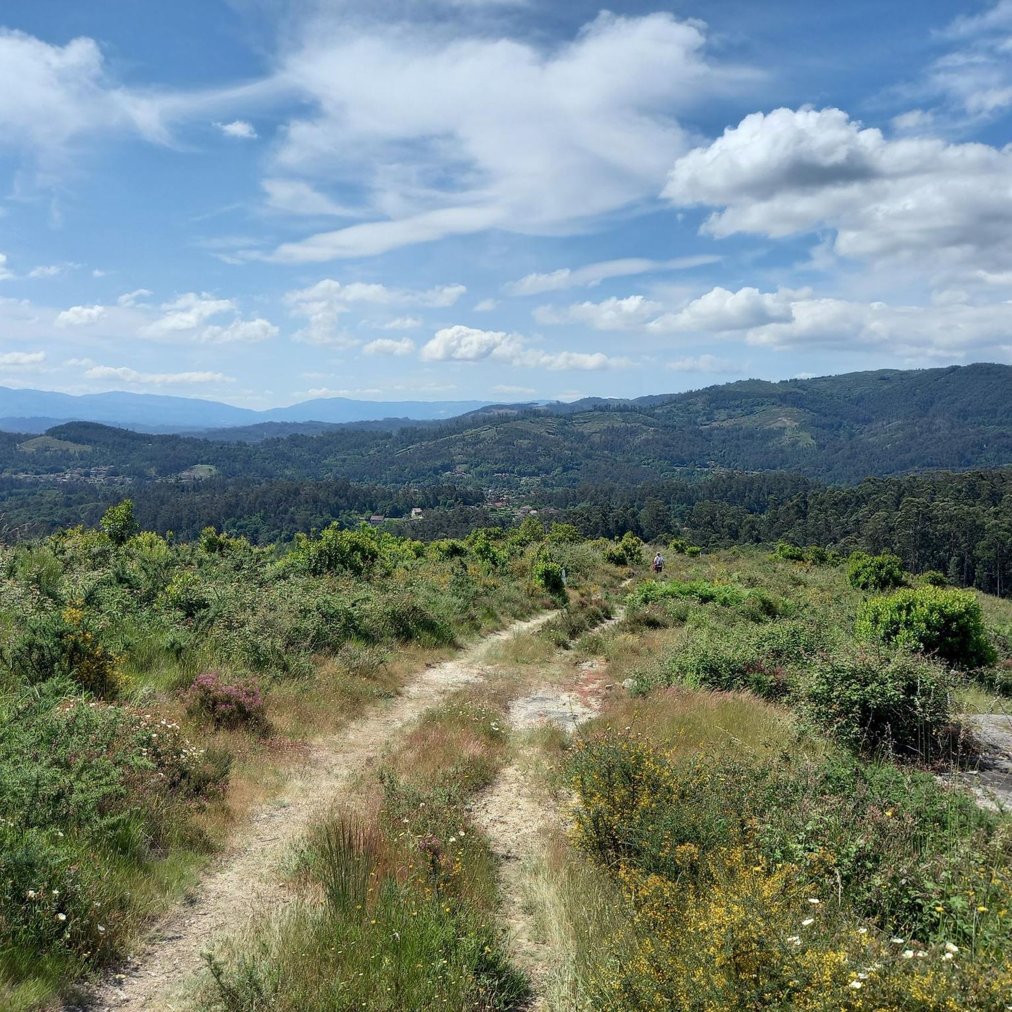
A long climb but never really steep, good training for alpine type climbs. Road surface is excellent.
0
0

If the distance to travel is short, then travel light to avoid setbacks. Don't forget to drink enough water. Remember that just because you don't get thirsty, you shouldn't hydrate yourself. On the contrary, you should always do it. Your body will thank you. Shoes like these are a good option ( hiking boots 🥾 for routes with long walks on asphalt they are not the best) wear comfortable shoes that are not tight and waterproof, dry feet are the best measure but if the weather is dry it will also be a great help.
2
0

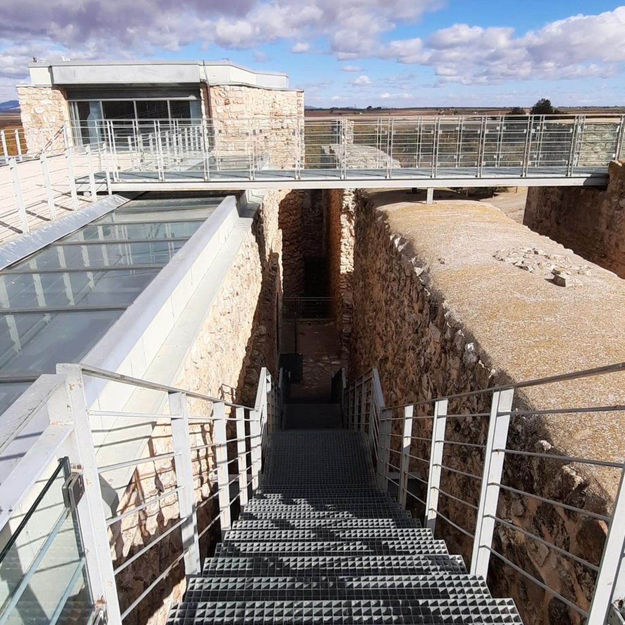
Incredibly well preserved 11th century defensive castle in the mountains above Tui and the Miño valley.
0
0
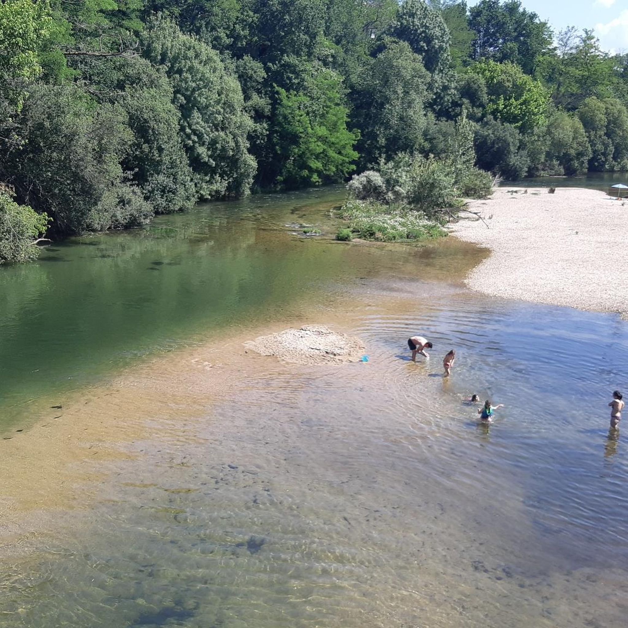
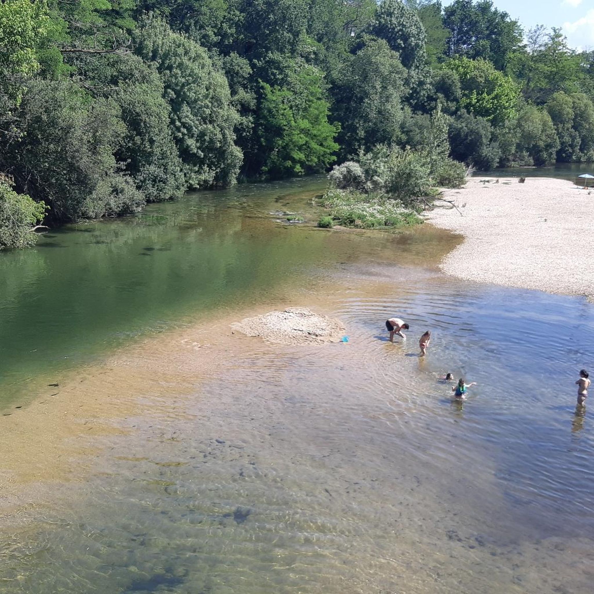
A beautiful river beach on the Tea River north of the town of Ponteareas. Enjoy a wild swim in this unique river landscape.
1
0
Frequently Asked Questions
How many road cycling routes are available in Río Tea?
Río Tea offers a wide selection of road cycling routes, with over 150 options available. These routes cater to various skill levels, including 1 easy route, 77 moderate routes, and 80 difficult routes, ensuring there's something for every cyclist.
What is the best time of year for road cycling in Río Tea?
The Río Tea region, located in Galicia, Spain, generally experiences a mild climate. Spring (April-June) and early autumn (September-October) are often ideal, offering pleasant temperatures and less rainfall than winter, making for comfortable riding conditions. Summers can be warm, especially in July and August.
Are there any easy road cycling routes suitable for beginners in Río Tea?
While many routes in Río Tea feature significant elevation changes, there is at least one easy road cycling route available. For those looking for a more moderate challenge, there are 77 moderate routes that offer rolling terrain without extreme climbs.
What kind of terrain can I expect on road cycling routes in Río Tea?
Road cycling in Río Tea is characterized by a diverse landscape of river valleys, rolling hills, and challenging climbs. You'll encounter varied countryside with both moderate paths along the river and demanding ascents through the surrounding areas, often featuring substantial elevation gains and descents.
What do other road cyclists enjoy most about the routes in Río Tea?
The road cycling routes in Río Tea are highly rated by the komoot community, with an average score of 4.1 stars from over 60 reviews. Cyclists frequently praise the varied terrain, which offers a good mix of river-side paths and challenging climbs, as well as the scenic beauty of the region.
Are there any challenging road cycling routes with significant elevation gain?
Yes, Río Tea is well-known for its challenging routes. For instance, the Mondariz Loop covers 31.9 miles (51.3 km) with over 3,400 feet (1036 meters) of elevation gain. Another demanding option is the Remedios Bridge – Footbridge loop from Ponteareas, which is 114.5 km long and includes over 2,200 meters of climbing.
Are there road cycling routes that form a loop in Río Tea?
Many road cycling routes in Río Tea are designed as loops, offering a convenient way to start and end your ride in the same location. Examples include the popular Footbridge – Ponte da Veiga loop from Ponteareas and the Fountain of the Village of Festín – O Porriño Town Center loop from A Castiñeira.
What interesting landmarks or attractions can I see along the road cycling routes in Río Tea?
The Río Tea area is rich in historical and natural landmarks. Along your rides, you might encounter several notable bridges, such as the historic Ponte de Fillaboa, Bridge of the Partitions, and Remedios Bridge. You could also pass by the impressive Gran Hotel de Mondariz, a significant historical site.
Are there any longer road cycling routes for endurance training?
For those seeking longer rides, the Río Tea region offers several options. The Remedios Bridge – Footbridge loop from Ponteareas is a substantial 71.2 miles (114.5 km) route, while the Remedios Bridge – Cernadela Bridge loop from O Condado covers 58.8 miles (94.6 km), both providing excellent endurance challenges.
What are some moderate road cycling routes in the Río Tea area?
If you're looking for a moderate challenge, the Fountain of the Village of Festín – Mondariz Spa loop from O Condado is a great choice, covering 37.4 miles (60.1 km) with manageable climbs. Another popular moderate route is the Remedios Bridge – Bridge of the Partitions loop from Insua da Aceña, which is 33 miles (53 km) long.
Are there any road cycling routes that pass through the town of O Porriño?
Yes, the Fountain of the Village of Festín – O Porriño Town Center loop from A Castiñeira is a 38.2 miles (61.4 km) route that leads through varied countryside and includes the town of O Porriño, offering a chance to explore the urban center.
Can I find routes that start near Ponteareas?
Absolutely. Ponteareas is a common starting point for several routes. For example, the Footbridge – Ponte da Veiga loop from Ponteareas is a popular moderate route originating from there. Another option is the longer Remedios Bridge – Footbridge loop from Ponteareas.
Most popular routes around Río Tea
Most popular attractions around Río Tea

Get inspired with the komoot mobile app


Explore more
Browse the best Road cycling routes in other regions.
