The best running trails in Pena Trevinca
5.0
(1)
41
runners
7
runs
Jogging routes in Pena Trevinca traverse a diverse landscape characterized by high mountain terrain, glacial lakes, and unique ancient forests. The region, located in the eastern part of Ourense, Spain, features peaks exceeding 2,000 meters and pristine glacial lakes like O Celo and Lagoa da Serpe. Runners can explore significant woodlands, including the Teixadal de Casaio, Europe's largest ancient yew forest, and follow paths alongside high mountain rivers such as the Xares and Bibei.
Best jogging routes in Pena Trevinca
…Last updated: July 12, 2026
5.0
(1)
7
runners
24.1km
03:37
1,050m
1,050m
Hard run. Very good fitness required. Sure-footedness, sturdy shoes and alpine experience required.
3
runners
11.4km
01:20
210m
210m
Moderate run. Good fitness required. Mostly paved surfaces. Suitable for all skill levels.

Sign up for free
5
runners
17.6km
02:35
660m
660m
Hard run. Very good fitness required. Sure-footedness, sturdy shoes and alpine experience required.
3
runners
11.4km
01:20
210m
220m
Moderate run. Good fitness required. Mostly paved surfaces. Suitable for all skill levels.
2
runners
18.1km
02:02
400m
400m
Hard run. Very good fitness required. Mostly paved surfaces. Suitable for all skill levels.
Get access to more routes and recommendations from other explorers.
Sign up for free
Already have an account?
Our route recommendations are based on thousands of hikes, rides, and runs completed by other people on komoot.
Start today with a free account
Your next adventure awaits.
Login or Signup
Popular around Pena Trevinca

Tips from the Community

The summit of Galicia, with very good 360º views
0
0

The path avoids the curves of the meanders that form the main course of the Tera River, and many more of other streams, and without gaining hardly any positive slope it reaches the meadows of Majada Trevinca, at the foot of the imposing east face of the mountain, at the confluence of the torrents that flow down the slopes of Peña Maseirón, Peña Negra, Alto Ladeira da Medias and Peña Surbia, creating a fantastic mountain setting at the sources of the Tera. The path to the top does not let up, it goes straight up the side of the mountain to the summit, the geographical roof of Galicia and the province of Zamora.
0
0

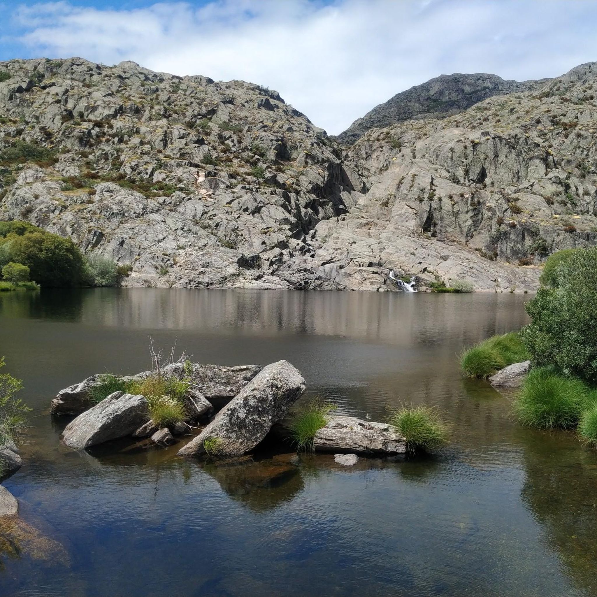
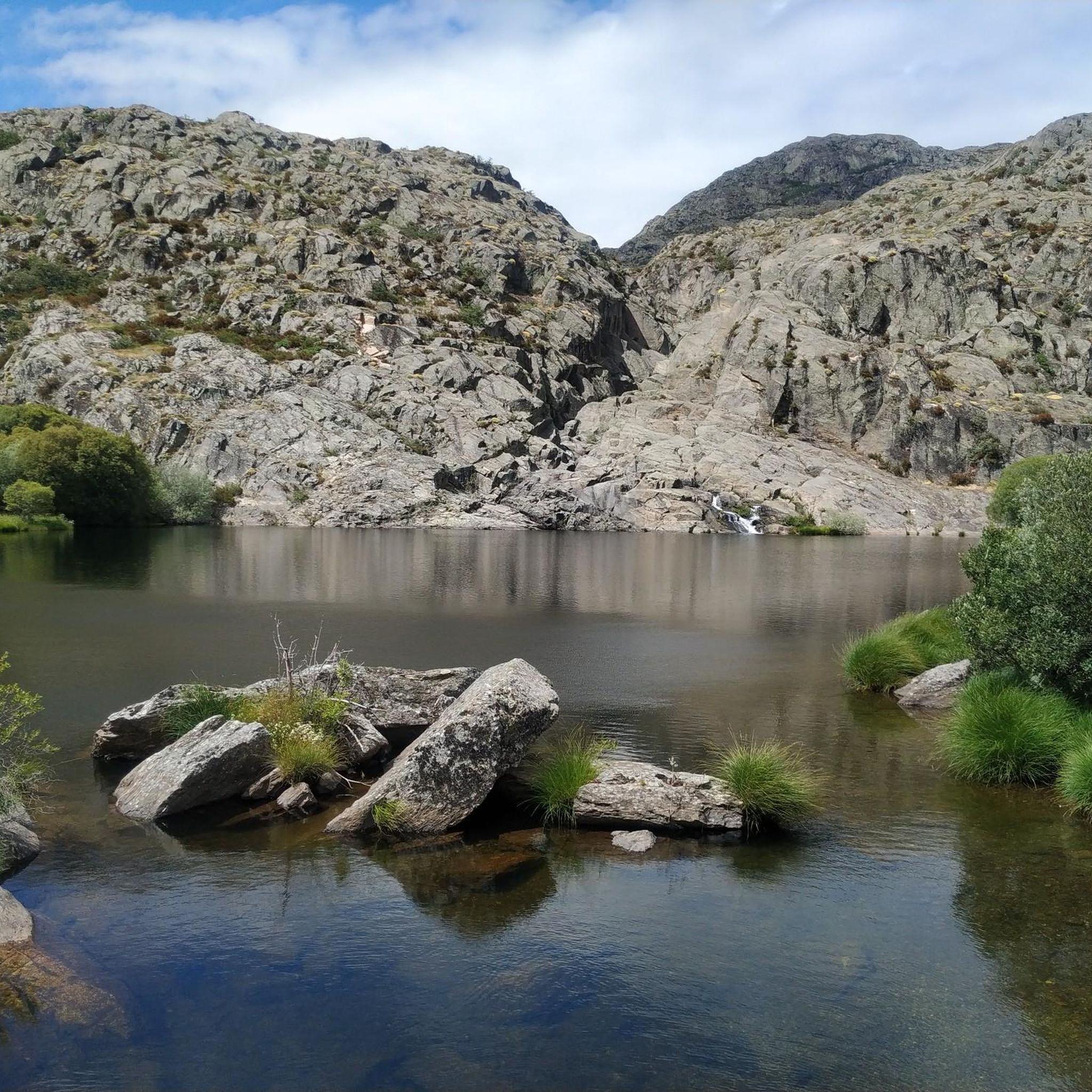
Located to the east of the province of Ourense, the Pena Trevinca mountains are a protected natural space that occupies almost 25,000 hectares. Its peaks, over 2,000 m high and snow-capped in winter, are crowned by glacial lakes such as O Celo or Lagoa da Serpe, with their purest, crystalline waters.
10
0

The Peña Trevinca peak is located at an altitude of 2127 meters above sea level and is located on the provincial border of Ourense with Zamora, thus being the highest peak of both provinces (Galicia and Zamora). The setting is spectacular. I personally recommend the climb from the Laguna de los Peces.
2
0

Viana do Bolo is located in the set of depressions in the southeastern Sierra of Galicia, Pena Trevinca. Built on the ruins of a small fort that is believed to have been first settled when a gold mine was discovered before the Roman Empire settled in the area. The town is located on the banks of the O Vao reservoir, on the Bibei river
1
0
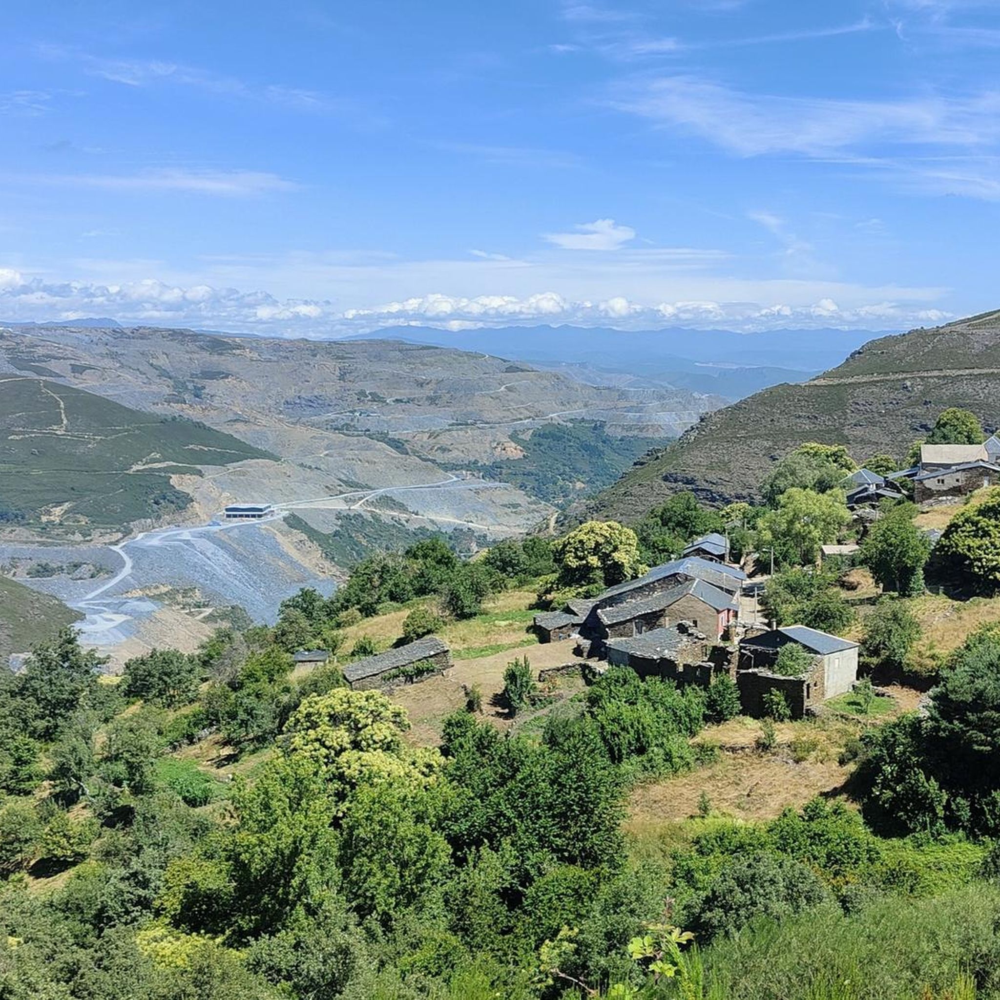
Near Alto da Vesada, at an altitude of 1,190m, you will find a magnificent viewpoint towards the valley of the Xares River and the mountains of the Peña Trevinca massif, whose peaks reach the highest levels in Galicia.
1
1
Viana do Bolo is an old trading post located in the mountains of southeastern Galicia
1
1
Frequently Asked Questions
What types of running routes can I find in Pena Trevinca?
Pena Trevinca offers a diverse range of running routes, from challenging high-mountain ascents to more moderate paths through forests and around glacial lakes. You'll find trails that traverse sub-alpine landscapes, ancient yew forests like the Teixadal de Casaio, and paths alongside high mountain rivers such as the Xares and Bibei. The region is known for its majestic scenery and varied terrain.
Are there any challenging running routes in Pena Trevinca?
Yes, Pena Trevinca is well-known for its challenging running experiences, particularly those reaching its highest peaks. For instance, the Peña Trevinca Summit loop from Vilanova is a difficult 15.0-mile (24.1 km) trail with over 1,000 meters of elevation gain, offering extensive high mountain views. Another demanding option is the Mare of the Mares and Vega de Conde Reservoir — circular trail running from the Fish Lake (GR-84), a difficult 10.7-mile (17.3 km) path exploring glacial lakes and reservoirs.
Are there any easier or moderate jogging trails suitable for beginners in Pena Trevinca?
While many routes in Pena Trevinca are challenging, there are options for those seeking a more moderate or easier experience. The Viewpoint of Viana do Bolo loop from A Ponte de Sanxé is a moderate 7.1-mile (11.4 km) trail with varied terrain and scenic viewpoints. For a shorter, easier run, consider the Castro de As Muradellas - running round trip from the Santuario de la Tuiza, which is just under 3 miles (4.5 km) with minimal elevation gain.
What natural features or landmarks can I expect to see while running in Pena Trevinca?
Pena Trevinca is rich in natural beauty. You can expect to encounter pristine glacial lakes like O Celo, Lagoa da Serpe, Carrizais, and A Laceira, some with local legends. The region also boasts unique forests, including the ancient Teixadal de Casaio, Europe's largest yew forest, and other woodlands with oak and chestnut trees. High mountain rivers like the Xares and Bibei, along with interesting rock formations, add to the scenic diversity.
Are there circular running routes available in Pena Trevinca?
Yes, several circular running routes allow you to experience the diverse landscapes of Pena Trevinca. Examples include the Peña Trevinca Summit loop from Vilanova and the Mare of the Mares and Vega de Conde Reservoir — circular trail running from the Fish Lake (GR-84), both offering extensive loops through the region's stunning terrain.
What kind of wildlife might I encounter on the running trails?
Pena Trevinca is a protected natural space and a haven for wildlife. While running, you might spot deer, wild boar, and hares. The area is also a Special Protection Area for bird-life, so keep an eye out for various bird species, including majestic golden eagles, adding to the sense of wilderness and tranquility.
Is Pena Trevinca suitable for family-friendly jogging or running with children?
While some routes are very challenging, Pena Trevinca does offer options that can be more suitable for families or those jogging with children. Look for shorter, less strenuous paths with minimal elevation gain. The 'Ruta das Lagoas do Xares' is noted as an approximately fourteen-kilometer itinerary suitable for all audiences, allowing exploration of several glacial lakes on relatively accessible terrain.
What is the best time of year to go running in Pena Trevinca?
The best time to go running in Pena Trevinca generally depends on your preference for conditions. Spring and summer offer milder weather and full access to trails, with lush landscapes. Autumn provides beautiful fall colors. However, the high mountain terrain means peaks can be snow-capped in winter, requiring appropriate gear and experience for winter running. Always check local weather conditions before heading out.
Are there any specific parking areas or trailheads for runners in Pena Trevinca?
Specific parking and trailhead information will vary by individual route. Many routes, especially those leading to popular areas like the Peña Trevinca Summit or glacial lakes, will have designated starting points. For example, routes might begin from villages like Vilanova or specific points like Alto do Campo. It's advisable to check the details of your chosen route for precise parking and trailhead locations.
What do other runners enjoy most about jogging in Pena Trevinca?
Runners often praise Pena Trevinca for its untouched natural beauty and the sense of wilderness it provides. The diverse terrain, from ancient forests to high mountain landscapes and pristine glacial lakes, offers a dynamic and engaging experience. Many appreciate the challenge of the higher elevation routes and the opportunity to connect deeply with nature in a relatively isolated environment.
Can I find routes that explore the glacial lakes of Pena Trevinca?
Absolutely. The glacial lakes are a highlight of Pena Trevinca. Routes like the Mare of the Mares and Vega de Conde Reservoir — circular trail running from the Fish Lake (GR-84) specifically explore these beautiful bodies of water. The 'Ruta das Lagoas do Xares' is also an excellent option for experiencing several of these pure, crystalline lakes.
Are there any unique forests to run through in Pena Trevinca?
Yes, Pena Trevinca is home to some truly unique forests. The most notable is the Teixadal de Casaio, an ancient yew forest considered the largest in Europe, featuring over 300 centuries-old yew trees. Running through this enchanting environment, alongside holly, ash, and hazelnut trees, offers a distinct and memorable experience. Other forested areas like the Reboleiras do Navea and Souto de Rozavales provide calming routes among oak and chestnut trees.

Get inspired with the komoot mobile app


Explore more
Browse the best Running Trails & Routes in other regions.
