The best cycling routes around Mistelgau
4.5
(193)
1,085
riders
48
rides
Touring cycling around Mistelgau offers diverse routes through a hilly landscape of dense forests and lush meadows, situated near Bayreuth in Bavaria. The region transitions into the steeper, wooded slopes of Franconian Switzerland to the southwest, providing varied terrain. Cyclists can explore well-developed paths like the Mistelbach–Mistelgau Cycle Path, which follows an old railway line. Distinctive features include the Neubürg table hill, offering panoramic views, and numerous historical sites.
Best touring cycling routes around Mistelgau
- The most popular touring cycling…
Last updated: November 3, 2026
4.3
(27)
139
riders
35.7km
02:20
290m
290m
Moderate bike ride. Good fitness required. Mostly paved surfaces.
4.2
(12)
77
riders
Moderate bike ride. Good fitness required. Mostly paved surfaces.

4.8
(46)
151
riders
16.2km
00:58
110m
110m
Easy bike ride. Mostly paved surfaces.
4.9
(7)
53
riders
Easy bike ride. Mostly paved surfaces.
5.0
(22)
94
riders
37.9km
02:35
260m
260m
Moderate bike ride. Good fitness required. Mostly paved surfaces.
Get access to more routes and recommendations from other explorers.
Already have an account?
Our route recommendations are based on thousands of hikes, rides, and runs completed by other people on komoot.
Start today with a free account
Your next adventure awaits.

Tips from the Community

The residential and stable house built by the musician Konrad Knörl in Mistelgau combines rural architecture with music history. Particularly noteworthy are the artfully carved window sills: a violin, a clarinet, and a flute can be seen here. The beautiful stonework is a regional specialty, as such decorations are otherwise only found on noble and grand bourgeois buildings.
0
0

Anyone who follows the Wiesent downstream from the historic Eichenmühle mill experiences one of the most untouched and picturesque sections of the entire valley. This section of the trail combines spectacular geology, centuries-old cultural history, and a vibrant river ecosystem in a confined space and is best explored on foot or by bike on the paved, natural farm track. The adventure begins directly below the old mill property at the Truppach confluence. Here, the upper Wiesent valley celebrates a small, quiet river spectacle when the Truppach, coming from the direction of Obernsees, joins from the left. Framed by dense alder stands and willows, the confluence area has an almost enchanted atmosphere. Looking back from the small Truppach bridge, you are offered a fantastic panorama: in the foreground, the water merges, while in the background, the historic half-timbered mill and the imposing dolomite walls rise up. Continuing along the river course in the shade of these mighty, bright rock formations, you reach the historic river weir on the Wiesent. Where the water now gently babbles over the barrier, the economic heart of the valley once beat. For centuries, the weir regulated the water level for the so-called "Wässerwiesen" – a sophisticated irrigation system that is now a UNESCO World Heritage site. At the same time, the facility was used for fishing, which is reflected in the name of the subsequent hamlet, Aalkorb. The designation, over a thousand years old, goes back to wooden fish traps that were hung in the flowing Wiesent at precisely these weirs. Today, the former barrier has been ecologically redesigned so that rare fish species such as the brown trout can once again easily pass the obstacle on their migrations. Behind the weir, the valley widens slightly, and the path leads along striking, vertical climbing rocks directly into the elongated district of Waischenfeld, Nankendorf. Here, the Wiesent flows quietly and peacefully through the village, past old willows, and invites you to stop for a well-deserved refreshment after an eventful passage through nature.
4
0
A particularly charming place, both scenically and geographically, in the northern part of Franconian Switzerland is the Eichenmühle, an idyllic estate in the municipality of Plankenfels. The historic property owes its very special significance to its striking location in the region's river system: directly below the mill, the nearly seven-kilometer-long Truppach, coming from Obernsees, flows into the Wiesent, which flows south there, from the left. Nestled in a wide valley bordered by wooded slopes and striking rock formations, the Eichenmühle once used the water power at this distinctive junction as a classic grain mill. Today, the historically rich site, which is reached via a short side road from the main road, is a perfect orientation and resting point for nature enthusiasts. It is located directly on popular hiking and cycling routes – such as the well-known tour “Truppach meets Wiesent” – and makes the gentle, water-rich river landscape of the Franconian natural scenery perfectly experienceable for excursionists.
4
0
An absolute highlight for history and photography enthusiasts in the Wiesenttal is the historic mill in the Nankendorf district of Waischenfeld. First documented in 1539, the striking building is one of the oldest architectural monuments in Franconian Switzerland. The current appearance as a long sandstone and half-timbered building with a hipped roof essentially dates back to 1800 and has been proudly owned by the Sebald family for centuries. Anyone standing on the idyllic riverbank today can admire the impressive undershot water wheel, which until 1992 still ground grain and today generates environmentally friendly green electricity. A closer look at the southern corner of the house also reveals historical flood marks, testifying to the dramatic water levels of past times. After extensive renovation in recent years, the owner family plans to make the fascinating historical mill technology inside accessible to the public in the long term as a small mill museum, making the place a perfect stopover on any discovery tour.
4
0
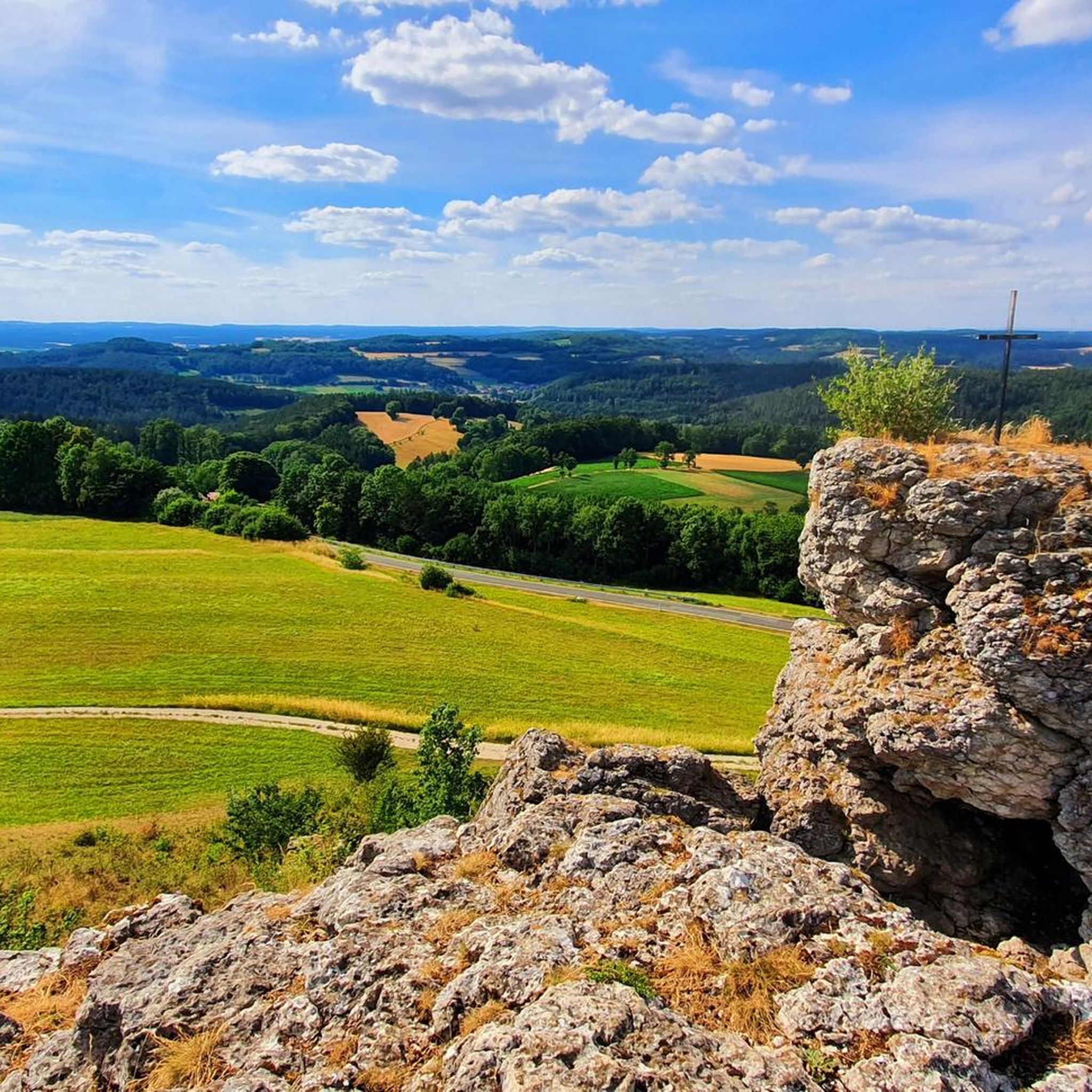
Truppach and Mengersdorf are neighboring districts of the municipality of Mistelgau. Truppach is primarily known for its historic castle, a former moated castle from the 14th century. In adjacent Mengersdorf, the St. Otto Church and a historic manor farm form the cultural centers. The region in the Truppach valley is a popular destination for hikers, especially due to attractions such as the WaldLebensWeg or the nearby Tafelberg Neubürg.
4
0
The Mistelbach cycle path is a central cycling connection in Bayreuth, linking the city center with the southwestern surroundings. It is considered one of the "established axes" in the city's cycle network. The path leads from the Bayreuth city center (near the Rotmain-Center) along the Mistelbach out of town towards the municipality of Mistelbach. It is part of the regional connection from Bayreuth to Hollfeld, which partly runs along a former railway line. The route is considered easy to moderate and is well suited for families due to only short uphill sections.
1
0
The cycle path between Hollfeld and Stechendorf is officially known as the Franconian Switzerland High Trail. The path follows the former railway line between Bayreuth and Hollfeld, which was closed in 1974. Thanks to the use of the old railway line, the route is largely flat and gently sloping. From Hollfeld, the path leads along the Wiesent Valley towards Stechendorf and on to Bayreuth. It is often also referred to as a leisure cycle path or a railway line path.
3
0

Frequently Asked Questions
How many touring cycling routes can I find around Mistelgau?
There are over 40 touring cycling routes available around Mistelgau. These include 11 easy routes, 18 moderate routes, and 12 difficult routes, offering options for various skill levels.
What kind of terrain can I expect when cycling in Mistelgau?
Mistelgau features a diverse, hilly landscape with dense forests and lush meadows. To the southwest, the terrain transitions into the steeper, wooded slopes of Franconian Switzerland, providing a mix of gentle and more challenging rides.
Are there any easy or family-friendly cycling routes in the area?
Yes, Mistelgau offers several easy routes suitable for families. An example is the Obernsees – Pond Near Mistelgau loop from Obernsees, which is an easy 15 km path. The Mistelbach–Mistelgau Cycle Path, running along an old railway line, is also known for being very easy to cycle on and well-developed.
What are some notable landmarks or attractions I can see along the cycling routes?
Cyclists can explore various attractions. The distinctive Neubürg table hill offers panoramic views. You might also encounter historical sites like the Old Castle in Mistelgau or the unique Calypso Grotto and Ruin Theater. For natural wonders, the Mistelgau Fossil Pit is a significant European fossil site.
Are there any circular cycling routes around Mistelgau?
Yes, many routes are designed as loops. For instance, the Viertelstein Rock Formation near Mistelbach – Mistelbach–Mistelgau Cycle Path loop from Mistelgau (VGem) is a popular circular route that incorporates a section of the well-developed Mistelbach–Mistelgau Cycle Path.
What do other touring cyclists say about the routes in Mistelgau?
The touring cycling routes in Mistelgau are highly rated by the komoot community, with an average score of 4.4 stars from over 190 reviews. Cyclists often praise the varied terrain, scenic views, and the well-maintained paths.
Can I find routes that offer scenic viewpoints?
Absolutely. The Neubürg table hill provides excellent panoramic views of the surrounding area. Additionally, the Panoramic view of Oberwaiz – Fantaisie Palace and Park loop from Mistelgau leads through areas known for their scenic vistas.
Are there any caves or waterfalls accessible from the cycling routes?
While not directly on every cycling route, several natural attractions are accessible from Mistelgau. You can explore stunning underground formations at the Sophien Cave or the adventurous Devil's Cave. For waterfalls, nearby options include the Devil’s Hole Waterfalls and Arzloch Waterfall.
What is the best time of year for touring cycling in Mistelgau?
The region is enjoyable for cycling during much of the year. Spring and autumn offer pleasant temperatures and beautiful scenery. Summer is also popular, but it's advisable to start early to avoid the midday heat on longer rides.
Are there any routes that pass through Obernsees?
Yes, the Pond Near Mistelgau – Obernsees loop from Mistelgau is a moderate route that leads through the varied landscape around Mistelgau, including areas near Obernsees. The Lochautal Circular Route also starts in Obernsees.
Where can I find a longer touring cycling route in Mistelgau?
For a longer ride, consider the Panoramic view of Oberwaiz – Mistelbach–Mistelgau Cycle Path loop from Mistelgau. This moderate route covers nearly 49 km, offering a substantial touring experience through the region's diverse landscapes.
Most popular routes around Mistelgau
Most popular attractions around Mistelgau

Get inspired with the komoot mobile app


Explore more
Browse the best Cycling routes in other regions.
