The best traffic-free bike rides around Artenara
4.5
(89)
4,040
riders
5
rides
Road cycling around Artenara offers routes through a mountainous landscape characterized by deep ravines, volcanic formations, and dense pine forests. As the highest municipality on Gran Canaria, the region features significant elevation changes and varied terrain. Predominantly paved routes provide challenging and moderate options for cyclists. The area's rugged geology and natural parks contribute to a diverse cycling environment.
Best no traffic road cycling routes around Artenara
- The most popular no traffic road cycling route is Cenobio Valcón Viewpoint –…
Last updated: June 27, 2026
5.0
(2)
95
riders
52.2km
02:47
980m
970m
Hard road ride. Very good fitness required. Mostly well-paved surfaces and easy to ride.
88
riders
44.8km
02:41
840m
840m
Moderate road ride. Good fitness required. Some segments of this route may be unpaved and difficult to ride.

Sign up for free
36
riders
16.9km
01:11
600m
600m
Moderate road ride. Good fitness required. Mostly well-paved surfaces and easy to ride.
94
riders
33.4km
01:49
600m
600m
Moderate road ride. Good fitness required. Mostly well-paved surfaces and easy to ride.
7
riders
22.5km
01:16
400m
400m
Moderate road ride. Good fitness required. Some segments of this route may be unpaved and difficult to ride.
Our route recommendations are based on thousands of hikes, rides, and runs completed by other people on komoot.
Start today with a free account
Your next adventure awaits.
Login or Signup



Tips from the Community

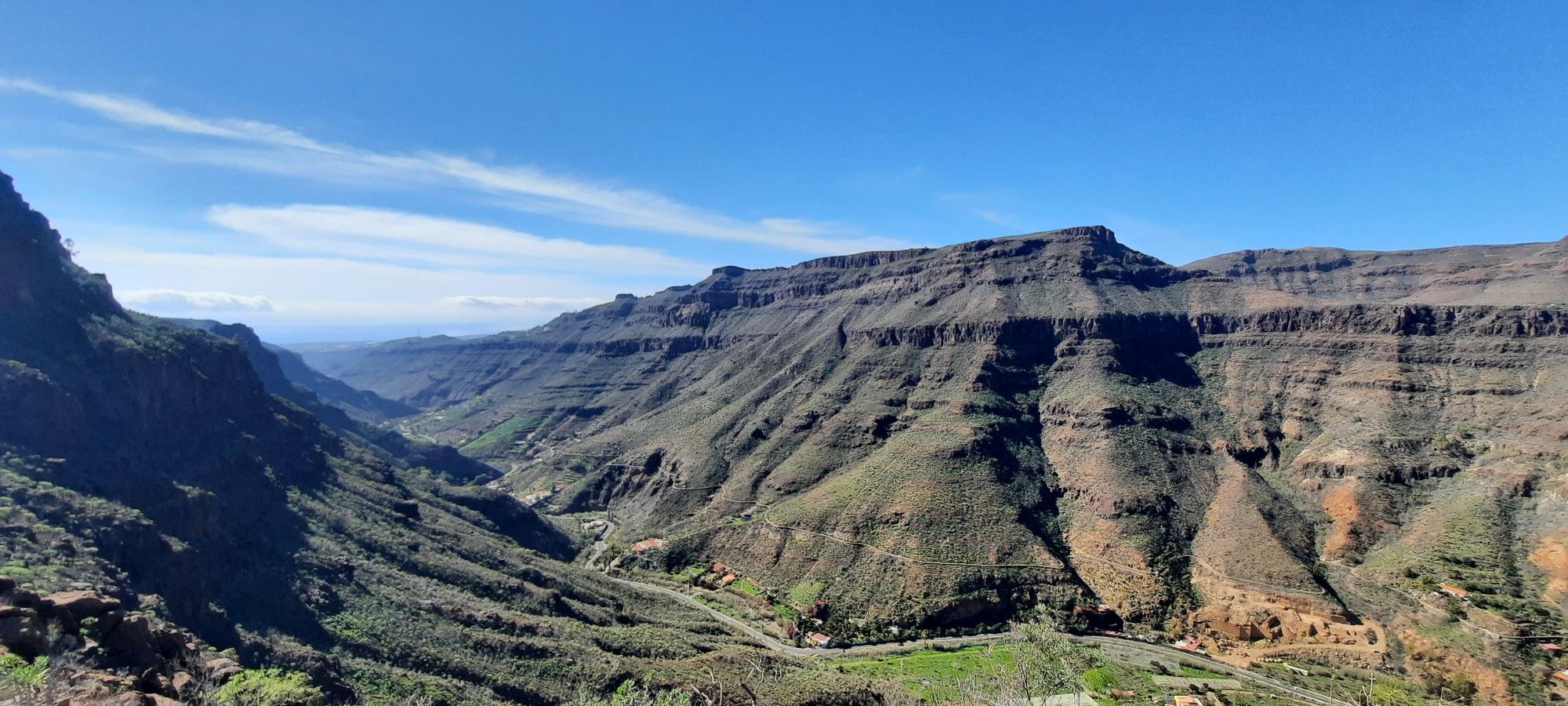
Super nice view over the serpentines and the landscape.
0
0

If you're coming from Santa Maria de Gula de GC, this is a highly recommended descent. Definitely worth planning, as it's a side track and has excellent surface (March 2025)!
0
0

Many riders climbing 😃
0
0

There is a fairly large parking lot directly opposite the entrance to the botanical garden.
0
0
Here you will find a small "park" or rest area with seating - and a beautiful view of Agaete. There is a large public car park nearby
0
0

Beautiful and impressively situated lighthouse.
1
0

The museum is located in the historic center of the town of Gáldar. Its mission is to protect the historical sites there, to conduct scientific research and to communicate the findings to the general public. The institution is named after the Cueva Pintada (painted cave), which was probably created in the 7th century AD by the island's original inhabitants, the Canarios. This cave was forgotten and buried after the conquest of the Canary Islands in the 15th century. It was only rediscovered in the second half of the 19th century. Its cultural and historical significance was already recognized by foreign experts at that time. It was not until the 1970s that a detailed scientific study of the cave began. After the site was declared a Bien de Interés Cultural in 1972, it was protected against environmental influences, which caused damage, among other things, from the irrigation of the surrounding fields. In 1982, access to the cave was closed to the public and in 1987 excavations began in the surrounding area. They revealed that the cave was not an isolated object, but part of a prehistoric settlement with more than 50 houses and other caves. To protect the site, construction began on a new type of museum. An area of 5700 m² was covered. Visitors now have the opportunity to walk through and view the archaeological site on footbridges. Reconstructed aboriginal dwellings were set up and exhibition, information and laboratory rooms were created. The new museum was opened in 2006. It displays objects found on site in separate exhibition rooms, such as pintaderas, statuettes, everyday objects and jewelry made of various materials.
4
0

The museum is more than just the painted cave. it is an archaeological park with real excavation sites where you can imagine what the oldest city in Gran Canaria looked like in indigenous times.
3
0
Frequently Asked Questions
How many no-traffic road cycling routes are available around Artenara?
There are 5 dedicated no-traffic road cycling routes around Artenara featured in this guide. These routes range in difficulty from moderate to difficult, offering diverse experiences for cyclists.
Are there routes suitable for beginners or advanced road cyclists?
While Artenara's mountainous terrain generally presents a challenge, this guide includes 1 easy route, 3 moderate routes, and 1 difficult route. For a challenging ride, consider the Cenobio Valcón Viewpoint – Cenobio de Valerón loop from Agaete, which covers over 52 km with significant elevation gain. The region is known for its demanding ascents and descents.
What kind of distances can I expect on these no-traffic routes?
The routes vary in length, catering to different preferences. You'll find rides ranging from approximately 17 km, like the Tauro Pass Serpentine Road – Barranco de Mogán loop from Pie De Cuesta, up to over 52 km for longer excursions. The average distance for routes in this guide is around 34 km.
What are the best times of year for no-traffic road cycling in Artenara?
Gran Canaria's generally favorable weather conditions make Artenara an appealing destination for cycling year-round. However, the cooler, drier months from autumn to spring (October to May) are often preferred, avoiding the peak summer heat while still enjoying pleasant temperatures for challenging climbs.
What scenic viewpoints can I discover along these routes?
Artenara is renowned for its breathtaking panoramic viewpoints. Many routes offer views of iconic landmarks like Roque Nublo and Roque Bentayga. You might pass by viewpoints such as the Unamuno Viewpoint, Mirador del Corazón de Jesús, or La Cilla Viewpoint, offering expansive vistas of the island's characteristic ravines and volcanic peaks. For specific highlights, check out the Roque Nublo or Roque Bentayga highlight pages.
Are there any circular no-traffic road cycling routes in Artenara?
Yes, all the routes listed in this guide are circular, allowing you to start and end at the same point. For example, the Limon y Miel – View of Agaete loop from Necrópolis de Maipez de Arriba offers a moderate 44.8 km loop through the scenic landscape.
What cultural or historical sites can I see near the cycling routes?
Artenara offers a rich cultural experience. You can explore traditional cave dwellings and the Ethnographic Museum, which provides insights into the ancient inhabitants' way of life. The Archaeological Complex of Acusa is also nearby. The Virgen de la Cuevita Hermitage, carved into volcanic rock, is a unique spiritual site often visited by cyclists. For more, explore the Caves around Artenara guide.
Where can I park my car when starting a no-traffic road cycling route in Artenara?
As Artenara is a municipality, parking is generally available within the town or at designated starting points for routes. It's advisable to check local parking regulations upon arrival, especially in smaller villages or near popular trailheads. Many routes, like the View of Agaete – Climbing and Bouldering Wall loop from Agaete, start from towns where parking facilities are more common.
What do other cyclists say about the no-traffic road cycling routes in Artenara?
The komoot community highly rates the cycling experiences around Artenara, with an average score of 4.52 stars. Reviewers often praise the challenging climbs, the stunning panoramic views of the volcanic landscape, and the sense of tranquility on these less-trafficked roads.
Are there any family-friendly no-traffic road cycling options?
Given Artenara's mountainous and challenging terrain, many routes feature significant elevation changes, making them more suitable for experienced cyclists. However, the guide does include 1 easy route. For families with younger or less experienced riders, it's recommended to carefully review the route profiles and choose shorter, less steep sections or consider routes with lower elevation gain, such as the View of Agaete – Climbing and Bouldering Wall loop from Agaete, which has less than 400m of elevation gain.
What natural features should I look out for while cycling in Artenara?
The region is a natural marvel. You'll cycle through deep ravines, past unique volcanic formations, and extensive Canary Island pine forests, particularly within the Tamadaba Natural Park and Roque Nublo Rural Park. Keep an eye out for the iconic rock formations of Roque Nublo and Roque Bentayga, which are visible from many points. The area also features several dams like Los Pérez, Lugarejos, and Las Hoyas, offering picturesque views.
Most popular attractions around Artenara

Get inspired with the komoot mobile app


Explore more
Browse the best Road cycling routes in other regions.
