The best traffic-free bike rides around Minglanilla
5.0
(2)
10
riders
3
rides
Gravel biking around Minglanilla offers a diverse landscape characterized by mountainous terrain, dense forests, and varied trails. The region features significant elevation changes, providing challenging climbs and panoramic views. Trails often combine unpaved roads with singletrack sections, catering to different skill levels. This area is known for its natural features, including hills and forested areas, making it suitable for no traffic gravel bike trails.
Best no traffic gravel bike trails around Minglanilla
- The most popular no traffic gravel bike trail…
Last updated: June 27, 2026
2
riders
35.1km
02:51
330m
330m
Moderate gravel ride. Good fitness required. Mostly paved surfaces. Suitable for all skill levels.
5.0
(1)
2
riders
48.9km
04:08
670m
660m
Hard gravel ride. Very good fitness required. Mostly paved surfaces. Suitable for all skill levels.

Sign up for free
2
riders
64.9km
05:15
720m
720m
Hard gravel ride. Very good fitness required. Mostly paved surfaces. Suitable for all skill levels.
Our route recommendations are based on thousands of hikes, rides, and runs completed by other people on komoot.
Start today with a free account
Your next adventure awaits.
Login or Signup
Popular around Minglanilla

Other adventures around Minglanilla

Tips from the Community

At this point, you'll pass through a private estate with a large house. We didn't see any gates or doors blocking your way, but it's best to be careful in case a guard dog comes out.
0
0
In the village of Los Cárceles in the Community of Castilla la Mancha we can cross the Cabriel river over two bridges and go to the Valencian community.
0
0
The bridge is built of carved stone and is founded with the same rocks that can be found on the banks of the river. Its single eye has about 33 m of span, making it one of the largest bridges of its kind not only in Spain, but also on the European continent.
0
0
Vadocañas Bridge It is a viaduct of Roman origin that connects the regions of Cuenca and Valencia passing over the waters of the Cabriel in a protected space known as the Hoces del Cabriel Natural Park – cataloged as a Natural Reserve on its La Mancha slope.
0
0
Los Cárceles is a Spanish town and district belonging to the municipality of Villamalea, in the province of Albacete, autonomous community of Castilla-La Mancha. It is located at the northern end of the Manchuela Albaceteña region, at the confluence of the limits of the provinces of Valencia, Cuenca and Albacete.
0
0

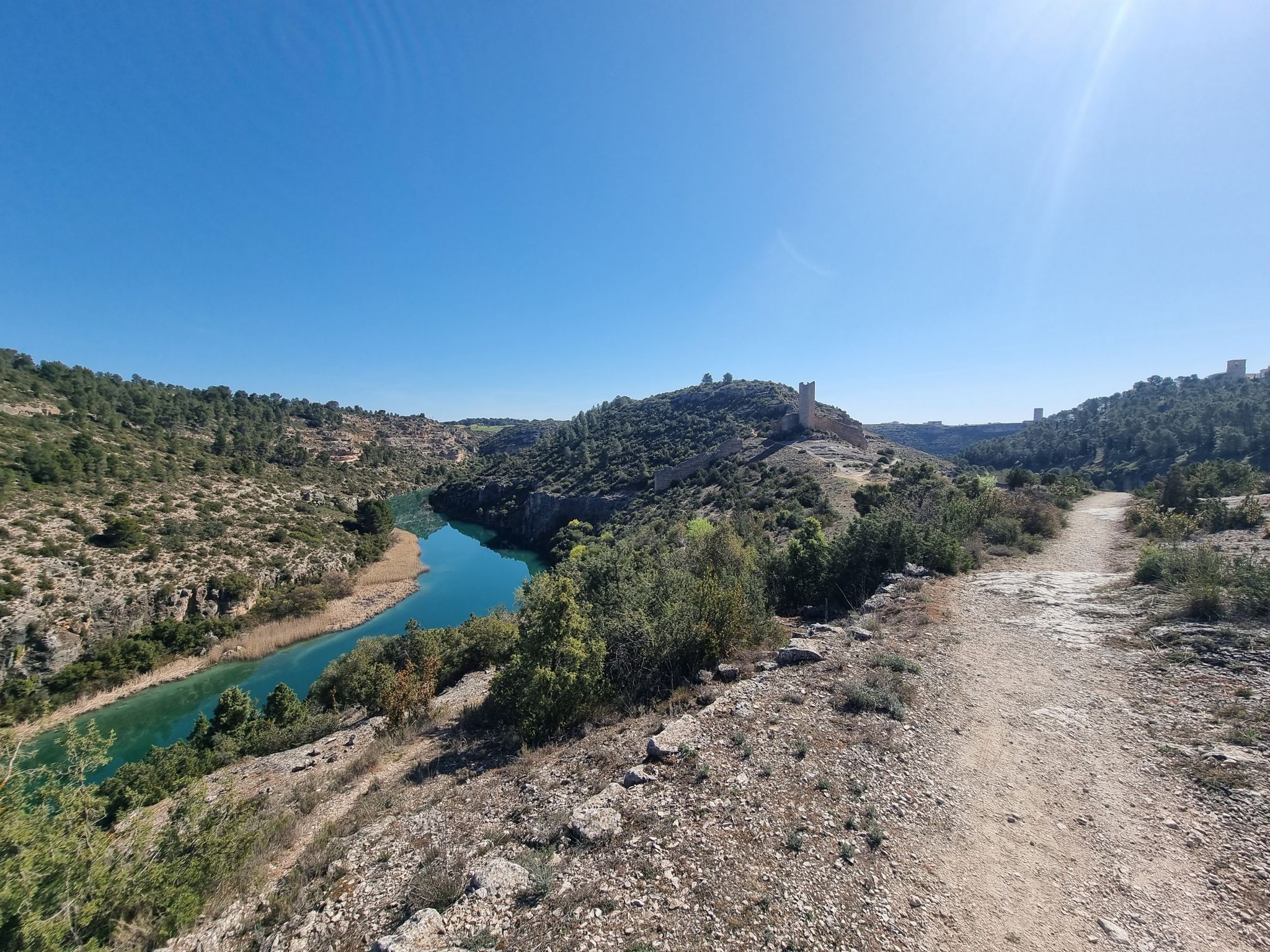
The cycling adventure leaves Los Cárceles along the river plain, passes the Barranco de la Vida and goes up a forest track for a few kilometers to avoid the narrowest meanders of the canyon. In this section there are paths near the shore of the Cabriel, marked with the GR-66 signs, but some are not cyclable for gravel bicycles and it is more convenient to go around the mountain. The climb is about four kilometers, to the agricultural fields of Los Armalletes, then the route takes a forest track to the right and goes down to Venta de Vadocañas, one of the historic passes between La Mancha and Valencia. The other was the Pajazo bridge, which is now submerged in the waters of the Contreras reservoir. The Vadocañas bridge is monumental, it has an eye of 33 light meters and shows an extraordinary work of ashlar masonry, the origin is Roman, although the current construction is from the 16th century. “Cars and people pass by. The eye has one hundred and twenty feet in a very long hole. They claim to be the largest and best and with the largest and largest stones in the kingdom, and they pass beasts, and everything else, from Toledo and other parts to Valencia and Requena where the customs is. On the Valencian shore there are signs for the Turia-Cabriel Nature Trail towards Villargordo del Cabriel. The climb is long, you have to climb again to the agricultural fields of La Plana along the rugged slopes of the Sierra del Rubial, it is a good time to see mountain goats, deer and wild boar. On Mount Moluengo there is a non-cyclable section, known as Senda de la Cueva de los Ladrones, and before arriving there is a detour on the left that crosses the mountain range along a forest track with good cyclability and connects with the Nature Trail in the ravine. from Los Pocicos, following the red milestones until the end of the stage between the vineyards of Villargordo del Cabriel.
0
0

The cycling adventure leaves Los Cárceles along the river plain, passes the Barranco de la Vida and goes up a forest track for a few kilometers to avoid the narrowest meanders of the canyon. In this section there are paths near the shore of the Cabriel, marked with the GR-66 signs, but some are not cyclable for gravel bicycles and it is more convenient to go around the mountain. The climb is about four kilometers, to the agricultural fields of Los Armalletes, then the route takes a forest track to the right and goes down to Venta de Vadocañas, one of the historic passes between La Mancha and Valencia. The other was the Pajazo bridge, which is now submerged in the waters of the Contreras reservoir. The Vadocañas bridge is monumental, it has an eye of 33 light meters and shows an extraordinary work of ashlar masonry, the origin is Roman, although the current construction is from the 16th century. “Cars and people pass by. The eye has one hundred and twenty feet in a very long hole. They claim to be the largest and best and with the largest and largest stones in the kingdom, and they pass beasts, and everything else, from Toledo and other parts to Valencia and Requena where the customs is. On the Valencian shore there are signs for the Turia-Cabriel Nature Trail towards Villargordo del Cabriel. The climb is long, you have to climb again to the agricultural fields of La Plana along the rugged slopes of the Sierra del Rubial, it is a good time to see mountain goats, deer and wild boar. On Mount Moluengo there is a non-cyclable section, known as Senda de la Cueva de los Ladrones, and before arriving there is a detour on the left that crosses the mountain range along a forest track with good cyclability and connects with the Nature Trail in the ravine. from Los Pocicos, following the red milestones until the end of the stage between the vineyards of Villargordo del Cabriel.
0
0

Graja de Iniesta is a small town in Cuenca surrounded by olive groves, vineyards and other crops. In its urban area you can find various services ideal for the traveler.
0
0
Frequently Asked Questions
What kind of no-traffic gravel bike trails can I expect in Minglanilla?
Minglanilla offers a variety of no-traffic gravel bike trails, ranging from challenging climbs in mountainous terrain to serene, tree-lined paths. You'll find a mix of unpaved roads, dirt trails, and even some singletrack sections, providing diverse experiences for gravel bikers seeking quiet routes.
Are there any challenging no-traffic gravel routes in Minglanilla?
Yes, Minglanilla's mountainous areas, such as those around Camp 7 and Lubas, provide tough climbs and significant elevation gains, perfect for experienced gravel bikers looking for a challenge away from traffic. The region is known for trails that offer intense workouts and panoramic views.
Can I find family-friendly gravel bike trails with no traffic in Minglanilla?
While many trails in Minglanilla offer challenging terrain, the region also has options for less strenuous rides. For a beginner-friendly experience, consider the 15km loop around Mt. Campagao, which starts and ends at the Municipal Hall and offers a manageable elevation gain, potentially with quieter sections.
What are some scenic viewpoints or natural attractions along the gravel trails?
Minglanilla's gravel trails often lead to stunning natural attractions. You can find picturesque stops at various waterfalls like Hinagdanan Falls, Kabugbugan Falls, Matun-og Falls, and Cuasan Falls. The Hoz del Rabo de la Sartén Viewpoint and Incredible viewpoint offer breathtaking vistas of the gorges and landscapes.
Are there any historical landmarks or interesting sites to see near the trails?
Yes, you can explore historical sites like the Peñas Blancas Path Trench and Contreras Trench. Additionally, the Vadocañas Bridge and Contreras Bridge - Cabriel River are notable structures that you might encounter on or near some routes.
What is the best time of year for gravel biking in Minglanilla to avoid traffic?
The best time for gravel biking in Minglanilla, especially to enjoy quieter trails, is typically during the dry season, which generally runs from December to May. This period offers more stable weather conditions, making trails less muddy and more accessible, and often allows for clearer views.
Are there any loop gravel bike routes in Minglanilla that are traffic-free?
Yes, many of Minglanilla's gravel trails are designed as loops or can be combined to form circular routes, allowing you to start and end at the same point without encountering significant traffic. For example, the Mt. Campagao trail offers a 15km loop, and other routes like the Graja de Iniesta loop from Graja de Iniesta provide a substantial circular ride.
Where can I find parking for gravel bike trails in Minglanilla?
Parking availability varies by trail. For routes starting near the Municipal Hall, such as the Mt. Campagao loop, you may find parking in designated areas within the town. For more remote trails like those in Camp 7, informal parking spots are often available near trailheads, but it's advisable to check local conditions or community forums for specific recommendations.
Are there any cafes or pubs near the quiet gravel routes in Minglanilla?
While the more remote gravel trails offer solitude, you'll find local eateries and small shops in Minglanilla's town proper and in some of the larger barangays. These can be good spots to refuel before or after your ride. For specific recommendations, it's best to check local guides or ask residents upon arrival.
What should I bring for gravel biking on Minglanilla's trails?
Given the varied terrain and potential for challenging climbs, it's essential to bring plenty of water, snacks, a repair kit, and appropriate safety gear. Sun protection is crucial, and a fully charged phone with offline maps is highly recommended, especially on less-trafficked routes. Depending on the season, light rain gear might also be useful.
What do other gravel bikers enjoy most about Minglanilla's trails?
The komoot community highly rates the gravel biking experience in Minglanilla, with an average score of 5.0 stars. Reviewers often praise the challenging climbs, the diverse natural landscapes including forests and waterfalls, and the opportunity to escape traffic for a peaceful and adventurous ride.
Most popular attractions around Minglanilla

Get inspired with the komoot mobile app


Explore more
Browse the best Gravel rides in other regions.
