The best hikes from bus stations around Area A (Kicking Horse/Kinbasket Lake)
4.7
(3003)
28,532
hikers
29
hikes
Bus station hiking trails around Area A (Kicking Horse/Kinbasket Lake) traverse a landscape defined by the Rocky and Purcell Mountains, featuring diverse terrains from alpine meadows to river valleys and subalpine forests. The region is characterized by glacier-fed lakes, powerful waterfalls, and ancient forests, with the Kicking Horse River carving dramatic canyons. Hikers can explore a variety of geological formations and extensive wetlands, offering a range of experiences.
Best bus station hiking trails around Area A (Kicking Horse/Kinbasket Lake)
- The…
Last updated: September 2, 2026
5.0
(1)
18
hikers
2.84km
00:45
30m
30m
Easy hike. Great for any fitness level. Easily-accessible paths. Suitable for all skill levels.
8
hikers
11.2km
03:44
480m
480m
Hard hike. Good fitness required. Sure-footedness, sturdy shoes and alpine experience required.

Sign up for free
5.0
(2)
6
hikers
6.66km
02:54
420m
420m
Hard hike. Good fitness required. Sure-footedness, sturdy shoes and alpine experience required.
5.0
(2)
8
hikers
5.94km
01:58
240m
240m
Hard hike. Great for any fitness level. Sure-footedness, sturdy shoes and alpine experience required.
Get access to more routes and recommendations from other explorers.
Sign up for free
Already have an account?
Our route recommendations are based on thousands of hikes, rides, and runs completed by other people on komoot.
Start today with a free account
Your next adventure awaits.
Login or Signup
Popular around Area A (Kicking Horse/Kinbasket Lake)
Other adventures around Area A (Kicking Horse/Kinbasket Lake)


Tips from the Community

Opabin Prospect is renowned as one of the most breathtaking and iconic panoramic views in the entire region. Hikers stand on a cliff band getting a vertical perspective of the vibrant blue waters of Lake O'Hara and Mary Lake, framed by massive peaks like Cathedral Mountain. The shortest route to the lookout is a 5.3-kilometre out-and-back on the West Opabin Trail, but if you have more time, consider a longer hike or look hike all the way around Lake O'Hara. Access to the area is strictly limited to 200 visitors per day via a competitive Parks Canada shuttle lottery, so if you can get the opportunity to hike, pack your lunch, layers and camera and enjoy the area for as long as you can.
0
0
Cascade Lakes are a series of three alpine lakes just south uphill from Lake O'Hara. They are breathtaking lakes full of bright turquoise water, and a great spot to have lunch at on a hike, since they can only be reached on foot. There are large, flat boulders to sit on at the water's edge, great for laying out on, and in fall the larch trees around the lake display a golden show of changing needles.
0
0
Seven Veils Falls is a brief out and back spur trail from the Lake O'Hara Circuit Trail along the turquoise-coloured Lake O'Hara shore. The falls get their name from the way the water cascades down a series of wide, terraced rock steps, divided into seven delicate veils of water. Hikers can hear the water rushing as far back as the Lake O'Hara Lodge area. The best place to view the falls is from the official viewing platforms, as the Lake O'Hara Trails Club recently constructed stone viewing and photography platforms for the best photos and to protect the fragile ecosystem around the falls.
0
0

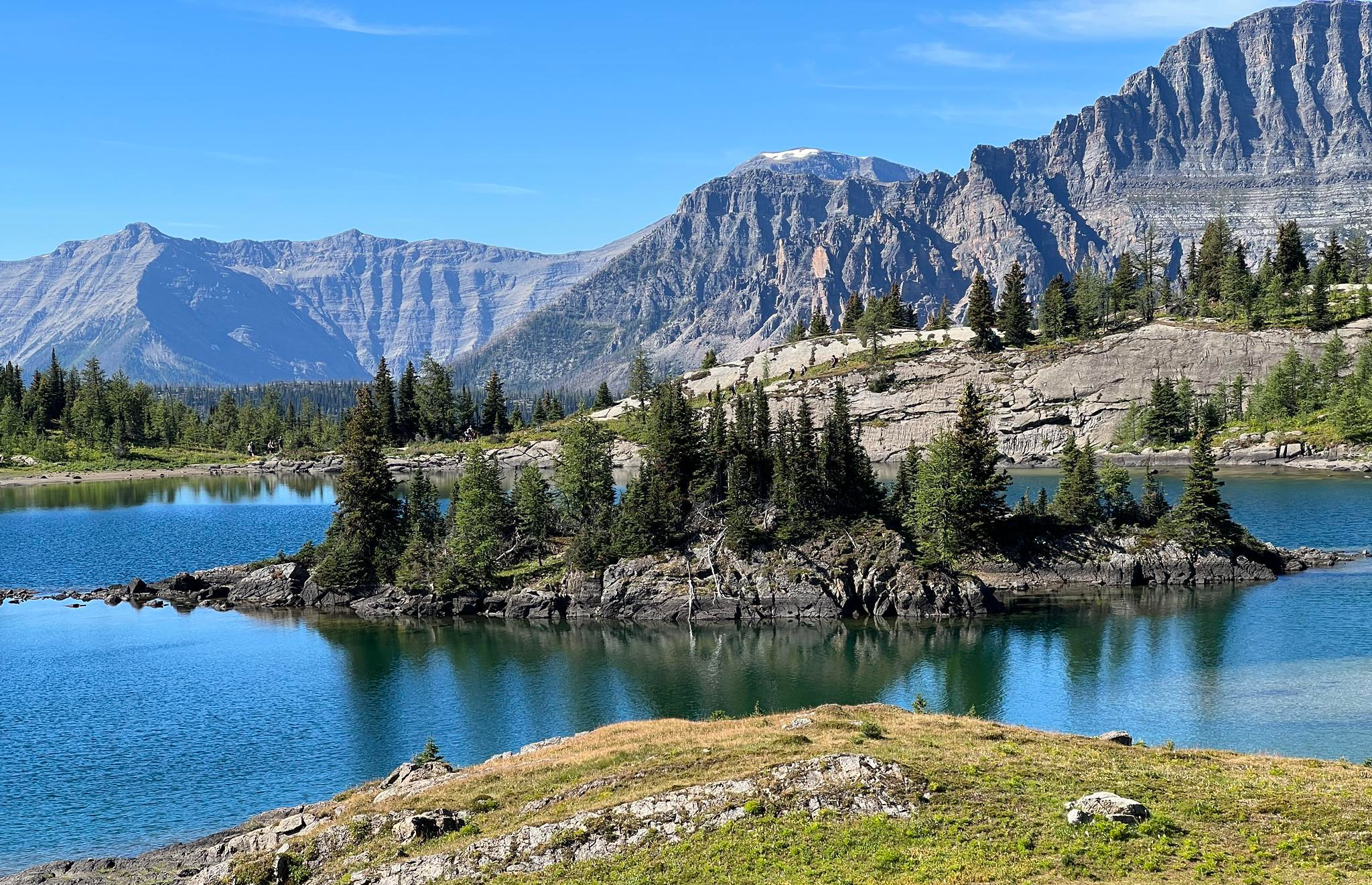
The views around Lake O'Hara are stunning no matter where you are, but the reflection on the water you get from here is truly special. However, this isn't somewhere you go to on a whim. Reservations are required to take the bus out to the lake, otherwise it's a long hike (22 km, round trip) in on the access road.
0
0
If you're hiking the Alpine Circuit in the recommended clock-wise manner then this viewpoint will be the payoff for your final steep ascent, and what a payoff it is! You'll be treated to spectacular views across the lake, valley, and surrounding mountains.
0
0
Access to Lake O'Hara is strictly controlled to preserve the delicate ecosystem and to offer a better experience for those who do visit the lake. The lottery controlled shuttle bus drops off at the campground and near the Le Relais Shelter for those lucky enough to win a reservation.
0
0
This section of trail gives you excellent views of Mary Lake in the foreground and the surrounding mountains in the distance.
0
0
High in Yoho National Park’s alpine realm, Lake Oesa sits at about 2,267 metres (7,438 ft) and is reachable via a scenic climb from nearby Lake O’Hara. Its name comes from the Stoney word for “corner,” likely referencing how the lake is tucked into a rock-walled niche.
0
0
Frequently Asked Questions
How many bus-accessible hiking trails are available in Area A (Kicking Horse/Kinbasket Lake)?
There are over 30 hiking trails in Area A (Kicking Horse/Kinbasket Lake) that are accessible from bus stations. These routes offer a diverse range of experiences, from easy strolls to challenging alpine treks, allowing you to explore the stunning Rocky and Purcell Mountains, glacier-fed lakes, and river valleys without needing a car.
Are there easy or beginner-friendly hikes accessible from bus stations in Area A?
Yes, Area A offers several easy and beginner-friendly hikes directly accessible from bus stops. For instance, the Lake O'Hara Shoreline Trail loop is an excellent choice, providing a gentle 2.8 km path around the exquisite Lake O'Hara, known for its jewel-blue waters and breathtaking vistas. There are 7 easy routes in total.
What kind of natural attractions can I expect to see on these bus-accessible hikes?
The bus-accessible hikes in Area A lead to some of the region's most iconic natural attractions. You can encounter stunning glacier-fed lakes like Emerald Lake and Moraine Lake, as well as powerful waterfalls such as Wapta Falls. Many trails also offer views of dramatic canyons, ancient forests, and the majestic Rocky and Purcell Mountains.
Are there any circular hiking routes available from bus stations?
Yes, several bus-accessible routes are designed as circular hikes, allowing you to start and end at the same point without retracing your steps. The Lake O'Hara Shoreline Trail loop is a prime example, offering a beautiful circuit around the lake. These loops are perfect for experiencing diverse scenery without logistical concerns.
Can I bring my dog on these bus station hiking trails?
Many trails in Area A are dog-friendly, but regulations can vary, especially within National Parks. Always check specific park rules and trail signage regarding pets. Generally, dogs must be kept on a leash. Ensure your dog is well-behaved and that you carry waste bags to maintain the pristine environment.
What is the best time of year to hike from bus stations in Area A?
The best time for hiking in Area A is typically from late spring (June) through early autumn (September). During these months, trails are generally free of snow, weather is more stable, and bus services to popular trailheads are usually fully operational. Always check current trail conditions and bus schedules before you go.
Are there any challenging or difficult hikes accessible by bus?
Absolutely. For experienced hikers seeking a challenge, Area A offers several difficult routes accessible by bus. The Lake Oesa – Lake O'Hara loop from Lake O'Hara is a demanding 11.2 km hike with significant elevation gain, leading to stunning alpine views. Another challenging option is the Le Relais Day Shelter – Lake O'Hara loop from Lake O'Hara, which covers 6.6 km with substantial ascents.
What do other hikers enjoy most about bus-accessible trails in Area A?
The bus-accessible trails in Area A are highly rated by the komoot community, with an average score of 4.7 stars. Reviewers often praise the convenience of reaching spectacular natural beauty without a car, the well-maintained paths, and the incredible diversity of landscapes, from serene lake shores to rugged mountain passes. The ability to access iconic spots like Lake O'Hara is frequently highlighted.
Are there any family-friendly bus-accessible hikes?
Yes, Area A has several family-friendly options that are easily reached by bus. These trails are typically shorter, have less elevation gain, and offer engaging natural features. The Lake O'Hara Shoreline Trail loop is an excellent example, perfect for families with children due to its gentle terrain and beautiful scenery.
Where can I find amenities like cafes or restrooms near bus station trailheads?
While many trailheads are in wilderness areas, some popular bus-accessible spots, especially within National Parks or near visitor centers, may have amenities. For broader services, the town of Golden, BC, serves as a hub for hikers in the region, offering cafes, pubs, restaurants, and accommodation. It's always wise to pack sufficient water and snacks, as amenities might be limited directly at the bus stops or trail starts.
Are there any specific permits or reservations needed for bus-accessible hikes?
For some popular areas, particularly within National Parks like Yoho, permits or reservations may be required, especially for shuttle services to trailheads (e.g., Lake O'Hara). It's crucial to check the official Parks Canada website or local visitor information centers well in advance for the most up-to-date requirements, as these can change seasonally and for specific high-demand locations.
Most popular routes around Area A (Kicking Horse/Kinbasket Lake)
Most popular attractions around Area A (Kicking Horse/Kinbasket Lake)

Get inspired with the komoot mobile app


Explore more
Browse the best Hikes in other regions.
