The best hikes from bus stations around gmina Głuchołazy
4.7
(305)
5,036
hikers
81
hikes
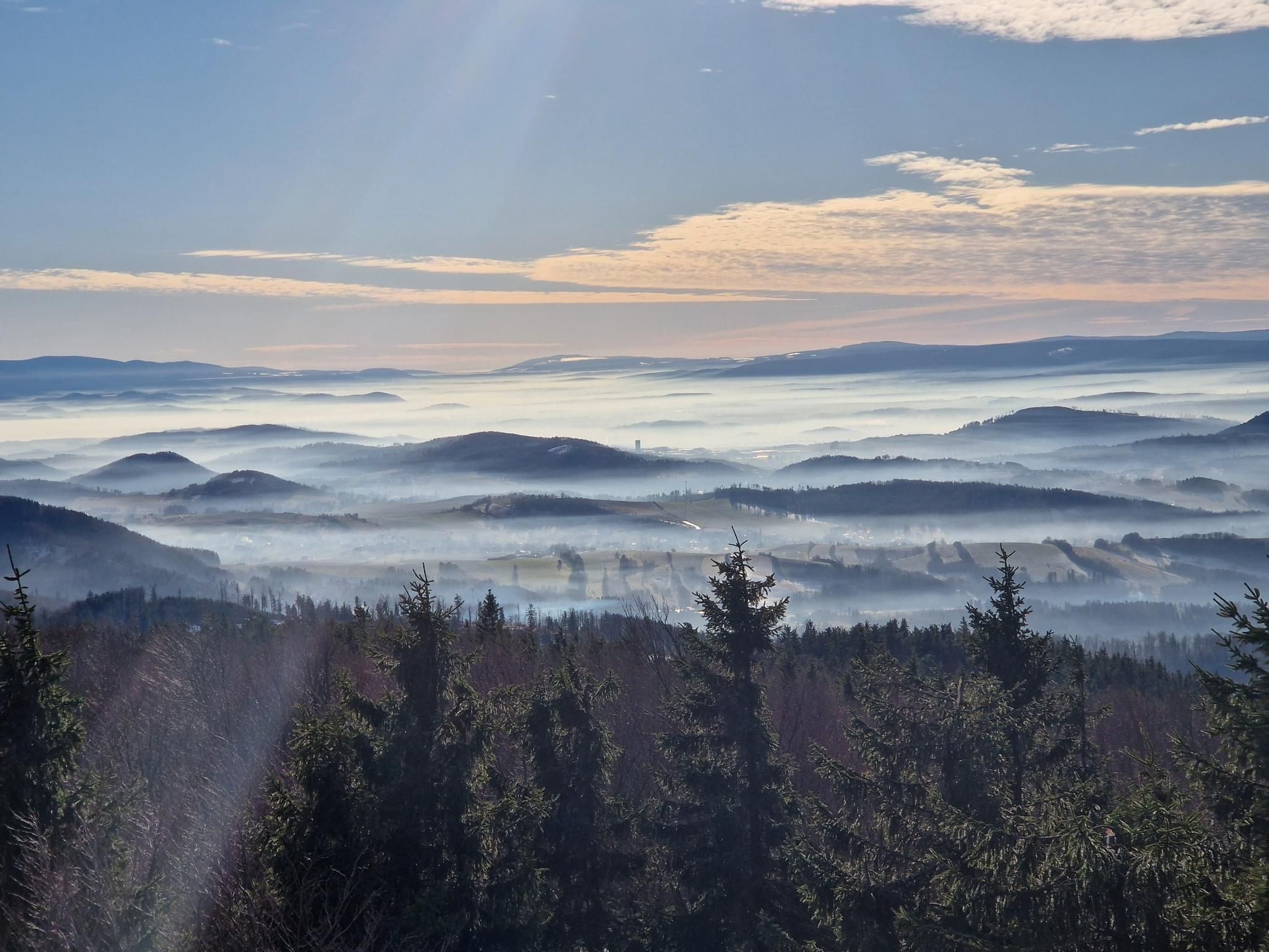
Bus station hiking trails around gmina Głuchołazy are situated in a region characterized by the Opawskie Mountains, Przedgórza Paczkowskie, and Płaskowyż Głubczycki. This varied topography includes mountains, foothills, and plateaus. Hikers can traverse lush forests and rolling hillsides, with prominent features like Biskupia Kopa offering elevated views. The area provides diverse natural features for outdoor activities.
Best bus station hiking trails around gmina Głuchołazy
- The most popular bus station hiking route is Jarnołtówek - Pokrzywna Trail, a 7.8 miles…
Last updated: July 10, 2026
4.6
(5)
93
hikers
12.5km
03:55
470m
490m
Hike the moderate Jarnołtówek - Pokrzywna Trail, a 7.8-mile route through the Opawskie Mountains Landscape Park, featuring Piekiełko Gorge.
4.7
(34)
734
hikers
Moderate hike. Good fitness required. Easily-accessible paths. Suitable for all skill levels.

Sign up for free
39
hikers
5.96km
01:53
230m
230m
Easy hike. Great for any fitness level. Easily-accessible paths. Suitable for all skill levels.
5.0
(1)
25
hikers
Easy hike. Great for any fitness level. Easily-accessible paths. Suitable for all skill levels.
4.0
(3)
23
hikers
7.92km
02:23
250m
250m
Moderate hike. Good fitness required. Easily-accessible paths. Suitable for all skill levels.
Get access to more routes and recommendations from other explorers.
Sign up for free
Already have an account?
Our route recommendations are based on thousands of hikes, rides, and runs completed by other people on komoot.
Start today with a free account
Your next adventure awaits.
Login or Signup
Popular around gmina Głuchołazy


Tips from the Community

This spa park was established in the second half of the 19th century, when efforts were underway to grant Głuchołazy spa status (which was achieved in 1877). This park combines climatic and landscape conditions and was an important part of the spa. In recent years, it has undergone numerous renovations and revitalizations, and it is truly beautiful. It's worth stopping here, even if only for half an hour.
1
0
A beautiful PTTK mountain shelter at an altitude of 850 meters above sea level, near the summit of Biskupia Kopa (hence its name, of course). The shelter was built here in 1923, but was later rebuilt. Everything is here: meals, accommodations (50 beds), a restaurant, and even the possibility of organizing discos (probably not for you today, right?). https://biskupiakopa.pl/
1
0
And that's what I call a view. This viewing platform (in the Cicha Dolina Reserve) offers stunning views of the forested slopes of the Opawskie Mountains. Marvelous!
1
0


The Siodło Pass, located at an altitude of 505 m above sea level, is located in the Opawskie Mountains, near Głuchołazy. It is a popular place among tourists due to its picturesque landscapes and numerous hiking trails. One of the main trails leading through the Siodło Pass is the blue hiking trail, which begins in the Głuchołaz-Zdrój district and leads through Góra Parkowa. Along this trail there are stone chapels of the Stations of the Cross, built in the early 20th century. Interestingly, the Stations of the Cross consist of 16 stations, including additional ones depicting the "Prayer in Ogrójec" and "Resurrection".
0
0
Siodło Pass, located at an altitude of 505 meters above sea level, is located in the Opawskie Mountains, near Głuchołazy. It is a popular tourist destination due to its picturesque landscapes and numerous hiking trails. One of the main trails leading through Siodło Pass is the blue hiking trail, which begins in the Głuchołaz-Zdrój district and leads through Góra Parkowa. Along this trail are stone chapels of the Stations of the Cross, built in the early 20th century. Interestingly, the Stations of the Cross consist of 16 stations, including additional ones depicting the "Prayer in Ogrójec" and "Resurrection."
0
0
A 22 m high observation tower built in 1898. It is located on the top of Przednia Kopa (495 m). The tower is currently inactive after a fire in 1996.
2
0
Żegnalce Spring is a picturesque place located in Głuchołazy, at the foot of Przednia Kopa, along Aleja Spacerowa. According to local legends, the name "Żegnalce" comes from the farewells that locals organized for their loved ones who were going abroad in search of work. Although the water from the spring does not have exceptional mineral properties, it is valued for its purity and refreshing taste, attracting both locals and tourists. There are also other attractions nearby, such as the Bialska Cave and a swinging bridge.
0
0
Frequently Asked Questions
How many bus station accessible hiking trails are available in gmina Głuchołazy?
There are over 70 hiking trails in gmina Głuchołazy that are easily accessible from bus stations. These routes cater to various skill levels, with a good mix of easy, moderate, and some challenging options.
What kind of terrain can I expect on hikes around gmina Głuchołazy?
The terrain in gmina Głuchołazy is quite varied, ranging from the rolling hills and lush forests of the Opawskie Mountains to the foothills of Przedgórza Paczkowskie and the plateaus of Płaskowyż Głubczycki. You'll find paths through dense woodlands, along scenic ridges, and beside streams, offering diverse natural experiences.
Are there any easy, family-friendly hikes accessible from bus stations?
Yes, gmina Głuchołazy offers several easy routes perfect for families. For a gentle stroll, consider the Spa Park in Glucholazy – Bialska Adit Entrance loop from Głuchołazy, which is just over 6 km. Another great option is the Zamkowa Góra (571 m) – Pass below Zamkowa Góra loop from Park Krajobrazowy Góry Opawskie, a 5.6 km route with moderate elevation.
What are the best circular routes that start and end near a bus stop?
Many routes in the region are designed as loops, making them convenient for public transport users. The Srebrna Kopa Summit – Emperor Franz Josef Observation Tower loop from Park Krajobrazowy Góry Opawskie is a popular moderate option, offering stunning views. Another excellent choice is the Gwarkowa Trail – View from Biskupia Kopa loop from Park Krajobrazowy Góry Opawskie, which also provides panoramic vistas.
What natural features or landmarks can I see along the bus station hiking trails?
Hikers can discover a variety of natural and historical landmarks. Many trails lead to prominent peaks like Biskupia Kopa, where you can find the historic Emperor Franz Josef Observation Tower. Other notable sights include the Zlatý Chlum Observation Tower, unique rock formations in the Stolec Mountain Nature Reserve, and the serene Głuchołazy Spa Park.
Are there any mountain huts or places to rest and eat along the trails?
Yes, the region is well-equipped with resting points. Near the summit of Biskupia Kopa, you'll find the Mountain Tourist House "Under the Biskupia Kopa", a PTTK mountain shelter offering meals and accommodation. Additionally, the Rychleby Trails Base, though known for biking, also has a pub and campsite that hikers can utilize.
What do other hikers say about the trails in gmina Głuchołazy?
The hiking trails in gmina Głuchołazy are highly regarded by the komoot community, with an average rating of 4.7 out of 5 stars from over 280 reviews. Hikers frequently praise the well-maintained paths, the diverse landscapes, and the stunning panoramic views from observation towers and peaks.
Are there any challenging hikes accessible by bus for experienced hikers?
While most routes are easy to moderate, there are a couple of more challenging options for experienced hikers. These often involve greater elevation gain and longer distances, leading to higher peaks and more remote sections of the Opawskie Mountains. For example, the Jarnołtówek - Pokrzywna Trail is a moderate-to-challenging route covering over 12 km with significant elevation changes.
Can I bring my dog on the hiking trails in gmina Głuchołazy?
Generally, dogs are welcome on most hiking trails in gmina Głuchołazy. It's always advisable to keep your dog on a leash, especially in nature reserves or areas with wildlife, and to follow local regulations. Remember to bring water for your pet and clean up after them.
What is the best time of year to hike in gmina Głuchołazy?
Gmina Głuchołazy offers great hiking opportunities throughout the year. Spring brings lush greenery and blooming wildflowers, while autumn provides spectacular fall foliage. Summer is popular for its warm weather, though trails can be busier. Winter hiking is also possible, especially on lower elevation paths, offering a serene, snow-covered landscape.
Are there any historical sites or cultural attractions along the hiking routes?
Yes, hikers can encounter several historical and cultural sites. These include remnants of medieval defensive walls like the Upper Gate Tower, and churches such as St. George's Church in Podlesie. The Salt Graduation Tower in Głuchołazy is another interesting point of interest that can be integrated into a hike.
Most popular routes around gmina Głuchołazy
Most popular attractions around gmina Głuchołazy

Get inspired with the komoot mobile app


Explore more
Browse the best Hikes in other regions.
