The best hikes from bus stations around Šolta
4.4
(268)
1,540
hikers
16
hikes
Bus station hiking trails around Šolta traverse a varied landscape characterized by ancient olive groves, fragrant pine woods, and rugged coastal sections. The island features numerous secluded bays with clear waters, accessible via trails. Its highest point, Vela Straža, reaches 238 meters, offering panoramic views. The routes often connect picturesque coastal villages with charming inland settlements, showcasing traditional stone architecture.
Best bus station hiking trails around Šolta
- The most popular bus station hiking route is View of Split – Secluded Coastal Bay loop from Rogač, a 6.5 miles (10.5 km) trail that takes 3 hours to complete. This moderate route features coastal views and a secluded bay.
- Another top favourite among local hikers is Maslinica Marina – View of the Offshore Islands loop from Maslinica, a moderate 4.8 miles (7.8 km) path. This trail offers views of the Maslinica Marina and the nearby Seven Islets.
- Local hikers also love the Necujam Lighthouse loop from Stomorska, a 6.9 miles (11.2 km) trail leading through coastal areas and pine woods, often completed in about 3 hours 7 minutes.
- Hiking around Šolta is defined by ancient olive groves, coastal paths, and pine woods. The network offers options for different ability levels, from easy strolls to moderate climbs.
- The routes in Šolta are highly rated by the komoot community with an average score of 4.4 stars from over 230 reviews. More than 1400 hikers have used komoot to explore Šolta's varied terrain.
Last updated: August 19, 2026
4.6
(18)
31
hikers
10.5km
03:02
270m
270m
Moderate hike. Good fitness required. Easily-accessible paths. Suitable for all skill levels.
5.0
(3)
19
hikers
6.50km
01:57
190m
190m
Easy hike. Great for any fitness level. Easily-accessible paths. Suitable for all skill levels.

Sign up for free
5.0
(1)
14
hikers
6.71km
02:00
190m
190m
Easy hike. Great for any fitness level. Easily-accessible paths. Suitable for all skill levels.
5.0
(3)
14
hikers
7.78km
02:14
190m
190m
Moderate hike. Good fitness required. Easily-accessible paths. Suitable for all skill levels.
4.8
(4)
7
hikers
11.2km
03:06
190m
190m
Moderate hike. Good fitness required. Easily-accessible paths. Suitable for all skill levels.
Get access to more routes and recommendations from other explorers.
Sign up for free
Already have an account?
Our route recommendations are based on thousands of hikes, rides, and runs completed by other people on komoot.
Start today with a free account
Your next adventure awaits.
Login or Signup
Popular around Šolta
Other adventures around Šolta

Tips from the Community

Small harbor, which is frequented by yachts. There is also a nice swimming beach and a restaurant.
0
0

The perfect place for a souvenir photo at the end of the tour, from there it's only a few minutes to Rogac, where a fantastic gemust awaits you in the port bar (one of the best I've tried in Dalmatia)
0
0

Following the path along the sea is not always easy, sometimes it just seems to "disappear". Since it actually always goes along the coast, you can't really get lost, sometimes you have to climb a bit or bend down under the pine trees. All in all, a very nice hike along the wild north-east coast of Solta.
0
0

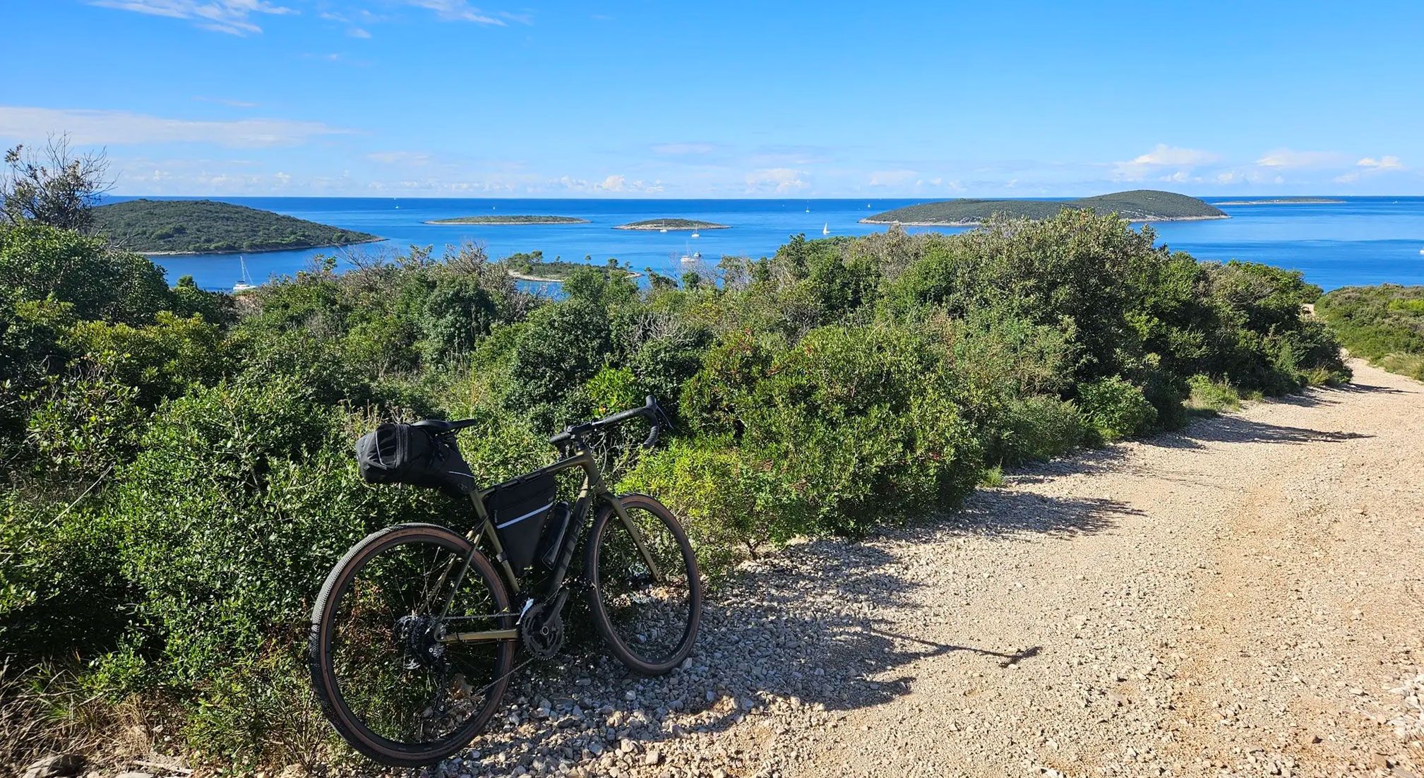
A viewpoint just above small town of Maslinica. Offers amazing view of the surrounding small islands across Maslinica, big island Drvenik, and even remote islands further in the Adriatic such as Vis and Sveti Andrija. Pay a visit if nearby. Gravel route is mostly good from each side.
0
0
Frequently Asked Questions
How many bus station hiking trails are available in Šolta?
There are 16 distinct hiking trails accessible directly from bus stations across Šolta. These routes offer a variety of experiences, from easy strolls to more moderate excursions, allowing you to explore the island's diverse landscapes conveniently.
What is the best time of year to go hiking from Šolta bus stations?
The best time to hike in Šolta is typically during the spring (April-June) and autumn (September-October). During these seasons, the weather is pleasantly mild, and the island's Mediterranean flora is vibrant. Summer can be hot, but early mornings or late afternoons are still suitable for hiking, especially on coastal paths where you can combine your walk with a refreshing swim in the crystal-clear bays.
Are there easy hiking trails accessible from Šolta bus stations?
Yes, Šolta offers several easy hiking trails starting from bus stations, perfect for a relaxed exploration of the island. For example, the Church in the Old Town loop from Gornje Selo is an easy route that takes you through charming inland areas. Another accessible option is the Church in the Old Town loop from Stomorska, offering a gentle introduction to the island's beauty.
Can I find challenging hikes starting from Šolta bus stations?
While Šolta's trails are generally not considered 'difficult' in the extreme sense, there are moderate routes that offer a good challenge with varied terrain and elevation. For instance, the View of Split – Secluded Coastal Bay loop from Rogač is a moderate hike with over 260 meters of elevation gain, providing rewarding views. Another moderate option is the Necujam Lighthouse loop from Stomorska, which covers over 11 kilometers.
Are the bus station hiking trails in Šolta suitable for families?
Many of the trails are suitable for families, especially the easier, shorter loops that explore the charming villages or coastal areas. These routes often feature gentle gradients and offer opportunities to discover local culture or enjoy a picnic. Always check the specific route details for distance and elevation to ensure it matches your family's capabilities.
Are dogs allowed on the hiking trails accessible from Šolta bus stations?
Generally, dogs are welcome on most hiking trails in Šolta. It's always advisable to keep them on a leash, especially when passing through villages, agricultural areas, or near livestock. Remember to bring enough water for your dog, particularly during warmer months, as natural water sources might be limited along some routes.
What kind of landscapes and natural features can I expect to see on these hikes?
Šolta's hiking trails offer a rich tapestry of Mediterranean landscapes. You can expect to traverse fragrant pine woods, ancient olive groves, and rugged coastal paths. Many routes lead to secluded bays with crystal-clear turquoise waters. The island's highest point, Vela Straža, offers panoramic views, and you'll encounter diverse terrain from lush forests to rocky sections.
Are there any good viewpoints on the hikes from Šolta bus stations?
Absolutely! Many trails offer stunning vistas. For example, the View of Split – Secluded Coastal Bay loop from Rogač provides breathtaking views of Split and the surrounding Adriatic Sea. Another route, the Maslinica Marina – View of the Offshore Islands loop from Maslinica, offers excellent perspectives of the picturesque Seven Islets. You can also find the specific highlight View of Split and View of the Offshore Islands along various routes.
What interesting places or attractions can I visit along these bus station routes?
Hiking from Šolta's bus stations allows you to discover both natural beauty and cultural heritage. You might encounter charming inland villages like Grohote, with its neo-Renaissance Tvrdic Honey – Island of Honey, or coastal settlements such as Maslinica and Stomorska. Historical sites like the 16th or 17th-century Slavić tower and the Bratska kuća can also be found. Don't miss the chance to visit Senjska Cove for a refreshing break.
Is there parking available near the bus stations for hikers?
While the focus of these guides is on bus-accessible trails, many villages with bus stations also offer public parking facilities. If you're driving to a starting point, you can usually find parking in the larger settlements like Rogač, Maslinica, or Stomorska. However, it's always recommended to check local signage for parking regulations and availability, especially during peak season.
What do other hikers say about the bus station trails in Šolta?
The bus station trails in Šolta are highly rated by the komoot community, with an average score of 4.41 out of 5 stars from 231 ratings. Reviewers often praise the island's serene atmosphere, the blend of coastal and inland scenery, and the convenience of accessing these beautiful routes via public transport. Many highlight the opportunity to combine hiking with exploring charming villages and enjoying secluded bays.
Can I find places to eat or drink near the bus station hiking trails?
Yes, the coastal and inland villages where bus stations are located, such as Maslinica, Stomorska, Nečujam, Rogač, and Grohote, offer various cafes, restaurants, and taverns. These are perfect spots to refuel before or after your hike, allowing you to sample local cuisine and enjoy the island's hospitality. Many establishments are conveniently located within walking distance of the bus stops.
Most popular attractions around Šolta

Get inspired with the komoot mobile app


Explore more
Browse the best Hikes in other regions.
