The best city hikes and walks around Monterey
4.6
(74)
933
hikers
42
hikes
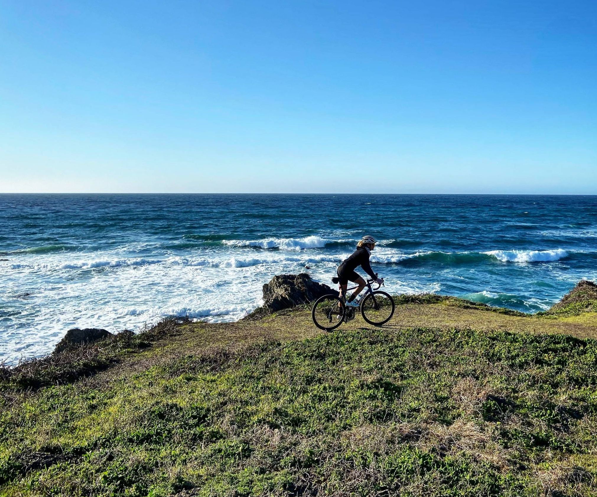
Urban hiking trails around Monterey offer a diverse landscape for exploration. The region features extensive coastlines with beaches and bluffs, providing scenic routes along the Pacific Ocean. Urban parks and historic districts are integrated into the trail network, offering a mix of natural beauty and cultural landmarks. The terrain generally includes flat coastal paths and gentle inclines through city areas.
Best urban hiking trails around Monterey
- The most popular urban hiking route is Monterey Bay Coastal Recreation Trail, a…
Last updated: July 8, 2026
2
hikers
12.2km
03:07
50m
40m
Moderate hike. Good fitness required. Easily-accessible paths. Suitable for all skill levels.
7
hikers
5.24km
01:25
70m
70m
Easy hike. Great for any fitness level. Easily-accessible paths. Suitable for all skill levels.

Sign up for free
4.5
(6)
198
hikers
5.39km
01:24
30m
30m
Easy hike. Great for any fitness level. Easily-accessible paths. Suitable for all skill levels.
4.6
(5)
163
hikers
Easy hike. Great for any fitness level. Easily-accessible paths. Suitable for all skill levels.
5.0
(4)
63
hikers
10.6km
02:46
80m
80m
Moderate hike. Good fitness required. Easily-accessible paths. Suitable for all skill levels.
Get access to more routes and recommendations from other explorers.
Sign up for free
Already have an account?
Our route recommendations are based on thousands of hikes, rides, and runs completed by other people on komoot.
Start today with a free account
Your next adventure awaits.
Login or Signup
Popular around Monterey
Other adventures around Monterey

Tips from the Community

A lovely wharf you should see
0
0

Nice flat run on footpath to aquarium.
0
0


Great paved trail that runs along the Pacific Ocean. You get wonderful views of the water and will pass through several popular cultural attractions in the area.
0
0

Kalisa Moore, known as the “Queen of Cannery Row,” was born in Latvia and came to America after World War II. She bridged the eras, opening her fine dining restaurant when most canneries had already closed. Over the years, “Kalisa’s” evolved into a bohemian coffeehouse where artists, writers and poets “hung out.” Her weekend cabaret was filled with musicians, dancers and the occasional celebrity from the Monterey Jazz Festival. As time went on and Cannery Row was reborn, Kalisa became a major factor in preserving memories of Steinbeck’s era and promoted tourism and commerce as president of the Cannery Row Foundation. For fifty years, she was a friend to the famous and a mother to the needy with a local following that knew and loved her. Kalisa's La Ida Cafe was a very special time and place, and Kalisa will always be remembered as the "Queen of Cannery Row."
3
0
Cannery Row, the waterfront district that boomed in the 1850s - For thousands of years it was home to the Ohlone, Esselen and Salinas tribes, and in the 19th century immigrants from Europe and Asia settled here to fish the waters, especially for sardines. Thanks to the canneries that resulted, Monterey became known as the "Sardine Capital of the World." John Steinbeck, born and raised in nearby Salinas, immortalized this era in his 1945 novel Cannery Row, and the name stuck.
3
0
Bruce Ariss Way is a narrow alley, the pedestrian-only continuation of Irving Avenue between Wave Street and Cannery Row. What was once an unofficial walkway between the residential area of the row, across the railroad tracks, and the waterfront canneries has been converted into a small park. In the early 1990s, the City of Monterey relocated three worker's shacks from 866 Wave Street to this site and opened them to the public. They are interpreted as being occupied by a Japanese, a Filipino, and a Spanish family, respectively, alluding to the cultural mix that characterized cosmopolitan Cannery Row and representing the living conditions of workers between the 1920s and 1950s. There were many shacks like this in the neighborhood in the early 20th century, but these are the only remaining remnants of this housing type on Cannery Row.
3
0

Nice, small (and free!) museum just before Fisherman's Wharf in Monterey. Nice exhibition.
1
0
Frequently Asked Questions
How many urban hiking trails are available in Monterey?
There are over 30 urban hiking routes in Monterey, ranging from easy strolls to more moderate excursions. This includes 21 easy routes and 9 moderate routes, offering a variety of experiences for different fitness levels.
What kind of scenery can I expect on urban hikes in Monterey?
Monterey's urban hikes offer a blend of dramatic coastlines, pristine beaches, and historic cityscapes. You'll find trails winding along the shoreline, through charming neighborhoods, and past significant historical sites, providing stunning ocean vistas and glimpses into the city's rich past.
Are there any family-friendly urban hikes in Monterey?
Yes, many urban trails in Monterey are suitable for families. Routes like the Monterey State Historic Park via Monterey City offer easy, accessible paths that are perfect for all ages. These trails often feature points of interest and relatively flat terrain, making them enjoyable for children.
Can I bring my dog on urban hikes in Monterey?
Many urban trails in Monterey are dog-friendly, especially those along the coast or in city parks, provided dogs are kept on a leash. Always check specific trail regulations before heading out, as some areas may have restrictions.
What are some notable landmarks or attractions I can see along urban hiking routes?
Urban hikes in Monterey often pass by significant landmarks. For example, the Monterey State Historic Park via Monterey City route takes you through historic areas. Along coastal paths, you might spot highlights like Sea Lion Point, Lone Cypress Tree, or Point Joe Vista Point. You can also explore El Estero Lake Park 🌳, which is a lovely urban green space.
Are there any circular urban hiking routes in Monterey?
Yes, several urban routes in Monterey are circular, offering convenient starting and ending points. For instance, the Cannery Row – Cannery Row, Monterey loop from Monterey is an easy circular hike that allows you to explore the iconic Cannery Row area without retracing your steps.
What is the best time of year to go urban hiking in Monterey?
Monterey offers pleasant urban hiking conditions year-round due to its mild climate. Spring and fall generally provide the most comfortable temperatures and fewer crowds. Summer can be popular, while winter offers cooler, often clear days, perfect for coastal walks.
Are there any longer urban coastal walks available?
For a longer coastal experience, consider the Monterey Bay Coastal Recreation Trail. This moderate route stretches over 12 kilometers, offering extensive views of the bay and connecting various points of interest along the shoreline.
What do other hikers enjoy most about urban hiking in Monterey?
The komoot community highly rates urban hiking in Monterey, with an average score of 4.9 stars from 71 ratings. Reviewers often praise the stunning coastal views, the accessibility of the trails, and the unique blend of natural beauty and historical charm found along the routes.
Are there urban hikes that connect different towns or areas?
Yes, some urban hikes connect Monterey with neighboring areas. The Lovers Point Beach – Fishermans Wharf loop from Pacific Grove is a moderate route that links popular coastal spots, allowing you to experience the distinct atmospheres of both Monterey and Pacific Grove.
What should I wear for urban walks in Monterey?
Given Monterey's coastal climate, it's best to dress in layers. Even on sunny days, a light jacket or windbreaker can be useful, especially along the exposed coastline. Comfortable walking shoes are essential, and sun protection like a hat and sunscreen is always recommended.
Most popular routes around Monterey
Most popular attractions around Monterey

Get inspired with the komoot mobile app


Explore more
Browse the best Hikes in other regions.
