The best hikes from bus stations around Alberni-Clayoquot
4.6
(1576)
12,006
hikers
18
hikes
Bus station hiking trails around Alberni-Clayoquot offer access to a diverse landscape of rugged coastlines, ancient rainforests, and freshwater lakes. The region is characterized by towering old-growth trees, including Western Red Cedar and Douglas Firs, alongside numerous waterfalls and mountain vistas. This area provides a variety of terrain, from coastal paths to forest trails, suitable for different hiking preferences.
Best bus station hiking trails around Alberni-Clayoquot
- The most popular bus station hiking route is View of the Pacific Ocean –…
Last updated: August 27, 2026
4.8
(162)
1,071
hikers
Moderate hike. Good fitness required. Easily-accessible paths. Suitable for all skill levels.
4.8
(81)
668
hikers
Easy hike. Great for any fitness level. Easily-accessible paths. Suitable for all skill levels.

Sign up for free
4.8
(88)
590
hikers
6.90km
01:50
70m
70m
Easy hike. Great for any fitness level. Easily-accessible paths. Suitable for all skill levels.
4.2
(11)
67
hikers
10.2km
02:41
80m
80m
Moderate hike. Good fitness required. Easily-accessible paths. Suitable for all skill levels.
4.3
(20)
108
hikers
12.0km
03:09
100m
100m
Moderate hike. Good fitness required. Easily-accessible paths. Suitable for all skill levels.
Get access to more routes and recommendations from other explorers.
Sign up for free
Already have an account?
Our route recommendations are based on thousands of hikes, rides, and runs completed by other people on komoot.
Start today with a free account
Your next adventure awaits.
Login or Signup
Popular around Alberni-Clayoquot
Other adventures around Alberni-Clayoquot

Tips from the Community


Such a shame. Not every change is positive. Thanks for your update.
0
0

Impressive totem sculpture of a weeping goddess / native lady
0
0

Third Beach is a hidden sandy beach; access is via the Tonquin Trail.
2
0
The Tonquin Trail Connector, opened in March 2014, has been partially widened to a gravel road. Residential construction plans are expected in the upper section; the trail is not recommended. (May 17, 2025)
0
0
Middle Beach is located at the southern end of the Tonquin Trail. Additional access to this beach is via MacKenzie Beach Road and the Middle Beach Trail. However, there is no parking available at the trailhead.
2
0
Access to Tonquin Beach is from the parking lot on Tonquin Park Road. The beach is a great place to watch the sunset.
2
0
From the Pacific Rim Highway, the Canso Bomber Ruins Trail leads to a low ridge where the ruins of a building stand. The former utility building is covered in graffiti. The trail continues down a muddy, root-filled path into a wetland; rubber boots are recommended for the hike. Fortunately, wooden planks have been laid in the depression, allowing us to reach the site where the plane wreckage was left with dry feet. The wreckage fascinated more than just us; on no other hike on Vancouver Island did we encounter so many people. (May 17, 2025)
2
0
Frequently Asked Questions
How many bus-accessible hiking trails are there in Alberni-Clayoquot?
There are over 20 bus-accessible hiking trails available in the Alberni-Clayoquot region, offering a variety of experiences for different skill levels. These routes are specifically curated to start or end near public transport stops.
What is the overall difficulty level of bus-accessible hikes in Alberni-Clayoquot?
The majority of bus-accessible hikes in Alberni-Clayoquot are considered easy to moderate. Out of 23 routes, 16 are easy and 7 are moderate, making the region very welcoming for casual hikers and families. There are no difficult routes listed in this collection.
What do other hikers say about the bus-accessible trails in Alberni-Clayoquot?
The komoot community highly rates the bus-accessible trails in Alberni-Clayoquot, with an average score of 4.6 out of 5 stars from over 1,200 ratings. Hikers often praise the stunning coastal views, the immersive ancient forests, and the convenience of accessing these natural wonders via public transport.
Are there easy bus-accessible hikes suitable for beginners or families?
Yes, many bus-accessible trails are perfect for beginners and families. For example, the Canso Plane Wreck – Canso Bomber Ruins Trail loop from Radar Hill Rd Parking Lot is an easy 4.7 km route, offering a unique historical point of interest. Another great option is the Amphitrite Point Lighthouse – Inspiration Point loop from Ucluelet, an easy 6.6 km trail with stunning ocean views.
Are there any circular bus-accessible routes?
Yes, several bus-accessible routes in Alberni-Clayoquot are circular, allowing you to start and end at the same point without needing to retrace your steps. Examples include the View of the Pacific Ocean – Fallen Tree as a Nursery Log loop from Ucluelet and the Canso Plane Wreck – Canso Bomber Ruins Trail loop from Radar Hill Rd Parking Lot.
What natural features or landmarks can I see on bus-accessible hikes?
Alberni-Clayoquot's bus-accessible trails offer access to diverse natural features. You can explore ancient forests at Cathedral Trail, MacMillan Park, or experience the lush rainforests on the Rainforest Trail, Pacific Rim National Park Reserve. Coastal trails often lead to viewpoints like Inspiration Point, offering dramatic ocean vistas.
Are there any waterfalls accessible by bus in the region?
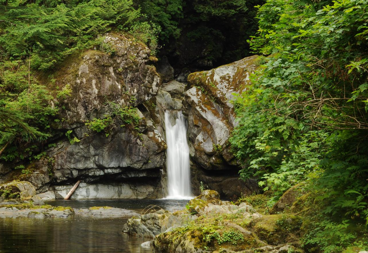
While direct bus access to all waterfalls can vary, the region is known for its beautiful cascades. Stamp Falls and Canyon is a notable highlight, offering impressive views of the Stamp River and its powerful falls, and is often reachable via local transport options or a short connection from a bus stop.
Where can I experience the ancient forests of Alberni-Clayoquot via public transport?
To experience the magnificent ancient forests, consider routes that lead to MacMillan Provincial Park, home to Cathedral Grove. Here, you can walk among towering old-growth Douglas firs, some estimated to be 800 years old. The Rainforest Trail in Pacific Rim National Park Reserve also offers an immersive experience through lush environments on boardwalks, often accessible via regional bus services.
What is the best time of year to hike these bus-accessible trails?
The best time to hike in Alberni-Clayoquot is generally from spring through fall (April to October) when the weather is milder and trails are most accessible. Summer offers the warmest temperatures, while spring and fall provide vibrant foliage and fewer crowds. Some coastal trails may be accessible year-round, but always check local conditions and bus schedules, especially during winter.
Are there places to eat or get refreshments near bus-accessible trailheads?
Many bus-accessible trailheads are located near towns like Ucluelet, Tofino, and Port Alberni, which offer a variety of cafes, restaurants, and shops where you can grab refreshments or a meal before or after your hike. It's always a good idea to check specific locations for amenities before you go.
Are there any longer, more challenging bus-accessible routes for experienced hikers?
While most bus-accessible routes in this collection are easy to moderate, some offer longer distances and more varied terrain. The Middle Beach – Tonquin Beach loop from Mikes Island is a moderate 11.8 km route that provides a good challenge with coastal views. For more extensive challenges, you might need to combine bus travel with additional local transport or consider multi-day treks like the West Coast Trail, which requires specific planning and permits.
Can I bring my dog on these bus-accessible trails?
Dog policies vary by trail and park. Many trails in the Alberni-Clayoquot region are dog-friendly, especially if dogs are kept on a leash. However, national parks like Pacific Rim National Park Reserve have stricter rules, often restricting dogs to specific areas or requiring them to be on a leash at all times. Always check the specific trail regulations before heading out with your furry friend.
Most popular attractions around Alberni-Clayoquot

Get inspired with the komoot mobile app


Explore more
Browse the best Hikes in other regions.
