The best hikes from bus stations around Winnipeg
5.0
(2)
119
hikers
14
hikes
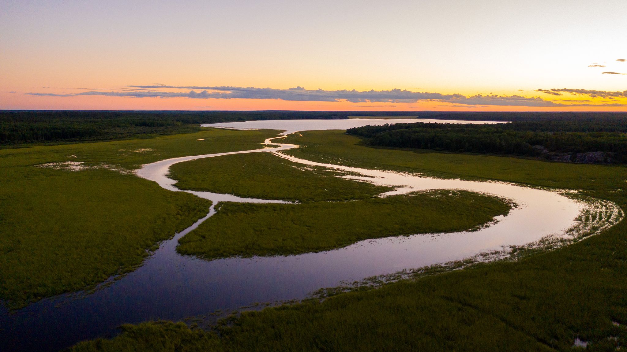
Bus station hiking trails around Winnipeg offer access to a diverse landscape characterized by urban forests, river greenways, and prairie wetlands. The region features generally flat terrain with gentle elevation changes, making many trails accessible. Hikers can explore environments ranging from aspen-oak vegetation to riverine ecosystems and open marshlands. These natural spaces provide varied settings for outdoor activities both within and just outside the city.
Best bus station hiking trails around Winnipeg
- The most popular bus station hiking route is…
Last updated: June 28, 2026
20
hikers
6.40km
01:37
10m
10m
Easy hike. Great for any fitness level. Easily-accessible paths. Suitable for all skill levels.
4.23km
01:05
10m
10m
Easy hike. Great for any fitness level. Easily-accessible paths. Suitable for all skill levels.

Sign up for free
1
hikers
4.07km
01:01
0m
0m
Easy hike. Great for any fitness level. Easily-accessible paths. Suitable for all skill levels.
8
hikers
4.17km
01:04
10m
10m
Easy hike. Great for any fitness level. Easily-accessible paths. Suitable for all skill levels.
6
hikers
4.47km
01:07
0m
0m
Easy hike. Great for any fitness level. Easily-accessible paths. Suitable for all skill levels.
Get access to more routes and recommendations from other explorers.
Sign up for free
Already have an account?
Our route recommendations are based on thousands of hikes, rides, and runs completed by other people on komoot.
Start today with a free account
Your next adventure awaits.
Login or Signup


Tips from the Community

The Seine River, a tributary of the Red River, winds through one of Winnipeg’s last intact riverbank forests, with trails that trace its oxbows and skirt wetlands shaded by cottonwoods. You’ll pass beaver lodges, spirit tree carvings, and maybe even deer, all within city limits. This stretch is popular with walkers and nature lovers, especially in spring and fall, when water levels rise and wildlife activity picks up.
0
0
Seine River South Trail follows a peaceful stretch of the Seine River, winding through a mix of forest, wetlands, and riverside habitat that feels surprisingly natural for an urban setting. It’s an easy, mostly flat route that runs under a canopy of mature trees, with sections close to the water, quiet woodland scenery, and opportunities to spot birds and other wildlife along the way. It's not as busy as some of the other nearby trails, and is a lovely path for a quieter walk through one of the city’s more secluded river corridors.
0
0
Creek Bend Riverbank is a quiet natural area along the Seine River where the riverside path and open green space create a surprisingly peaceful setting at the edge of the city. The trail follows the riverbank through mature trees and lush vegetation, with beautiful views of the calm, slow-moving water.
0
0

The Forks is the heart of Winnipeg. Frequented by Indigenous peoples thousands of years ago, it is now home to a pleasant park on the banks of the Red and Assiniboine Rivers, the Canadian Museum for Human Rights, and a lively market hall with shops and restaurants.
0
0
From this quiet bend in the trail, the Red River flows steadily past, lined with trees and the urban skyline. It’s a peaceful place to pause and take in the contrast between nature and city before continuing along the path.
0
0
Lagimodière-Gaboury Heritage Park sits on land that was initially granted to Jean-Baptiste Lagimodière and his wife, Marie-Anne Gaboury, pioneering settlers whose family would include Métis leader Louis Riel. The park is part of a riverside greenway along the Seine and Red Rivers, with natural trails, interpretive signage, and peaceful viewpoints over the water. It celebrates early Francophone and Métis heritage, marking the site of St. Boniface’s first settlement and its foundational role in Manitoba history.
0
0
Fort Gibraltar is a replica of the 1809 North West Company trading post that once stood near the junction of the Red and Assiniboine rivers. Rebuilt in 1978 by the Festival du Voyageur, it serves as an interpretive site that illustrates Métis culture and the fur trade era. Today, the fort hosts educational programs and cultural events and plays a central role in the annual Festival du Voyageur.
0
0
The Red River flows north from the United States into Manitoba, winding through Winnipeg before emptying into Lake Winnipeg. Its slow, meandering course has long shaped the region’s landscape and history, serving as a vital route for Indigenous peoples, fur traders, and early settlers. Today, its banks are lined with parks, trails, and neighbourhoods that celebrate the river’s enduring role in the heart of the prairie city.
0
0
Frequently Asked Questions
How many hiking trails are accessible from bus stations around Winnipeg?
There are over 20 hiking trails around Winnipeg that are easily accessible from bus stations, offering a convenient way to explore the region's natural beauty without needing a car. These routes cater to various preferences, with 17 easy and 3 moderate options available.
What kind of landscapes can I expect on bus-accessible hikes in Winnipeg?
Winnipeg's bus-accessible trails offer a diverse range of landscapes, from urban forests and river greenways to prairie wetlands. You can expect to hike through towering trees, along scenic riverbanks, and across open meadows. Areas like Assiniboine Forest and the Seine River Greenway provide lush, forested experiences, while others might feature unique wetland ecosystems.
Are there easy, beginner-friendly trails accessible by bus?
Yes, many of the bus-accessible trails in Winnipeg are considered easy and are perfect for beginners or those looking for a relaxed stroll. For example, the Bunn’s Creek Trail offers a gentle 6.4 km path through wetlands and forest groves. Another great option is the Trans Canada Trail: Whittier Park Loop, an easy 4.2 km route.
Are there any circular or loop trails accessible by bus?
Absolutely! Many bus-accessible routes in Winnipeg are designed as loops, making them convenient for hikers. The View of the River – Esplanade Riel Footbridge loop offers a pleasant 4.2 km urban hike, while the Preston Trail loop from Assiniboine Park provides a 4.5 km experience within one of the city's largest parks.
What can I see along the bus station hiking trails in Winnipeg?
Along these trails, you can discover a variety of interesting sights. Many routes offer views of the Assiniboine River, like those near the Esplanade Riel Footbridge. You might also encounter historical sites such as The Forks National Historic Site, or enjoy natural features like Birds Hill Quarry Lake. Keep an eye out for wildlife, especially in areas like Bunn's Creek Trail or the Seine River Greenway.
Are the bus-accessible hiking trails in Winnipeg suitable for families?
Yes, many of the trails are very family-friendly, featuring gentle terrain and shorter distances. The Riley Family Duck Pond loop from Assiniboine Park is a great example, offering a 5.2 km easy walk perfect for all ages. These trails often pass through parks with amenities, making them ideal for a family outing.
Can I bring my dog on these bus-accessible hiking trails?
Many parks and trails in Winnipeg are dog-friendly, though leash laws typically apply. It's always best to check specific park regulations before heading out. Generally, trails like the Bunn’s Creek Trail and routes within Assiniboine Park are popular choices for dog walkers.
When is the best time of year to hike these trails?
The best time to hike these trails is generally from spring through fall (May to October), when the weather is mild and the natural scenery is at its peak. Spring brings fresh greenery and blooming wildflowers, while fall offers vibrant autumn colors. Summer is also popular, but be prepared for warmer temperatures. Some trails are also suitable for winter hiking, especially those that are well-maintained and cleared.
Are there opportunities for wildlife observation on bus-accessible trails?
Absolutely! Winnipeg's diverse ecosystems provide excellent opportunities for wildlife observation. Trails along the Seine River Greenway and Bunn's Creek are known for birdwatching, and you might spot various species of waterfowl and songbirds. In more forested areas like Assiniboine Forest, deer and other small mammals are often seen, especially during quieter times of the day.
What do other hikers enjoy most about hiking from bus stations in Winnipeg?
The komoot community highly rates these trails, with an average score of 5.0 stars. Hikers frequently praise the convenience of accessing beautiful natural spaces directly from public transport. They often highlight the peaceful urban forests, well-maintained paths, and the surprising variety of scenery available within and just outside the city limits.
Most popular routes around Winnipeg
Most popular attractions around Winnipeg

Get inspired with the komoot mobile app


Explore more
Browse the best Hikes in other regions.
