The best family-friendly hikes and walks in Copper River Census Area
4.8
(26)
226
hikers
7
hikes
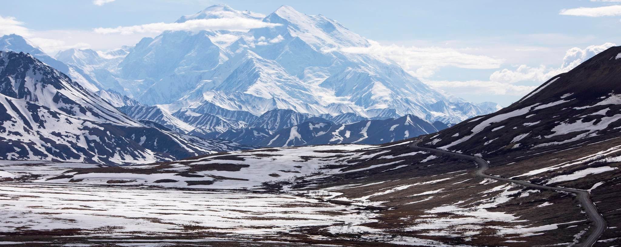
Family friendly hiking trails in Copper River Census Area traverse a rugged and diverse landscape shaped by glaciers, mountains, and powerful rivers in south-central Alaska. This vast region is characterized by dramatic natural features, including the Chugach, Wrangell, and St. Elias Mountains, with extensive glaciers like the Root Glacier. The Copper River, renowned for its wild salmon runs, defines the area's significant delta ecosystem. Glacier-carved valleys and expansive mountain wilderness provide varied terrain for outdoor exploration.
Best family friendly hiking…
Last updated: October 10, 2026
2
hikers
2.22km
00:35
20m
10m
Easy hike. Great for any fitness level. Easily-accessible paths. Suitable for all skill levels.
4.4
(5)
25
hikers
11.3km
03:16
300m
300m
Moderate hike. Good fitness required. Easily-accessible paths. Suitable for all skill levels.

1.81km
00:39
110m
110m
Easy hike. Great for any fitness level. Easily-accessible paths. Suitable for all skill levels.
27.6km
07:33
430m
430m
Hard hike. Very good fitness required. Easily-accessible paths. Suitable for all skill levels.
4.5
(2)
26
hikers
21.8km
05:51
260m
260m
Hard hike. Very good fitness required. Easily-accessible paths. Suitable for all skill levels.
Get access to more routes and recommendations from other explorers.
Already have an account?
Our route recommendations are based on thousands of hikes, rides, and runs completed by other people on komoot.
Start today with a free account
Your next adventure awaits.
Popular around Copper River Census Area





Other adventures in Copper River Census Area


Tips from the Community

This is about as far as you'd want to go on the sometimes steep, unstable and unofficial gravel "path" that parallels the glacier. You do get some amazing views here, but all the warning signs you hiked past are there for a reason. This isn't the safest trail on the planet, and it's very easy to suddenly notice you're walking on the glacier itself, as the rock and dirt you started on merge seamlessly into the ice itself. Don't believe me? Look for the glimmers of blue and blue-white ice peeking out through the grime, and trace the source of the miniature waterfalls spilling down near the trail. They're fueled by melting ice.
1
0
This is the closest of a couple different viewpoints you can reach with some easy walking. From here, you get very nice views of the glacier's blue ice and the lake of meltwater in front of it. What might be less obvious is that the glacier is actually larger than it appears: A portion of it is covered in dirt, rock, and silt that makes it look like part of the earth.
1
0


The Kennicott Mine can be visited in the summer after the mine has melted. There are guided tours and mountain tours as well as glacier tours on the nearby Kennicott Glacier. Important: the car can only be driven as far as McCarthy.
0
0

A small town that formed alongside the Kennecott Mine and Mill site, five miles away. McCarthy flourished during the copper mining boom, and played a part in the railroad infrastructure that shipped the copper ore to Tacoma, WA for processing. After a decline in the mid-to-late-1900s, McCarthy has been revived to serve the tourists visiting Wrangell-St. Elias National Park. The town has restaurants and several air taxi and guiding companies.
0
0
A rustic cabin at the end of Caribou Creek Trail. Reservations are required and must be made at least six months in advance of intended stay. More information can be found here: nps.gov/wrst/planyourvisit/caribou-creek-cabin.htm
0
0
This trail follows the course of McCarthy Creek, and may be washed out in places. If you continue beyond the end of the trail, you can access a mining-era tunnel and also climb to Nicolai Pass.
0
0
A small town that formed alongside the Kennecott Mine and Mill site, five miles away. McCarthy flourished during the copper mining boom, and played a part in the railroad infrastructure that shipped the copper ore to Tacoma, WA for processing. After a decline in the mid-to-late-1900s, McCarthy has been revived to serve the tourists visiting Wrangell-St. Elias National Park. The town has restaurants and several air taxi and guiding companies.
0
0
Frequently Asked Questions
How many family-friendly hiking trails are available in the Copper River Census Area?
There are 7 family-friendly hiking trails listed in this guide for the Copper River Census Area, offering a range of experiences from easy strolls to more challenging adventures. You'll find 3 easy routes, 1 moderate, and 3 more difficult options.
What is the best time of year for family hiking in the Copper River Census Area?
The best time for family hiking in the Copper River Census Area is generally during the summer months, from June to August. During this period, the weather is milder, trails are typically free of snow, and the long daylight hours allow for extended exploration. This region is known for its dramatic natural features, and summer offers the most accessible conditions to enjoy them.
What kind of terrain can we expect on family hikes in this region?
The Copper River Census Area offers diverse terrain, from glacier-carved valleys to forested paths. You can expect trails that range from relatively flat, easy walks like the Boreal Forest Trail, to more undulating paths with moderate elevation changes, such as the Caribou Creek Trail. Some routes, especially those leading to historic mining sites, can involve significant climbs, but many family-friendly options focus on accessible natural beauty.
Are there any short and easy trails suitable for young children or strollers?
For shorter, easier walks, the Boreal Forest Trail is a great option, covering just over 2 kilometers with minimal elevation gain. Another accessible choice is the Worthington Glacier Ridge Trail, which is under 2 kilometers and offers impressive views. While some paths might be suitable for sturdy strollers, it's always best to check specific trail conditions as many trails in this rugged region are unpaved.
What natural features or landmarks can we see along family-friendly hiking trails?
Many trails offer stunning views of the region's natural wonders. For example, the Worthington Glacier Ridge Trail provides excellent views of the Worthington Glacier. You can also explore areas near the Root Glacier, with highlights like the Root Glacier Trail and Erie Mine Trail Junction, or enjoy a View of Kennicott Glacier from Kennicott Mine. The region is rich with glacier-carved valleys and expansive mountain wilderness.
Are there any historical sites or points of interest accessible on family hikes?
Absolutely. The Copper River Census Area is rich in history, particularly related to mining. The historic Kennecott Mill Town is a significant attraction, offering insights into the region's past. While some routes to mining sites can be challenging, the area around Kennecott and McCarthy provides a unique historical context for your family's outdoor adventure.
Are dogs allowed on the family-friendly hiking trails in Copper River Census Area?
Policies regarding dogs can vary by specific trail and land management agency. While many trails in the Copper River Census Area are generally dog-friendly, it's always recommended to check the specific regulations for each trail or park unit you plan to visit, especially within Wrangell-St. Elias National Park and Preserve. Always keep dogs on a leash and practice Leave No Trace principles.
Are there any circular routes suitable for families?
Yes, there are circular options that provide a varied experience. For instance, the McCarthy Town Center – Kennecott Mill Town loop from Camping McCarthy offers a longer circular route, allowing your family to explore both the historic town and the mill site. This route is considered difficult due to its length, but provides a comprehensive loop experience.
What are the parking and public transport options for these trails?
Access to trails in the Copper River Census Area primarily relies on personal vehicles, as public transport options are limited in this vast, sparsely populated region. Many trailheads will have designated parking areas. For areas like Kennecott and McCarthy, access often involves driving to a parking area outside McCarthy and then walking or taking a shuttle across a pedestrian bridge to reach the town and trail access points. Always check specific access details for your chosen trailhead.
What do other hikers enjoy most about family-friendly hiking in Copper River Census Area?
The area is highly rated by the komoot community, with an average score of 4.8 stars. Reviewers often praise the breathtaking views of glaciers and mountains, the sense of wilderness, and the unique historical context provided by sites like the Kennecott Mill Town. Hikers appreciate the opportunity to experience Alaska's rugged beauty and diverse landscapes.
Are there any trails that follow rivers or offer water views?
Yes, the region is defined by its powerful rivers and extensive watersheds. The Copper River itself is renowned, and while specific family-friendly trails directly along its banks might be limited in this guide, the Caribou Creek Trail follows Caribou Creek, offering pleasant water features. The broader landscape is shaped by rivers like the Chitina, Klutina, and Tonsina, providing many opportunities for scenic water views.
Most popular routes in Copper River Census Area
Most popular attractions in Copper River Census Area

Get inspired with the komoot mobile app


Didn’t find what you were looking for?
Check out more Hikes throughout Copper River Census Area below and find the perfect route in your destination.
Explore more
Browse the best Hikes in other regions.
