The best traffic-free bike rides in Carroll County
4.8
(4)
47
riders
6
rides
No traffic gravel bike trails in Carroll County, Maryland, traverse a landscape characterized by rolling hills, scenic woodlands, and river valleys. The region, part of the Piedmont Plateau, features varied topography with elevations reaching up to 1,600 feet. This blend of natural features provides diverse terrain for gravel cyclists seeking routes away from vehicular traffic. The county's parks and natural areas offer a network of trails suitable for gravel biking.
Best no traffic gravel bike trails in Carroll County
- The…
Last updated: July 7, 2026
5.0
(1)
13
riders
89.6km
07:02
530m
530m
Hard gravel ride. Very good fitness required. Mostly paved surfaces. Suitable for all skill levels.
5.0
(1)
13
riders
71.0km
04:59
600m
600m
Hard gravel ride. Very good fitness required. Mostly paved surfaces. Suitable for all skill levels.

Sign up for free
4.0
(1)
7
riders
39.3km
03:14
230m
230m
Moderate gravel ride. Good fitness required. Mostly paved surfaces. Suitable for all skill levels.
5.0
(1)
6
riders
Moderate gravel ride. Good fitness required. Mostly paved surfaces. Suitable for all skill levels.
4
riders
30.3km
02:08
350m
350m
Moderate gravel ride. Good fitness required. Mostly paved surfaces. Suitable for all skill levels.
Our route recommendations are based on thousands of hikes, rides, and runs completed by other people on komoot.
Start today with a free account
Your next adventure awaits.
Login or Signup

Other adventures in Carroll County

Tips from the Community

The Hoover Mountain Bike Complex has over three miles of trails open to hikers and mountain bikers, all rated easy or moderate. These trails explore what was once a mining area used by Hoover Color Corporation and have informational signage about the area's past. You'll see colorful rock walls and mountain vistas. The trails in this park can make for a fun detour and a change of pace if you choose to add them to an adventure along the paved New River Trail.
0
0
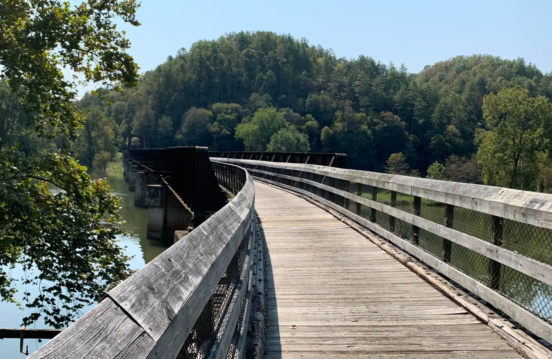
Fries Junction Bridge is the longest and highest bridge along New River Trail State Park. This bridge has you crossing the New River from over a thousand feet above.
0
0
This small gravel parking lot is the northern terminus of The New River Trail and an entrance point for the Dora Trail. Both trails are paved and signage in the lot denotes the required parking fees.
0
0
While the entire 57-mile length of the New River Trail is technically all state park land, this section of the trail offers a bit of forest for exploring as well as public river access in conjunction with the Virginia Department of Conservation Recreation. Baker Island, a small forested island in the river, can be accessed from this area if you brave a river crossing.
0
0
The Ivanhoe Access Point offers public restrooms, potable water, and a covered picnic shelter.
0
0
The Whistle Stop Inn is a small, one-unit, nightly rental that is just steps away from New River Trail. The building was originally used as the city of Allisonia's train station in the late 1800's. It sleeps 2 to 4 people and can be reserved through New River Retreat's website.
0
0
Draper Mercantile and Trading Company is a restaurant and marketplace featuring local foods and goods. It's a pet-friendly spot that can be a helpful place to refuel and refill water along the trail.
0
0
This blasted-stone tunnel is one of two tunnels along the New River Trail. These tunnels make evident the history of this area- the trail was constructed on an abandoned railway right-of-way.
0
0
Frequently Asked Questions
What makes Carroll County a good destination for no-traffic gravel biking?
Carroll County, Maryland, offers a diverse landscape of scenic woodlands, rolling hills, and river valleys, making it ideal for gravel biking. The region features gently to steeply sloping hillsides, providing varied challenges. Many routes utilize quiet back roads and multi-use trails with gravel sections, ensuring a low-traffic experience. The county embraces cycling with over 150 miles of designated tours designed to showcase its picturesque countryside and historic attractions.
Are there any specific areas known for good gravel biking in Carroll County?
Yes, areas like Westminster offer gravel routes, including roads such as Gablehammer Road and Warehime Road. Multi-use trails around Hashawha Environmental Center and Union Mills also provide hilly, intermediate gravel options. Patapsco Valley State Park, though primarily known for mountain biking, also features trails with loose gravel sections suitable for mixed-terrain rides.
What kind of terrain and elevation can I expect on gravel trails in Carroll County?
Carroll County's topography is characterized by gently to steeply sloping hillsides, with elevations reaching up to 1,600 feet. This varied terrain, part of the Piedmont Plateau, means you can expect a mix of climbs and descents, offering diverse scenic vistas and engaging routes for gravel cyclists. Some routes, like the difficult-rated Fries Junction – Foster Falls loop from Galax, feature significant elevation changes over their length.
What natural features or landmarks can I see along the gravel bike trails?
Many routes offer views of the region's natural beauty. You might encounter features like the Fries Junction or the scenic Chestnut Creek Falls. The expansive Patapsco Valley State Park offers scenic woodlands and riverbanks along the Patapsco River. Hashawha Environmental Center features Lake Hashawha, known for wildlife like great blue herons and painted turtles. Piney Run Park also offers a large lake and numerous trails.
Are there any family-friendly gravel biking options in Carroll County?
While specific family-friendly gravel routes are not detailed, many multi-use trails and quiet back roads in Carroll County can be suitable for families. Parks like Hashawha Environmental Center and Piney Run Park offer trails that are generally less challenging and provide a safe environment for all ages. Always check the route details for distance and elevation before heading out with children.
Can I bring my dog on the gravel bike trails?
Many multi-use trails and public parks in Carroll County are dog-friendly, provided your dog is on a leash. However, specific regulations can vary by park or trail. It's always best to check the rules for the particular trail or park you plan to visit, such as Hashawha Environmental Center, before bringing your furry companion.
What is the best time of year to go gravel biking in Carroll County?
The spring and fall seasons generally offer the most pleasant conditions for gravel biking in Carroll County. Temperatures are milder, and the natural scenery is particularly vibrant with spring blooms or autumn foliage. Summer can be enjoyable, but be prepared for warmer temperatures and potential humidity. Winter riding is possible, but trails may be affected by snow or ice.
Are there any circular gravel bike routes available?
Yes, several routes in Carroll County are designed as loops, allowing you to start and end at the same point. Examples include the challenging Fries Junction – Foster Falls loop from Galax and the moderate Chestnut Creek Falls – Fries Junction loop from Fries. These circular routes are great for exploring the diverse landscapes without needing a shuttle.
What do other gravel bikers enjoy most about the trails in Carroll County?
The gravel biking experience in Carroll County is highly rated by the komoot community, with an average score of 4.75 out of 5 stars. Reviewers often praise the quiet, scenic back roads, the varied terrain that keeps rides interesting, and the opportunity to explore the picturesque countryside away from traffic. The blend of natural beauty and challenging sections makes it a rewarding destination for many.
Where can I find parking for gravel bike trails in Carroll County?
Parking is generally available at major parks and trailheads throughout Carroll County. For instance, Hashawha Environmental Center, Piney Run Park, and various access points for multi-use trails typically offer designated parking areas. It's advisable to check specific park websites or route descriptions for detailed parking information before your ride.
Are there any moderate difficulty gravel routes for intermediate riders?
Yes, Carroll County offers several moderate difficulty gravel routes suitable for intermediate riders. For example, the Foster Falls – New River Trail State Park loop from New River Trail State Park is a moderate 34.4 km route. Another good option is the Foster Falls – Fries Junction loop from New River Trail State Park, which covers nearly 60 km with moderate elevation changes.
What kind of wildlife might I encounter on the trails?
Carroll County's diverse natural environments are home to various wildlife. At places like Hashawha Environmental Center, you might spot great blue herons, painted turtles, and other birdlife around Lake Hashawha. The woodlands and river valleys throughout the county provide habitats for deer, foxes, and a wide array of bird species, offering opportunities for nature observation during your ride.
Most popular routes in Carroll County
Most popular attractions in Carroll County

Get inspired with the komoot mobile app


Explore more
Browse the best Gravel rides in other regions.
