The best family-friendly hikes and walks in Perry County
4.7
(11)
148
hikers
4
hikes
Family friendly hiking trails in Perry County offer a diverse landscape characterized by dense forests, rolling hills, and scenic waterways. The region features varied terrain, from gentle paths around lakes to more challenging routes through national forests. Hikers can explore areas with significant elevation changes and discover natural features such as rock outcrops and tranquil streams.
Best family friendly hiking trails in Perry County
- The most popular family friendly hiking route is Ouachita and Lake Sylvia Trail, a 4.5…
Last updated: May 27, 2026
6
hikers
7.20km
01:59
110m
140m
Easy hike. Great for any fitness level. Easily-accessible paths. Suitable for all skill levels.
1
hikers
604m
00:11
30m
0m
Easy hike. Great for any fitness level. Easily-accessible paths. Suitable for all skill levels.

Sign up for free
400km
116:17
8,970m
8,850m
Hard hike. Very good fitness required. Mostly accessible paths. Sure-footedness required.
2
hikers
17.7km
05:00
380m
380m
Hard hike. Very good fitness required. Easily-accessible paths. Suitable for all skill levels.
Our route recommendations are based on thousands of hikes, rides, and runs completed by other people on komoot.
Start today with a free account
Your next adventure awaits.
Login or Signup
Popular around Perry County
Other adventures in Perry County

Tips from the Community

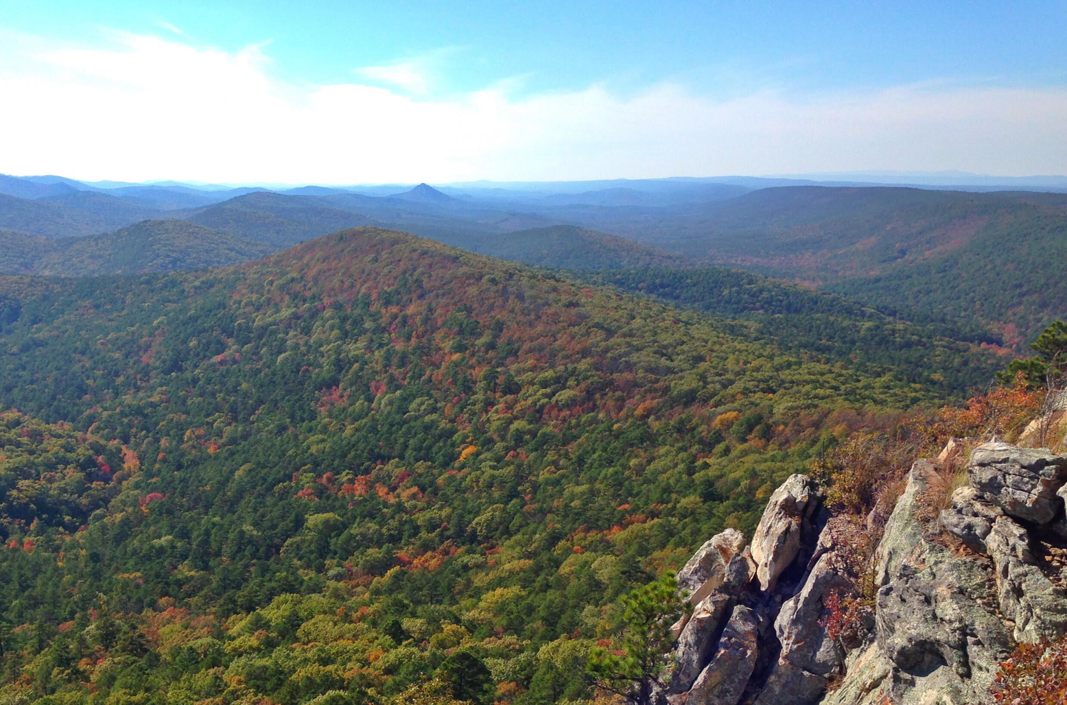
This high point on the trail offers a beautiful view of Lake Winona to the southeast, nestled within the beautiful trees of the Ouachita National Forest. For a higher vantage point, the Lake Sylvia trail junction here leads 1/2 mile north to the spur trail of the Chinquapin Mountain summit, which offers excellent views of the valley, Pinnacle Mountain, and Lake Maumelle to the east.
0
0

This trailhead sits right along Highway 298 and is one of several access points for the Ouachita National Recreation Trail (ONRT). While there are no restrooms or drinking water here, there is a short spur trail leading to the Upper Fork Ouachita River—it is an excellent water source and a great spot to pitch a tent if you are thru-hiking the 223-mile trail.
0
0
The Ouachita National Forest, established by President Theodore Roosevelt in 1907 and initially named the Arkansas National Forest, covers an impressive 1.8 million acres in central Arkansas and southeastern Oklahoma. It is the oldest and largest National Forest in the Southern Region. The forest features a diverse mix of pine and hickory trees with over 700 miles of trails for hiking, mountain biking, and horseback riding. There are multiple developed recreation areas, scenic vistas, shooting ranges, historical sites, wilderness areas, and one national recreation area within the forest. Most of the developed recreation areas are open from April to September, although some sites remain accessible year-round. The Ouachita National Forest is breathtaking in every season, providing expansive views of mountains that stretch for miles.
0
0
Flatside Pinnacle stands at 1,550 feet and offers stunning panoramic views. The short 0.2-mile trail from the gravel road to the summit is clearly marked and relatively easy, though it does get rocky and a little steep at the end. At the top are some of the best views in the state, including Pinnacle Mountain and Rattlesnake Ridge to the east. On clear days, you may even spot Mt. Nebo, Petit Jean, and Mt. Magazine. It's a perfect spot to hang a hammock, have lunch, or simply enjoy some solitude. Dispersed camping is allowed here, making it an ideal spot for thru-hikers to unwind and soak in the scenery.
0
0
The Brushy Trail Complex combines Brushy Mountain, Mountain Top, Rockhouse, and Brushy Creek Trails, which, along with the Ouachita National Recreation Trail, offer a variety of fantastic loop-trail hiking options spanning from 3 to 12 miles. This area is picturesque, with flowing streams, waterfalls, unique geological formations, and peaceful woodlands. Entrance to the day use area and dispersed camping is free—just be sure you camp at least 100 feet away from any trail. Brushy Creek is a reliable water source for thru hikers exploring the ONRT, making it an excellent spot to spend the night during a long journey.
0
0
This trailhead sits right along Highway 7 with a relatively large parking area and trail registration box. There is no water or restroom here. It is an access point of Ouachita Trail that leads to Wolf Pinnacle, a popular destination for day hikers for its scenic views, and is commonly used as a supply drop for thru-hikers.
0
0
Queen Wilhelmina State Park offers some of the most breathtaking views in the state from its fully renovated lodge. Known as the original “Castle in the Sky,” originally built in 1898, the lodge is situated on the 2,681-foot Rich Mountain—Arkansas' second highest peak. The original lodge was built in the late 1800s as a Victorian resort named Wilhelmina Inn to honor the young Queen of the Netherlands, after Dutch investors helped fund the construction of the railroad system. The park includes 41 campsites, including five tent sites with water, one hike-in tent site, picnic areas, and several short hiking trails, and the lodge features 40 rooms, a restaurant featuring Southern cuisine, and a gift shop. Dogs are welcome except in the restaurant and the large hearth room.
0
0
The Kiamichi River is a beautiful tributary of the Red River, stretching for 177 miles as it winds through Pushmataha County and the Kiamichi Mountains. The river is mostly untouched, with limited access, and is known for its excellent bass and catfish fishing opportunities. It's a favorite destination for organized canoe float trips (Class I-II), so you may encounter others enjoying this scenic river while you're here.
0
0
Frequently Asked Questions
How many family-friendly hiking trails are available in Perry County?
This guide features 5 family-friendly hiking trails in Perry County. These range from easy strolls perfect for younger children to moderate paths for families looking for a bit more adventure.
What are some easy hiking trails suitable for families with young children?
For an easy and enjoyable outing, consider the Ouachita and Lake Sylvia Trail, which is about 7.2 km long. Another great option for a shorter walk is the Flatside Pinnacle Spur Trail, a quick 0.6 km route.
Are there any loop trails in Perry County that are good for families?
Yes, the View of Lake Winona loop from Chinquapin Mountain offers a moderate 7.8 km loop, providing scenic views and a satisfying circular route for families.
What kind of natural features or landmarks can we expect to see on these trails?
Many trails in Perry County, particularly those in the Ouachita National Forest area, offer beautiful forest scenery, views of lakes like Lake Sylvia and Lake Winona, and opportunities to experience the natural beauty of the region.
What do other hikers enjoy most about family-friendly trails in Perry County?
The komoot community rates the trails in Perry County highly, with an average score of 4.8 stars. Reviewers often praise the peaceful forest settings, the well-maintained paths, and the beautiful lake views that make for memorable family outings.
Are there any dog-friendly hiking options for families in Perry County?
Many trails within the Ouachita National Forest, where these routes are located, are generally dog-friendly, provided your pet is on a leash. Always check specific trail regulations before heading out to ensure a pleasant experience for everyone.
When is the best time of year for family hikes in Perry County?
Spring and fall generally offer the most pleasant hiking conditions in Perry County, with mild temperatures and beautiful foliage. Summer can be warm, so early morning or late afternoon hikes are recommended, while winter can be quiet and serene, though some trails might be less accessible depending on conditions.
Are there any trails with viewpoints or overlooks suitable for families?
The Flatside Pinnacle Spur Trail, though short, leads to a viewpoint. Additionally, the View of Lake Winona loop from Chinquapin Mountain offers scenic vistas over the lake.
What is the longest family-friendly trail listed in this guide?
The longest family-friendly trail featured here is the Ouachita Trail and Chinquapin Mountain Loop, which spans approximately 17.7 km. While rated difficult, it can be a rewarding challenge for active families with older children.
Are there any moderate trails for families looking for a bit more challenge?
Yes, the View of Lake Winona loop from Chinquapin Mountain is a moderate 7.8 km trail that provides a good balance of distance and elevation for families seeking a more engaging hike.

Get inspired with the komoot mobile app


Explore more
Browse the best Hikes in other regions.
